. . . on the street where you live.
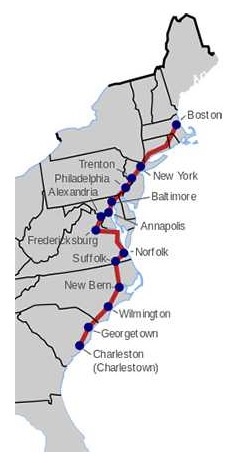
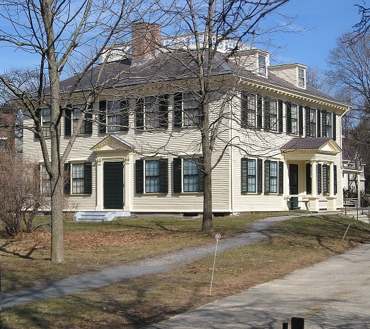
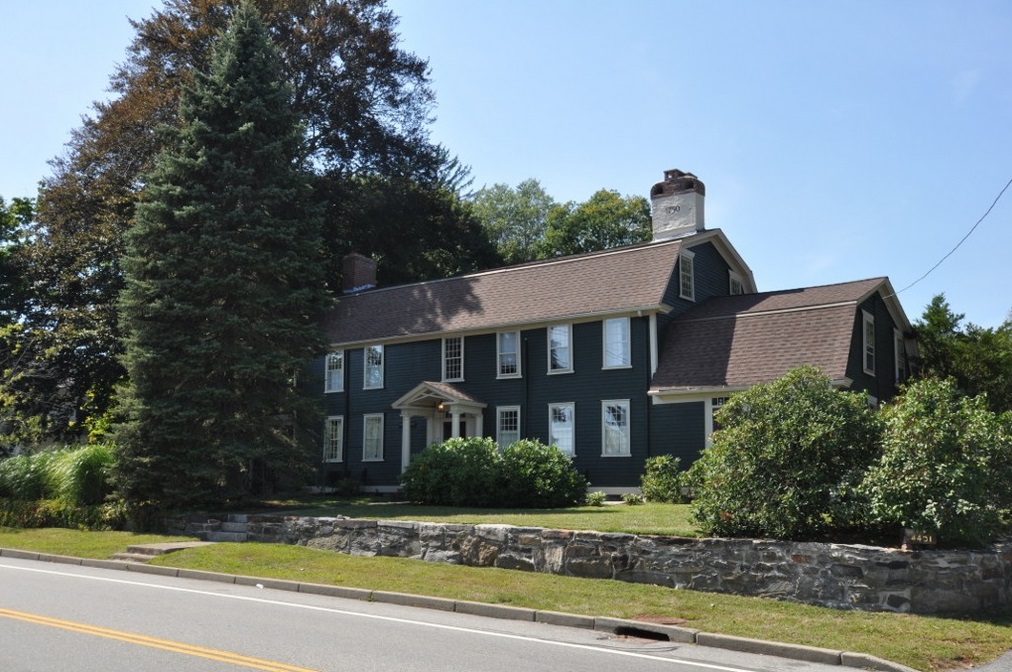
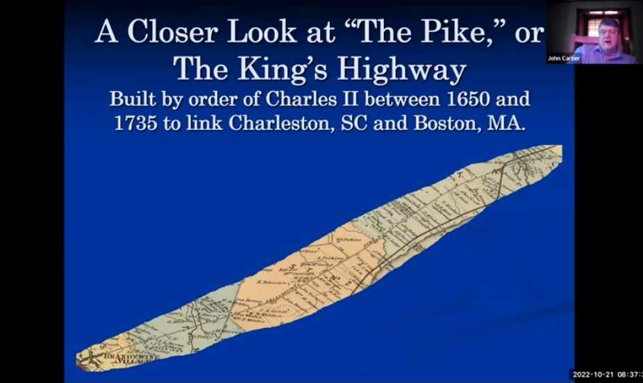
In 1989, Peter and Marilyn Carroll Biggins purchased a newly-built house at 230 Old Kings Highway North. on the site of The Red Mill in Darien, Connecticut. In 2016, Peter started this page. It was about his street being part of the old Post Road between New York and Boston. In May 2023, when Charles III was crowned King of England, Peter wondered who was "Charles II" and found that the street he lived on was part of a 1,300-mile highway between Boston, Massachusetts, and Charleston, South Carolina, ordered in 1664 by Charles II to unite the colonies. The focus of this page is now being expanded from the four miles in Darien to the 1,300 miles of the whole Kings Highway. Any comments, suggestions, or corrections would be much appreciated (see: Contacts).
The page is divided into five parts:
- Index to Places on the Kings Highway. A map and links to the States, Counties, Cities, and Towns in Part 5
- Famous Places and Other Famous Highways. Famous places on the Kings Highway. Other famous highways in America and around the world
- History of the Kings Highway. History of the Kings Highway in general and how it has changed over the years
- Sources for Tracing the Route. Sources used to construct the route of the Kings Highway, including Gary Denton's Walking the Post Road, Christopher Colles' 1789 Maps, Walter Ristow's Index Map for the Colles maps, and J.D. Lewis' Carolana
- The Route of the Kings Highway. Present-day streets from Boston, Massachusetts, to Charleston, South Carolina, that constitute the Kings Highway, including points of interest along the way
1. Index to Places on the Kings Highway
|
|
| 11 States | 100 Sections of the Kings Highway |
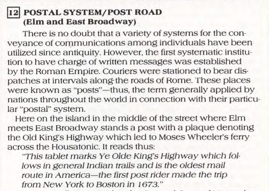
|---|
| Massachusetts | Suffolk County: Boston (Downtown, South End), Roxbury, Jamaica Plain, West Roxbury. Norfolk County: Dedham, Westwood, Islington, Norwood, East Walpole, Sharon, Foxborough, Plainville. Bristol County: North Attleborough, Attleboro |
|
Rhode Island | Providence County: Pawtucket, Providence, Cranston. Kent County: Warwick, East Greenwich. Washington County: North Kingstown, South Kingstown, Charlestown, Westerly |
| Connecticut | New London County: Stonington, Groton, New London, Waterford, East Lyme, Old Lyme. Middlesex County: Old Saybrook, Westbrook, Clinton. New Haven County: Madison, Guilford, Branford, East Haven, New Haven, West Haven, Milford. Fairfield County: Stratford, Bridgeport, Fairfield, Westport, Norwalk, Darien, Stamford, Greenwich |
| New York | Westchester County. New York City: The Bronx, Manhattan |
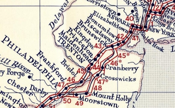
| New Jersey | Hudson County: Jersey City, Kearny. Essex County: Newark. Union County: Hillside, Elizabeth, Linden, Rahway' Middlesex County: Woodbridge, Edison, Highland Park, New Brunswick, North Brunswick, South Brunswick. Mercer County: Princeton, Lawrence, Trenton |
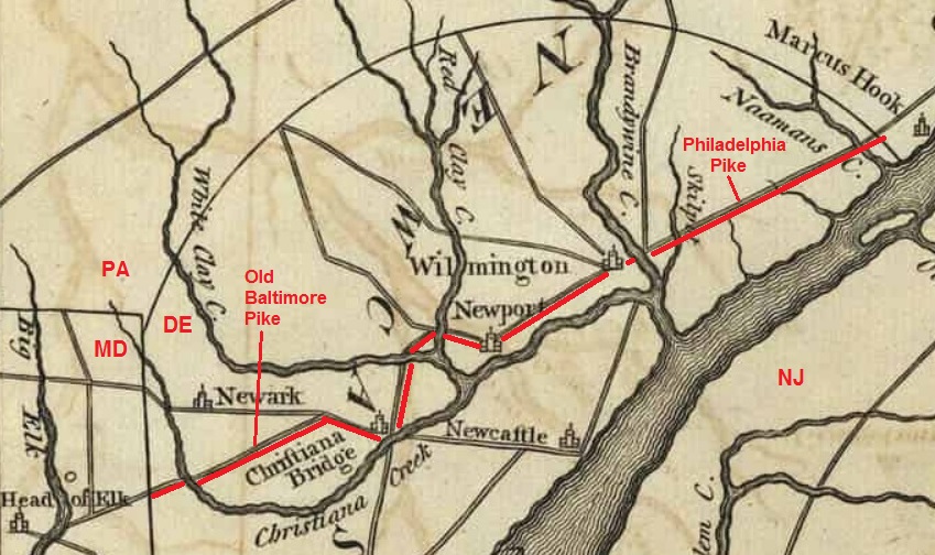
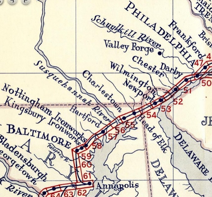
| Pennsylvania | Bucks County, Philadelphia, Delaware County |
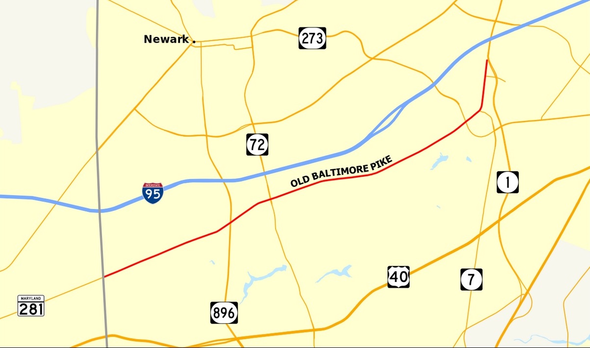
| Delaware | New Castle County |
| Maryland | Cecil County, Harford County, Baltimore County, Howard County, Anne Arundel County (Annapolis), Prince George's County, District of Columbia (part of Maryland before 1791) |
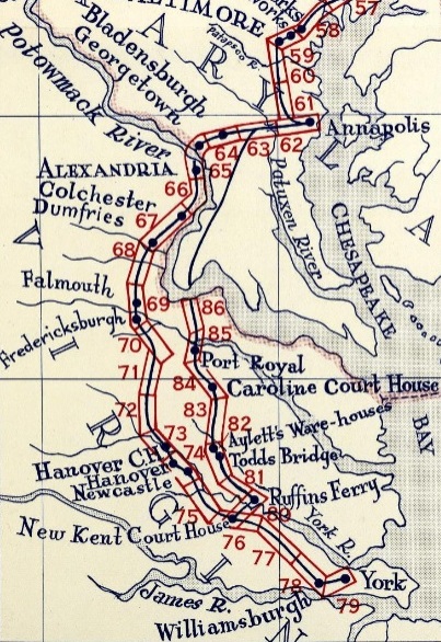
| Virginia | Arlington County, Alexandria, Fairfax County, Prince William County, Stafford County, Fredericksburg, Spotsylvania County, Caroline County, Hanover County, New Kent County, James City County, Williamsburg, York County (Yorktown), Hampton, Norfolk, Portsmouth, Suffolk |
| North Carolina | Gates County, Chowan County, Bertie County, Martin County, Beaufort County, Craven County (New Bern), Jones County, Onslow County, Pender County, New Hanover County (Wilmington), Brunswick County |
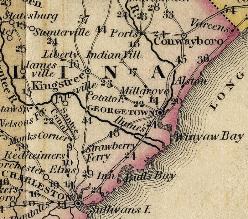
| South Carolina | Horry County (Myrtle Beach), Georgetown County, Charleston County |
|
2. Famous Places and Other Famous Highhways
Famous Places on the Kings Highway
- Massachusetts: Boston Town Hall (Old State House), Old South Meeting House
- Rhode Island: Brown University on College Hill, South Kingstown named after King Charles II
- Connecticut: Yale University
- New York: Columbia University, Central Park (northeast corner), Millionaire's Row, Madison Square Park, Ladies Mile, Union Square, The Cooper Union, Newspaper Row, St. Paul's Chapel, Trinity Church, New York Stock Exchange, Federal Hall
- New Jersey: Rutgers University, Princeton University
- Pennsylvania: Benjamin Franklin's House, Independence Mall, President's House, Declaration House, University of Pennsylvania
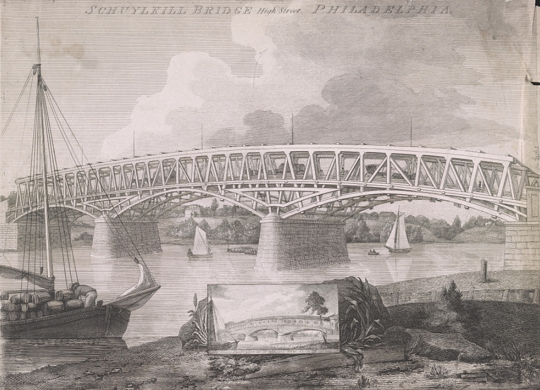
- Delaware: Brandywine Bridge, Cooch's Bridge
- Maryland: Charles Carroll House in Annapolis
- Virginia: Arlington National Cemetery, Mount Vernon, College of William & Mary, Colonial Williamsburg, Siege of Yorktown
- North Carolina: Edenton Tea Party
- South Carolina: Myrtle Beach, Charleston named after King Charles II
Other Famous Highways in America
- Great Wagon Trail, a route for the early settlement of the Southern United States, particularly the "backcountry," by Scotch-Irish immigrants. The road went over 800 miles from Philadelphia, Pennsylvania, to Augusta, Georgia, passing through the Shenandoah Valley and the east side of the Blue Ridge Mountains
- Cumberland Road, also known as the National Road, the first major improved highway in the United States built by the federal government. Built between 1811 and 1837, the 620-mile road went from Cumberland, Maryland, to Vandalia, Illinois. It connected the Potomac and Ohio Rivers and was a main transport path to the West for thousands of settlers. When improved in the 1830s, it became the first macadam road in North America, using the process pioneered by Scotsman John Loudon McAdam
- Oregon Trail, a 2,170-mile east west, large-wheeled wagon route and emigrant trail in the United States that connected the Missouri River to valleys in Oregon Territory. Laid by fur traders and trappers from about 1811 to 1840 and was initially only passable on foot or horseback
- Green Bay Trail, a 250-mile mail route between Green Bay and Chicago, over which a carrier passed once a month. It was in use as early as 1825. It traversed the wilderness between Fort Dearborn in Chicago, Illinois, and Fort Howard in Green Bay, Wisconsin. The route led northwesterly from the Chicago River on Rush Street and Clark Street in Chicago, then Chicago Avenue in Evanston. There is a 50-mile stretch today from Evanston to Racine, Wisconsin, called Green Bay Road. The Pope's mother Mildred Martinez lived at 881 Rush Street as a teenager (see MGS Newsletter). My father worked at 844 Rush Street as a U.S. Navy supply officer during World War II. I attended Quigley Preparatory Seminary at 835 Rush Street from 1953 to 1956.
- Lincoln Highway, America's first national memorial to President Abraham Lincoln, established in 1913. It runs coast-to-coast from Times Square in New York City west to Lincoln Park in San Francisco, covering a total of 3,389 miles. With the establishment of the U.S. Numbered Highway System in 1926, the route from Pennsylvania to Wyoming became U.S. Route 30. When the Interstate Highway System was formed in the 1950s, the former alignments of the Lincoln Highway were largely superseded by Interstate 80. Includes part of the Kings Highway in New Jersey
- Route 66, one of the original numbered highways in the US, established in 1926, ran from Chicago, Illinois, to Santa Monica, California, covering a total of 2,448 miles
Famous Highways Around the World
- Camino de Santiago, a network of pilgrims' ways or pilgrimages leading to the shrine of the apostle James in the cathedral of Santiago de Compostela in Galicia in northwestern Spain, where tradition holds that the remains of the apostle are buried. Created after the discovery of the relics of Saint James in the 9th century
- Appian Way, a 400-mile road constructed around 312 BC, leading southwest from Rome to Brindisi on the heal of Italy. The road began as a leveled dirt path on which small stones and mortar were laid. This base was covered with gravel, and finally topped with tightly fitting, interlocking stones to create a flat and durable surface. The road was cambered in the middle to allow for water runoff and flanked by ditches on either side, which were protected by retaining walls
- Via Flaminia, a 200-mile Roman road constructed around 330 BC, leading north from Rome over the Apennine Mountains to Rimini on the coast of the Adriatic Sea
- Way of the Patriarchs, an ancient north south route traversing the land of Israel and the region of Palestine. The modern Highway 60 (Israel-Palestine) follows roughly the route of the Way of the Patriarchs. The name is used by biblical scholars because of mentions in biblical narratives that it was frequently travelled by Abraham, Isaac and Jacob. It is also called the Hill Road or the Ridge Route because it follows the watershed ridge line of the Samarian and Judaean Mountains. It runs from Megiddo and Hazor south to Beersheba by way of Shechem, Bethel, Jerusalem, Ephrath and Hebron
- Via Maris, an ancient trade route, dating from the early Bronze Age, linking Egypt with the northern empires of Syria, Anatolia and Mesopotamia along the Mediterranean coast of modern-day Egypt, Israel, Turkey and Syria. In Latin, Via Maris means "way of the sea."
- King's Highway, a 700-mile trade route connecting Africa with Mesopotamia. It ran from Egypt across the Sinai Peninsula to Aqaba, then turned northward across Transjordan, to Damascus and the Euphrates River, The Israelites used the road in their Exodus from Egypt
- Silk Road, a network of Eurasian trade routes active from the second century BC until the mid-15th century. It spanned over 4,000 miles. The Silk Road derives its name from the highly lucrative trade of silk textiles that were primarily produced in China
- Great Wall of China, a series of fortifications that were built across the historical northern borders of ancient Chinese states and Imperial China as protection against various nomadic groups from the Eurasian Steppe. The path of the Great Wall also served as a transportation corridor
3. History of the Kings Highway
|
|
|
|
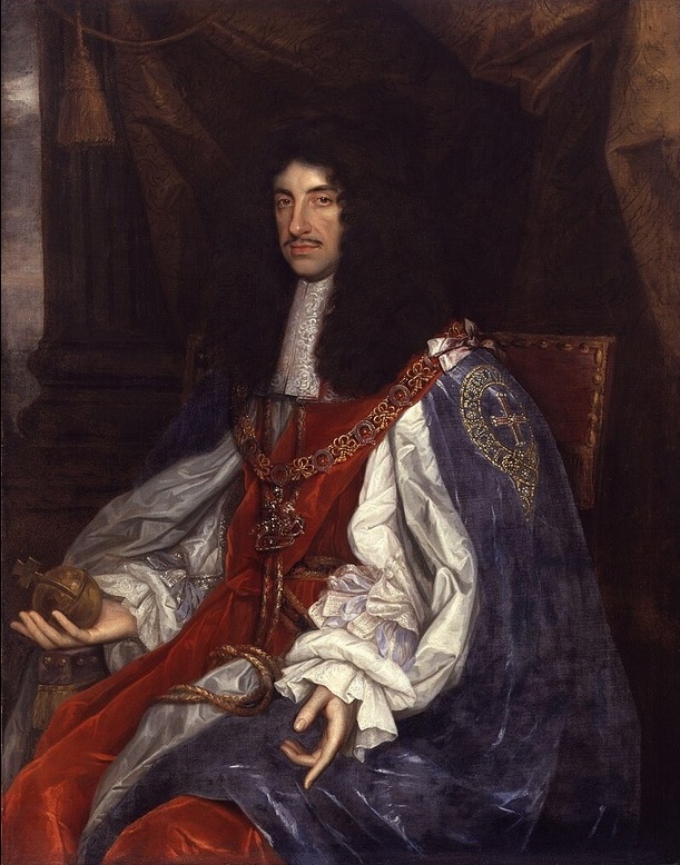
1630-1685 - Charles II, King of England
The 1,300-mile Kings Highway was ordered in 1664 by Charles II to unite the American colonies.
Charles was born in 1630. His father Charles I became King of England in 1625. In 1649, when the son was 15 years ld, he learned of his father's beheading. Charles the son did a deal with the Scots and was proclaimed King of Scotland. With a Scottish army he invaded England but was defeated by Cromwell at the Battle of Worcester in 1651. He escaped into exile. In 1660 he was invited back to England to reclaim the throne of England.
In 1662, Charles married Catherine of Braganza (1638-1705) who was the daughter of King John IV of Portugal. The couple had three children, but all died in infancy.
Charles's reign saw the rise of colonization of North America.
- In 1662, a Royal Charter was granted to the Connecticut Colony.
- In 1663, Charles granted the lands of 'Carolina' in America to eight noblemen. The colony's constitution was written by the philosopher John Locke (1632-1704).
- In 1663, a Royal Charter was granted to the Rhode Island colony.
- In 1664, Charles II directed his colonial governors to link Boston, Massachusetts, and Charlestown, South Carolina by building a highway.
- In 1664, British privateers took over from the Netherlands the port of New Amsterdam, then a major hub of the fur trade. It was renamed New York when it was officially ceded by the Dutch in the 1667 Treaty of Breda. The name was in honour of the king's brother James, Duke of York. Across the East River, Brooklyn was named Kings County. Queens was named in honor of Queen Catherine.
- In 1681, the Charles granted the Quaker entrepreneur William Penn the territory of Pennsylvania in return for Penn's father cancelling the king's debt to him.
Charles died on February 6, 1685, converting to Catholicism on his death bed.
Charles I and II of England descend from The Royal Stuarts family that started out in Scotland when the first of the line, Walter Fitz Alan (1110-1177) was appointed High Steward of Scotland under King David I. His descendants became Hereditary High Stewards of Scotland, and the 4th High Steward, Alexander Stewart (1214-1283) was the first to use Stewart as his surname. Descendants of this line of Stewarts possess particular Y-chromosome DNA mutations: R-M269, L21 ("Celtic"), L745 (1150 AD, Scotland). See: Stewart (Royal) DNA Project and Deep Ancestry: Genealogy and DNA.
The English rulers of the American colonies from 1607 to 1776 were:
- James I, King of England, 1603-1625 (House of Stuart). Begins the colonization of America in 1607 (Virginia) and 1620 (New England) and the plantation of Ulster in 1609
- Charles I, King of England, 1625-1649 (son of James I). Personal Rule. Star Chamber prosecutes Puritans. An estimated 20,000 Puritans emigrate to the Massachusetts Bay Colony from 1630 to 1640. Some go on to Connecticut, including Stamford, in 1641 and 1642. Beheaded by Rump Parliament in 1649
- Abolition of the Monarchy (beheading of Charles I)
- Charles II, King of England, 1660-1685 (son of Charles I). Restoration of the House of Stuart
- James II, King of England, 1685-1688 (brother of Charles II). Seeks to take back the Connecticut Royal Charter in 1687, but it disappears, said to be hidden in in the trunk of a large white oak tree called the Charter Oak
- William and Mary
- Mary II, Queen of England, 1689-1694
- William III, King of England, 1689-1702. William of Orange-Nassau
College established in 1695 on the Kings Highway in Williamsburg, Virginia
- Anne, Queen of England, 1702-1714 (daughter of James II). Her son William, styled "Duke of Gloucester," was born in 1689 and died in 1700 at age 11
- George I, King of England, 1714-1727 (House of Hanover)
- George II, King of England, 1727-1760
- George III, King of England, 1760-1820.
- Stamp Act in 1765.
- Boston Tea Party in 1773.
- Lexington and Concord in 1775.
- Declaration of Independence in 1776.
- Siege of Yorktown in 1781
- Treaty of Paris in 1783
1664 - Highway Ordered by King Charles II
The Kings Highway, a roughly 1,300-mile road, was built on the order of Charles II, King of England, who in 1664 directed his colonial governors to link Charlestown, South Carolina, and Boston, Massachusetts.
The section of the Kings Highway north of New York City was laid out on January 22, 1673. It eventually became the Boston Post Road.
The Kings Highway was the most important road in colonial America and served as the major transportation route for the colonies. It played a vital role in the American Revolution as military route and was used by George Washington's army during the war. It was also used by early colonists for trade and transportation of goods.It played a critical role in the ultimate independence of the United States from England even though it was ordered to be built by Charles II of England.
When The Kings Highway was fully completed in 1735, it was basically a trail. Wagons and stagecoaches used it, but it was difficult going with few bridges and many river crossings. Sections were often impassable.
Sources:
Boston Post Road, The Kings Highway, Kings Highway - Charleston to Boston, First Major Route of The Colonies - The Kings Highway, and
Exploring the Oldest Road in The USA - The Kings Highway.
1673 - The Boston Post Road
The section of the Kings Highway north of New York City was laid out on January 22, 1673. It eventually became the Boston Post Road. The Boston Post Road was a system of mail-delivery routes between New York City and Boston, Massachusetts, that evolved into one of the first major highways in the United States. The three major alignments were:
- Lower Post Road (now roughly U.S. Route 1 (US 1) along the shore via Providence, Rhode Island),
- Upper Post Road (now US 5 and US 20 from New Haven, Connecticut, by way of Springfield, Massachusetts), and
- Middle Post Road (which diverged from the Upper Road in Hartford, Connecticut, and ran northeastward to Boston via Pomfret, Connecticut).
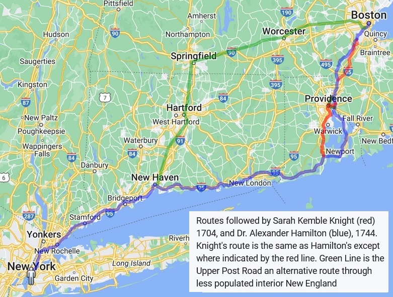
The Lower Post Road is presented here. This is now the best-known of the routes. It is the route taken by Sarah Kemble Knight in 1704-1705 and Gary Dention in 2010-2011.
1673 - Post-Riders
The Boston Post Road was the first postal route between Boston and New York. The three different routes
or alignments were: Upper Post Road, Lower Post Road, and Middle Post Road. Portions of these postal
roads were eventually incorporated into more substantial trails and pathways, leading to portions of several U.S. and interstate eroutes.
Before European settlers colonized North America, Native Americans had established trails that were
used frequently. These paths eventually became portions of post roads, which were used by post riders
to deliver mail to the early colonists. The first portions of the Boston Post Road were laid out in 1673,
becoming America's first mail route. In the 1700s, riders carried the Boston News-Letter, widely considered America's first
regular newspaper, along the Boston Post Road with regular mail, sharing information with settlers and connecting towns along
the route.
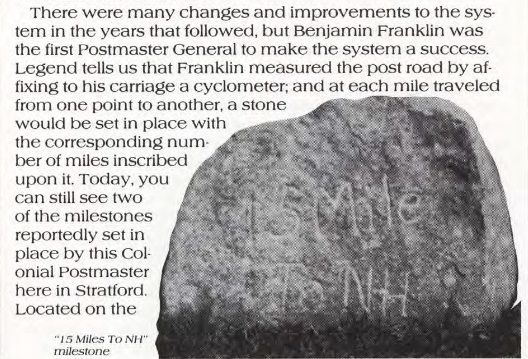
In 1753, then-Deputy Postmaster Benjamin Franklin traveled the Boston Post Road to standardize postal rates based on
distance. Stone markers were placed at mile points along the route. Source: U. S. Department of Transportation and Benjamin Franklin.
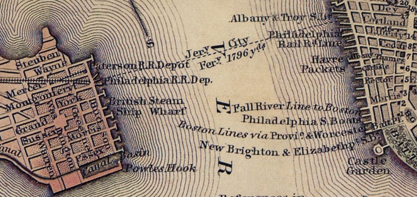
1685 - A new map of New England, New York, New Iarsey, Pensilvania, Maryland and Virginia
In 1685, Thornton, Morden, and Lea produced A new map of New England, New York, New Iarsey, Pensilvania, Maryland and Virginia that included a road from Boston to Lyme. Thornton, Morden, and Lea were working members of the growing map trade in London. They had access to government sources and records, as well as updated information from traders and sea captains who had recently returned from their voyages.
The map appears in Cotton Mather's Magnalia Christi Americana, London, 1702. The map provided little new geographic information, since it was based on the New England and New York portion of a 1685 map by Thornton, Morden, and Lea (see above).
Cotton Mather was born in 1663 in Boston to the Rev. Increase Mather and his wife Maria n e Cotton. His grandfathers were Richard Mather and John Cotton, both of them prominent Puritan ministers. Richard Mather was a graduate of the University of Oxford and John Cotton a graduate of the University of Cambridge. Increase Mather was a graduate of Harvard College and the Trinity College Dublin.
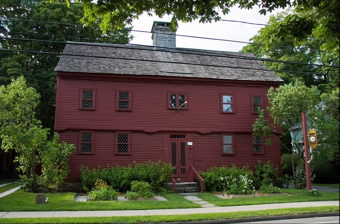
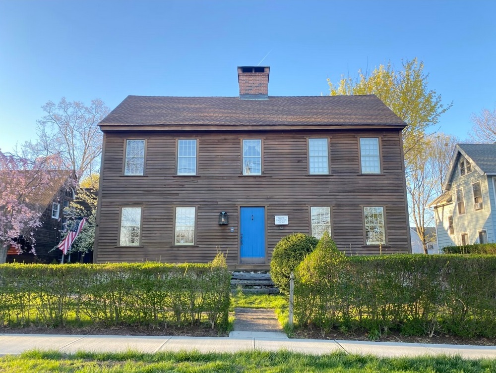
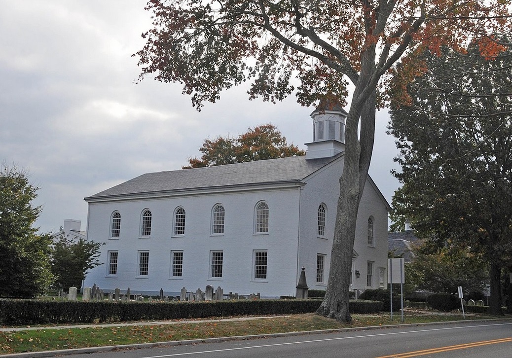
Richard Mather, through his son Timothy, was an ancestor on Moses Mather, who served 60 years as pastor of the First Congregational Church on the Kings Highway in Darien, Connecticut. Moses Mather, in turn, was an ancestor of Stephen Mather, who founded the National Park Service. See: The Mather Homestead.
Cotton Mather was a fellow of Harvard College from 1690 to 1702. In 1716, the Collegiate School moved from Saybrook, Connecticut, to the Kings Highway in New Haven. In 1718, Cotton convinced Boston-born British businessman Elihu Yale to make a charitable gift sufficient to ensure the school's survival. It was also Mather who suggested that the school change its name to Yale College after it accepted that donation.
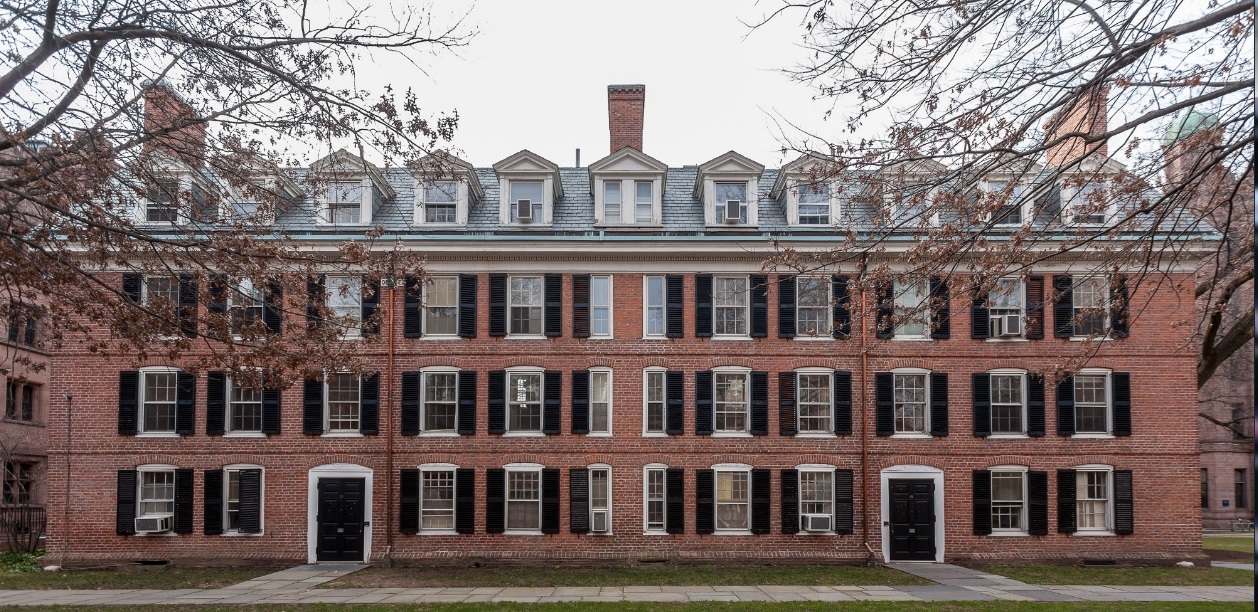
1693-1766 - Seven Colonial Colleges
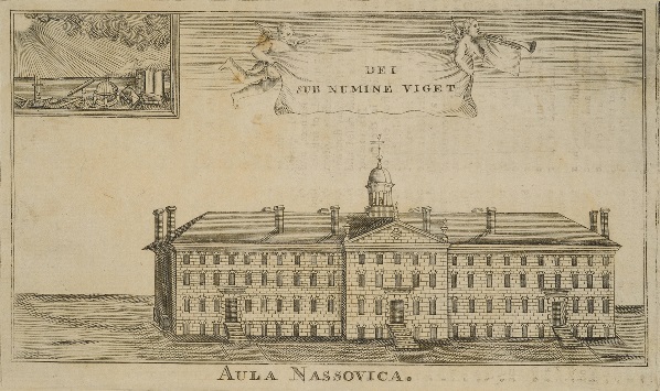
The colonial colleges are nine institutions of higher education founded in the Thirteen Colonies, predating the United States. The first was William & Mary, founded in 1693. All are on the Kings Highway except Dartmouth and Harvard.
- Not on the Kings Highway
- Dartmouth - 125 miles from the Kings Highway
- Harvard - 3.5 miles from the Kings Highway
- On the Kings Highway
- Brown (was College of Rhode Island) - on College Hill at North Main Street in Providence, Rhode Island
- Yale - on Chapel Street in New Haven, Connecticut
- Columbia (was Kings College) - on Broadway in New York City
- Rutgers (was Queens College) - on French Street in New Brunswick, New Jersey
- Princeton (was College of New Jersey) - on Nassau Street in Princeton, New Jersey
- Penn (was College of Philadelphia) - on Woodland Avenue in West Philadelphia, Pennsylvania
- William & Mary - on West Duke of Gloucester Street in Williamsburg, Virginia
As the only American universities old enough to have alumni that participated in the American Revolution and the founding of the United States, these schools have been identified as a group for their influence on U.S. history. Many signers of the Declaration of Independence attended one of these colleges.
While all nine colonial colleges were founded as private institutions, two later became public universities: the College of William & Mary in 1906, and Rutgers University in 1945. The remaining seven are all members of the Ivy League and remain private to the present day.
Source:
Colonial colleges.
1732-1799 - George Washington
George Washington was born in 1732 at Pope's Creek, Virginia, 36 miles east of Fredericksburg, where the Kings Highway ran. His father cultivated tobacco on his several plantations, as his ancestors had done. The family moved to Little Hunting Creek (Mount Vernon) in 1734 before eventually settling in Ferry Farm just across the Rappahanock River from Fredericksburg and the Kings Highway. When his father died in 1743, Washington inherited Ferry Farm. Ferry Farm is "ferry" across the river from mile marker 95 in Fredericksburg.
His older half-brother Lawrence inherited Little Hunting Creek and renamed it Mount Vernon. Lawrence died in 1752, and George Washington leased Mount Vernon from his widow Anne. When George Washington married Martha Custis in 1759, they lived at Mount Vernon. Upon Anne's death in 1761, George Washington inherited Mount Vernon outright. At mile marker 53 on the 1789 Colles map 66 is "Gen. Washington's Land" This is the Mount Vernon area, which was once a part of the farms of George and Martha Washington's expansive Mount Vernon estate. Much of the land was gradually donated through the dying wishes of George and Martha Washington to the public and others who are affiliated with the Washington family. The area is located on the Kings Highway (US 1) in Northern Virginia, 13 miles south-southwest of downtown Washington, D.C.
George Washington was an American military officer, statesman, and Founding Father who served as the first president of the United States from 1789 to 1797. He was appointed by the Second Continental Congress as commander of the Continental Army in June 1775. He led Patriot forces to victory in the American Revolutionary War. He served as president of the Constitutional Convention in 1787, which drafted and ratified the Constitution of the United States and established the American federal government. He has thus been called the "Father of his Country".
George Washington is known to have traveled on the Kings Highway in 1756, 1775-76, and 1789, as Colonel, General, and President.
1756 - Colonel George Washington - Virginia to Massachusetts
On or about February 12, 1756, Colonel George Washington of the Virginia Regiment, age 23, passed northbound through Darien as he traveled to Boston to discuss issues related to his rank with Governor William Shirley of Massachusetts. (Shirley was then Commander-in-Chief of British forces in North America.) Washington was accompanied on this trip by Captains George Mercer and Robert Stewart of the Virginia Regiment, as well as his two hired servants, John Alton, and Thomas Bishop. The party left Alexandria, Virginia, on February 4, 1756, and traveled the approximately 450 miles to Boston. Darien would have been approximately 275 miles, which would take nine days at 30 miles per day. He traveled through Philadelphia, New York, and New London. While in New London, they stayed at the home of a friend, Joseph Chew, where they left their horses. On his return trip, he arrived in New London on March 8, 1756. Joshua Hempstead noted Washington's arrival in his diary:
"Col. Washington is returned from Boston and gone to Long Island, in Power's sloop; he had also two boats to carry six horses and his retinue; all bound to Virginia."
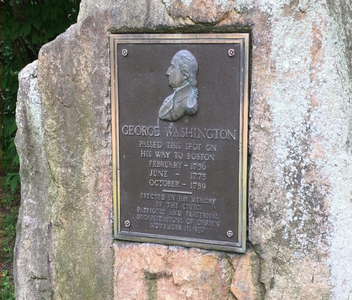
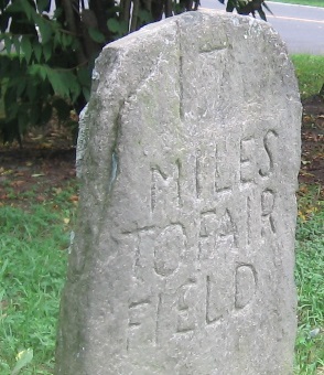
George Washington is known to have traveled on the Old Post Road in Middlesex (Darien) in 1756, 1775-76, and 1789, as Colonel, General, and President. On Old Kings Highway South, two miles south of our house in Darien, there is an old stone mile marker that says "Fairfield 17 Miles." Since Armistice Day in 1932, an historical marker next to the mile marker reminds passers-by that George Washington went by in 1756, 1775, and 1789. The marker is at the intersection of Old Kings Highway South and Goodwives River Road. The marker says "George Washington passed this spot on his way to Boston: February 1756, June 1775, October 1789. Erected in his memory by the civic, patriotic and fraternal organizations of Darien, November 11, 1932." See: The Story of Darien, Connecticut, by Kenneth M. Reiss, The Darien Historical Society, 2009. |
1775 - General George Washington - Pennsylvania to Massachusetts
On or about June 27, 1775, General George Washington, age 43, traveled over 300 miles from Philadelphia, Pennsylvania, to Cambridge, Massachusetts. On June 14, the Second Continental Congress had created a Continental Army, to be formed out of the individual militias of the Thirteen Colonies. The next day, Congress created the position of Commander-in-Chief of the Continental Army, and unanimously elected Washington to that position. Congress formally presented him with his commission on June 19, and he departed Philadelphia, Pennsylvania, on June 23, headed for Massachusetts. After traveling over 300 miles in ten days, he arrived at Cambridge, Massachusetts on July 2, and took command of the siege. He probably traveled through Darien on the fourth day, June 27.
1776 - General George Washington - Boston to New York
On his way from Boston to New York City, on April 12, 1776, General George Washington traveled 40 miles from Fairfield, Connecticut, to New Rochelle, New York.
- In Fairfield he stayed at the Sun Tavern,
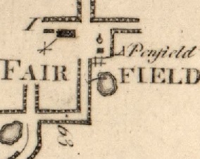
Samuel Penfield, proprietor, on Town Hall Green. Mile 63 on Colles 1789 Map 6a. Samuel Penfield (1734-1811) owned the Sun Tavern on the green in Fairfield.
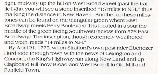
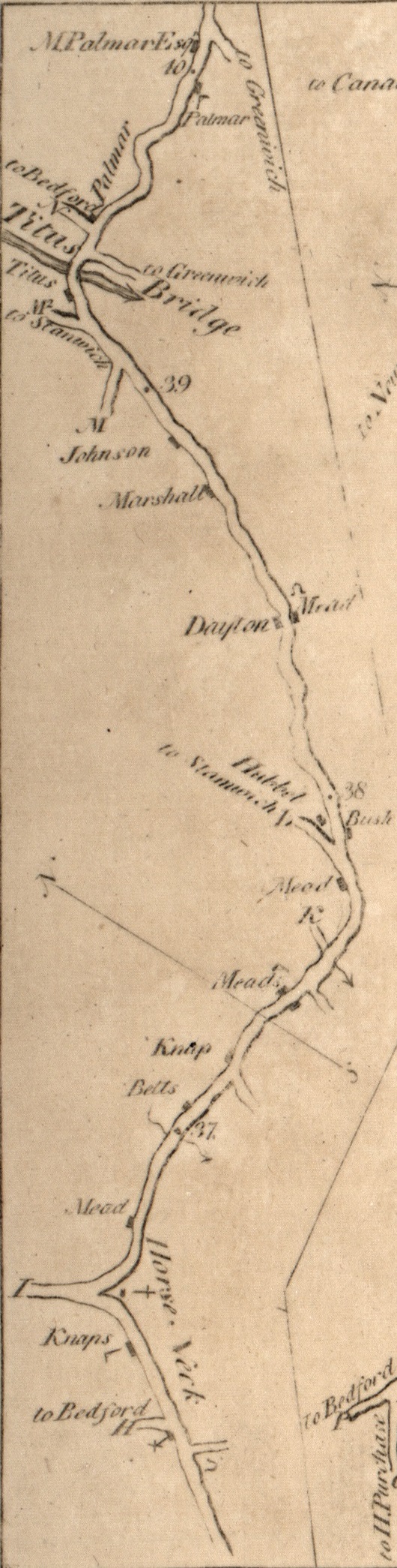
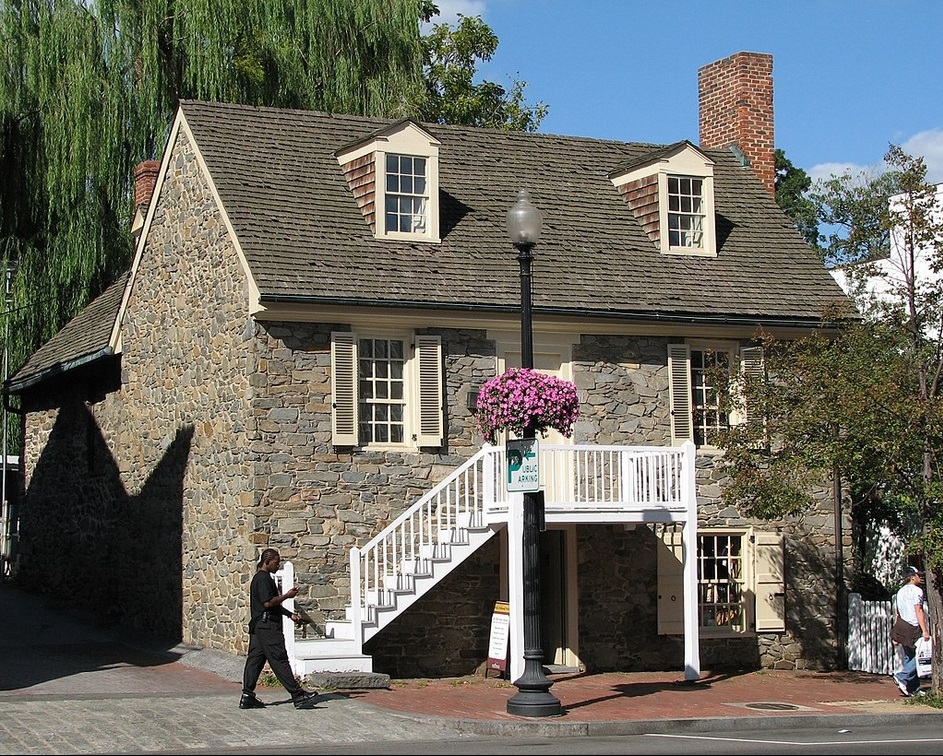
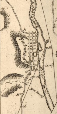
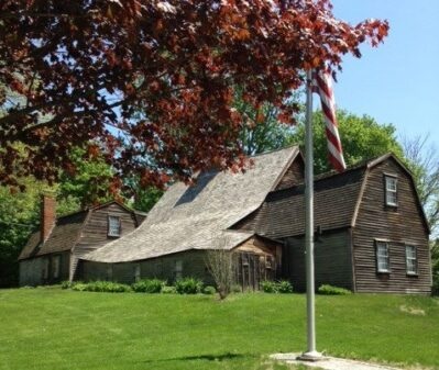
- In Darien, he would have passed by The Red Mill sometime mid-morning. Mile 48 on Colles 1789 Map 4c. Samuel Richards (1746-1785) had bought The Red Mill from the Reeds in 1767.
- In Greenwich, he had lunch at Knapp's Tavern (now Putnam Cottage) on the Post Road (now East Putnam Avenue). Mile 36.6 on Colles 1789 Map 4a. Israel Knapp (1705-1783) was an innkeeper in Greenwich for many years.
- In New Rochelle, New York, he stayed at Guion's Tavern on the Boston Post Road (now Huguenot Street). Mile 23 on Colles 1789 Map 2c. The Guions, including Isaac Guion (1685-1785), were a prominent Huguenot family in Westchester County, New York.
Continental Army commander-in-chief George Washington was on his way from Boston to New York City. He had just spent ten months in the opening phase of the Revolutionary War at the Siege of Boston (April 19, 1775 to March 17, 1776). After defeating the British, he relocated his army to defend the port city of New York, located at the southern end of Manhattan. Washington had an army of 19,000 when he reached New York. They would have taken the smae route and travelled around the same time as George Washington.
Sources: National Archives/a> and Battle of Long Island.
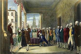
1789 - President George Washington - Connecticut to New York
In 1789, President George Washington embarked on a month-long tour of New England, beginning on October 15, to strengthen the new federal government, promote national unity, and inspect the region's economy. He traveled by carriage through Connecticut, Massachusetts, and New Hampshire, stopping in nearly sixty towns, including Darien, Connecticut. The tour lasted until November 13, 1789, and helped solidify his popularity and the legitimacy of his administration.
1799 - George Washington Burial at Mount Vernon
George Washington died December 14, 1799 (aged 67). He was buried at
his home, Mount Vernon. Source: Find a Grave. His wife Martha died May 22,1802, and was buried next to him.
George Washington on Colles Maps
Boyhood home. George Washington's boyhood home, Ferry Farm, at "ferry" on the Rappahannock River across from Fredericksburg and mile marker 95 on the Kings Highway. Excerpt from: 1789 Colles map 69a. |
|
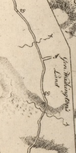
Mount Vernon. At mile marker 53 on the Kings Highway is "Gen. Washington's Land." Shown on the map on either side of Gen. Washington's Land are two small tributaries of the Potomac River that flow south through the area: Dogue Creek and Little Hunting Creek. The Mount Vernon Mansion is on the Potomac between the mouths of the two rivers. Just off the map to the right would be Mount Vernon and the Potomac River. Excerpt from: 1789 Colles map 66b. |
|
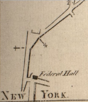
Inauguration. From 1789 Colles atlas, Map 1a, showing Federal Hall on Wall Street where Washington was inaugurated. Below Federal Hall is Broad Street. At the end of Wall Street is Broadway. The angular street is Park Row. St. Paul's Chapel is on Broadway near the start of Park Row (+), where George Washington prayed following his inauguration. The first Brick Presbyterian Church was on Park Row (x). Mile marker 1 is at Chatham Square at the start of the Bowery. (The Trinity Church now at Wall Street is not shown because it was not built until 1790.) Excerpt from: 1789 Colles map 1a. |
|
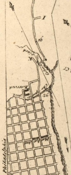
Philadelphia White House. Washington occupied the Philadelphia President's House from November 27, 1790 to March 10, 1797. The house was located on what is now Market Street, one block north of Independence Hall. Market Street runs westbound from the Delaware River. Market Street is 5 miles south of Pennypack Creek. 91 and 92 are miles from Federal Hall in New York. Cohocksink Creek (now a sewer) is at mile 91.5. Cohoquinoque Creek (now a sewer) is at mile 92. Excerpt from 1789 Colles Map 47 |
|
Sources: George Washington , Mount Vernon Area, Mount Vernon Map, First inauguration of George Washington, and President's House (Philadelphia).
1735 - Kings Highway Completed
For official Crown business at least, King Charles II (reigned 1660-1685) ordered the governors of his Atlantic coast colonies to cooperate in building a road that would link all their capitals and as many local seats of government as possible. By the mid-1730s this roadway linked Boston with Charleston, SC. Source: Kings Highway Historic Site
1781 - Siege of Yorktown
In Yorktown, in the fall of 1781, General George Washington, with allied American and French forces, besieged General Charles Lord Cornwallis's British army. On October 19, Cornwallis surrendered, effectively ending the war and ensuring independence. See: Siege of Yorktown.

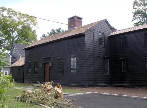
Surrender of Lord Cornwallis is an oil painting, 12 feet 18 feet, by John Trumbull. The painting, which was completed in 1820, now hangs in the rotunda of the United States Capitol in Washington, D.C.
The painting depicts the surrender of British Lieutenant General Charles, Earl Cornwallis at Yorktown, Virginia, on October 19, 1781. Included in the depiction are many leaders of the American troops that took part in the siege of Yorktown. . Source: Surrender of Lord Cornwallis |
1783 - Stagecoaches
In 1783, the Boston Post Road carried America's first
long-distance stagecoach service from New York to Boston, corresponding with improvements in the road's surface that resulted in a faster, safer, and more efficient transportation system. The success of the stagecoach service along this route convinced
Congress to send mail by stagecoach instead of lone rider. Source: U. S. Department of Transportation.
1791 - Planned City of Washington DC
In 1791, the planned city of Washington DC replaced portions of the Kings Highway. Major Pierre Charles L'Enfant developed a street plan for the new city of Washington, DC. for George Washington. see: L'Enfant Plan.
1800 - Paved Roads and Turnpikes
The period from 1800 to 1830 saw improvements in road construction, most importantly the widespread implementation of Macadam roads up and down the country. The speed of coaches in this period rose from around 6 miles per hour (including stops for provisioning) to 8 miles per hour. For example, in 1808, an improved Turnpike Road (now the Post Road) was opened in Fairfield County, Connecticut, and later a daily mail service was established. As was often the case in Connecticut, a small community grew up around the meetinghouse and the Turnpike Road. A school was erected and shops providing hats, shoes, and other sundries were nearby.
The Turnpike had toll gates in Greenwich, Stamford, Saugatuck, and Fairfield. People were exempt from the toll if they were going to church or attending to ordinary farm business. And, locals knew routes that would avoid the toll gate. Tolls were eliminated in 1854. See: The Story of Darien, Connecticut, by Kenneth M. Reiss, 2009, p. 119.
The new turnpikes in some areas along the Kings Highway tended to replace the original highway if there were no people living along it.
1811 - Planned City of New York
In 1911, the planned city of New York replaced portions of the Kings Highway. A Commission designed a street plan for the area of Manhattan above Houston Street and below 155th Street. The Commission consisted of Gouverneur Morris, a Founding Father of the United States; the lawyer John Rutherfurd, a former United States Senator; and the state Surveyor General, Simeon De Witt. Their chief surveyor was John Randel Jr., who was 20 years old when he began the job. see: Commissioners' Plan of 1811.
1815 - Steamboats
Robert Fulton built the world's first commercially successful steamboat in 1807, but it was not until after the War of 1812 that these vessels entered service along coastline. For 127 years, between 1815 and 1942, steamboats provided a link between New York and cities, greatly reducing travel time. For example, by the mid-1830s, there was a twice-daily stage to the steamboat dock in Stamford, Connecticut. Sources: Steamboats on Long Island Sound by Norman J. Brouwer, 2014; The Story of Darien, Connecticut, by Kenneth M. Reiss, 2009, p. 119.
1836 - Railroads
Stagecoaches were replaced by railroads. The Philadelphia, Wilmington and Baltimore Railroad was started in 1836, headquartered in Philadelphia. It was greatly enlarged in 1838 by the merger of four state-chartered railroads in three Mid-Atlantic states to create a single line between Philadelphia and Baltimore. The right-of-way laid down by the PW&B line is still in use today as part of Amtrak's Northeast Corridor and the Maryland Department of Transportation's MARC commuter passenger system from Baltimore to Maryland's northeast corner.
The New York and New Haven Railroad connected New York City to New Haven, Connecticut, along the shore of Long Island Sound in 1849.
Railroads soon replaced many canals and turnpikes and by the 1870s had significantly displaced steamboats as well. The railroads were superior to these alternative modes of transportation, particularly water routes because they lowered costs in two ways. Canals and rivers were unavailable in the winter season due to freezing, but the railroads ran year-round despite poor weather. And railroads were safer: the likelihood of a train crash was less than the likelihood of a boat sinking. Likewise, railroads changed the style of transportation. For the common person in the early 1800s, transportation was often traveled by horse or stagecoach. The network of trails along which coaches navigated were riddled with ditches, potholes, and stones. This made travel fairly uncomfortable. Adding to injury, coaches were cramped with little leg room. Travel by train offered a new style. Locomotives proved themselves a smooth, headache free ride with plenty of room to move around. Some passenger trains offered meals in the spacious dining car followed by a good night sleep in the private sleeping quarters. Railroad companies in the North and Midwest constructed networks that linked nearly every major city by 1860. Source: Philadelphia, Wilmington and Baltimore Railroad and History of rail transportation in the United States.
In 1869, the Railway Mail Service was officially inaugurated. It was a significant mail transportation service in the US from the mid-19th century until the mid-20th century.
1845 - Telegraph
In 1845, the Magnetic Telegraph Company was formed in order to build telegraph lines from New York City toward Boston and other cities. Telegraphic lines rapidly spread on railroad right-of-ways and street utility poles throughout the United States in the next few years, with 12,000 miles of wire laid by 1850. Sources: The Story of Darien, Connecticut, by Kenneth M. Reiss, 2009, p. 146; and Samuel Morse.
1864 - Arlington National Cemetery
In 1864, Arlington National Cemetery was built over Arlington Ridge Road, the path of the Kings Highway. Nearly 400,000 people are buried in its 639 acres, including my sister-in-law, Anne Roarty Biggins (1944-2014). Arlington National Cemetery.
1878 - Telephone
Telephones were invented by Alexander Graham Bell in 1875. In 1878, the Boardman Building in New Haven became the site of the world's first commercial telephone exchange, the District Telephone Company of New Haven. The first-ever telephone directory was printed. In 1882 the District Telephone Company of New Haven changed its name to the Southern New England Telephone Company. Source: First Commercial Telephone Exchange. Telephone lines soon were added to telegraph lines on utility poles.
1892 - Electricity and Tram Ways
The first municipal electric plant in Connecticut began operating in South Norwalk in 1892. Utility poles that had been built for telegraph and telephone were used top carry electric lines. Water mills became antiquated. The New York and New Haven Railroad was electrified. Tramways were built between neighboring towns.
1890 - Bicycles
The bicycle made a great change in lifestyle for many Americans in the late 1800s, offering previously unknown personal mobility. In Connecticut in 1895, there were about 12,000 miles of roadway. Although there were some paved streets in the cities, the vast majority of these roads were still simple, unimproved dirt roads. Bicycles and horse buggies were the two mainstays of private transportation just prior to the automobile, and the grading of smooth roads in the late 19th century was stimulated by the widespread advertising, production, and use of these devices. Source: Connecticut Department of Transportation History: Chapter 1 and Chapter 2.
1900 - Automobiles, Street Cars, and Buses
In 1900, mass production of automobiles began. The 1908 Ford Model T was the first automobile to be mass-produced on a moving assembly line. The Ford Model A came in 1927. See: History of the Automobile. Street cars began around 1900 and buses around 1930. See: CT Transit.
1926 - US 1
In 1922, the Post Road became NE 1 in New England when an area-wide route numbering system (New England Interstates) was established to help motorists find their way. In 1926, the US route numbering system was inaugurated, and NE 1 became part of a much longer US 1 from Maine to Florida. Source: Kurumi.
US 1 is about 850 miles from Boston, Massachusetts, to Charleston, South Carolina.
1928 - Parkways
Parkways were designed in the 1920s and 1930s as an alternative to the congested Boston Post Road.
In 1928, the first 11 miles of the 18-mile Hutchinson River Parkway were opened in New York, connecting Pelham Manor with White Plains. It eventually extended from Throgs Neck in the Bronx to Greenwich, Connecticut.
In 1938, the first 17 miles of the 37-mile Merritt Parkway were opened from Greenwich to Norwalk in southwestern Connecticut. It eventually extended to Stratford. These parkways were just a few miles north of the Post Road. They were cothenceived as a way to alleviate congestion on the the Post Road. Trucks and buses over eight feet tall are excluded. The Merritt is listed in the National Register of Historic Places. It is acknowledged for the beauty of the forest through which it passes, as well as the architectural design of its overpasses.
In 1932, the 15-mile George Washington Memorial Parkway, from Arlington to Mount Vernon was completed. The dedication ceremony was headed by President Herbert Hoover who became the first person to drive it. He lead a small party of 12 cars across the Arlington Memorial Bridge and down the Parkway to Mount Vernon as a kick-off for George Washington's 200th birthday celebration.
Sources:
Parkway,
Hutchinson River Parkway,
Merritt Parkway, and
George Washington Memorial Parkway.
1936 - Airplanes
American Airlines inaugurated passenger service on June 26, 1936, with the Douglas DC-3, a propeller-driven airliner manufactured by Douglas Aircraft Company, which had a lasting effect on the airline industry in the 1930s to 1940s. The DC-3 had many exceptional qualities compared to previous aircraft. It was fast, had a good range, was more reliable, and carried passengers in greater comfort. Before the World War II, it pioneered many air travel routes. It is one of the first airliners that could profitably carry only passengers without relying on mail subsidies. In 1939, at the peak of its dominance in the airliner market, around ninety percent of airline flights on the planet were by a DC-3 or some variant. Source: DC-3.
1950 - BWI Airport
In 1950, the Baltimore/Washington International Thurgood Marshall Airport (BWI) was opened, replacing a portion of the Kings Highway in Anne Arundel County, Maryland.
1956 - I-95
Interstate 95 (I-95) was started in 1956 and has become the main north south Interstate Highway on the East Coast of the United States, running from Florida to Maine. I-95 largely parallels the Atlantic coast and US 1, except for the portion between Savannah, Georgia, and Washington, D.C., and the portion between Portland and Houlton in Maine, both of which follow a more direct inland route. I-95 is one of the oldest routes of the Interstate Highway System. Many sections of I-95 incorporated preexisting sections of toll roads where they served the same right-of-way. Source: I-95.
US 1 and I-95 are each about 850 miles from Boston, Massachusetts, to Charleston, South Carolina.
4. Sources for Tracing the Route
|
|
Alternate Routes Between Boston and New Haven
There were three alternative routes between Boston Massachusetts, and New Haven, Connecticut, for the Kings Highway (Boston Post Road):
- Lower Post Road - roughly U.S. Route 1 south through Providence, Rhode Island, then southwest near the shoreline of Long Island Sound
- Upper Post Road - roughly west on US 20 to Springfield, MassachusettsUS, then south roughly on US Route 5 to New Haven, Connecticut, where it joined the Lower Post Road
- Middle Post Road - southwestward from Boston via Pomfret, Connecticut, to Hartford, where it joined the Upper Post Road
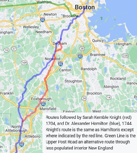
The Lower Post Road is presented here. This is now the best-known of the routes. It is the route taken by Sarah Kemble Knight in 1704-1705 and Gary Dention in 2010-2011.
The route described here is part of the Old Roebuck Road that stretched from Boston to Providence, Rhode Island. It is the road traveled by Sarah Kemble Knight in 1704.
There was a later alternate route in Norfolk County that went through Walpole, Norfolk, and Wrentham. It is the road traveled by Alexander Hamilton in 1744.
Source: Walking the Post Road and Boston Post Road.
Walking the Post Road - 2010-11
Gary Denton has been invaluable to me in developing this web page. In 2010 and 2011, Gary Denton walked the Post Road from Boston to New York City. He writes about it in Walking the Post Road and Boston Rambles. "This blog is dedicated to the Boston Post Road, one of the oldest routes in existence in North America. Originally an Indian trail, the road roughly follows the route of US 1. Although many roads are called the Post Road, this one has the most interest to me as the most ancient and documented route from Boston to New York."
He did the trip in stages and wrote down his findings in 65 blog posts. When he entered a new town, he went directly to the library to find books and maps that helped him chart the course of the Kings Highway. In his Walking the Post Road #52, he wrote on February 3, 2011, about walking past our house on Old Kings Highway North in Darien, Connecticut. He started his 4.62-mile walk that day on Wall Street at Norwalk Green, crossed the Norwalk River, went down West Avenue, then onto Flax Hill Road, which becomes Old Kings Highway North across the Five Mile River in Darien, and ended at the Congregational Church in Darien. He refers to our street as "a lovely old neighborhood which holds a number of colonial era houses."
| States | Route | Miles | Colles 1789 Maps | Denton 2010-11 Walking |
|---|
| Massachusetts | Old State House-Attleboro | 45 | | 1,
2,
3,
4,
5,
6,
7,
8,
9,
10,
11,
12,
13,
15,
16,
17,
18 |
| Rhode Island | Pawtucket-Westerly | 57 | | 19,
20,
21,
22,
23,
28,
29,
30,
31,
32,
33,
34
|
| Connecticut | Stonington-Milford | 83 | | 35,
36,
37,
38,
39,
40,
41,
42,
43,
44,
45,
46,
47 |
| Stratford-Greenwich | 40 |
7,
6,
5,
4,
3c
| 48,
49,
50,
51,
52,
53,
54,
55 |
| New York | Port Chester-Manhattan | 33 |
3c,
2,
1
| 56,
57,
58,
59,
60,
61,
62,
63,
64,
65 |
| Sub-Total | 258 |
Excerpt from Gary Denton's map on Walking the Post Road showing the Boston Post Road from Boston to New York. |
For a discussion of books about the Boston Post Road, see Gary Denton's Walking the Post Road #22
1789 - Colles Road Maps
In 1789, Christopher Colles created a road atlas which the Library of Congress has put on line at: A Survey of the Roads of the United States of America. This is the first American "road book." It shows great detail in a series of strip maps of various routes around the middle Atlantic states. Included are 512 miles for the portion of the Kings Highway that runs from Stratford, Connecticut, to Yorktown, Virginia.
| State | Route | Miles | Colles 1789 Maps |
|---|
| Stratford to Federal Hall in Manhattan |
|---|
| Connecticut | Stratford-Greenwich | 40 |
7,
6,
5,
4,
3c
|
| New York | Port Chester-Federal Hall | 33 |
3c,
2,
1
|
| Federal Hall in Manhattan to Philadelphia |
|---|
| New Jersey | Paulus Hook-Trenton | 63 |
40,
41,
42,
43,
44,
45b
|
| Pennsylvania | Morrisville-Philadelphia | 29 |
45b,
46,
47,
|
| Philadelphia to Annapolis |
|---|
| Pennsylvania | Philadelphia-Marcus Hook | 20 |
47,
51,
52b
|
| Delaware | Claymont-Iron Hill | 26 |
52b,
53,
54c
|
| Maryland | Elkton-Annapolis | 88 |
54c,
55,
56,
57,
58,
59,
60,
61,
62
|
| Annapolis to Yorktown |
|---|
| Maryland | Annapolis-Georgetown | 38 |
62,
63,
64,
65a
|
| Virginia | Arlington-Yorktown | 175 |
65a,
66,
67,
68,
69,
70,
71,
72,
73,
74,
75,
76
77,
78,
79
|
| Total | 512 |
|
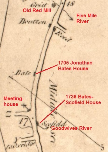
My Colles Map. Annotated excerpt from 1789 Colles Map 4c. Main road is Old Kings Highway North. 48 and 47 are miles from Federal Hall in New York City. Grist is the Old Red Mill on the Five Mile River, where I live. Unmarked road south is Raymond Street. x is the Congregational Church. Z is Brookside Road. Y to Oxridge is Sedgewick Avenue. The Goodwives River runs between Z and Y. Middlessex is the name of Darien before 1820. Source: Colles Maps. |
|
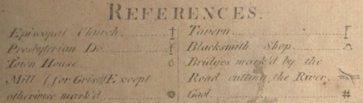
Symbols used on the 1789 Colles maps (Colles symbols):
- Episcopal Church
- Presbyterian De.
- Town House
- Mill (for Grist Except otherwise mark'd)
- Tavern
- Blacksmith Shop
- Bridges mark'd by the Road cutting the River)
- Gaol
|
The David Rumsey Map Collection includes a 1961 Index Map for the Colles maps, created by Walter W. Ristow, then Assistant Chief of the Map Division at the Library of Congress. It was included in a reproduction of Colles' maps: A Survey of the Roads of the United States of America, 1789, by Christopher Colles, edited by Walter W. Ristow, The John Harvard Library (Cambridge: Belknap Press of Harvard University Press, 1961. Below are excerpts from the Index Map (Ristow retained the 1789 spellings).
| Stratford to Federal Hall in Manhattan |
|---|
Excerpt from 1961 Ristow Index Map, showing location of Colles maps 1 to 7 in New York and Connecticut, 73 miles from Federal Hall to Stratford. Middlesex is Darien. |
| Federal Hall in Manhattan to Philadelphia |
|---|
Excerpt from 1961 Ristow Index Map, showing location of Colles maps 40 to 47 in New Jersey and Pennsylvania, 92 miles from Federal Hall to Philadelphia. Also shown is an alternate route in New Jersey that goes from Brunswick to Camden, crossing to Philadelphia via Coopers Ferry. |
| Philadelphia to Annapolis |
|---|
Excerpt from 1961 Ristow Index Map, showing location of Colles maps 47 to 62 in Pennsylvania, Delaware, and Maryland, 134 miles from Philadelphia to Annapolis. |
| Annapolis to Yorktown |
|---|
Excerpt from 1961 Ristow Index Map, showing location of Colles maps 62 to 79 in Maryland and Virginia, 213 miles from Annapolis to Yorktown. |
1704 - The Journal of Madam Knight
In 1704-1705, Sarah Kemble Knight wrote a diary of of her five-month journey on the post road from Boston to New York and back to Boston. She traveled by horse with someone who knew the way, usually a Post rider. Her diary provides a first-hand-account of travel conditions during colonial times. It also provides a list of locations on the Boston Post Road. Those locations are shown in the table below, along with the page number from the diary at: The Private Journal of Sarah Kemble Knight: being the record of a journey from Boston to New York in the year 1704, published by the Academy Press, Norwich, Connecticut, 1901, including the introductory preface by W. R. Deane in Littell's Living Age, June 26, 1858.
| Location | Boston to New York | New York to Boston |
|---|
| Boston, MA | 27 - Oct. 2, 1704 | 74 - Mar. 3, 1705 |
| Dedham, MA | | 74 |
| Providence, RI | 32 | |
| Narragansett Country, RI | 35, 38 - Oct. 4, 1704 | |
| Kingston, RI | 39 | |
| Pawcatuck River, RI/CT | 41 | |
| Stonington, CT | 44 | 73 |
| Groton, CT | | 72 |
| New London, CT | 45 - Oct. 5, 1704 | 72 |
| Old Saybrook, CT | 46. 47 | |
| Killingsworth (now Clinton), CT | 47, 48 - Oct. 7, 1704 | |
| Guilford, CT | 48 | |
| New Haven, CT | 48, 57 - Dec. 6, 1704 | 71 - Dec. 24, 1704 |
| Milford, CT | | 69 |
| Stratford, CT | 57 | 69 |
| Fairfield, CT | 57 | 68 |
| Norwalk, CT | 57 | 68 - Dec. 23, 1704 |
| Stamford, CT | | 67 |
| Greenwich (Horse Neck), CT | | 67 |
| Rye, NY | 58 | |
| Mamaroneck, NY | | 67 |
| New Rochelle, NY | 59 | 66 |
| Eastchester, NY | | 66 |
| Kings Bridge, Spuyten Duyvil, NY | | 65 |
| New York, NY | 61 | 61 |
Sarah was born in 1666 in Boston to Captain Thomas Kemble, a merchant of Boston, and Elizabeth Trerice. In 1689, she married Richard Knight. They had one child, Elizabeth. Her husband died in 1703. She lived on Moon Street, about a half mile northeast of the Boston Town Hall. When she composed the journal, she was on her way to New Haven (and later to New York City) to act on behalf of a friend in the settlement of her deceased husband's estate. Around 1714, she moved to New London, Connecticut, where here married daughter lived. Sarah died in 1727. Her diary was first published in 1825 by W. R. Deane in the weekly Littell's Living Age.
See also Sensibility and the Road: The Journal of Madame Knight and the Cultural Refinement of Eighteenth-Century New Yor k.
1744 - Dr. Alexander Hamilton's Itinerary
Dr. Alexander Hamilton was a Scottish-born doctor and writer who lived and worked in Annapolis in 18th-century colonial Maryland. His travel diary Gentleman's Progress: The Itinerarium of Dr. Alexander Hamilton records his journey in 1744 from Maryland, to York, Maine. Source: Alexander Hamilton (Maryland doctor). The diary is available at Library of Congress.
1776 - Washington Trip from Boston to New York
George Washington and his aides made a trip from Boston, Massachusetts, to New York City from Thursday, April 4, to Saturday, April 13, 1776. They took the "lower" road through Providence, Norwich, and New London to New Haven where the two roads met. He left Cambridge on April 4, ate a snack in Boston about two o'clock that afternoon, and proceeded toward Providence. The large expenditure recorded at Dr. Nathaniel Ames's tavern in Dedham, Massachusetts, suggests that he spent the first night of his trip there, 11 miles along the post road from Boston. He reached Providence on the afternoon of April 5 after passing through Wrentham, Massachusetts, which lies about halfway between Dedham and Providence. He left Providence on Sunday, April 7, and reached Norwich, Conn., the next day. He spent the night somewhere along the road between the two towns, possibly at Coventry, Rhode Island, or Plainfield, Connecticut. At Norwich on April 8, he lodged at the house of Jabez Huntington, the father of Col. Jedediah Huntington, and conferred with Gov. Jonathan Trumbull, Sr., either that evening or early the next morning.
On Tuesday morning, April 9, he proceeded to New London, where he arrived about one o'clock in the afternoon. The expenditure for a "Boatswain & Barges Crew" was probably for transporting his baggage down the Thames River from Norwich, but he may have ridden overland to New London by way of Montville, Connecticut, where, according to local tradition, Col. John Raymond and several others saw him pass by while they were working on the road. At New London he boarded the warship Alfred to confer with Commodore Esek Hopkins, whose fleet had recently arrived in the harbor. Later in the day he inspected the fortifications under construction at New London and Groton. He spent the night at the home of Nathaniel Shaw, Jr., a prominent New London merchant.
From New London he traveled with little further delay along the Connecticut coast toward New York. On Wednesday, April 10, he may have lodged at the house of merchant John McCurdy in Lyme, Connecticut. Or he may have extended his journey that day beyond Lyme, crossing the Connecticut River on the ferry to Saybrook and going as far as Guilford, which lies about twelve miles from New Haven, where he is known to have arrived on the morning of Thursday, April 11. Isaac Beers operated a tavern at the corner of College and Chapel streets in New Haven. He tarried only a few hours in New Haven before proceeding to the ferry that crossed the Housatonic River at Stratford and then to Samuel Penfield's tavern in Fairfield, Connecticut, where he apparently spent the night of April 11. Samuel Penfield (1734-1811) owned the Sun Tavern on the green in Fairfield.
On Friday, April 12, he passed through Greenwich, Connecticut. Israel Knapp (1705-1783) was an innkeeper in Greenwich for many years. He probably lodged that evening at Guion's tavern in New Rochelle, Westchester County, New York. The Guions were a prominent Huguenot family in Westchester County, New York.
On Saturday, April 13, he reached New York City by way of Kings Bridge at the northern tip of Manhattan Island. He apparently dined on the day that he arrived in New York at Samuel Fraunces's popular tavern on the corner of Pearl and Broad streets.
Source: National Archives. Original source: The Papers of George Washington, Revolutionary War Series, vol. 4, 1 April 1776 - 15 June 1776, ed. Philander D. Chase. Charlottesville: University Press of Virginia, 1991, pp. 40-42.
1781 - Washington Rochambeau Revolutionary Route
The Washington Rochambeau Revolutionary Route is a 680-mile series of roads used in 1781 by the Continental Army under the command of George Washington and the Exp dition Particuli re under the command of Jean-Baptiste de Rochambeau during their 14-week march from Newport, Rhode Island, to Yorktown, Virginia.
French forces left Rhode Island in June 1781 and joined Washington's force on the Hudson River the following month. The combined American and French armies headed south in August, marching through New Jersey, Pennsylvania, Delaware, and Maryland, a route that allowed them to evade British troops. They reached Williamsburg, Virginia, in late September, several weeks after the French royal fleet had won the Battle of the Chesapeake, preventing the British from reinforcing or evacuating General Cornwallis's army. On September 22, they combined with troops commanded by the Marquis de Lafayette. A three-week siege of Yorktown led to Cornwallis's surrender on October 19, 1781. Source: Washington Rochambeau Revolutionary Route.
The route is a designated National Historic Trail with interpretive literature, signs, and exhibits that describe the key role of French diplomatic, military, and economic aid to the United States during the American Revolutionary War. See: The National Washington Rochambeau Revolutionary Route Association, Inc. (W3R-US).
Some Additional Sources
- The Old Boston Post Road, by Stephen Jenkins, 1913 (Upper Post Road). Online at: Smithsonian
- Boston Post Road, Wikipedia
- The Boston Post Road, by Beverly Whitaker, 2006.
- The King's Best Highway, by Eric Jaffe, 2010.
- 10 Streets That Changed America, by Geoffrey Baer, WTTW Chicago, 2018.
5. The Route of the Kings Highway
Massachusetts
The route for the Kings Highway in Massachusetts from Boston to Attleboro is roughly as follows.
- Suffolk County
- Norfolk County
- Dedham
- Westwood
- Islington
- Norwood
- East Walpole
- Sharon
- Foxborough
- Plainville
- Bristol County
- North Attleborough
- Attleboro
Boston Downtown and South End
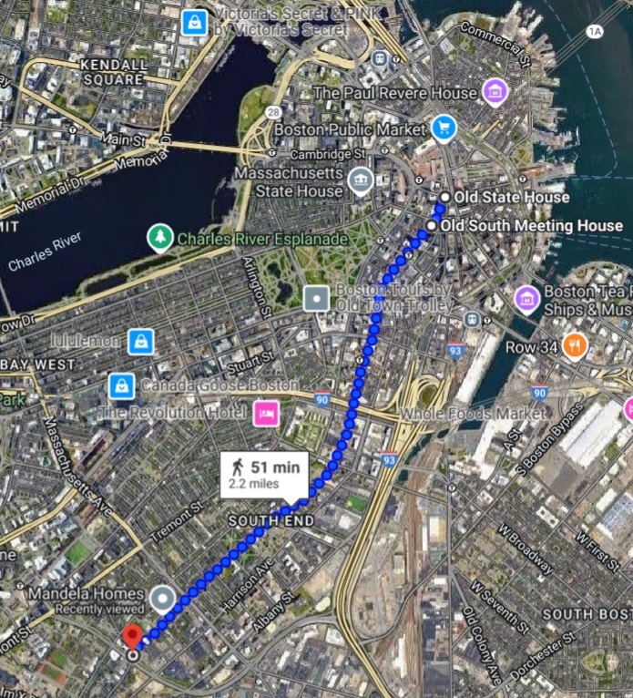
Washington Street in Boston Downtown and South End. 2.2 miles. Google map, February 2025. |
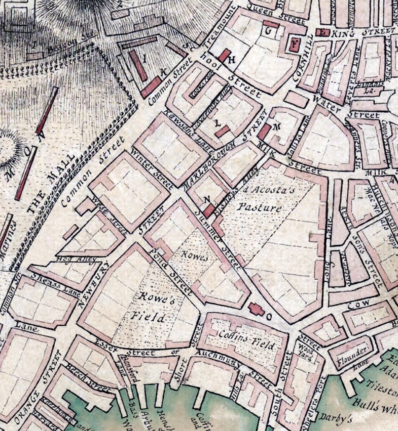
Excerpt from 1775 map of Boston, showing the Town Hall (E) in the upper right at King Street (now State Street) and Cornhill (now Washington Street). It was built in 1713 to replace the 1658 Town Hall. Also shown is the Old South Meeting House (M) at Milk Street. Source:
1775 Map of Boston. |
The 2.2 miles of the Kings Highway in Boston Downtown and South End is:
- Downtown
- State Street - Old State House (Boston Town Hall)
- Washington Street - Old South Meeting House
- South End (Boston Neck)
Gary Denton walking through Boston Downtown and South End:
- 1 - Introduction
- 2 - Boston Downtown
- 3 - Boston Downtown
- 4 - South End
The northern portion of the Kings Highway began at a street called
- Market Street from 1636 to 1708
- King Street from 1708 to 1784
- State Street since 1784
It proceeds south on what is now called Washington Street in honor of George Washington.
1658 - Boston Town Hall
In 1658, the wooden Boston Town Hall was erected at Market Street. The building was destroyed in the great fire in 1711. Source:
Old State House.
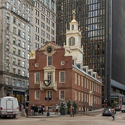
1713 - Old State House
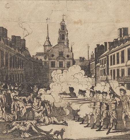
The Boston Town Hall was replaced in 1713 by a brick Town hall, which is now called the Old State House. In 1770, the Boston Massacre occurred next to the building. In England, the massacre is known as the Incident on King Street. The 1713 building is one of the oldest public buildings in the United States. Source:
Old State House and Boston Massacre.
Sources: King Street, Boston, Washington Street, Boston, First Town-House, Boston, Old State House (Boston), and Walking the Post Road #3
1729 - Old South Meeting House
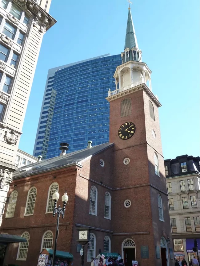
The Old South Meeting House is a historic Congregational church building located at the corner of Milk and Washington Streets in the Downtown area of Boston, Massachusetts. Built in 1729, it gained fame as the organizing point for the Boston Tea Party on December 16, 1773. Five thousand or more colonists gathered at the Meeting House, the largest building in Boston at the time. Source: Old South Meeting House.
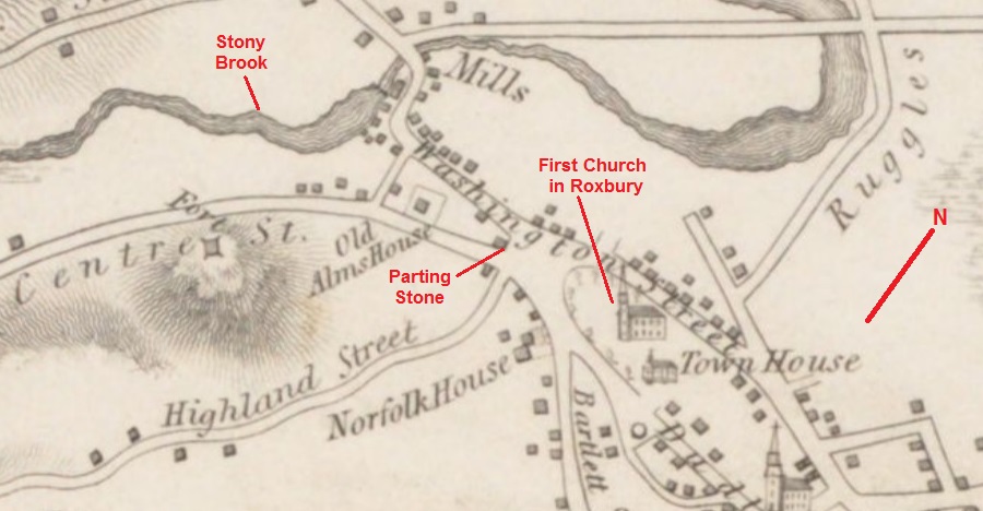
Roxbury
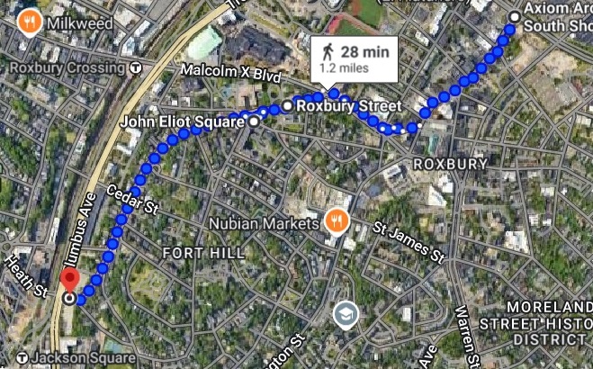
Washington, Roxbury and Centre streets in Roxbury. 1.2 miles. Google map, February 2025. |
The 1.2 miles of the Kings Highway in Roxbury is:
- Washington Street - Eliot Burying Ground
- Roxbury Street
- Malcolm X Boulevard
- Roxbury Street
- corner of Roxbury and Centre streets - First Church in Roxbury
- Centre Street
- Parting Stone
- Three Mile Marker
Gary Denton walking through Roxbury: 5, 6, 7
1630 - Eliot Burying Ground
Eliot Burying Ground is a historic seventeenth-century graveyard at Eustis and Washington Streets in the Roxbury neighborhood of Boston. It occupies a roughly triangular lot of 0.8 acres. Many well-known historical figures of colonial Massachusetts are buried at Eliot Burying Ground, including John Eliot, and members of the Dudley family, including Governors Thomas and Joseph Dudley, and Chief Justice Paul Dudley. Sources: Eliot Burying Ground.
1632 - First Church in Roxbury
The First Church in Roxbury is the current headquarters of the Unitarian Universalist Urban Ministry. A church on this site has been in use since 1632 when early English settlers built the first meetinghouse. Since then, the meetinghouse has been rebuilt four times, and its appearance today reflects how the meetinghouse looked in the late 19th and early 20th centuries.
The church is at John Eliot Square in the northern Roxbury neighborhood of Boston. At John Eliot Square, the Post Road branches off Roxbury Street to Centre Street. The square was the site of the Roxbury town center after its founding in 1630. Roxbury was annexed to Boston in 1868.
John Eliot was ordained as the first teacher. Eliot, as a Puritan missionary became known by many as "the apostle to the Indians" for learning the Algonquin language. He used this knowledge to translate the ten commandments, the Lord's prayer, and other scriptures into the Algonquin language, to try converting the natives to Puritan Christianity.
Across from church is the Dillaway Thomas House, a large colonial structure built in 1750 and thought to be Roxbury's oldest surviving house. The Georgian-style home was built as a parsonage for Rev. Oliver Peabody, pastor of the First Church of Roxbury in 1750. The house was later owned by Martha Dillaway and then John Thomas, an American commander in the Continental Army during the American Revolutionary War.
Sources: First Church in Roxbury, John Eliot Square, and Walking the Post Road #7.
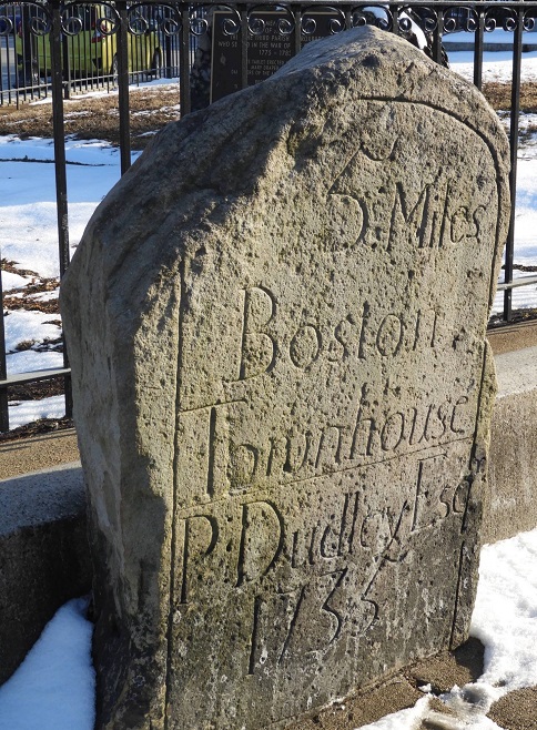
1744 - The Parting Stone on Centre Street in Roxbury
A parting stone shows where each leg of a road fork leads. Numerous such stones were set by Paul Dudley, Chief-Justice of Massachusetts, as they bear his name or initials. One well known example of a Dudley stone is the Roxbury Parting Stone, known locally as simply the Parting Stone. It is located at the corner of Centre and Roxbury Streets, on Eliot Square.
- front face: "The / Parting / Stone / 1744 / P Dudley"
- south face: "to / Dedham / x Rhode / Island"
- north face: "to / Cambridge / Watertown"
Sources: Parting Stone, Walking the Post Road #6, and Walking the Post Road #7.
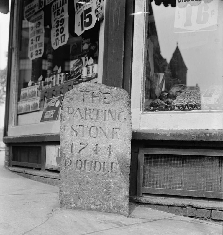
1940 photo of The Parting Stone in front of 1-15 Centre Street in Eliot Square, Roxbury. Source: Library of Congress. |
|
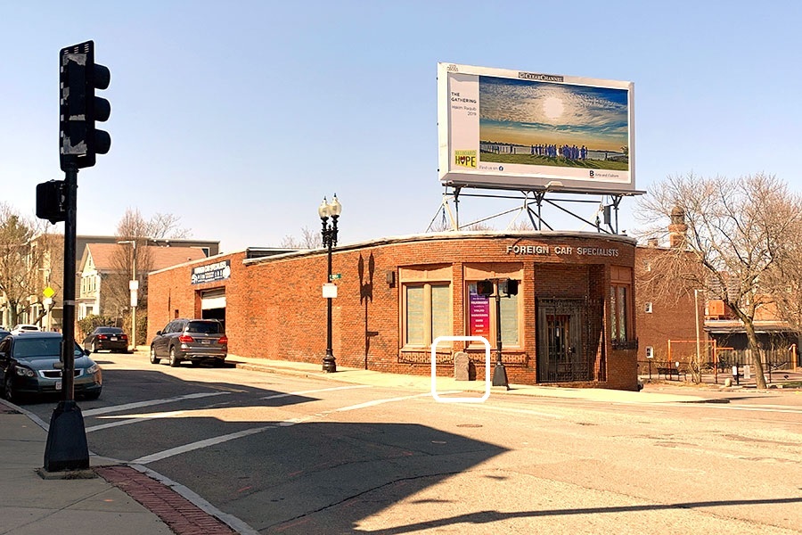
2023 photo of The Parting Stone in front of 1-15 Centre Street in Eliot Square, Roxbury. Photo by Godino & Company, Inc. offering the proerty for sale or lease. "This property has the potential to contain 30 apartments and 22 parking spaces. This is an extraordinary opportunity to develop residential condos in this highly desirable area of Roxbury. The location is superb . . ." |
|
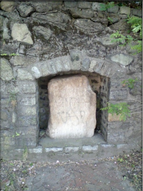
1729 - 3-Mile Marker on Centre Street in Roxbury
The three-mile stone is on Centre Street a few hundred yards south of Eliot Square in Roxbury. This stone is hard to read. It is at the corner of Centre Street and Highland Avenue. It is inscribed:
Boston
3 MILES
1729
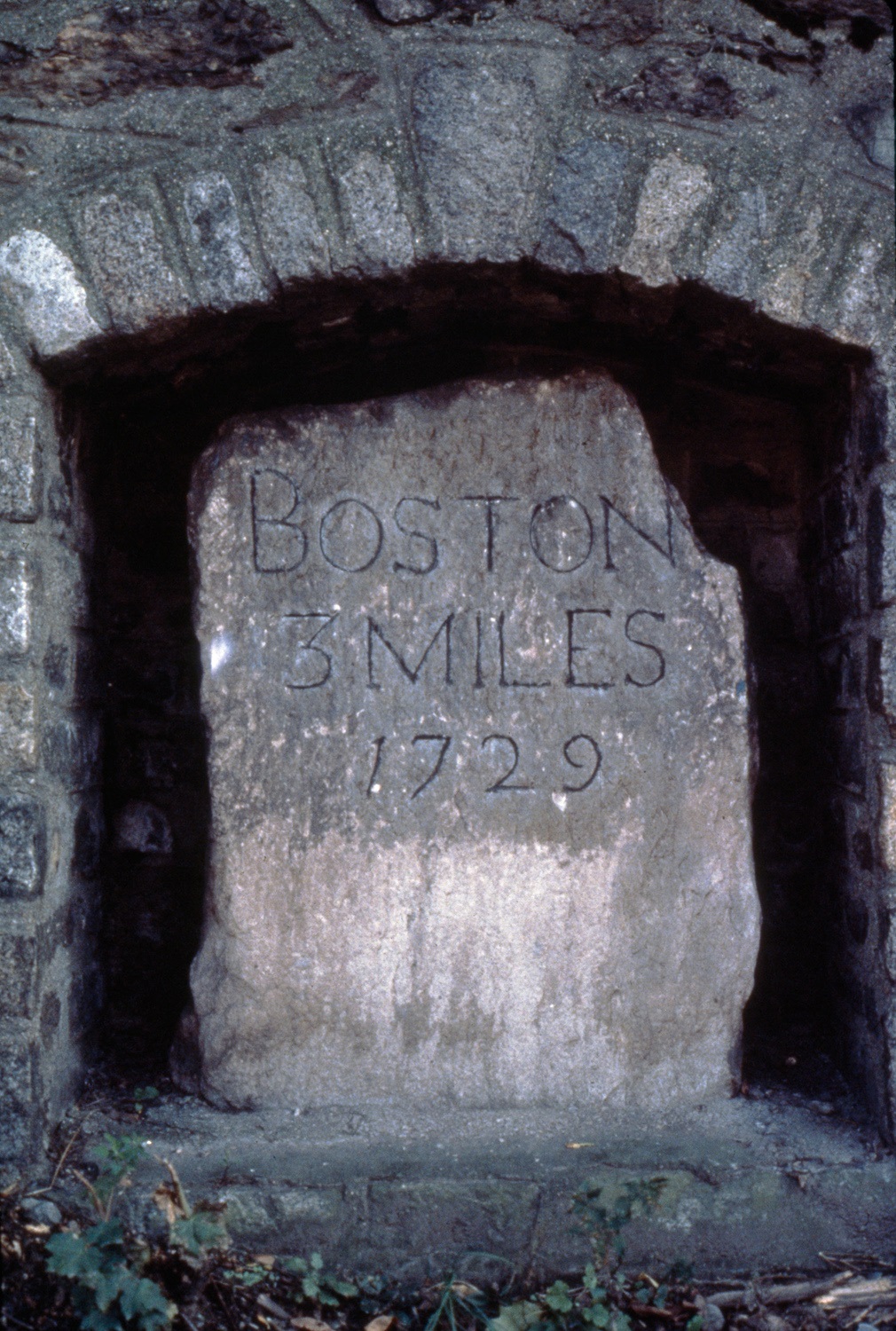
3-Mile Marker on Centre Street in Roxbury. Source:
MIT Libraries. |
|
|
Jamaica Plain and West Roxbury
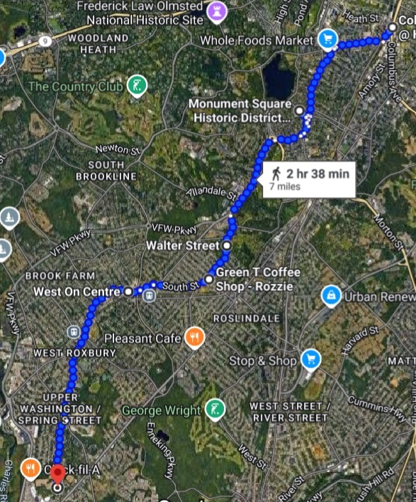
Centre, Walter, South and Centre streets in in Jamaica Plain and West Roxbury. 7 miles. Google map, February 2025 |
The 7-miles of the Kings Highway in Jamaica Plain and West Roxbury is:
- Jamaica Plain
- Southwest Corridor Park
- Centre Street
- opposite Creighton street - 4-Mile Marker
- Monument Square
- 5-Mile Marker
- Loring-Greenough House
- Walter Street
- South Street
- Centre Street
- Arnold Arboretum of Harvard University - 6-Mile Marker
- West Roxbury
Gary Denton walking through Jamaica Plain and West Roxbury:
- 8 - Jamaica Plain
- 9 - Jamaica Plain
- 10 - Jamaica Plain
- 11 - West Roxbury
1735 - 4-Mile Marker on Centre Street in Jamaica Plain
The four-mile stone is on Centre street, opposite Creighton street, in Hyde Square section of Jamaica Plain. It is in the front wall of a store front at ground level. It sits opposite Creighton street.
|
|
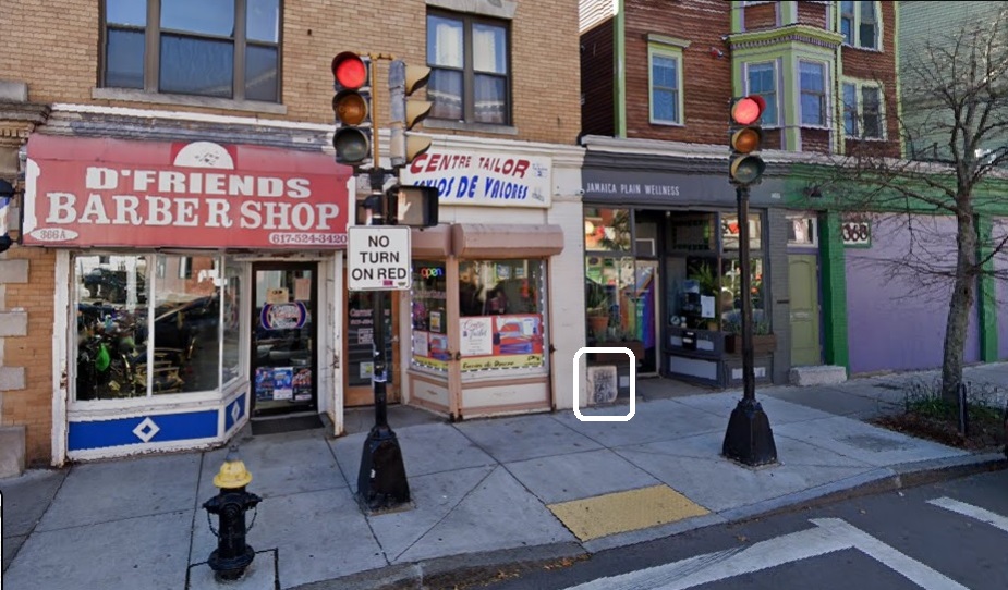
4-Mile Marker at 368 Centre Street in Jamaica Plain. Source: Google Maps, October 2022. |
|
1735 - 5-Mile Marker on Centre Street in Jamaica Plain
On Centre Street in Jamaica Plain, next to Monument Square, there is a mile marker thet told travelers that they have 5 miles left to get to the Boston Townhouse. The stone was placed there in 1735 by Paul Dudley, Esq. Across Centre Street from the stone is the First Church of Jamaica Plain, established in 1769 as the Third Church of Roxbury and rebuilt in 1853. On the other side is the Loring-Greenough House, built in 1760. In the center of the square is a Civil War Monument erected in 1871. Sources: Jamaica Plain Historical Society and Walking the Post Road #9.
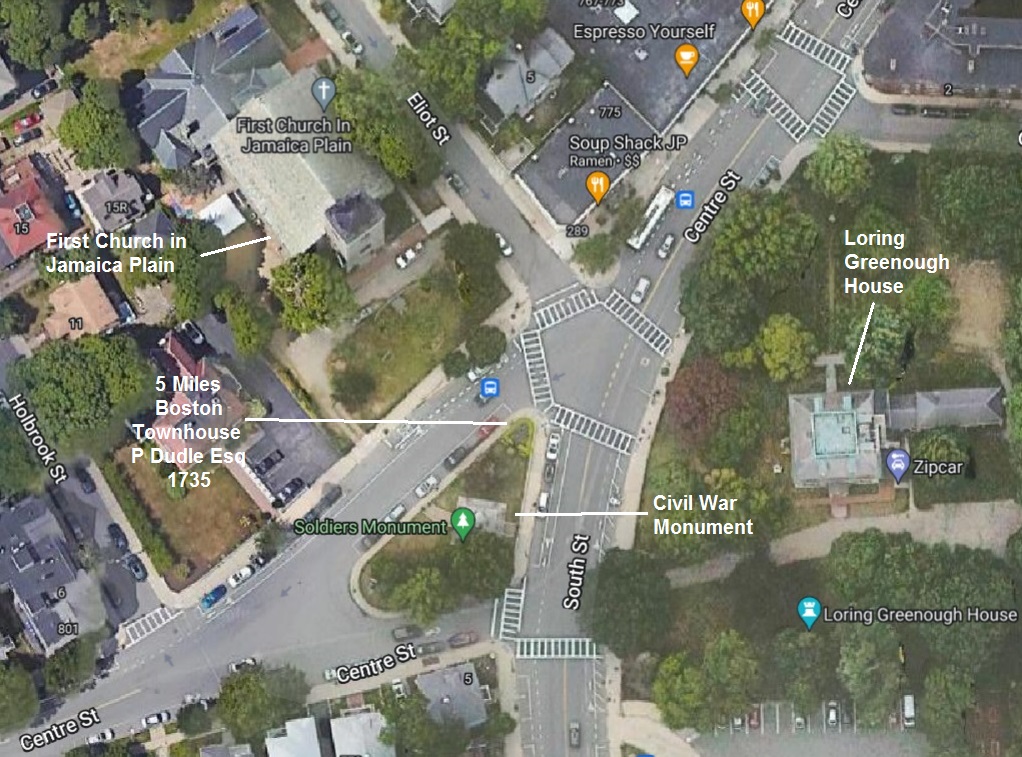
Map of Monument Square in Jamaica Plain. |
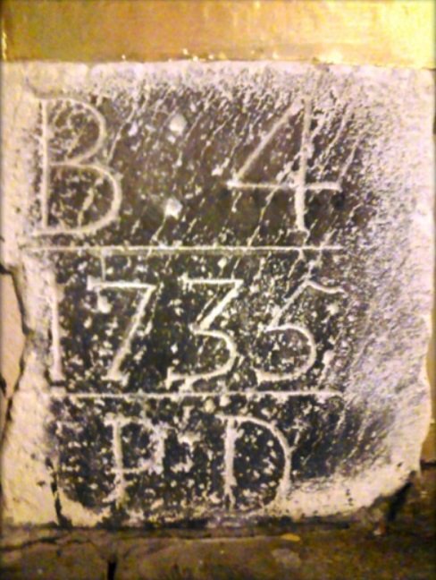
1735 - 6-Mile Marker on Centre Street in Jamaica Plain
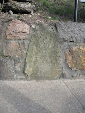
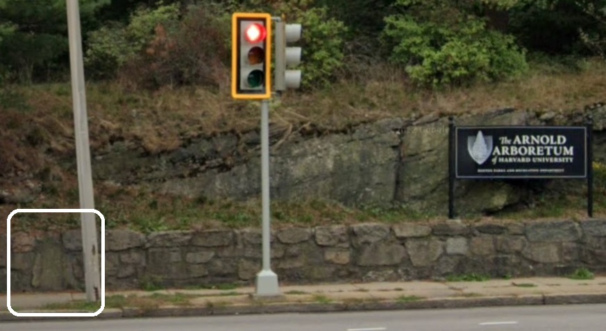
In the wall of the Arnold Arboretum of Harvard University is a mile marker by Paul Dudley that says:
6 Miles
Boston
1735 P D
The marker is in the Centre Street wall at the end of Allandale Street in Jamaica Plain. It is the last extant milestone in the series. The Arnold Arboretum of Harvard University is a botanical research institution and free public park, located in the Jamaica Plain and Roslindale neighborhoods of Boston, Massachusetts. Established in 1872, it is the oldest public arboretum in North America. Sources:
Walking the Post Road #10,
Brookline Historical Society, and
Arnold Arboretum.
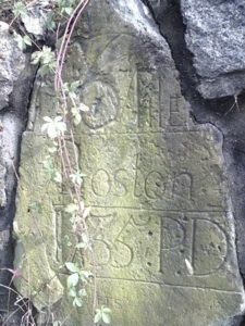
Mile Marker in Arboretum Wall. |
|
Mile Marker in Arboretum Wall. |
|
Mile Marker in Arboretum Wall at the end of Allandale Street in Jamaica Plain. |
|
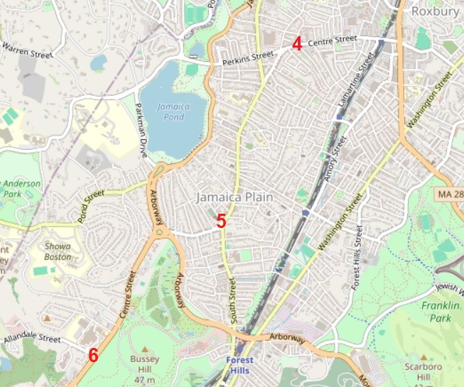
Mile Markers 4, 5, and 6 on Centre Street in Jamaica Plain. OpenStreetMap, January 2024 |
1735 - Westerly Burying Ground in West Roxbury
The Westerly Burying Ground on Centre Street at LaGrange Street in West Roxbury was was established in 1683 to permit local burial of residents of Jamaica Plain and the western end of Roxbury. The oldest graves contain many of the town's earliest and most prominent families. The oldest gravestone, from 1691, commemorates James and Merriam Draper, members of a prominent West Roxbury family. Source:
West Roxbury.
Norfolk County

Map of he route of the Kings Highway in Norfolk County. Source:
Google maps. |
- Dedham
- Lower East Street
- Mother Brook
- Eastbrook Road
- East Street
- High Street
- East Street - Fairbanks House
- Westwood
- East Street
- South Brook
- East Street
- Washington Street (MA 1A)
- Purgatory Brook
- Washington Street (MA 1A)
- Norwood
- Washington Street (MA 1A)
- Washington Street
- Neponset Street
- Pleasant Street
- Neponset River
- Pleasant Street
- Walpole
- Pleasant Street
- Old Post Road
- Walpole Country Club
- Sharon
- Old Post Road
- Spring Brook
- Old Post Road
- unnamed road
- South Main Street
- Foxborough
- Mechanic Street
- Robinson Brook
- Mechanic Street
- South Street
- Cedar Street (MA 106)
- Wading River
- Cedar Street (MA 106)
- Plainville
- Messenger Street (MA 106)
Gary Denton walking through Norfolk County:
- 12 - Dedham
- 13 - Dedham
- 15 - Dedham, Westwood
- 16 - Norwood, East Walpole, Sharon
- 19 - Foxborough, Plainville
1641 - Fairbanks House in Dedham
The Fairbanks House in Dedham, Massachusetts is a historic house built ca. 1641. It the oldest surviving timber-frame house in North America that has been verified by dendrochronology testing. Puritan settler Jonathan Fairbanks constructed the farm house for his wife Grace (n e Smith) and their family. The house was occupied and then passed down through eight generations of the family until the early 20th century. Over several centuries the original portion was expanded as architectural styles changed and the family grew. Sources:
Walking the Post Road #13 and
Fairbanks House.
Fairbanks House, 511 East Street, Dedham, Massachusetts. Source:
Fairbanks House. |
Billings Tavern in Sharon
"In the cemetery is a grave with great significance to my project of rediscovering the Old Post Road. The grave of Ebeneezer Billings, the owner of the Billings Tavern for more than half a century who died in 1758 at the age of eighty, sits in the middle of the small graveyard. A tavern existed in this remote area as early as 1658. Roger Billings was the first colonial landowner in the area, possessing 700 acres in 1682 which he passed on to his two sons upon his death in 1684. Roger Billings's other claim to fame in relation to the Post Road is that he was one of the two individuals granted the right in 1652 to build the Kings Bridge in Norwood that I crossed a couple of hours ago. (8). The original tavern, called Wainman s, was located on property deeded to Ebeneezer Billings, so his tavern must have been a successor to the original, as there were few inhabitants in the area even in the eighteenth century. Judge Samuel Sewall visited the tavern almost annually on his circuit tours of the colony, and he missed Sarah Knight's visit by only two weeks in 1704. The tavern stood on the opposite side of the street from the cemetery . . ." Source:
Walking the Post Road #16.

Map of West Cemetery in Sharon, Massachusetts. Source:
Google maps. |
|
|
Bristol County
The route of the Kings Highway in Bristol County is:
- North Attleborough
- Elmwood Street
- North Washington Street - Woodcock Hatch Maxcy House
- South Washuington Street
- Old Post Road
- Attleboro
- Newport Avenue
- Newport Avenue (MA 123)
- Newport Avenue (MA 1A)
- boundary line with Pawtucket, Rhode Island
Gary Denton walking through Bristol County: 19 - North Attleborough, Attleboro
1711 - Woodcock Hatch Maxcy House in North Attleborough
The Woodcock Hatch Maxcy House, also known as the Woodcock Garrison House, is located at 362 North Washington Street in North Attleborough, Massachusetts. It is now a museum operated by the North Attleborough Historical Society. This house was probably built between 1711 and 1722 by John Daggett. It was operated as a tavern by Daggett, John Maxcy (1722-1789), and Israel Hatch and his descendants (until the late 19th century). Sources:
Walking the Post Road #19 and
Woodcock Hatch Maxcy House.
Rhode Island
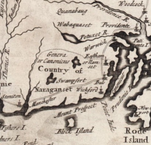
Highway through Rhode Island in 1702, between Woodcock (North Attleborough), Massachsetts, and Stoniton (Stonington), Connecticut. Excerpt from "An exact mapp of New England and New York" created by Cotton Mather (1663-1728). Source:
Norman B. Leventhal Map & Education Center Collection. |
The route for the Kings Highway in Rhode Island from Pawtucket to Westerly is roughly as follows:
- Providence County
- Kent County
- Washington County (also known as South County; Kings County before 1781)
1636 - Rhode Island
Rhode Island was founded by Roger Williams, who fled religious persecution in the Massachusetts Bay Colony to establish a haven for religious liberty. He founded Providence in 1636 on land purchased from local tribes, creating the first settlement in North America with an explicitly secular government. Source: Rhode Island
See: 1797 map of Rhode Island.
Town of Pawtucket
The route of the Kings Highway in Pawtucket is:
- boundary line with Attleboro, Massachusetts
- Newport Avenue (US 1A)
- Cottage Street
- North Bend Street
- Walcott Street
- Main Street
- Blackstone/Seekonk River
- Main Street
- East Avnue
- George Street
- Pawtucket Avenue (US 1)
- boundary line with Providence
Gary Denton walking through Pawtucket: 20.
1793 - Slater Mill in Pawtucket
The Slater Mill is a historic water-powered textile mill complex on the banks of the Blackstone River north of Main Street in Pawtucket, Rhode Island. It is modeled after cotton spinning mills first established in England. It is the first water-powered cotton spinning mill in America to utilize the Arkwright system of cotton spinning as developed by Richard Arkwright. The original portion of the Slater Mill built in 1793 was six bays long and two stories tall. Several additions were made beginning in 1801, and a second added in 1835. Between 1869 and 1872, a large addition was made to the north end of the mill. Cotton spinning continued until 1895, after which the mill was used for various industrial purposes until 1923.
The Slater Mill is said to have been responsible for starting the Industrial Revolution in America.
Pawtucket Falls is a waterfall on the Blackstone River that provided power for Samuel Slater's cotton spinning mill. Sources:
Walking the Post Road #20 and Slater Mill.
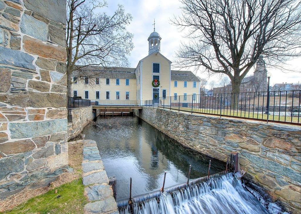
The Slater Mill on the banks of the Blackstone River in Pawtucket. |
Town of Providence
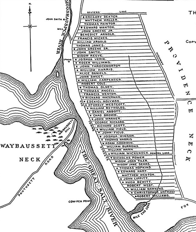
Early town layout of Providence. The plots are concentrated in the area now known as College Hill. Source:
College Hill. |
The route of the Kings Highway in Providence is:
- boundary line with Pawtucket
- North Main Street (US 1) - The Towne Street was the colonial-era name
- College Street
- Providence River - Weybosset Bridge
- Westminster Street
- Weybosset Street
- Broad Street
- boundary line with Cranston (Montgomery Avenue)
Gary Denton walking through Providence: 20,
21, and 28.
College Hill
College Hill is a historic neighborhood of Providence, Rhode Island, and one of six neighborhoods comprising the city's East Side. It is roughly bounded by South and North Main Street to the west, Power Street to the south, Governor Street and Arlington Avenue to the east and Olney Street to the north. The toponym "College Hill" has been in use since at least 1788. The name refers to the neighborhood's topography and numerous higher educational institutions: Brown University, Rhode Island School of Design, Pembroke College, and the since relocated Bryant University. Prior to Brown University's 1770 relocation to Providence, the area was known as Prospect Hill. Source:
College Hill.
Roger Williams National Memorial
The Roger Williams National Memorial is a landscaped urban park located on a common lot of the original settlement of Providence established by minister Roger Williams in 1636. The national memorial commemorates the life of Williams, who co-founded the Colony of Rhode Island and Providence Plantations and championed religious freedom. The park is bounded by North Main, Canal, and Smith Streets, and Park Row. The 1736 Antram-Gray House is at the northeast corner. Major features in the northern section include the site of the spring which prompted Williams to select the site. Source:
Roger Williams National Memorial.
1722 - Cathedral of St. John
The Episcopal Cathedral of St. John, located at 271 North Main Street in Providence, was built in 1810 and was designed and built by John Holden Greene in the early Gothic Revival style, replacing a smaller wooden 1722 church on the same site. The church was made a seat of the Episcopal Diocese of Rhode Island in 1929. The church closed in 2012 due to declining membership and the need for extensive renovations. Currently, the church is being repaired and renovated to become a "exhibition and reconciliation center" focusing on the trans-Atlantic slave trade. It was partially reopened in 2018. Source:
Cathedral of St. John.
1638 - First Baptist Meetinghouse
The First Baptist Meetinghouse also known as the First Baptist Church in America. It is the oldest Baptist church congregation in the United States. The Church was founded in 1638 by Roger Williams in Providence, Rhode Island. The present church building was erected between 1774 and 1775 and held its first meetings in May 1775. It is located at 75 North Main Street in Providence's College Hill neighborhood. Source:
First Baptist Church in America.
1660 - Weybosset Bridge
The first bridge across the Providence River was erected in 1660, connecting the shore of the Neck with Weybosset Neck and the Pequot path which provided access to the meadow lands. Previously, a ford in the river had been used as an approach to that path which led through Pawtuxet and the Narragansett country into the lands of the Pequots in Connecticut. Poor construction and lack of repairs caused the bridge to fail in the late 1670's. For the next several decades the townspeople, their cattle, and their teams waded across the ford until a second bridge was constructed in 1711. It was destroyed by a flood and rebuilt in 1719. A fourth bridge, funded by the colony's lottery in 1745, was carried away by a gale and record high tides in 1761. During those years, farmers from the meadows to the west crossed over the bridge and sold their produce in what is still known as Market Square. A Marker is on College Street, on the right when traveling west. Source:
The Historical Marker Database.
Town of Cranston
The route of the Kings Highway in Cranston is:
- boundary line with Providence (Montgomery Avenue)
- Broad Street
- Pawtuxet River
Gary Denton walking through Cranston: 28 and 29.
1803 - Pawtuxet Baptist Church
The earliest factual records that apparently can be found pertaining to a Baptist Church in Pawtuxet are those concerning a donation a small piece of land by Peleg Arnold in April 1764 and 18 months later, a similar donation of adjoining land by his neighbor, Abraham Sheldon, for a local church home. The deeds of these gifts stated, Unto my said neighbors and inhabitants of Pawtuxet and others in the colony, as above said, to them and their heirs forever, for the use and benefit of settling a meeting house for the society of the Baptist Church for the propagating of the Christian Religion of Jesus Christ and the good of the neighbors and inhabitants of Pawtuxet. With some slight modifications of boundary, our present church building now stands on those two lots of land. No records appear to exist as to the building of the first and original edifice other than the statement of Having been erected in 1803 , quoted from An Account of the Churches of Rhode Island published by George Whitney, Providence, 1854. Source:
Pawtuxet Baptist Church.
Town of Warwick
The route of the Kings Highway in Warwick is:
- Pawtuxet River
- Post Road (US 1A)
- Post Road (US 1)
- boundary line with East Greenwich (Division Street)
Gary Denton walking through Warwick: 29 and 30.
1750 - Capt. Oliver Gardiner House
Captain Oliver Gardiner House is a historic house located in Warwick, Rhode Island. Built about 1750, it is a wood-frame structure with a gambrel roof. Its main facade has six irregularly-spaced bays, with a centrally positioned entrance. The house is unusual for its period in that it has a large central hallway, a feature not commonly seen until the Federal period. Oliver Gardiner, its first owner, was a ship's captain. Source:
Capt. Oliver Gardiner House.
Town of East Greenwich
The route of the Kings Highway in East Greenwich is:
- boundary line with Warwick (Division Street)
- Main Street (US 1)
- Maskerchugg River
- Post Road (US 1)
- Hunt River
Gary Denton walking through East Greenwich: 30.
1773 - Col. Micah Whitmarsh House in East Greenwich
The Colonel Micah Whitmarsh House is located at 294 Main Street in East Greenwich, Rhode Island. It was acquired by Micah Whitmarsh in 1773. It is the only brick house on the street. It has been owned since 1966 by the East Greenwich Historical Society. Source:
Col. Micah Whitmarsh House.
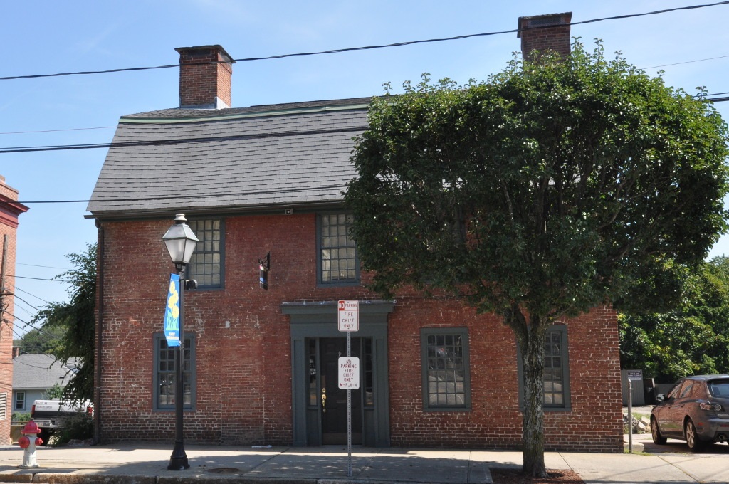
Colonel Micah Whitmarsh House, 294 Main Street, East Greenwich, Rhode Island. |
Town of North Kingstown
The route of the Kings Highway in North Kingstown is:
- Hunt River
- Post Road (US 1)
- Cocumscussoc Brook
- Post Road (US 1)
- Old Post Road
- Post Road (US 1)
- Tower Hill Road (US 1)
- Mattatuxet River
- Pendar Road
- Shermantown Road
- Tower Hill Road (US 1)
- boundary line with South Kingstown
Gary Denton walking through North Kingstown: 31 and 32.
32,
33,
34.
1637 - Roger Williams Trading Post in North Kingstown
The Palmer-Northrup House is an historic house at 7919 Post Road in North Kingstown, Rhode Island. In front of the house is a marker for the trading post established by Roger Williams in 1637. Source:
Palmer-Northrup House.
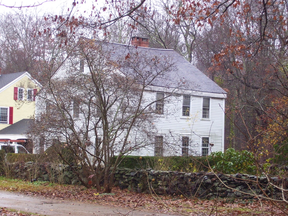
Palmer Northrup House at 7919 Post Road in North Kingstown, Rhode Island. |
|
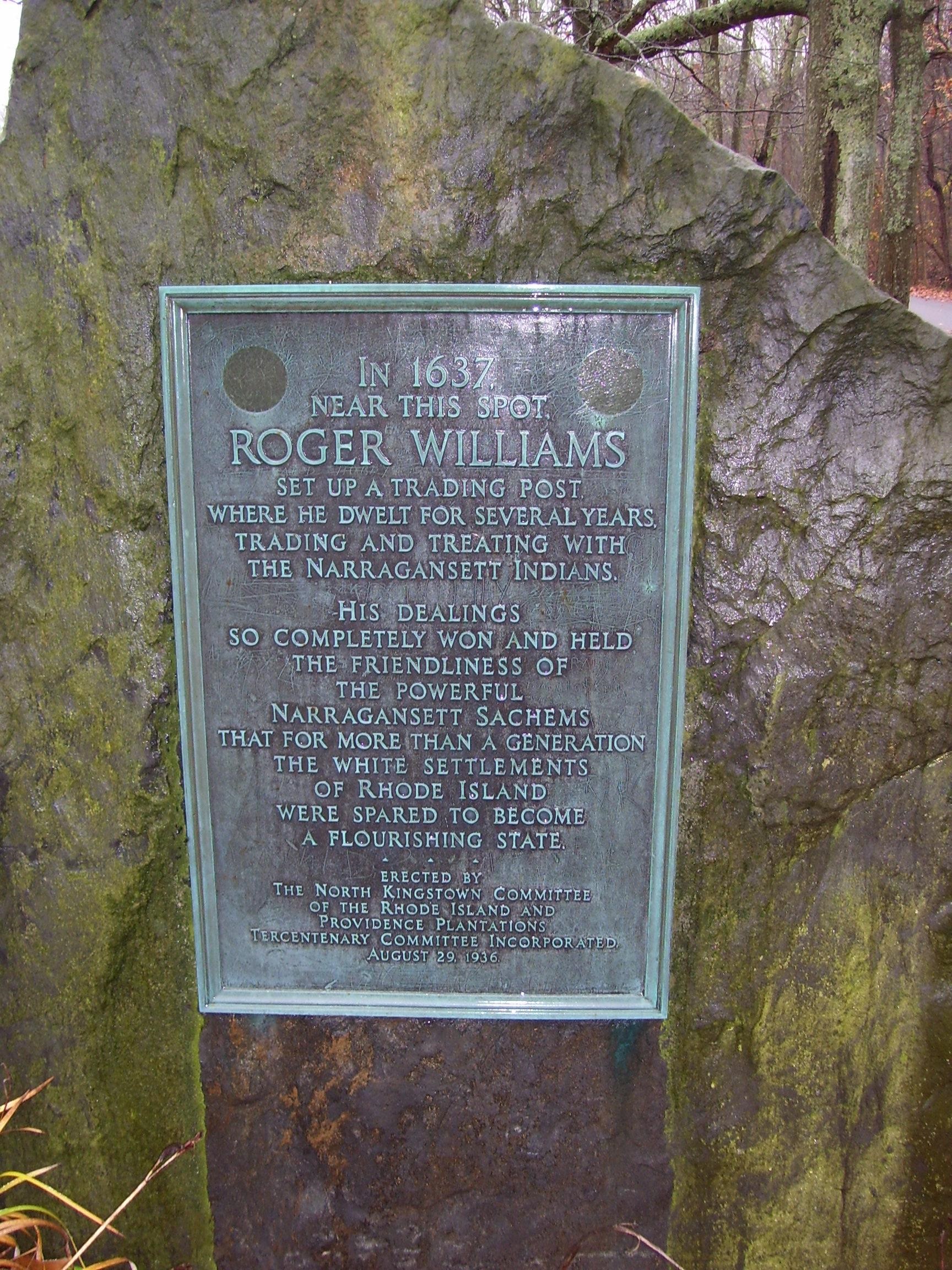
Marker for Roger Williams Trading Post. |
|
1678 - Smith's Castle in North Kingstown
Smith's Castle was built in 1678 to replace an earlier structure which the Narragansett Tribe destroyed during King Philip's War. The land on which the house was built was known as Cocumscussoc (or Cocumscossoc) and was near the original site of Roger Williams' trading post. Williams was the founder of Providence Plantations and a prominent Baptist theologian. He built the trading post on the site in 1637 to trade with the Narragansetts after receiving the land from the tribe. Eventually, he sold the trading post to Smith to finance his trip to Great Britain to secure a charter for Rhode Island.
Smith constructed a large house which was fortified, giving the house its nickname as a castle. His son Richard Smith Jr. inherited the plantation in 1666 and invited militias from Massachusetts and Connecticut to use the property during King Philip's War. The house was burned in retaliation for the Great Swamp Fight, and the present structure was built in its place, originally as a saltbox house, and later modified into its current form. . Source:
Smith's Castle.
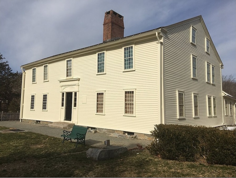
Smith's Castle, across from 7919 Post Road in North Kingstown, Rhode Island. |
Town of South Kingstown
The route of the Kings Highway in South Kingstown is:
- boundary line with North Kingstown
- Tower Hill Road (US 1)
- Old Tower Hill Road (RI 1A)
- Main Street (RI 1A)
- Suagatucket River
- Main Street (RI 1A)
- Old Post Road
- Post Road
- Commodore Perry Highway (US 1)
- Post Road (RI 1A)
- boundaryline with Charlestown
Gary Denton walking through South Kingstown: 32.
32,
33,
34.
1752 - Willow Dell/Weeden Farm in South Kingstown
Willow Dell, also known as Weeden Farm, is a historic farmhouse in South Kingstown, Rhode Island. It is located on the south side of the highway, just west of Matunuck Beach Road, on a 7-acre parcel of land. The main block of the gambrel-roofed house was built c. 1752 by Colonel Jeremiah Bowen, and was purchased in 1826 by Wager Weeden, whose descendants still own the property. The property includes two barns, a garage, and a stable which has been converted to residential use, as well as the Wager Weeden Memorial Fountain, visible on the south side of the highway by a stone marker. Source:
Willow Dell.
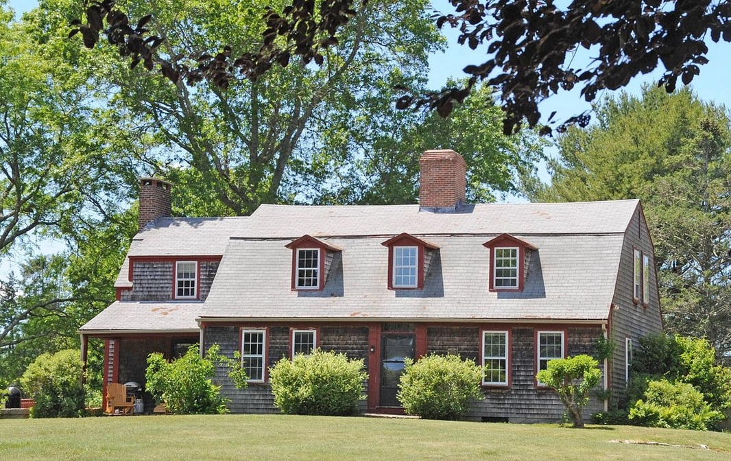
Willow Dell, 2700 Commander Oliver Hazard Perry Highway, South Kingstown, Rhode Island. Source:
Willow Dell |
Town of Charlestown
The route of the Kings Highway in Charlestown is:
- boundary line with South Kingston
- Old Post Road (RI 1A)
- Post Road (US 1)
- Old Post Road (RI 1A)
- Post Road (US 1)
- Old Post Road (RI 1A)
- Post Road (US 1)
- Old Post Road (RI 1A)
- Post Road (US 1)
- Old Post Road (RI 1A)
- Post Road (US 1)
- Old Post Road (RI 1A)
- boundaryline with Westerly
Gary Denton walking through Charlestown: 33.
1738 - Charlestown
In 1738, Charlestown separated from the town of Westerly and was named in honor of Charles II, the English King who had granted Rhode Island its charter. Brought on primarily by the hardship to citizens traveling to attend town meetings and gatherings, the separation was finally passed, although not without much debate. At that point in time, Richmond was still part of Charlestown and would not separate until 1747.
A young, colonial Charlestown was active and prosperous with its many mills, farms and coastal environment. The establishment of the Old Post Road along its seaboard had become a well-traveled route, thankfully as a result of its presence as a Native American trail thousands of years old. It now served as a means of communication and commerce within the colonies. Charlestown would go through many growing pains over the next 300 years, along with the rest of Rhode Island's early towns, but retained its diversity, cultural heritage and its rich history.
Source:
Charlestown Historical Society.
1739 - Joseph Stanton House in Charlestown
The Joseph Stanton House (also known as the Wilcox Tavern) is a historic house at 5153 Old Post Road in Charlestown, Rhode Island. The main house is a 2- story wood-frame structure built some time before 1739 by Joseph Stanton II, and it is where his son Joseph Stanton, Jr., who would serve as one of Rhode Island's first United States Senators, was born. The house belonged to Stanton, Jr. until 1811 when he sold it to Edward Wilcox, who began operating a tavern on the premises. Source:
Joseph Stanton House.
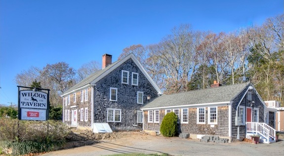
Joseph Stanton House (also known as the Wilcox Tavern), 5153 Old Post Road, Charlestown, Rhode Island. Source:
Joseph Stanton House. |
1740 - Stanton Inn in Charlestown
In 1650, the Niantics, a tribe in Narragansett Nation, rewarded Thomas Stanton property in Charlestown, Rhode Island, for brokering a deal to return their beloved Native American princess who had been abducted. The notorious Manese tribe had staged a daring night raid and kidnapped the young princess, taking her to their village on Block Island. Thomas Stanton rowed 12 miles over ocean swells to the island and negotiated her freedom. Upon her return, the Narragansetts gifted Stanton with a four by two-mile tract of land. In 1740, Thomas Stanton's grandson, Joseph Stanton II, built the Stanton Inn next to a small dwelling on the gifted land. He converted this small dwelling, which dates to 1667, into what is believed to be the first Native American school in Colonial America. The schoolhouse has been preserved in its original colonial-period form. In the 1800's the Stanton Inn became a welcome stop for horse-drawn carriages and stagecoaches on the well-traveled Post Road between Boston and Philadelphia. Source:
Stanton Inn.
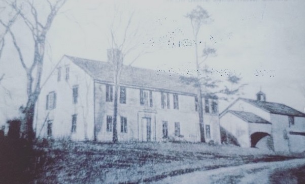
Stanton Inn, 4115 Old Post Road, Charlestown, Rhode Island. Circa 1879. Source:
Rhode Island Monthly. |
Town of Westerly
The route of the Kings Highway in Westerly is:
- boundary line with Charlestown
- Old Post Road (RI 1A)
- Post Road (US 1)
- Old Post Road (RI 1A)
- Post Road (US 1)
- Franklin Street (US 1)
- Granite Street (US 1)
- Broad Street (US 1)
- Pawcatuck River
Gary Denton walking through Westerly: 34.
1734 - Babcock Smith House in Westerly
The Babcock Smith House is a historic house in Westerly, Rhode Island.
The house was built around 1734. Dr. Joshua Babcock, a correspondent with Benjamin Franklin, lived in the house and hosted both Franklin and General George Washington at the home. Babcock served also as a general in the state militia, as a justice of the Rhode Island Supreme Court, and as Westerly's first postmaster in the 1770s. He operated the post office and a general store out of this house. Babcock died in 1783 and "his family occupied the house until 1817. When his second wife, Anna Maxson Babcock, died in 1812, the property was passed to Dudley Babcock. Dudley, having lost some ships in the war of 1812 and unable to pay some debts, sold the house to his distant cousin, Oliver Wells, in 1817. Mr. Wells used it as a prosperous tenant farm, however the house was allowed to fall into disrepair."
Orlando Smith bought the property in 1846; he repaired the house and started a successful granite business based on a granite outcrop he had discovered there. The house became a museum in 1972. Source:
Babcock Smith House.
.
Connecticut
The route for the Kings Highway in Connecticut from Stonington to Greenwich is roughly as follows.
- New London County
- Middlesex County
- New Haven County
- Fairfield County
1636 - Connecticut Colony
The Connecticut Colony was organized in 1636 as a settlement for a Puritan congregation. The English permanently gained control of the region in 1637.
Two other English settlements in Connecticut were merged into the Colony of Connecticut:
- Saybrook Colony in 1644
- New Haven Colony in 1662
Connecticut Colony played a significant role in the establishment of self-government in the New World with its refusal to surrender local authority to the Dominion of New England, an event known as the Charter Oak incident which occurred at the Jeremy Adams inn and tavern in Hartford.
Source:
Connecticut Colony.
Town of Stonington
The route of the Kings Highway in Stonington is:
- Pawcatuck River
- West Broad Street (US 1)
- Pequot Trail (CT 234)
- Anguilla Brook
- Pequot Trail (CT 234)
- Stony Brook
- Pequot Trail (CT 234)
- Copps Brook
- Pequot Trail (CT 234)
- Main Street (CT 27)
- Whitford Brook (tributary of Mystic River)
Gary Denton walking through Stonington: 35.
1674 - The Road Church, 1829
The First Congregational Church of Stonington is the oldest church in Stonington (The Road Church) and one of the oldest in Connecticut. The church was established in 1674 and the first Minister was Reverend James Noyes. The current Road Church Meetinghouse was built in 1829 after the original building burned. Many of the beams and other significant architectural features that were salvaged after the fire, were used when constructing the Sanctuary you see here today. The church has a unique design and all attempts were made to keep it as original as possible. The box style pews and the simplicity of the church architecture datte 17th century. Source
First Congregational Church of Stonington.
Town of Groton
The route of the Kings Highway in Groton is:
- Whitford Brook (tributary of Mystic River)
- Route 27 (CT 27)
- Gold Star Highway (CT 184)
- Welles Road
- Red Brook
- Welles Road
- Packer Road
- Haleys Brook
- Packer Road
- Godfrey Road
- Cold Spring Road
- Haleys Brook
- Cold Spring Road
- Gold Star Highway (CT 184)
- Haleys Brook
- Gold Star Highway (CT 184)
- Candlewood Road
- Gold Star Highway (CT 184)
- Great Brook
- Gold Star Highway (CT 184)
- Hempstead Brook
- Gold Star Highway (CT 184)
- Kings Highway
- crossing highway, including I 95
- Kings Highway
- Bridge Street
- Broad Street
- Thames Street
- Thames River - Ferry to New London
Gary Denton walking through Groton: 36.
1842 - Pequot Hotel
The Pequot Hotel was built about 1842 for Richard Burnett. It is rominently sited in the center of the Burnetts Corner Historic District at the intersection of Cow Hill and Packer roads. Source: Burnetts Corner Historic District.
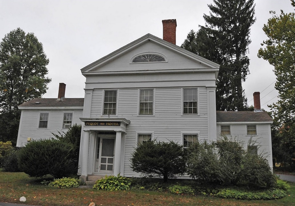
Pequot Hotel on Packer Road at Cow Hill Road in Burnetts Corner, Groton. Source: Jerrye & Roy Klotz, MD |
1756 - George Washington
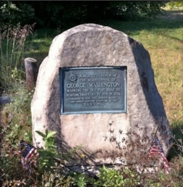
DAR marker: Dedicated in honor of the bicentennial of George Washington marking the Old Post Road traveled by him in 1756. Source Gary Denton: 36 |
|
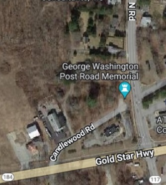
Location of marker on Google maps 2023. Center Groton. |
|
1893 - Thames River Ferry
Ferries have existed in Connecticut from the earliest days of the colony because of its many rivers and streams too wide to cross by any other means. Ferries were also utilized at crossings where bridges, though feasible, were too costly or difficult to construct. Most ferry boats were scow-type, flat-bottomed boats that operators poled, rowed, or sailed across the water. Unlike the building of a bridge, where the cost of construction and repair was a drain on the town treasury, a ferry was a low-cost alternative. In return for the right to collect a toll, a willing ferryman promised to provide a boat and operate the service for a given period of years, usually seven. The General Court set the fare for each ferry, with toll rates depending on the nature of the crossing. Tolls were highest at the colony's two widest crossings, the Thames and the Connecticut Rivers, where a further surcharge was allowed for a winter crossing. Source: Richard DeLuca, Connecticut History.
New London. Excerpt from 1893 map of New London showing the ferry to Groton at the foot of State Street. Source: New London map |
|
Groton. Excerpt from 1893 map of Groton showing the ferry to New London at the foot of School Street. Source: Groton map |
|
Town of New London
The route of the Kings Highway in New London is:
- Thames River - Ferry from Groton
- Bank Street
- Bank Street (US 1)
- boundary line with Waterford
Gary Denton walking through New London and Waterford: 37.
1835 - New London Customhouse
The New London Custom House is a historic custom house at 150 Bank Street in New London, Connecticut. it was built in 1833-35. It was designed by Robert Mills, one of the country's first formally trained architects. From 1839-40, the schooner La Amistad, on which captured Africans meant for the slave trade rebelled, was impounded at a wharf behind the customhouse. It is now a local museum covering the city's maritime history. Source
New London Customhouse.
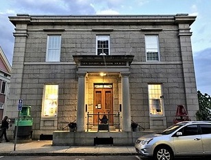
New London Custom House, 150 Bank Street, New London. The New London Custom House is located on New London's waterfront, facing north onto Bank Street east of its junction with Pearl Street. It is a three-story masonry structure, built out of dressed granite of differing colors. |
Town of Waterford
The route of the Kings Highway in Waterford is:
- boundary line with New London
- Boston Post Road (US 1)
- Rope Ferry Road (CT 156)
- Jordan Brook
- Rope Ferry Road (CT 156)
- Niantic River - Rope Ferry to East Lyme
Gary Denton walking through New London and Waterford: 37.
Niantic River Rope Ferry
The technology utilized by early Connecticut ferries varied from crossing to crossing. Most were scow-type, flat-bottomed boats that operators poled, rowed, or sailed across the water or, in the case of the Niantic ferry, pulled across using a rope line that spanned the river. A most ingenious crossing was at Windsor. Here a cable-pulley system stretched across the river and was firmly anchored to each shore. The cable passed through a pulley on the side of the ferry scow. After shoving off, the ferryman turned the boat at an angle to the river's current, whose force moved the boat along the cable line in much the way a sailboat tacked into the wind. On the return crossing, the ferryman simply reversed the angle of the boat to the flow of the water. Source: Richard DeLuca, Connecticut History.
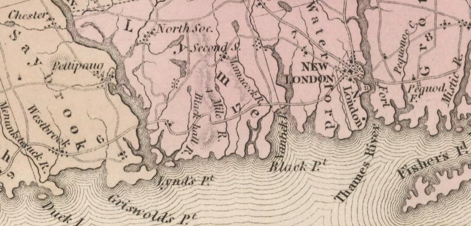
Excerpt from 1834 map of Connecticut, showing Groton, New London, Lyme, and Saybrook, separated by the Thames River, the Niantic River, and the Connecticut River (at Lynd's Point). Source 1834 map of Connecticut. |
Town of East Lyme
The route of the Kings Highway in East Lyme is:
- Niantic River - Rope Ferry from Waterford
- Main Street (CT 156)
- West Main Street (CT 156)
- Fourmile River
Gary Denton walking through East Lyme and Old Lyme: 38.
1660 - Thomas Lee House
The Thomas Lee House was built about 1660 and is one of the oldest in Connecticut. It is on Main Street at Giants Neck Road in East Lyme. Today the house is a historic house museum operated by the East Lyme Historical Society, and furnished as it would have been in the 18th century. Source: Thomas Lee House.
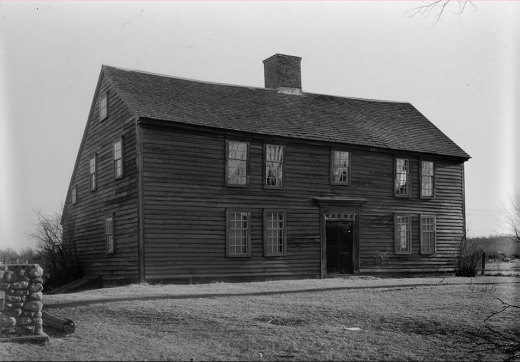
1940 photo of Thomas Lee House on Main Street in East Lyme. Source: Thomas Lee House |
Town of Old Lyme
The route of the Kings Highway in Old Lyme is:
- Fourmile River
- Shore Road (CT 156)
- Mile Creek Road
- Armstrong Brook
- Mile Creek Road
- Black Hall River
- Mile Creek Road
- Shore Road (CT 156)
- Johnny Cake Hill Road
- McCurdy Road
- Duck River
- McCurdy Road
- Ferry Road
- Lieutenant River
- Ferry Road
- Connecticut River - Ferry
Gary Denton walking through East Lyme and Old Lyme: 38.
Connecticut RiverFerries have existed in Connecticut from the earliest days of the colony because of its many rivers and streams too wide to cross by any other means. Ferries were also utilized at crossings where bridges, though feasible, were too costly or difficult to construct. Most ferry boats were scow-type, flat-bottomed boats that operators poled, rowed, or sailed across the water. Unlike the building of a bridge, where the cost of construction and repair was a drain on the town treasury, a ferry was a low-cost alternative. In return for the right to collect a toll, a willing ferryman promised to provide a boat and operate the service for a given period of years, usually seven. The General Court set the fare for each ferry, with toll rates depending on the nature of the crossing. Tolls were highest at the colony's two widest crossings, the Thames and the Connecticut Rivers, where a further surcharge was allowed for a winter crossing. Source: Richard DeLuca, Connecticut History.
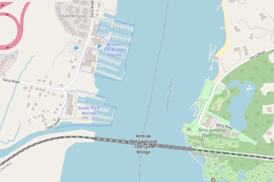
Connecticut River between Ferry Road in Old Lyme to the east and Ferry Road in Old Saybrook to the west. The railroad bridge was originally built in 1870. Source: OpenStreetMap 2023. |
The Connecticut River is the longest river in New England. It is 406 miles lomg. It rises from Fourth Connecticut Lake, a small pond 300 yards south of the Canada United States border in the town of Pittsburg, New Hampshire, at an elevation of 2,670 feet above sea level. It discharges into Long Island Sound between Old Lyme and Old Saybrook, Connecticut. It produces 70% of Long Island Sound's fresh water. Source: Connecticut River.
Town of Old Saybrook
The route of the Kings Highway in Old Saybrook is:
- Connecticut River - Ferry
- Ferry Road
- Boston Post Road
- Boston Post Road (US 1)
- Oyster River
- Boston Post Road (US 1)
- Cold Spring Brook
Gary Denton walking through Old Saybrook: 39 and 40.
1693 - John Whittlesey Jr. House
The John Whittlesey Jr. House is located in northeastern Old Saybrook, on the south side of Ferry Road. It is set back from the street on a lot lined at the street by a low stone retaining wall. Source: John Whittlesey Jr. House.
Town of Westbrook
The route of the Kings Highway in Westbrook is:
- Cold Spring Brook
- Boston Post Road (US 1)
- Old Clinton Road
- Patchogue River
- Old Clinton Road
- Old Post Road (CT 145)
- Menunketesuck River
Gary Denton walking through Old Saybrook, Westbrook, and Clinton: 40.
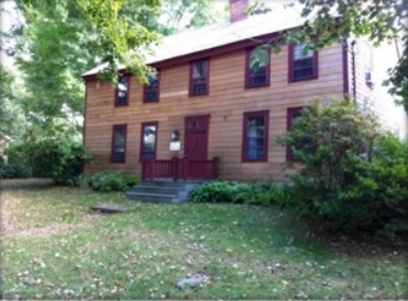
Jeremiah Lee House, Old Clinton Road, Westbrook. Source: Gary Denton 40 |
Jeremiah Lee House, 1740-1750
Almost immediately on Old Clinton Road I pass the old town cemetery. Then I head downhill, and I cross a bridge over the surprisingly wide and swift-running Patchogue River. I then head back uphill and enter a neighborhood of old houses. One house immediately attracts my attention-- a house with a sign that reads Jeremiah Lee House, 1740-1750. Westbrook was part of Saybrook until 1840. Both Hamilton and Birket bypassed the center of Saybrook and stopped at a place run by a widow named Lay, which was seven miles from Saybrook Ferry according to Birkett and six miles from Seabrook according to Hamilton. A tavern run by a Leigh is listed as five miles from Saybrook Center and seven miles from Saybrook Ferry in Low's 1775 Almanac. As this house is in what was once part of Saybrook, is five miles from Old Saybrook, and dates to the 1740s, lacking any further evidence to the contrary, I suggest that this may be the place mentioned as Leigh's (or Lay's). Source: Gary Denton 40.
Town of Clinton
The route of the Kings Highway in Clinton is:
- Menunketesuck River
- Old Post Road (CT 145)
- East Main Street (US 1)
- Indian River
- West Main Street (US 1)
- Hammonasset River
Gary Denton walking through Clinton and Madison: 40 and 41.
1701 Yale University
Connecticut Colony's General Court granted a charter in 1701 for "the founding of a collegiate school within His Majesty's Colony of Connecticut," and its founders chose Abraham Pierson as its rector. Pierson was one of the early leaders of Clinton's church, and the first classes were held in his parsonage in Clinton. The school was later moved to Saybrook and then to New Haven, where it eventually became Yale University. Abraham Pierson is today interred in Clinton, Connecticut. Abraham Pierson School in Clinton (grades 4-5), was named for him; and a bronze statue of him is located on East Main Street in Clinton. Source: Clinton.
1735 Merrill House
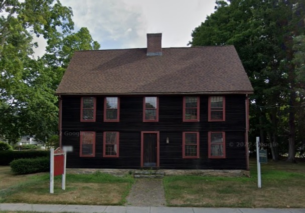
1735 Merrill House, 130 East Main Street, Clinton |
Town of Madison
The route of the Kings Highway in Madison is:
- Hammonasset River
- Boston Post Road (US 1)
- Fence Creek
- Boston Post Road (US 1)
- Old Boston Post Road
- Boston Post Road (US 1)
- Neck River
- Boston Post Road (US 1)
- Old Boston Post Road
- Boston Post Road (US 1)
- East River
Gary Denton walking through Clinton and Madison: 41.
1681 - Deacon John Grave House
The Deacon John Grave House, located at 581 Boston Post Road in Madison is a saltbox house that was built by Deacon John Grave in 1681. The Grave family lived in the house for 300 years. The Deacon John Grave Foundation was formed in 1983 to save the house from demolition, and converted it into a museum. Source:
Deacon John Grave House.
Town of Guilford
The route of the Kings Highway in Guilford is:
- East River
- Boston Post Road (US 1)
- Boston Street (CT 146)
- Whitfield Street
- Broad Street
- River Street
- Boston Post Road (US 1)
- York Street
- West River
- York Street
- Spinning Mill Brook
- York Street
- Boston Post Road (US 1)
- boundary line with Branford
Gary Denton walking through Guilford: 42 and 43.
1713 - Hyland House
The Hyland House Museum or Hyland Wildman House is a historic house museum at 84 Boston Road in Guilford. Built in 1713, it is one of the town's best-preserved houses of that period. It has been open to the public as a museum since 1918, under the auspices of a local historic preservation group. Source: Hyland House Museum.
Town of Branford
The route of the Kings Highway in Branford is:
- boundary line with Guilford
- East Main Street (US 1)
- Branford River
- East Main Street (US 1)
- Queach Brook
- East Main Street (US 1)
- East Main Street
- Main Street
- Main Street (CT 146)
- West Main Street (US 1)
- Farm River
Gary Denton walking through Branford: 43 and 44.
1750 - Frisbie House
The Edward Frisbie House is a historic house at 699 East Main Street in Branford, Connecticut. It was robably built about 1750, historically attributed to one of the area's early settlers. Source:
Edward Frisbie House (Branford, Connecticut).
1724 - Harrison House
The Harrison House, also known as Harrison Linsley House, is a historic house museum at 124 Main Street in Branford. Built in 1724 by a descendant of Branford's founders, it is a good example of a Connecticut saltbox structure. Since 2016 it has been operated as a house museum by the Branford Historical Society. Source: Harrison House.
Town of East Haven
The route of the Kings Highway in East Haven is:
- Farm River
- West Main Street (US 1)
Farm River
- West Main Street (US 1)
- Main Street (CT 100)
- Main Street
- boundaryline with New Haven
Gary Denton walking through East Haven: 44.
1774 - Old Stone Church
The First Congregational Church of East Haven (also known as Old Stone Church) is a historic church at 251 Main Street in East Haven. It was built in 1772-74 by George Lancraft, a local builder, and is one of Connecticut's few surviving pre-Revolutionary churches. It is also one of New England's oldest stone churches, preceded principally by King's Chapel in Boston, Massachusetts Source: Old Stone Church.
Town of New Haven
The route of the Kings Highway in New Haven is:
- boundaryline with East Haven
- Main Street Annex
- Townsend Avenue
- Quinnipiac Avenue
- East Ferry Street
- Quinnipiac River - Ferry Street Bridge
- Ferry Street
- Chapel Street
- Mill River
- Chapel Street - Connecticut Hall
- York Street
- Davenport Avenue
- Congress Avenue (US 1)
- Boston Post Road (US 1)
- West River
Gary Denton walking through New Haven: 44, 45, and 46.
1640s - Quinnipiac Ferry
Ferries have existed in Connecticut from the earliest days of the colony because of its many rivers and streams too wide to cross by any other means. Ferries were also utilized at crossings where bridges, though feasible, were too costly or difficult to construct. One of the earliest ferries in Connecticut operated across East (Quinnipiac) River in New Haven. This ferry began operation in the 1640s. Source: Richard deLuca, Connecticut History.
1638 - New Haven Green
The New Haven Green is a 16-acre privately owned park and recreation area located in the downtown district of the city of New Haven. It comprises the central square of the nine-square settlement plan of the original Puritan colonists in New Haven. Today the Green is bordered by the modern paved roads of College, Chapel, Church, and Elm streets. Temple Street bisects the Green into upper (northwest) and lower (southeast) halves. The Green is a traditional town green (common) and was originally known as "the marketplace." It was completed in 1638. The Puritans were said to have designed the green large enough to hold the number of people who they believed would be spared in the Second Coming of Christ: 144,000. In its early years, the Green held a watch house and a prison. Source: New Haven Green.

Excerpt from the 1748 Wadsworth Map of New Haven, showing Yale College at bottom left (now Bingham Hall) and Hopkins Grammar School next to the Jail on the New Haven Green. The shaded area is the burial ground. College Street runs from bottom to top. Chapel Street is at lower left. Source: Norman B. Leventhal Map & Education Center |
1660 - Hopkins School
In 1660, the Hopkins School was opened in a one-room building on the New Haven Green. It was a traditional grammar school that taught Latin, Greek, and Hebrew grammar. Grammar schools of the time generally prepared young men for college. The school relocated three miles west northwest in 1926. Edward Hopkins, seven-time governor of the Connecticut Colony, bequeathed a portion of his estate to found schools dedicated to "the breeding up of hopeful youths." Source: Hopkins School.
1752 - Connecticut Hall
Connecticut Hall is a Georgian building on the Old Campus of Yale University. Completed in 1752, it was originally a student dormitory, a function it retained for 200 years. Part of the first floor became home to the Yale College Dean's Office after 1905, and the full building was converted to departmental offices in the mid-twentieth century. It is currently used by the Department of Philosophy, and its third story contains a room for meetings of the Yale Faculty of Arts & Sciences, the academic faculty of Yale College and the Graduate School. Source: Connecticut Hall.
1832 - Exchange Building
The Exchange Building, at the northeast corner of Church and Chapel Streets in New Haven, was completed in 1832, as one of the first major commercial blocks in downtown New Haven. The brick, Greek Revival-style building stands four stories tall, and it is topped with a large cupola. It has a roughly square footprint, with 18 window bays here along Church Street, plus 17 window bays around the corner along Chapel Street. Attorney Roger Sherman Baldwin had his law offices here during his work on the 1841 Amistad case. Baldwin succ essfully defended the Africans who had been illegally sold into slavery, and he subsequently became governor of Connecticut from 1844 to 1846, and a U. S. Senator from 1847 to 1851. Source: Exchange Building.
1600s - Beers Tavern
The Taft Apartments building, 990 Chapel Street, at the southeast corner of College and Chapel Streets in New Haven, was completed in 1912. It is on the site of what was once known as Beers Tavern, then The Ordinary, which has been around since the 1600s, when it first opened for business only some 20 years after the founding of the city of New Haven. The pub has held several roles over its long history, ranging from general shop to bookstore, but during its earliest days, the bar maintained a successful inn. During the Revolutionary Era, Isaac Beers led as the Ordinary’s innkeeper, leading to the moniker of Beers Tavern. Under Beers, the Ordinary found itself at the center of New Haven’s political activity, as local leaders used the building as an unofficial meeting place.
This choice to frequent the bar led to the Ordinary’s historic association with the infamous Benedict Arnold, who rode to the pub in 1775, demanding the keys to the town’s powder house from the Town Selectman. His objective was singular: to bring New Haven’s militia to assist the Patriots at the beginning of the Revolution. His ride was successful, and New Haven’s militia journeyed to Cambridge, Massachusetts following the British attacks during the Battle of Lexington. Several years later, Arnold would betray his comrades and the militia he led by joining the British army in 1780.
The inn also hosted several famous guests, including General George Washington, who stayed at Beers Tavern for a night with Martha Washington on his way to Cambridge, Massachusetts. The bar still proudly commemorates this fact with a plaque on the building’s wall, which details Washington’s route through New Haven.
After Beers’ time as innkeeper, the Ordinary went through several owners, before being torn down to create the New Haven Hotel in the mid-19th century, which was subsequently replaced with the famous Hotel Taft in the early 20th century. Both of these hotels called back to the site’s original tavern, however, with the Taft featuring a full bar called the “Tap Room.”
Since the closing of the Taft Hotel, the Tap Room has been renovated by several proprietors, but is today headed by four restauranteurs, who have revived the bar in its early 20th century style. Today, the Ordinary features Prohibition-era cocktails and modern cuisine, while keeping its long history alive. Source: Yesterday's America.
Town of West Haven
The route of the Kings Highway in West Haven is:
- West River
- Boston Post Road (US 1)
- Campbell Avenue
- Main Street
- Main Street (CT 162)
- Cove River
- Main Street (CT 162)
- Cove River
- Main Street (CT 162)
Jones Hill Road (CT 162)
- Ocean Avenue
- Oyster River
Gary Denton walking through West Haven:
46.
1725 - Ward-Heitman House
The Ward-Heitman House is a historic house museum at 277 Elm Street in West Haven. The house displays furnishings and objects that might have been used by families that lived here in more than 250 years of residential occupancy. The house is on the north side of Elm Street between Campbell Avenue and Ward Place. The house's exact construction date is not known but could date to as early as 1684. It was certainly on the site by 1725. Source: Ward-Heitman House.
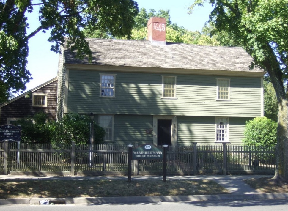
Ward-Heitman House on the north side of Elm Street between Campbell Avenue and Ward Place. Source: Ward-Heitman House |
Town of Milford
The route of the Kings Highway in Milford is:
- Oyster River
- Kings Highway
- Chapel Street
- New Haven Avenue (CT 162)
- Indian River
- New Haven Avenue (CT 162)
- Buckingham Avenue
- Prospect Street
- West Main Street
- Wepawaug River
- West Main Street
- Clark Street
- Washington Street
- gap created by railroad
- South Washington Street
- US 1
- Beaver Brook
- US 1
- Housatonic River - Washington Bridge
Gary Denton walking through Milford:
46 and
47.
1750 - Carrington House
The Abijah Carrington House, at 88 West Main Street in Milford, is an early-Colonial saltbox built around 1750. The property is a key part of Milford's River Park Historic District. The Carrington family were some of the earliest English settlers in Milford. Source:
Abijah Carrington House.
1776 - Liberty Rock
Liberty Rock was one known as Hog Rock . The rock appears to be in the shape of a hog. Somewhere in the rock can be found the imprint of a hog's foot.
The site served as a lookout post and signal station. From Liberty Rock, Milford patriots watched the Housatonic River, then called the Stratford River, to guard against invasion by British forces during the Revolutionary War. The Spot was the highest elevation in the area. It was possible to see clear across the river to Stratford. The initials P.P. and date 1776 were carved by a young native of Milford, Peter Pierett. Pierett was the leader of a group calling themselves The Liberty Boys . This group later became a part of the famous Minute Men.
The Rock is 10 feet in diameter and weighs almost 35 tons. This type of rock is strange to the locality for there are no signs of similar rocks or stones of this variety for miles around. The Post Road side was the back of the rock. The original Post Road was to the North of the rock. Source:
Liberty Rock
Town of Stratford
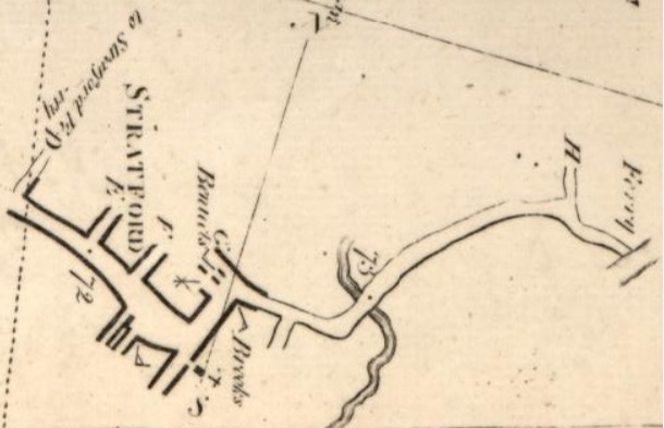
Colles Map 7b. Included are mile markers 72 and 73. Source: 7. |
The route of the Kings Highway in Stratford, using Colles map
7 is:
- Housatonic River - Ferry - mile 73.9 on map 7b
- Barnum Avenue (US 1) - "H" to East Main Street at mile 73.7 on map 7b
- Ferry Boulevard
- East Broadway
- Elm Street
- Broad Street
- Main Street
- West Broad Street
- Barnum Avenue (US 1)
- Boston Avenue (US 1)
- Bruce Brook - mile 71 on map 7a
Gary Denton walking through Stratford: 48.
Stratford is said to be named after the town of Stratford-upon-Avon in England. : Town of Stratford.
1648 Ferry Across the Housatonic River
The first ferry across the Housatonic River was operated by Moses Wheeler. Born in Kent, England in 1598, Wheeler immigrated to America in the 1630s, arriving first in Boston before making his home in New Haven and eventually in Stratford. A ship carpenter by trade, Wheeler profited by living near the water and building vessels in addition to farming his extensive fields. As early as the 1640s, residents living along the Housatonic River then called the Great River or the Stratford River desired ferry service between the small communities of Stratford and Milford. In 1648, the General Court in Fairfield granted Wheeler, who had already built his own ferry, a contract to begin service. From the streets of the village, Wheeler constructed a ferry road through the salt marsh near today's Washington Bridge. His 21-year, renewable contract stated that travelers were to be ferried over for one half penny per person and two pence for horse or beast. His ferries which he built himself to accommodate up to four people traveling by foot were narrow-beamed, heavy-planked rowing boats. Later, the ferry added horseboats with large, wide beams that were able to hold a thousand pounds for passengers with animals. Most of Wheeler's passengers were local residents, tradesmen, and travelers lodging at taverns in Milford and Stratford. They benefitted from this ferry service across the river, which Wheeler provided for over half a century. Source: Moses Wheeler: Legendary Housatonic Ferryman.
The first bridge was built in 1803. It was called the Washington Brdge. Source: Washington Brdge.
A Walk Through Time
Town of Bridgeport
The 4.8-mile route of the Kings Highway in Bridgeport, using Colles maps
7 and 6 is:
- Bruce Brook - mile 71 on map 7a
- Boston Avenue (US 1)
- Old Mill Brook - at mile 70.3 on map 7a - start of Old Mill Green in the center of Boston Avenue
- Milestone: "17 miles to N.H" - 17 miles to New Haven - at mile 70 on map 7a
- Harpin Tavern, where General Washington and Lafayette stopped - 70.1 on map 7a
- crosses East Main Street ("Y") at mile 69.6 on map 7a - end of Old Mill Green
- Pequonnock River - mile 69 on map 7a
- North Avenue (US 1)
- crosses Main Street ("T") just before mile 68 on map 7a
- crosses Park Avenue ("R") just before mile 67 on map 7a (Old Fairfield)
- Mountain Grove Cemetery, burial place of P. T. Barnum
- Rooster River - river extends southward into Black Rock Harbor and Long Island Sound by way of Ash Creek - mile 66.2 on map 6b
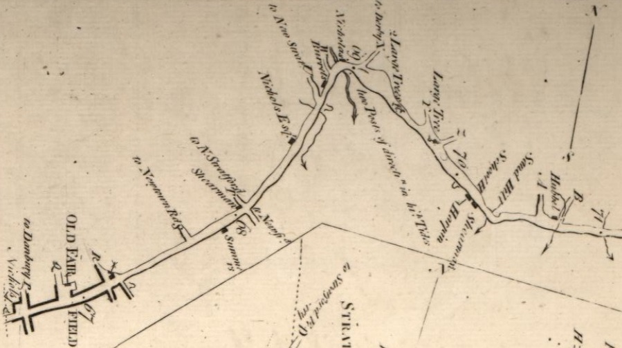
Colles Map 7a. Included are mile markers 67 to 71. Source: 7. |
Gary Denton walking through Bridgeport: 49.
1685 - Old Mill Green
Old Mill Green, or Pembroke Park, was set aside as common land in 1685 when the town act which established King's Highway (presently Boston Avenue) was passed which stated that "all the uplands and marshes lying southward of the road leading to Fairfield, between the physical spring and the uppermost cartway over (Pan) Brook shall be left for a perpetual Common, and twenty rods in breadth shall be left for a road to Fairfield bounds." Town proprietors later sold much of this land reducing the width of the highway. However, Theophilus Nichols who lived on the Old Mill Green around 1700, was influential in preserving what remains of the green today.
It is named after Mill Brook upon which a mill was constructed in 1654. By the time there were enough people settled along the road to form a community, the first mill had become old; hence the name, Old Mill Hill and Old Mill Green. By the late 1790s, a bark mill and tannery had joined the grist mill. The last one situated along the brook was a wool carding mill in 1818.
The Old Mill Green was a flourishing and aristocratic part of the Town of Stratford from about 1700 into the 19th century. Most of the townspeople resided at the green including the three person committee in charge of oversight of the New Pasture, a point of land south of the green reaching to the Sound. The green was formally deeded to the town in 1740 by nine townspeople for use as a perpetual common.
The green is the site of a Benjamin Franklin milestone ("17 miles to N.H") which is associated with the oldest mail route in the United States established along the King's Highway. The green is also associated with General Washington and Lafayette who are said to have stopped at Harpin's Tavern located at the southwest corner of the green.
Source: 1991-92 Survey of Town Greens.
1886 - Old Stratfield Map
Other than Black Rock and Parts of Brooklawn which were originally part of the township of Fairfield, Bridgeport was originally a part of the township of Stratford. The first English settlement on the west bank of the mouth of the Pequonnock River was made in about 1665 and was called Pequonnock. This village was renamed Newfield sometime before 1777. More people settled further inland and to the West and the area collectively became known as Fairfield Village in 1694, a name that was officially changed to Stratfield in 1701, likely due to its location between the already existing towns of Stratford and Fairfield. Bridgeport was chartered as a city in 1836. Source: History of Bridgeport.
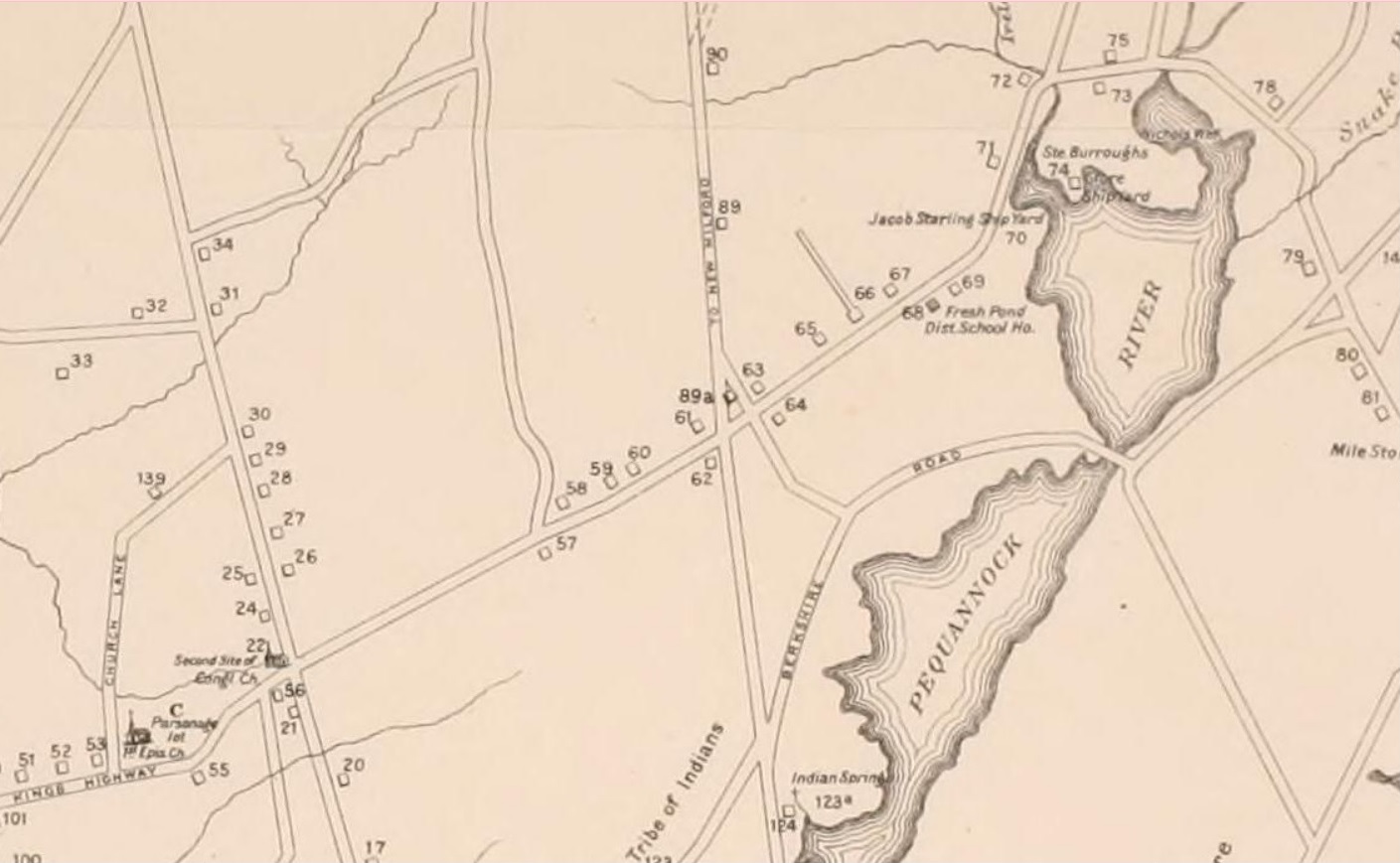
Excerpt from 1886 Map of Old Stratfield (Bridgeport), showing the "Kings HIghway" and today's North Avenue running northeast to the bridge over the Pequonnock River. Source: History of Bridgeport. |
Town of Fairfield
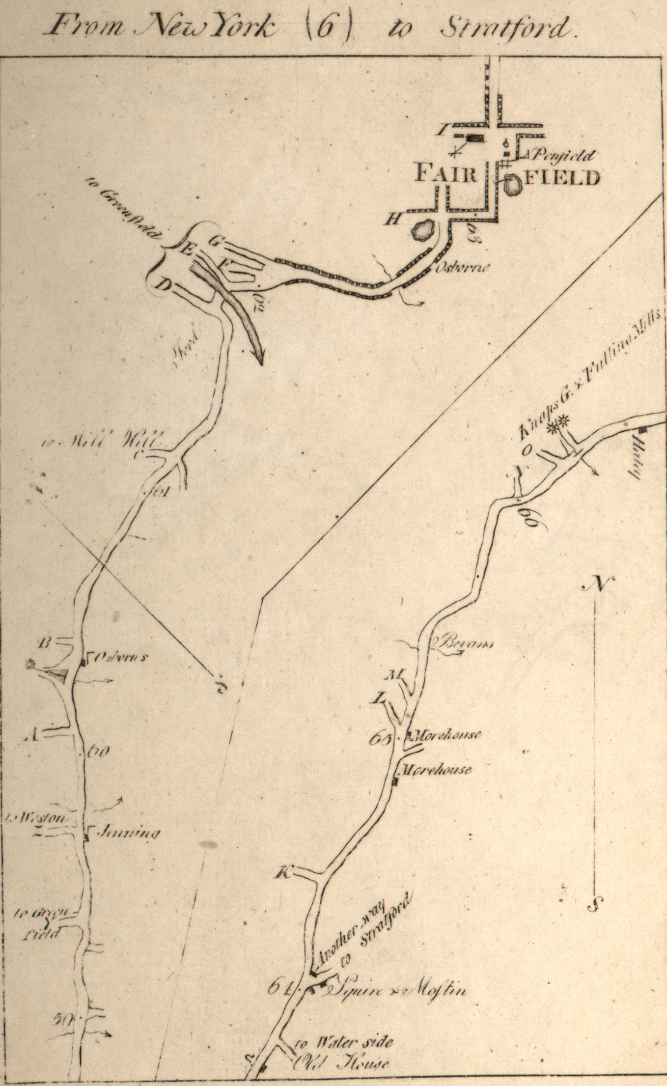
Colles Map 6. Included are mile markers 59 through 66. Source: 1789 Colles Maps. |
The route of the Kings Highway in Fairfield, using Colles map
6 is:
- Rooster River - river extends southward into Black Rock Harbor and Long Island by way of Ash Creek - mile 66.2 on map 6b
- Kings Highway East (US 1) - includes mile 66 on map 6b
- Kings Highway - includes miles 65 and 64 on map 6b
- Old Post Road - on map 6a:
- "I" is Beach Road (Round Hill Road north)
- First Congregational Church at 148 Beach Road
- Town House is the Old Town Hall at 611 Old Post Road
- Penfield Tavern is the Sun Tavern built by Samuel Penfield in 1780, just south of the Old Town Hall
- Gaol
- Mile 63
- "H" is Unquowa Road
- Post Road (US 1)
- Pine Creek (behind St. Thomas Aquinas Church)
- Mill Plain Road
- "G" on map 6a is Mill Plain Road
- "F" on map 6a is Old Mill Road
- "E" on map 6a is Sturges Road
- Sturgis Road - includes mile 62 on map 6a
- Mill River - ford
- Mill Hill Terrace
- Bronson Road - "D" on map 6a
- Kings Drive
- Uncertain route
- Kings Highway West
- "C" on map 6a is Mill Hill Road
- Mile 61 on map 6a
- John Osbourne House at mile 60.4
- Sasco Brook - mile 60.3 on map 6a
Gary Denton walking through Fairfield: 50,
51.
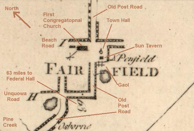
Annotated excerpt from Colles Map 6 showing mile marker 63. Source: 1789 Colles Maps. |
1789 - President George Washington at Penfield's Sun Tavern
On October 16, 1789, the newly inaugurated President George Washington, age 57, likely spent the night at Samuel in Fairfield on his tour surveying damage from the Revolutionary War. The destruction from the 1779 burning was so widespread that it was still evident ten years later when Washington wrote: The destructive evidences of British cruelty are yet visible both in Norwalk and Fairfield, as there are chimneys of many burnt houses standing in them yet. At the time, it took two days to travel from New York to Fairfield by carriage on the Boston Post Road, so travelers needed a place to stay overnight and refresh their horses.
1732 - Burr House, Rebuilt in 1790
The Burr House is located at 739 Old Post Road, in Fairfield's Old Post Road Historic District. The house is owned by the Town of Fairfield. Originally built in 1732, Thaddeus Burr (uncle of Aaron Burr) and Eunice Burr resided in the home during the American Revolution. John Hancock married Dorothy Quincy here in 1775, as Boston's patriotic activists fled the British. The home also hosted George Washington, John Adams, and Samuel Adams during this time. In 1779, it was destroyed during the Burning of Fairfield, but Hancock insisted that the Burrs rebuild their home, and it was completed in 1790.
The Burr family held the property from the 1600s until the mid-1800s. The home was renovated in the 1800s. In 1962, the Burr House became a Town of Fairfield property. Source
Historic Buildings of Connecticut .
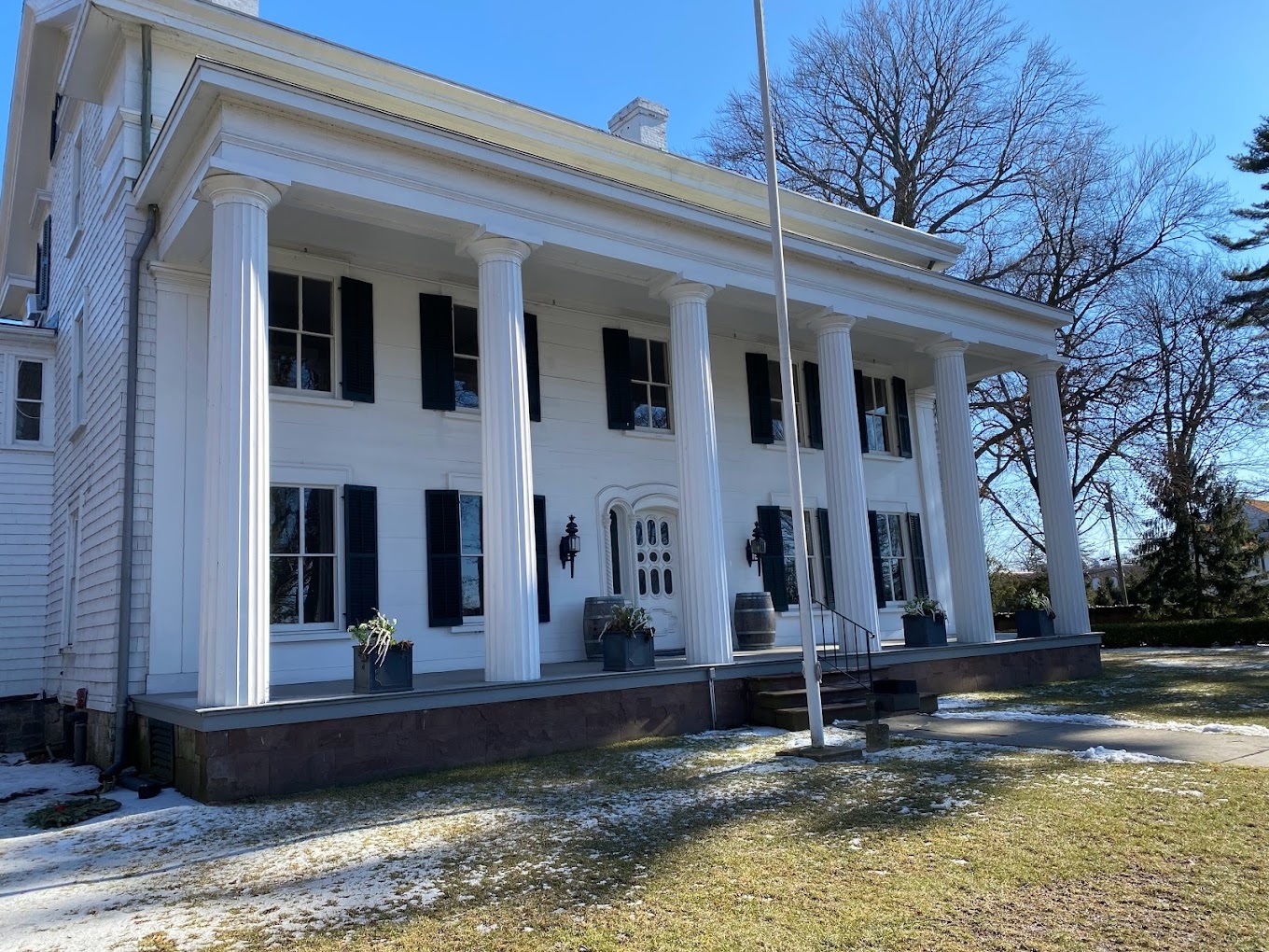
1790 Burr House at 739 Old Post Road, Fairfield, Connecticut. Photo by Ashraf Allam. Source Town of Fairfield. |
1734 - Osborne House in Fairfield
The oldest house in Fairfield is the John Osbourne House at 909 Kings Highway West. The oldest section consists of the original center-chimney block, which probably began as one-room and was then expanded. A lean-to added several decades after the house was built. The traditional date of construction is 1673, but the later date of 1734 is more likely. The house is traditionally associated with John Osborne, who married in 1673. His father Richard fought in the Pequot War and received a grant of land for his services. The last battle of the war was fought in 1637 in Pequot Swamp, which is located adjacent to the house. The colonial-era section of the house is flanked at both ends by two twentieth-century wings. Source
Historic Buildings of Connecticut .
Miles to Fairfield
There are eight stone mile markers on a 12-mile stretch of the Kings Highway in Fairfield County, Connecticut, that show the miles to the town of Fairfield. The markers are in Darien, Stamford, and Greenwich. The markers are all replicas except the one in Darien. For more on the markers, see Darien,
Stamford,
Greenwich.
For more on Greenwich, see: New Haven Register. The table below shows the eight Fairfield mile stones and how they correspond to the Federal Hall mile markers on the 1789 Colles maps.
| Location | 1789 Colles Maps | Physical Markers |
|---|
| Miles | Decrease | Miles | Increase |
|---|
| Fairfield-953 Old Post Road | 63 | | 0 | |
| Darien-Old Kings Highway South at Goodwives River Road | 46 | 17 | 17 | 17 |
| Stamford-Main and Bank Streets | 42 | 4 | 21 | 4 |
| Stamford-Stillwater and West Avenues | 41 | 1 | 22 | 1 |
| Old Greenwich-212 Palmer Hill Road | 40 | 1 | 23 | 1 |
| Greenwich-Valley Road and Orchard Street | 38 | 2 | 25 | 2 |
| Greenwich-across from Presbyterian Church, 1 West Putnam Avenue | 36 | 2 | 27 | 2 |
| Greenwich-West Putnam Avenue near Edgewood Avenue | 35 | 1 | 28 | 1 |
| Greenwich-West Putnam Avenue at Western Junior Highway | 34 | 1 | 29 | 1 |
Town of Westport
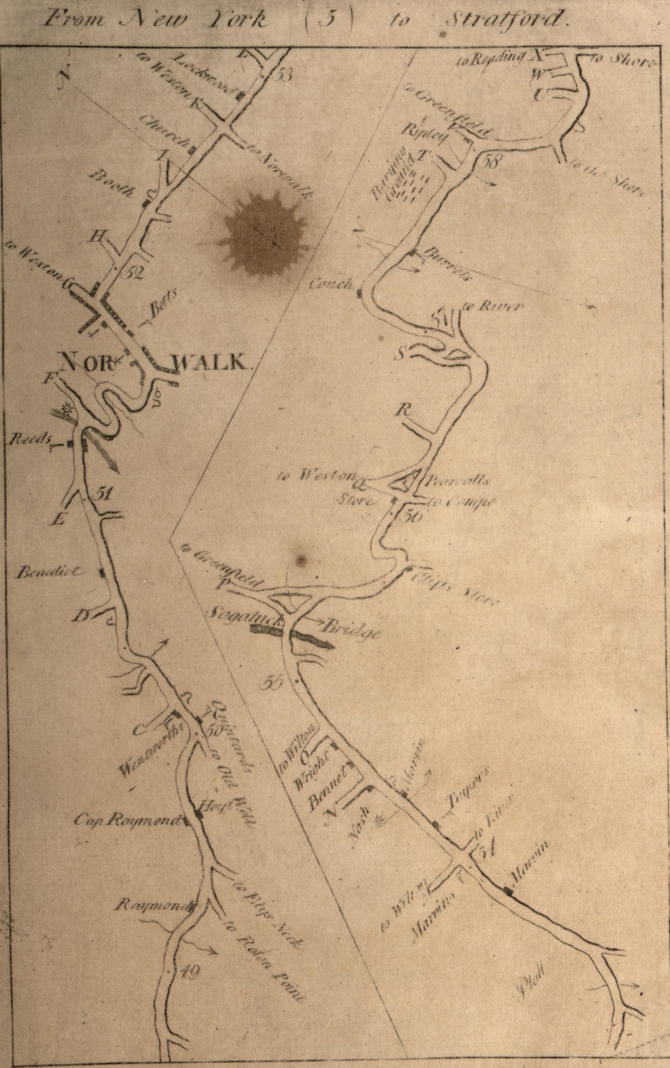
Colles Map 5. Included are mile markers 49 through 58. Source: 1789 Colles Maps. |
The route of the Kings Highway in Westport, using Colles maps
6a and
5b is:
- Sasco Brook - mile 60.3 on map 6a
- Greens Farms Road
- Mile 59 on map 6a
- "to the Shore" - Beachside Avenue, and Burying Hill Road
- Mile 58 on map 5b
- Colonial Cemetery, also known as Colonial Burying Ground and Greens Farms Lower Cemetery
- Gap - Mile 57 on map 5b
- Prospect Avenue
- Spicer Road
- Post Road East (US 1)
- Mile 56 on map 5b
- "Q" on map 5b - Compo Road (CT 136)
- East Main Street
- Myrtle Avenue
- Kings Highway North - "P" on map 5b is Main Street (CT 57)
- Saugatuck River - mile 55.2 on map 5b
- Kings Highway North - includes mile 55 on map 5b
- "O" on map 5b is Old Hill Road.
- "N" on map 5b is Woodside Avenue
- Stony Brook - "Nash" grist mill on map 5b
- Post Road West (US 1)
- includes mile 54 on map 5b
- "Marvins" Tavern is there
- Kings highway South (called County Street in Norwalk)
- boundary with Norwalk - mile 53 on map 5a
Gary Denton walking through Westport: 51.
1867 - Westport map
The 1867 Westport map below shows various points on the Kings Highway in Westport, east of the Saugatuck River (from right to left):
- Kings Highway crossing of the Sasco Rver
- Beachside Avenue (to Burying Hill Road)
- Burying Ground
- Fruit Hill Prospect that gave Prospect Avenue its name
- Spicer home that gave Spicer Road it name
- triangle formed by Post Road East, Compo Road, and East Main Street
- the Kings Highway bridge
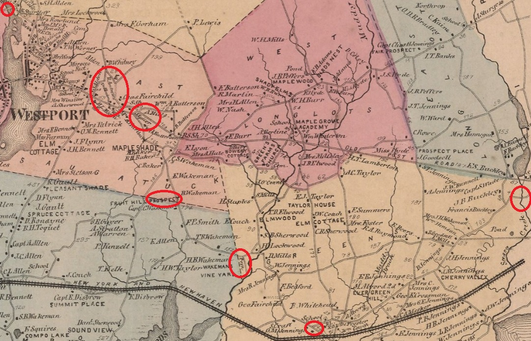
Excerpt from 1867 Westport map with red circles showing various points on the Kings Highway in Westport, east of the Saugatuck River. Source; 1867 Westport map |
1761 - Kings Highway North Bridge
In 1761, a Kings Highway bridge was erected over the Saugatuck River. Source
Westport.
Kings Highway North Historic District
The Kings Highway North Historic District is a residential area on the west side of the Saugatuck River in Westport. it encompasses about two-thirds of a mile of Kings Highway North, the spine of the district.
The path of the Old Kings Highway was first known as King Street. It was laid out in 1672 at the behest of the governors of the New York and Connecticut colonies to facilitate communication between New York and Boston. The section of the highway now in the district diverged to the north to ford the Saugatuck River upstream. The river then was the border between Fairfield and Norwalk; people who settled in the district on the west side were Norwalk proprietors and their descendants. King Street remained the major through route until the construction of the Post Road, which bypassed this section of King Street in the early nineteenth century to accommodate commercial wharves and storage facilities located nearer the mouth of the Saugatuck. The eighteenth-century village encompassed by the district was first known as Taylortown for the many members of that family who settled there. One early site remains that is identified with this family: the 1730 house built by Lt. John Taylor in the center of the district at Old Hill Road.
Some of the older houses are:
- 1769 Captain Nathan Burwell House, 104 Kings Highway North, in the north end of the district.
- 1730 Lt. John Taylor House, 1 Old Hill Road, near the center
of the district, faces east at the intersection of Old Hill Road and Kings Highway North.
- 1760 Obediah Wright House, 78 Kings Highway North, built by Odediah Wright for his son, Dennis.
- 1766 or 1776 Samuel Lord House, 67 Kings Highway North, built on the east side of the street.
- 1727 Daniel Freelove Nash House, 41 Kings Highway North, one of the few set back from the road, is at the corner of Woodside Avenue, and it too faces east towards Kings Highway North. It is said that it once served as a public house, or tavern. The
Nashes bought the Marvin grist mill and moved it
from another site in Taylortown, perhaps as early as 1784.
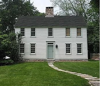
1727 Daniel Freelove Nash House, 41 Kings Highway North, Westport. |
Many owners of colonial period houses are buried in the King Street Cemetery at 119 Kings Highway North, which was laid out in 1740. Included are 17 soldiers who fought in the Revolution.
Villagers had to travel great distances to the centers of Norwalk and Fairfield to attend town meetings, record deeds, and pay taxes. These inconveniences led to the incorporation of Westport as a separate town in 1835.
Source: Kings Highway North Historic District.
1700 - John Platt House - Kings Highway South
The John Platt House is at 46 Kings Highway South in Westport. Built in 1700, it is one of the oldest houses in Westport. Source
CT Insider.
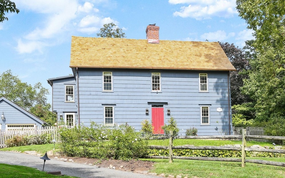
John Platt House, 46 Kings Highway South, Westport. |
Town of Norwalk
Colles Map 5. Included are mile markers 49 through 58. Source: 1789 Colles Maps. |
The 5-mile route of the Kings Highway in Norwalk, using Colles maps
5a, and 4c is:
- boundary with Westport - mile 53 on map 5a
- County Street (called Kings Highway South in Westport) (called Old Post Road on the 1867 map)
- mile 53 on map 5a
- "K" to Weston" and "to Norwalk" on map 5a is Strawberry Hill Avenue
- Westport Avenue (US 1)
- "I" on map 5a is Wolfpit Avenue
- "H" on map 5a is Dry Hill Road
- mile 52 on map 5a
- East Avenue
- "G to Weston" on map 5a is East Avenue (CT 53).
- The west side of East Avenue is the Green, where there are two churches: St. Paul's Episcopal Church (+) and the First Congregational Church (x). Both churches were burned by the British in 1779
- "Betts" Tavern is on the east side across from the two churches
- Wall Street
- Betts Pond Brook. There are markers for a blacksmith shop and the Town Hall
- "F" on map 5a is Main Street
- the asterisk by the river on map 5a is a grist mill
- Norwalk River - arrow at mile 51.2 on map 5a
- Wall Street
- "Reeds" Tavern on map 5a is before the Norwalk River.
- West Avenue
- "E" on map 5a is Belden Avenue, where West Avenue starts
- included is mile 51 on map 5a
- Just before "D" on map 5a is a blacksmith shop
- "D" on map 5a is wjat bevame part of the new Post Road built in 1808, now called Connecticut Avenue in Norwalk. Opposite D is where the Lockwood-Mathews Mansion was built in 1864-1868
- between "D" and "C" on map 5a is Reed Street
- "C" on map 5a is Garner Street.
- at the foot of "C" on map 5a is a blacksmith shop.
- "Quintards" Tavern is right at the corner. "Wentwoths" Tavern is on the other side of the street
- Martin Luther King Drive
- Flax Hill Road (called Old Post Road on the 1867 Norwalk map)
- starts at mile 50 on map 5a
- "to Old Well" on map 5a is North Main Street, which goes to Washington Street, which goes to Old Well at the Norwalk River. Old Well was renamed South Norwalk in 1870
- "to Elys Neck" on map 5a is Lowe Street, which goes to Wilson Point, which was initially settled by Nathaniel Ely.
- "to Roton Point" on map 5a is Soundview Avenue.
- includes mile 49 on map 5a. The street before mile 49 is Highland Avenue
- Five Mile River - mile 48 on map 4c
Gary Denton walking through Norwalk: 51,
52.
1867 - Norwalk East map
Excerpt from 1867 Norwalk map showing West Avenue at lower left, Wall Street crossing the Norwalk River, Turnpike Road, which is now Westport Avenue (US 1), and Old Post Road, which is now County Street. In the bottom lefthand corner is a dotted-line street, which is probably what would become the Lockwood-Mathews Mansion, built in 1864-1868. Source: 1867 Norwalk map |
1867 - Norwalk West map

Excerpt from 1867 Norwalk map showing the Old Post Road, which is now Flax Hill Road, and West Avenue, which parallels the west side of the Norwalk River, and Wall Street crossing the Norwalk River in the upper right. Source: 1867 Norwalk map |
Norwalk Green
Since the 1600's The Norwalk Green has been a public commons, a place for people to gather. The green is bounded by Park Street, East Avenue, and St. Pauls Place. It was a common area until 1851. It is now a park. St. Paul's Episcopal Church and the First Congregational Church both face the green.
Mill Hill Historic Park
Mill Hill Historic Park is at 2 Wall Street, between Hubble Lane and Smith Street, in Norwalk. It is composed of:
- 1740 Governor Thomas Fitch IV "law office." The original Fitch house was constructed on Goodman Hoyt Hill (which was later known as Earl's Hill) on the east side of what is now East Avenue. Governor Thomas Fitch died on July 18, 1774, and the house was left to his survivors including his wife Hannah and son Thomas Fitch, V (of Yankee Doodle fame).
- 1767 Town House Hill Cemetery. The burial ground on Mill Hill, the third oldest in Norwalk, was established by the First Congregational Church. Find a Grave contains a list of 240 people buried there.
- 1826 Schoolhouse. The schoolhouse at the Mill Hill site was constructed around 1826 near a former southern intersection of Willow Street and East Avenue. The school became known as the Down Town district schoolhouse since "Down Town District" was the name used for what is now called East Norwalk until about 1883 or 1893. The building was used as a school until 1876.
- 1835 Norwalk Town Hall. The Norwalk Town House was first constructed at Wall Street and Knight Street. The next Town House was built on the Mill Hill site but that building was burned in the 1779 British raid. The reconstruction of the Norwalk Town House was not completed in 1794. The 1794 Town House was torn down by vandals in 1834. The present Town House at Mill Hill was built in 1835 by Captain Lewis Raymond, who had brought brick to Norwalk as ship ballast. This Town House served the Town of Norwalk until the city-town consolidation that took in 1913.
See: Mill Hill Historic Park.
1868 - Lockwood-Mathews Mansion

Lockwood-Mathews Mansion at 295 West Avenue. West side of the home seen from the south, showing porte-cochere and greenhouse. Now a museum, it was built in 1864-68 for railroad and banking magnate LeGrand Lockwood. There are 62 rooms and 44,000 square feet. Source: Lockwood-Mathews Mansion. See: The Lockwood-Mathews Mansion Museum |
1802 - Fodor Farm Homestead
Fodor Farm is a historic site turned playground and community garden, owned by the town of Norwalk. The property highlights the importance of agriculture in Norwalk history - Fodor Farm was a functioning farm and homestead from the 1650s through most of the 20th century. Agriculture was important in the early settlements of Norwalk, and remained part of the economy as the area industrialized, waning near the end of the 19th century as Norwalk became more suburban. During the Revolutionary War period, many people grew flax (to turn into fiber and clothing) and hemp and raised cows. See: Fodor Farm.
Beside the main building at Fodor Farm is a statue and fountain dedicated to Revolutionary War figure Nathan Hale. A Connecticut native, Nathan Hale attended Yale College and enlisted in the militia to fight in the Revolutionary War. He then volunteered as a spy on the British in New York, where he was to be disguised as a school teacher. To cross the Long Island Sound to get to New York, Hale traveled to Norwalk, where he left his uniform, papers, and commission before beginning his mission. Unfortunately, Hale was not a talented spy, and it was not long before he revealed his mission to an undercover British agent and was arrested and killed by the British Army. He is seen as a hero and martyr by many, and his short time in Norwalk is honored by the fountain at Fodor Farm. See: Fodor Farm.
|
|

Fodor Farm in the 19th Century. See: Fodor Farm" target="Separate Window">Fodor Farm |
|
1742 - Kings Way
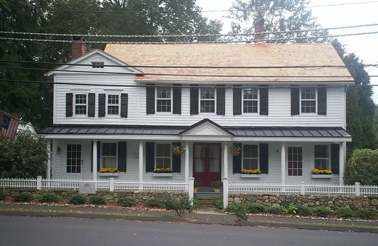
Kings Way House at 498 Flax Hill Road |
1812 - Flax Hill Road House
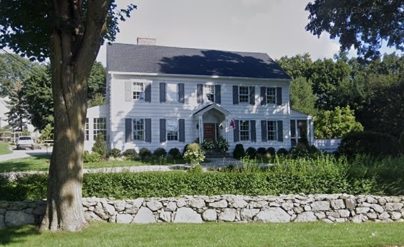
521 Flax Hill Road |
1790 - John Reed House
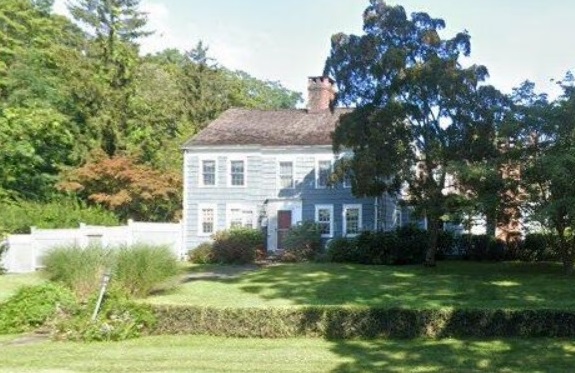
John Reed House at 537 Flax Hill Road, across Shadybrook Lane from the left bank of the Five Mile River |
Town of Darien
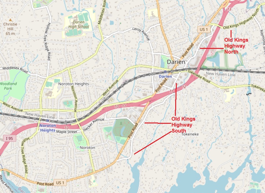
Kings Highway in Darien, 2023. Just north of Long Island Sound. Separated by the 1849 New Haven Railroad Line when it was enlarged in 1894. Parallel to the straighter Post Road, built in 1808. Twice crossed by I-95. Map source:
OpenStreetMap. |
The 4-mile route of the Kings Highway in Darien, using Colles maps
4c and 4b, is:
- Five Mile River - mile 48 on map 4c
- Old Kings Highway North
- I-95
- Old Kings Highway North
- Goodwives River - mile 47 on map 4c
- Old Kings Highway North
- New Haven Railroad - obstructs Kings Highway
- Old Kings Highway South
- I-95
- Old Kings Highway South - includes mile 46 on map 4c
- Stony Brook - mile 45.4 on map 4c
- Old Kings Highway South
- Post Road (US 1) - includes mile 45 on map 4c
- Noroton River - mile 44 on map 4b
Gary Denton walking through Darien: 52,
53.
Historical Name of the Kings Highway in Darien
The name Kings Highway apparently went out of use as the colonies got closer to the Revolutionary War. But the name came back in use in some areas as time went on. In a 1908 Atlas, the old road east of St. Luke's Church in Darien is named Kings Highway, except for a short portion west of the railroad tracks that is named Maple Avenue. In the 1910 census, it was called the Old Post Road. In the 1920 census, it was called the Old Kings Highway. Following is a history of the portion of the old road north of the railroad.
Old Kings Highway in Darien now is crisscrossed by three newer and straighter routes in Darien: the new Post Road built in 1808, the New York and New Haven Railroad built in 1849, and I-95 built in 1953. The Railroad did not build a viaduct when it was enlarged in 1894; thus, today's Old Kings Highway is divided betwen North and South.
1641 - Stamford and Darien
Charles I, King of England from 1625 to 1649, was noted for his Personal Rule and his Star Chamber that prosecuted Puritans. An estimated 20,000 Puritans emigrated to the Massachusetts Bay Colony from 1630 to 1640. Some went down the Connecticut River to Wethersfield, Connecticut, around 1635. Some of those went on to Stamford in 1641 and 1642. Included among those going to Stamford were two whose descendants lived in houses on the Kings Highway in Darien that are still standing: Jonas Weed and Robert Bates.
1684 - John Reed and the Red Mill in Darien
John Reed (1633-1730), a Puritan, fled England in 1660 when the monarchy was restored under Charles II. He had served as a Captain in the army of the Commonwealth after the fall of Charles I. He lived in Rhode Island and New York, then settled in the Connecticut Colony in 1684 and built the The Red Mill on the Five Mile River at what is today my house at 230 Old Kings Highway North.
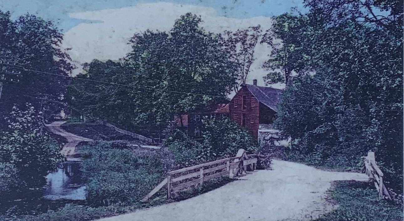
1894 photo of the Old Red Mill on what is today Old Kings Highway North in Darien, Connecticut. |
|
My Colles Map. Annotated excerpt from 1789 Colles Map 4c. Main road is Old Kings Highway North. 48 and 47 are miles from Federal Hall in New York City. Grist is the Old Red Mill on the Five Mile River, where I live. Unmarked road south is Raymond Street. x is the Congregational Church. Z is Brookside Road. Y to Oxridge is Sedgewick Avenue. The Goodwives River runs between Z and Y. Middlessex is the name of Darien before 1820. Source: Colles Maps. |
|
The photo above was enhanced by the Norwalk Historical Society and displayed at Brookside Cemetery on Rowayton Avenue. Shot southwesterly from the Norwalk side of the Five Mile River bridge. In the foreground, the non-macadamized road (called the Farm Road in the 1900 census) crosses an A-frame bridge over the river. The road winds past the grist mill up the hill toward Raymond Street.
The mill building center right. The mill run and wheel are under the roof on the right side of the building. The mill is three stories high. At the top is a hoist that would lift grain to the top floor.
Two utility poles can be seen at the far left. They would surely have included telegraph and telephone wires. And, the first municipal electric plant in Connecticut began operating in South Norwalk in 1892. Between the utility pole and the bridge is the mill run flowing back into the Five Mile River. To the left of the mill is a house built in 1880 that today is 222 Old Kings Highway North. A long white fence parallels the road toward Raymond Street, probably starting in front of the house. See Unenhanced photo.
1705 - Jonathan Bates House in Darien
One of the oldest houses on the Kings Highway in Darien, Connecticut, is the Jonathan Bates House. Built in 1705, it is at 150 Old Kings Highway North. The house is shown between mile markers 47 and 48 on the 1789 Colles map 4c (Middlessex, which became Darien in 1820) shown later on this page.
Jonathan Bates House, 1705. At 150 Old Kings Highway North, Darien, Connecticut. Google Maps street view, 2019. |
|
Excerpt from 1789 Colles Map 4c. Main road is Old Kings Highway North. 48 and 47 are miles from Federal Hall in New York City. Grist is the Old Red Mill on the Five Mile River. Unmarked road south is Raymond Street. + is Congregational Church. Z is Brookside Road. Y to Oxridge is Sedgewick Avenue. The Goodwives River runs between Z and Y. Middlessex is the name of Darien before 1820. Source: Colles Maps. |
|
Perhaps this is the Jonathan Bates, whose grandfather Robert Bates migrated to New England during the Puritan migration of 1630-1640 and moved from Wethersfield, Connecticut, to Stamford in May 1641. This Jonathan Bates had a son John Bates Jr., who died in 1800 and is the first person buried in the Bates Cemetery, which is 300 yards northwest of the 1705 house. See: Bates Cemeteries 1 & 2.
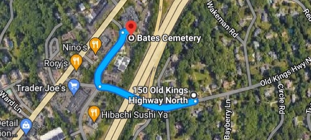
Bates Cemetery and the Jonathan Bates House at 150 Old Kings Highway North, Darien, Connecticut. Google Maps. |
1730 - House in Darien
The house at 70 Old Kings Highway North was built in 1730. It is much altered. Siding is
wood shingles. The central, small brick
chimney is not original. The Greek Revival
style doorway and portico may have been added
c. 1835. A 2-story addition on the northeast
end includes a recessed screened-in porch with
Doric columns. There is an unusually old and
large red oak tree in the front yard, and a
carriage house, much altered, in the back
yard." It was owned by a minister of the Congregatiional Church before
1859. It is now a Scouting building named in honor of Eric N. Ferguson. Sources: National Register of Historic Places and Ferguson House.
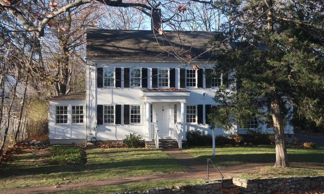
1730 House at 70 Old Kings Highway North, Darien, Connecticut. Source: Ferguson House |
\1736 - Bates-Scofield House in Darien
One of the older houses on the Kings Highway in Darien, Connecticut, is the Bates-Scofield House. It was built in 1736 on the east side of the Kings Highway, just north of where it crosses the Goodwives River (part of the parking lot for Goodwives Shopping Center). The house is shown at mile marker 47 on the 1789 Colles map 4c (Middlessex, which became Darien in 1820) that appears later on this page.
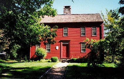
Bates-Scofield House, 1736. At 45 Old Kings Highway North, Darien, Connecticut. This building houses both the Museum of Darien (formerly the Darien Historical Society). The house is a saltbox with period furnishings and a herb garden. Source Town of Darien. |
|
Excerpt from 1789 Colles Map 4c. Main road is Old Kings Highway North. 48 and 47 are miles from Federal Hall in New Yol Hall in New York City. Grist is the Old Red Mill on the Five Mile River. Unmarked road south is Raymond Street. + is Congregational Church. Z is Brookside Road. Y to Oxridge is Sedgewick Avenue. The Goodwives River runs between Z and Y. Middlessex is the name of Darien before 1820. Source: Colles Maps. |
|
The Bates-Scofield house is a colonial saltbox-style house, built around 1736 by John Bates Jr. Before Darien's first meetinghouse was built in 1744, services were held in the Bates House. After the Bates family, the house was owned by the Scofield family for almost a century, starting with Ezra Scofield in 1822. By 1964 the house faced demolition, until it was given to the Darien Historical Society and moved a hundred yards north to 45 Old Kings Highway North to become a museum.
John Bates Jr. died in 1800 and is the first person buried in the Bates Cemetery, which is 300 yards northwest of the 1705 Jonathan Bates house at 150 Old Kings Highway North. See: Bates Cemeteries 1 & 2.
1744 - Darien Congregational Church
The first meetinghouse of the Congregational Church on Old Kings Highway North (Country Road) was built in 1744. The first pastor was Dr. Moses Mather. He was a graduate of Yale Divinity School. He served as pastor for 62 years until his death in 1806.
Moses was the great great grandson of Rev. Richard Mather, who had immigrated with his family to Massachusetts on the ship James in 1635. Included was his son Rev. Increase Mather, President of Harvard College from 1692 to 1701. Increase Mather was the father of Rev. Cotton Mather.
A great great grandson of Moses Mather was Stephen Mather, first director of the National Park Service. He lived in The Mather Homestead built in 1778 by Joseph Mather, son of Moses Mather, 2.3 miles north of the Congregational Church.
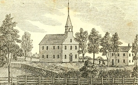
Middlesex meetinghouse on Old Kings Highway North. An 1830s wood engraving of the 1740s meetinghouse, which was still in use. Source: Darien, 1820, by Kenneth M. Reiss, Museum of Darien, 2020; and The Mather Homestead |
|
Excerpt from 1789 Colles Map 4c. Main road is Old Kings Highway North. 48 and 47 are miles from Federal Hall in New York City. Grist is the Old Red Mill on the Five Mile River. Unmarked road south is Raymond Street. + is Congregational Church. Z is Brookside Road. Y to Oxridge is Sedgewick Avenue. The Goodwives River runs between Z and Y. Middlessex is the name of Darien before 1820. Source: Colles Maps. |
|
1781 - Tory Raid in Darien
During the American Revolution, Middlesex Parish was frequently raided by local Tories who had fled to Lloyd's Neck on Long Island. The Tories disrupted services at the meetinghouse on Old Kings Highway North (Country Road) in 1781. They captured Dr. Moses Mather, the minister, and forty-seven other men, and transported them across Long Island Sound. Dr. Mather, with twenty-six of his parishioners, suffered five months in British prisons in New York City before those who survived their confinement were exchanged and returned to their homes. Source: Town of Darien.
|
|
Excerpt from 1789 Colles Map 4c. Main road is Old Kings Highway North. 48 and 47 are miles from Federal Hall in New York City. Grist is the Old Red Mill on the Five Mile River. Unmarked road south is Raymond Street. + is Congregational Church. Z is Brookside Road. Y to Oxridge is Sedgewick Avenue. The Goodwives River runs between Z and Y. Middlessex is the name of Darien before 1820. Source: Colles Maps. |
|
1715 - Quintard-Frost House in Darien
One of the older houses on the Kings Highway in Darien, Connecticut, is the Quintard-Frost House built in 1715 at what is now 64 Old Kings Highway South.
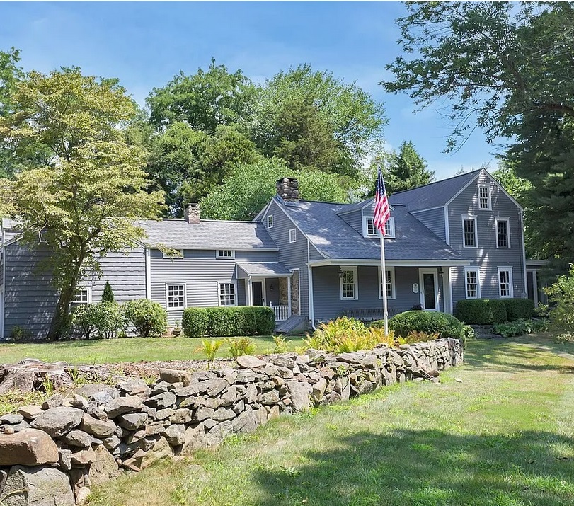
1715 House at 64 Old Kings Highway South, Darien, Connecticut. |
1756 - Colonel George Washington - Virginia to Massachusetts
On or about February 12, 1756, Colonel George Washington of the Virginia Regiment, age 23, passed northbound through Darien as he traveled to Boston to discuss issues related to his rank with Governor William Shirley of Massachusetts. (Shirley was then Commander-in-Chief of British forces in North America.) Washington was accompanied on this trip by Captains George Mercer and Robert Stewart of the Virginia Regiment, as well as his two hired servants, John Alton, and Thomas Bishop. The party left Alexandria, Virginia, on February 4, 1756, and traveled the approximately 450 miles to Boston. Darien would have been approximately 275 miles, which would take nine days at 30 miles per day. He traveled through Philadelphia, New York, and New London. While in New London, they stayed at the home of a friend, Joseph Chew, where they left their horses. On his return trip, he arrived in New London on March 8, 1756. Joshua Hempstead noted Washington's arrival in his diary:
"Col. Washington is returned from Boston and gone to Long Island, in Power's sloop; he had also two boats to carry six horses and his retinue; all bound to Virginia."
George Washington is known to have traveled on the Old Post Road in Middlesex (Darien) in 1756, 1775-76, and 1789, as Colonel, General, and President. On Old Kings Highway South, two miles south of our house in Darien, there is an old stone mile marker that says "Fairfield 17 Miles." Since Armistice Day in 1932, an historical marker next to the mile marker reminds passers-by that George Washington went by in 1756, 1775, and 1789. The marker is at the intersection of Old Kings Highway South and Goodwives River Road. The marker says "George Washington passed this spot on his way to Boston: February 1756, June 1775, October 1789. Erected in his memory by the civic, patriotic and fraternal organizations of Darien, November 11, 1932." The marker commemorated the 200th anniversary of the birth of George Washington, which was February 22, 1732. See: The Story of Darien, Connecticut, by Kenneth M. Reiss, The Darien Historical Society, 2009. |
1775 - General George Washington - Pennsylvania to Massachusetts
On or about June 27, 1775, General George Washington, age 43, traveled over 300 miles from Philadelphia, Pennsylvania, to Cambridge, Massachusetts. On June 14, the Second Continental Congress had created a Continental Army, to be formed out of the individual militias of the Thirteen Colonies. The next day, Congress created the position of Commander-in-Chief of the Continental Army, and unanimously elected Washington to that position. Congress formally presented him with his commission on June 19, and he departed Philadelphia, Pennsylvania, on June 23, headed for Massachusetts. After traveling over 300 miles in ten days, he arrived at Cambridge, Massachusetts on July 2, and took command of the siege. He probably traveled through Darien on the fourth day, June 27.
1776 - General George Washington - Boston to New York (Not on the Marker)
On his way from Boston to New York City, on April 12, 1776, General George Washington traveled 40 miles from Fairfield, Connecticut, to New Rochelle, New York.
- In Fairfield he stayed at the Sun Tavern,
Samuel Penfield, proprietor, on Town Hall Green. Mile 63 on Colles 1789 Map 6a. Samuel Penfield (1734-1811) owned the Sun Tavern on the green in Fairfield.
- In Darien, he would have passed by The Red Mill sometime mid-morning. Mile 48 on Colles 1789 Map 4c. Samuel Richards (1746-1785) had bought The Red Mill from the Reeds in 1767.
- In Greenwich, he had lunch at Knapp's Tavern (now Putnam Cottage) on the Post Road (now East Putnam Avenue). Mile 36.6 on Colles 1789 Map 4a. Israel Knapp (1705-1783) was an innkeeper in Greenwich for many years.
- In New Rochelle, New York, he stayed at Guion's Tavern on the Boston Post Road (now Huguenot Street). Mile 23 on Colles 1789 Map 2c. The Guions, including Isaac Guion (1685-1785), were a prominent Huguenot family in Westchester County, New York.
George Washington was on his way from Boston to New York City. He had just spent ten months as Commander-in-Chief of the Continental Army in the opening phase of the Revolutionary War at the Siege of Boston (April 19, 1775 to March 17, 1776). Washington left Boston on April 4, arrived in New York on April 13. He had an Army of 19,000 when he reached Manhattan. They would have traveled the same route as George Washington and around the same time.
Sources: National Archives and Battle of Long Island.
1789 - President George Washington - Connecticut to New York
In 1789, President George Washington embarked on a month-long tour of New England, beginning on October 15, to strengthen the new federal government, promote national unity, and inspect the region's economy. He traveled by carriage through Connecticut, Massachusetts, and New Hampshire, stopping in nearly sixty towns, including Darien, Connecticut. The tour lasted until November 13, 1789, and helped solidify his popularity and the legitimacy of his administration.
1789 - 17 Miles from Darien to Fairfield
There is an old stone marker on the Country Road (now Old Kings Highway South) in Darien that says that it is 17 miles from Fairfield. It is located at the point where Goodwives River Road branches off from the Country Road. The 17 miles agrees with the 1789 Colles atlas. Map 4, page 7, of the Colles atlas says that the point where the Goodwives Road branches off from the Country Road (to Long Neck) is 46 miles from Federal Hall. Map 6, page 9, says that the Fairfield is 63 miles from Federal Hall. The difference is 17 miles, same as the distance shown on the mile marker at Goodwives River Road. Perhaps they used the Colles atlas to make the marker. Perhaps the marker goes back to 1789.
Darien is in Fairfield County. The town of Fairfield was the county seat of Fairfield County from 1666 to 1853.
1696 - Pond-Weed House in Darien
One of the older houses on the Kings Highway in Darien, Connecticut, is the Pond-Weed House, a colonial saltbox-style house known as "The House Under the Hill." It was built in 1696 by Nathaniel Pond, a blacksmith from Branford. Nathaniel Weed and his descendants lived there for more than 150 yers. The house is at what is now 2591 Post Road, at the intersection with Hollow Tree Ridge Road. The road from the Noroton River to what is now Noroton Avenue became know as the Noroton River Settlement. Source: The Story of Darien, Connecticut, by Kenneth M. Reiss, The Darien Historical Society, 2009, p. 24
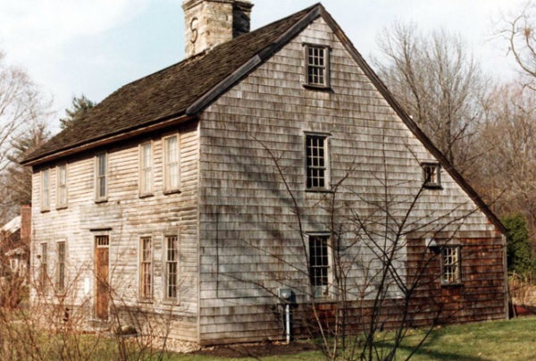
Pond-Weed House. At 2591 Post Road, Darien, Connecticut. The Pond Weed House Historic Preservation | Christopher Fagan Studio Architecture. Source: Pond-Weed House. |
|
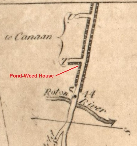
Excerpt from 1789 Colles Map 4b. Main road is the Post Road. Along the road is shown the Noroton River Settlement, which extended from mile marker 44 to a little past mile marker 45 (see Map 4c below). U is Gardiner Street. T is Hollow Tree Ridge Road. Horseshoe is a blacksmith shop. 44 is miles from Federal Hall in New York City. Source: Colles Maps. |
|
There is a Noroton River Cemetery 0.2 miles east of the Pond-Weed House on the south side of the Post Road. There are 13 persons named Weed buried there. Included is Capt. Nathaniel Weed (1696-1750). The earliest decipherable burial is Dr. Ebenezer Bishop (1669-1711. See: Noroton River Cemetery.
There is a Weed Cemetery #2 a quarter mile southwest of the house, on the shore of Holly Pond. There are 71 persons named Weed buried there. The earliest burial was 1763. See: Weed Cemetery #2.
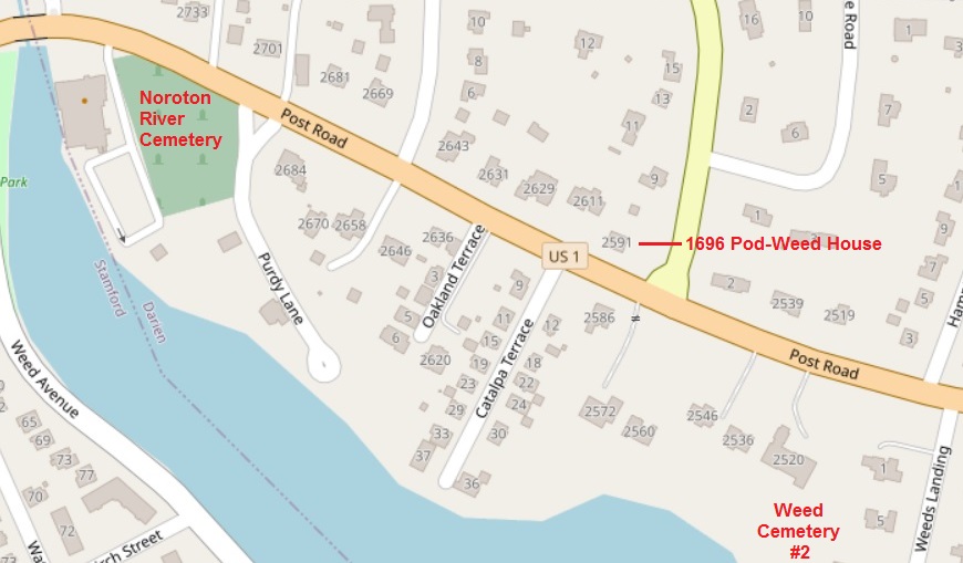
Map showing the 1696 Pond-Weed House, Weed Cemetery #2, Weed Landing, Noroton River Cemetery, and Weed Avenue. Map source:
OpenStreetMap. |
1789 - Colles Map for Darien
In 1789, Christopher Colles created a road atlas which the Library of Congress has put on line at: A Survey of the Roads of the United States of America. Included is the portion of the Kings Highway that runs from Yorktown, Virginia, to Stratford, Connecticut.
Maps 1 to 7, pages 4 to 10, show the route from Federal Hall in New York City to Stratford, Connecticut. Included are 73 mile markers from Federal Hall. Map 4, page 7, shows three four-mile road panels:
- 4c: Middlesex (Darien) and part of Norwalk, including mile markers 45 to 48
- 4b: Stamford and part of Middlesex (Darien), including mile markers 41 to 44
- 4a: Greenwich, including mile markers 37 to 40
Map 4c is the oldest known map of Old Kings Highway North and South in Darien, Connecticut.
The Colles maps do not give street names. The present-day names for the old Post Road on Map 4c are:
- southern part of Flax Hill Road in Norwalk
- Old Kings Highway North (OKHN) in Darien
- Old Kings Highway South (OKHS) in Darien
- new Post Road in Darien south of OKHS and north of Hollow Tree Ridge Road.
The Stamford Map 4b includes new Post Road from Hollow Tree Ridge Road in Darien south to Stamford.
Miles are marked on the atlas with dots and mile number. They were measured with a perambulator. The miles from New York City to Stratford, Connecticut, are measured from the tip of Manhattan, just south of Federal Hall on Wall Street.
Colles Map 4c - Norwalk and Middlesex (Darien) - Mile Markers 48 to 45 - North: 45° left
|
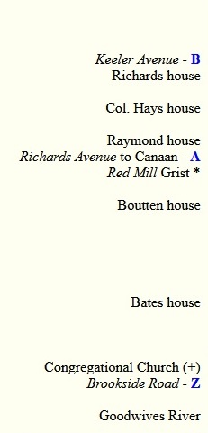 |
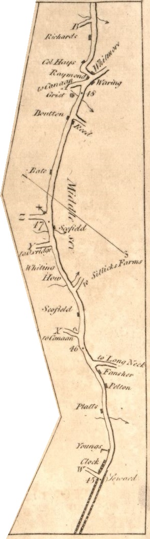 |
 |
 |
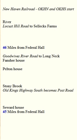 |
1820 - Middlesex Becomes Darien
In 1820 Middlesex Parish was finally granted independence from Stamford and renamed Darien. Source: Darien History.
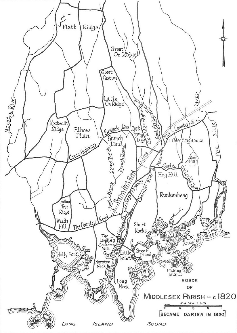
1820 Map. Middlesex Map showing The Country Road (Kings Highway) and the new Boston post Road. Source: Darien - 1641-1820-1970 - Historical Sketches, by Darien Historical Society, 1970. |
1849 - New Haven Railroad in Darien
Stagecoaches were replaced by the New Haven Railroad in 1849. The New York and New Haven Railroad (NY&NH) was a railroad connecting New York City to New Haven, Connecticut, along the shore of Long Island Sound. It opened in 1849, and in 1872 it merged with the Hartford & New Haven Railroad to form the New York, New Haven & Hartford Railroad. The line is now the Metro-North Railroad New Haven Line and part of Amtrak's Northeast Corridor. The railroad eventually changed Darien into a residential suburb of metropolitan New York. It also shifted the center of Darien from Noroton (called Darien on the map below) to the Darient Station (in the center of the map below, where the railroad crosses the new Post Road and the old Post Road). Both the new Post Road and the old Post Road crossed the railroad at street level. The original Darien station was between the the new and old Post Roads.
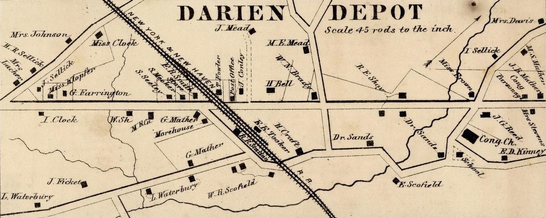
1867 Map of Darien Station, with the new Post Road straight across the middle and the old Post Road meandering across the bottom half. The train station is between the two roads. It appears that there were grade level crossings for both roads. From 1867 Map of Darien. |
1867 Darien Map
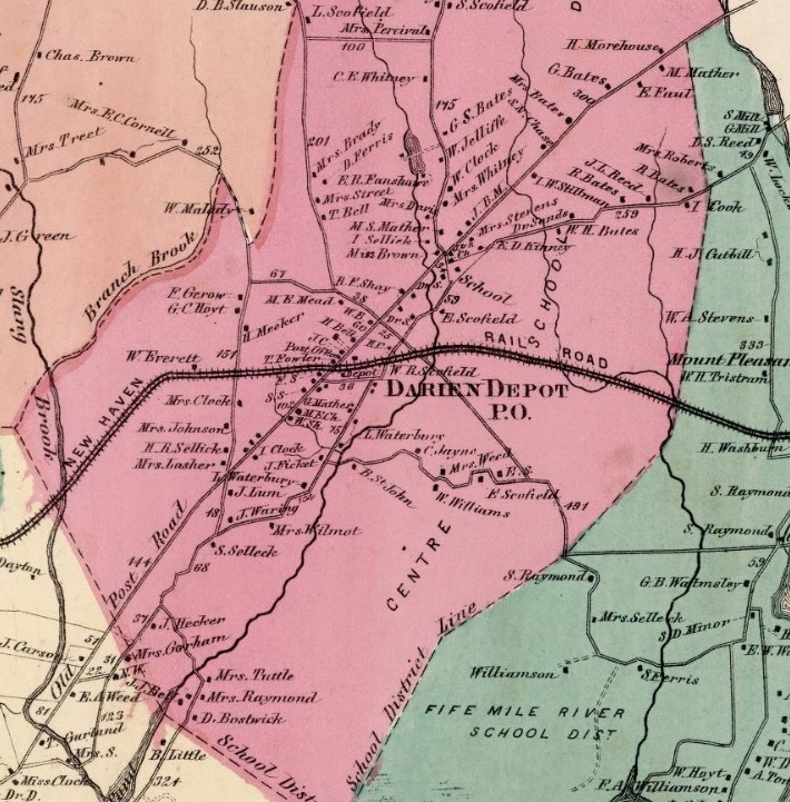
Excerpt from 1867 Darien Map of the new Post Road and old Post Road (Old Kings Highway North and South) leading to Norwalk. The oew Post Road is called "Old Post Road." Darien is called "Darien Depot." From 1867 Map of Darien. |
|
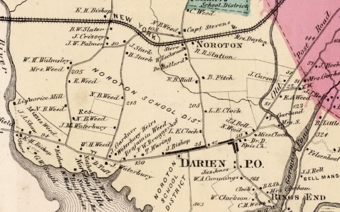
Excerpt from 1867 Darien Map of the new Post Road and old Post Road (Old Kings Highway South) leading to Stamford. The New Post Road is called "Old Post Road." Noroton is called "Darien." Noroton Heights is called "Noroton." From 1867 Map of Darien. |
|
1894 - New Haven Railroad Underpass in Darien
In 1894, the New Haven Railroad expanded from two tracks to four tracks. Steam power was replaced by electric power. the grade level was raised. In the process, The grade level crossing of the new Post Road was replaced by an underpass. No underpass was created for the old Post Road.
It appears on the 1867 Map of Darien that there was a grade crossing for the old Post Road to begin with. And it is clear on the 1908 map that there is no crossing.
Also in 1894, a new railroad station was built just east of the new Post Road, replacing the original station between the new Postroad and the old Post Road.
Source: New York and New Haven Railroad, Darien station, and Darien station.
1895 - Tramway in Darien
From 1895 to 1933, a tram from Rowayton extended into Darien past the Five Mile River at White Bridge and the old Post Road to the new Post Road, where people could connect with the Stamford tram that went down the new Post Road from Stamford an ended at the New Haven Railroad. Source: The Story of Darien, Connecticut, by Kenneth M. Reiss, 2009, p. 192.
1895 - Bicycle Map of Darien
An 1895 map shows the good roads for bicycles in the Darien area. East of the Darien Station, the old Post Road was better the the new Post Road, perhaps because the Red Mill was still operating at the Five Mile River. The new Post Road was better west of the Darien Station. The map does not name the roads.
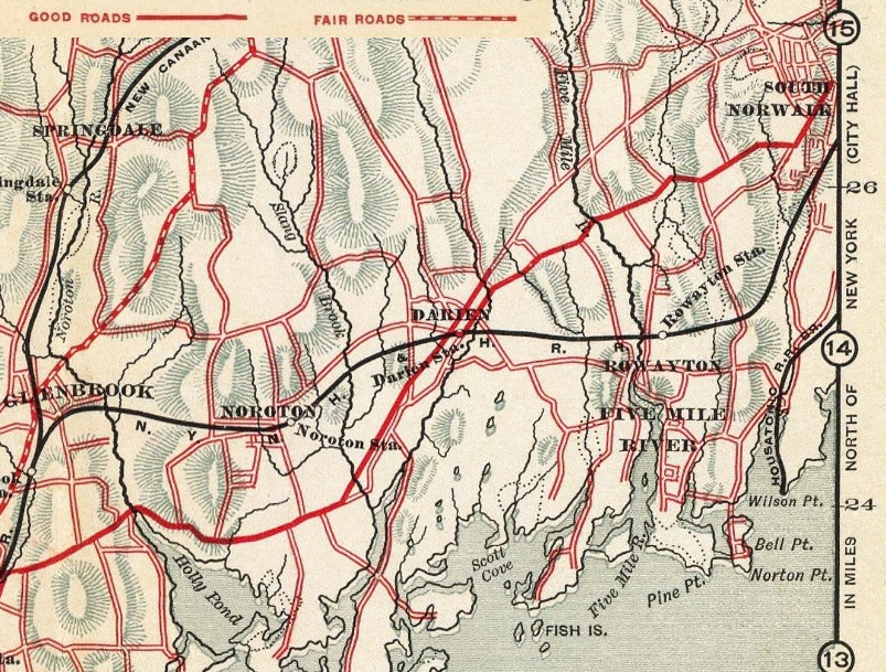
1895 Map. Excerpt from 1895 mini-atlas of Westchester County, New York, and part of Fairfield County, Connecticut, published by R.D. Servoss of New York, shows the good roads (solid red line) for bicycles. Source: David Rumsey Map Collection. |
1908 - Street Map of Darien
A 1908 atlas of "rural country district north of New York City" shows the old Post Road as Kings Highway, except for the portion in the downtown area which is called Maple Avenue. It shows the new Post Road as Connecticut Turnpike. Also shown are the New Haven Railroad and the Norwalk and Stamford tramways. The old Post Road clearly does not cross the New Haven Railroad.
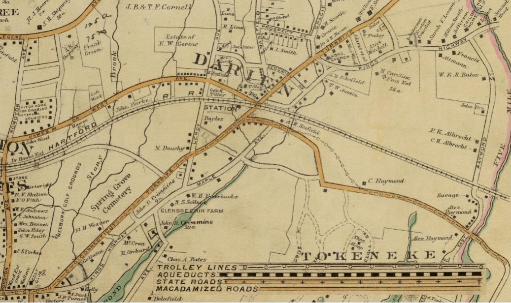
1908 Map. Excerpt from 1908 street map of Darien showing
- the old Post Road as Kings Highway and Maple Street and not macadamized
- the new Post Ropad as Connecticut Turnpike and macadamized
. Also shown are the New Haven Railroad and the Norwalk and Stamford tramways. Source: Atlas rural country district north of New York City. |
1935 - Mural
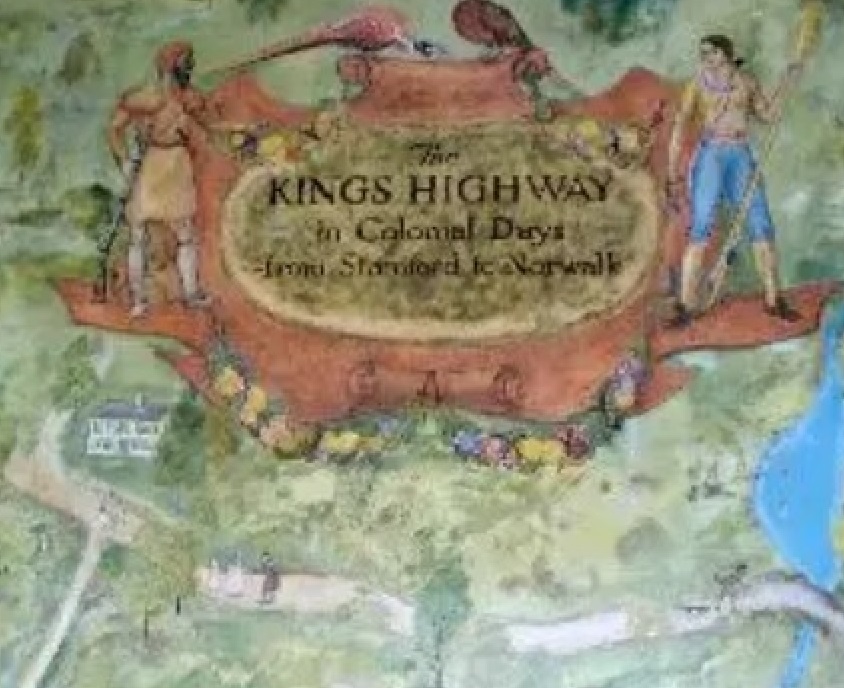
1935 Mural. Excerpt from a mural by Robert Pallesen of the Kings Highway in Darien in the entranceway of what is now the Darien Towm Hall (then the High School), built in 1926. Robert Pallesen lived at 70 Old Kings Highway North. |
In the 1930s, "Darien was the beneficiary of $46,943 that the federal government awarded for civic improvement projects, including the painting of murals for public buildings. The projects were funded through the Works Progress Administration. Two-dozen murals were painted, and they remain intact, lining the walls of the Town Hall (then high school). Enter the building and look to the right. A piece titled The Kings Highway in Colonial Days from Stamford to Norwalk, continues on the left as The Kings Highway Main Overland Route Between Boston and New York in the Eighteenth Century." Juliana Force, then director of the Whitney Museum in New York and regional director for the Federal Arts Project, came to Darien in 1935, to formally dedicate the mural. Source: Darien Patch and Darien Times.
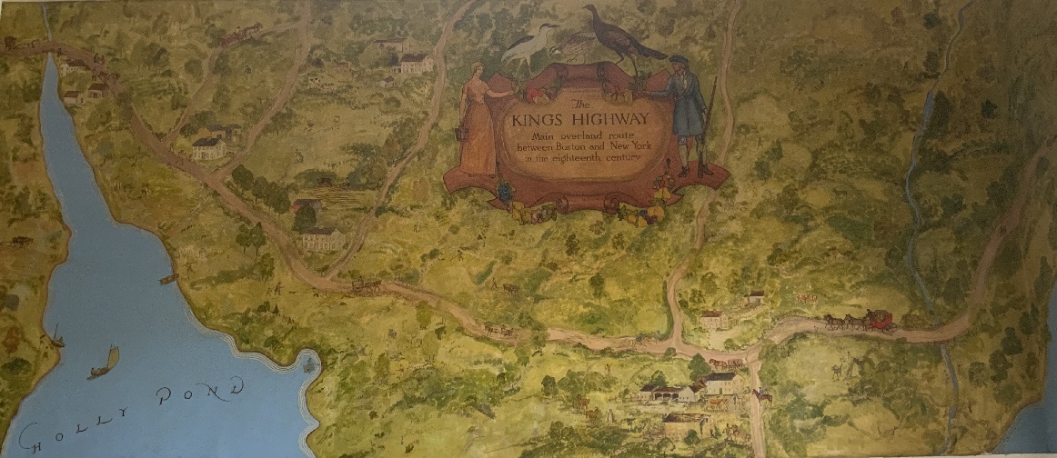
1935 Mural. Excerpt from a mural by Robert Pallesen. Crossing the Kings Highway from left to right are the Noroton River (Stamford/Darien border) into Holly Pond, Hollow Tree Ridge Road, Gardiner Street, Noroton Avenue, and Rings End Road. In the bottom right hand corner is Gorham's Pond. |
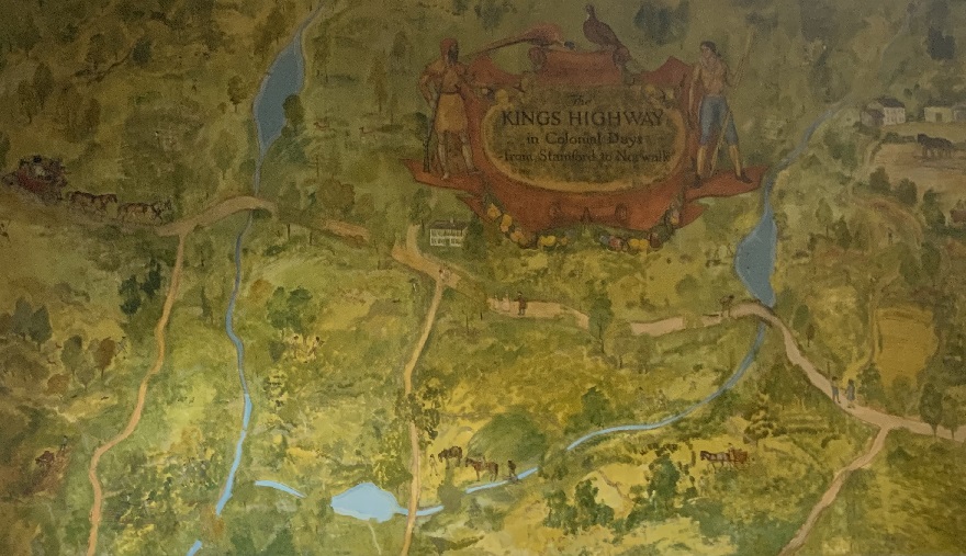
1935 Mural. Excerpt from a mural by Robert Pallesen. Crossing the Kings Highway from left to right are Raymond Street, the Five Mile River (Dariem/Norwalk border), Richards Avenue, Rowayton Avenue, Keelers Brook, and Highland Avenue. |
1938 - Merritt Parkway
In 1938, the Merritt Parkway was opened. It is just three miles north of the new Post Road. It was conceived as a way to alleviate congestion on the the Kings Highway. Trucks and buses over eight feet tall are excluded. The Merritt is listed in the National Register of Historic Places. It is acknowledged for the beauty of the forest through which it passes, as well as the architectural design of its overpasses, Source: Merritt Parkway.
1953 - Darien Bypass of US 1
In 1953, a short segment of freeway was opened to bypass the "choke point" on US 1 in Darien. The segment was between current-day Exits 11 and 13. It crosses
- Old Kings Highway North near Parkland Drive
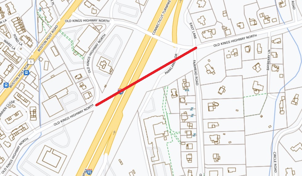
Rough approximation of the original path of Old Kings Highway North before the Darien Bypass. Town of Darien Map. |
- Old Kings Highway South near Corbin Drive
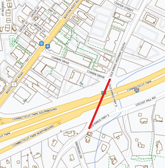
Rough approximation of the original path of Old Kings Highway South before the Darien Bypass. Town of Darien Map. |
Source: Kurumi.
1958 - Interstate 95 in Darien
In 1958, Interstate 95 came through Darien, incorporating the Darien Bypass of US 1. It was originally a 129-mile toll road called the Connecticut Turnpike. There were toll booths in Greenwich, Norwalk, and six other locations farther east to Plainfield in eastern Connecticut. Tolls were unpopular and were abolished in 1985. Source: Connecticut History.
There is a northbound entrance ramp from Old Kings Highway North to I-95.
I-95 has a total of six lanes, three in each direction.
In 1983, the northbound I-95 bridge over the Mianus River in Greenwich collapsed, killing three people and injuring three others. This led to rebuilding many I-95 bridges, including the bridge for Old Kings Highway North in 2018.
I-95 runs 1,900 miles from Miami to the Canadian border.
I-95 includes 1,000 miles from Boston to Chaleston, SC, quite a bit less than the 1,300 miles of the original Kings Highway ordered by Kings Charles II.
1977 - Junior League of Stamford-Norwalk
The Environmental Committee of The Junior League of Stamford-Norwalk published a study guide on river flood plains: The River Book, A Study Guide to the River and Its Environment. The Five Mile River was used as an illustration of a river's diverse wetland species and its role as a refuge for many types of wild life. Included was a history of the Five Mile River. In the 1980s and 1990s, the study guide was used extensively in the spring and fall for river study programs for Darien and Norwalk 4th and 5th graders and other groups. Following is an excerpt of the history of the Kings Highway (1977 edition, page 35).
|
King's Highway. King's Highway North, the road where we park to walk on the Traendly flood plain, was the first "Colonial Road" and united New York and Boston. In 1679 it was recognized as an indispensable artery connecting the coastal communities when the General Assembly ordered that "the country road or King's highway connecting the plantations be cleared to one rod wide. Then in 1703 an order was issued under the Act of the Provinces relating to highways to survey and lay out a continuous road to follow the Indian trails and the cartways already in existence. For many years after, this improved road was still little more than a cartway full of rocks, holes,and stumps.
In 1722 a stagecoach schedule was established between Boston and new York once very two weeks. This schedule was discontinued during the Revolution when British forces occupied new York. But by 1787 commerce had grown, and the New York-Boston stage made three trips a week.
Among the many famous men who travelled this road were Paul Revere, John Hancock, and General Lafayette. John Adams drove along this spot in 1774 on his way to the First Continental Congress. He was accompanied by the other delegates from Massachusetts: Samuel Adams, Robert Paine, and Thomas Cushing.
George Washington passed this way three times. He was interested in the stone fences along the way and remarked upon the many droves of beef cattle and flocks of sheep he saw being driven along this area to the New York market.
Benjamin Franklin, our first postmaster general, travelled the road measuring each mile of the improved road with a special wheel, which was attached to his wagon. At the end of every mile he drove into the ground a wooden stake which was later replaced by a solid milestone.
|
1982 - Historic District in Darien
The Boston Post Road Historic District was listed on the National Register of Historic Places in 1982. It encompasses a cross-section of residential architectural styles representative of much of the history of Darien, Connecticut. Included are:
- 45-70 Old Kings Highway North
- 1-25 Brookside Road
- 567-728 Boston Post Road (US 1)
Source: Boston Post Road Historic District.
Town of Stamford
The 3.8-mile route of the Kings Highway in Stamford, using Colles maps
4b, is:
- Noroton River - mile 44 on map 4b
- East Main Street (US 1) - includes mile 43 on map 4b
- Main Street - includes St. John's Episcopal Church
- Gap created by buildings constructed between Greyrock Place and Atlantic Street
- Stamford Town Center mall
- Landmark Square offfice building 6
- Veterans Memorial Park
- Main Street - includes mile 42 on map 4b (marker 21 miles to Fairfield)
- Mill River - mile 41.8 on map 4b
- West Main Street (US 1)
- Stillwater Avenue - includes mile 41 on map 4b (marker 22 miles to Fairfield)
- Palmer Hill Road
- boundary with Greenwich
Gary Denton walking through Stamford: 53,
54.
Colles Map of Stamford
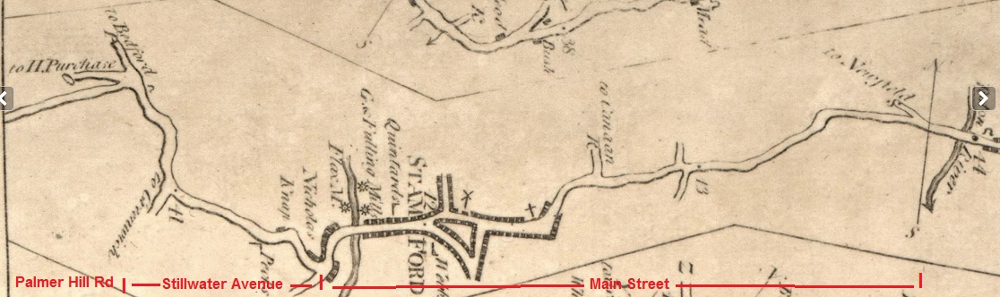
Excerpt from 1789 Colles Map 4b of Stamford, Connecticut. Mile 41 to Federal Hall is mile 22 to Fairfield. Grist, Fulling, and Flax mills are shown north of the Mill River at mile 41.8. Mile 42 to Federal Hall is mile 21 to Fairfield. The north-bound street at the triangle is Summer Street. The south-bound street at the triangle is Atlantic Avenue. The angle street in the triangle is BanK Street. The x was the First Congregational Church. The + is St. John's Episcopal Church. A portion of Main Street between Atlantic Avenue, but before St/ John's Episcopal Church, no longer exits. "R to Canaan" is Glenbrook Road. The Noroton River is at mile 44. Source: Colles Map 4b. |
1747 - St. John's Episcopal Church, Stamford
St. John's Church is located at 628 Main Street in Stamford. The first notice of Church of England services in Stamford was in 1705, when George Muirson, the rector of Rye, New York, made excursions eastward into the towns within the Connecticut colony. The wardens wrote to the Society for the Propagation of the Gospel in Foreign Parts in London, asking it to help them in their efforts to get a clergyman of the Church of England to minister to them; the wardens hoped that the Society would look favorably on their desire that Ebenezer Dibblee, a Congregational minister from Danbury who had become an Anglican convert, should receive Holy Orders in England and be sent by the Society back to St. John's Church. The Society agreed, and Mr. Dibblee traveled to London for ordination. He returned to Stamford in 1748 and became rector of the church, holding that position for 51 years until his death in 1799. Until the American Revolution, Mr. Dibblee remained a missionary for the Society for the Propagation of the Gospel, ministering to a parish that included all of Stamford, Greenwich, Darien, and New Canaan. During the revolution, many Anglicans remained loyal to the Crown, and many Stamford Anglicans emigrated to Canada. Mr. Dibblee stayed in Stamford and held services in parishioners homes during the war.
In 1742, an appeal was made to the town of Stamford for a grant of land on which to build a church. As the result of this appeal, the town agreed to give the professors of the Church of England a piece of land to set a church upon, at the southwest corner of the present lot held by St. John's parish. It was at that time a rude ledge of loose rock, bounded on the north and east by an almost impassable swamp, from which it it would appear that the Puritan town fathers did not much favor the Church of England. The Anglicans, however, thanked the town for the omen, that they were founded upon a rock. The cornerstone was laid in 1743, and the church was so far finished in 1747 that it could be used.
Source: St. John's Episcopal Church.
Main Street Dam in Stamford
The Main Street dam on the Mill River created the mill pond for the Grist, Fulling, and Flax mills shown on the 1789 Colles map at mile 41.8.
Stamford Mile Markers
There are seven stone mile markers on a 12-mile stretch of the Kings Highway in Fairfield County, Connecticut. The markers show the miles to the town of Fairfield. The markers are in Darien, Stamford, and Greenwich. The markers are all replicas except the one in Darien. The two in Stamford are:
- 21 miles to Fairfield is on Main Street at Bank Street (at mile 42 on map 4b)
- 22 miles to Fairfield is on Stillwater Avenue at West Avenue (at mile 41 on map 4b)
See the full list under Greenwich.
Stamford - 21 Miles to Fairfield
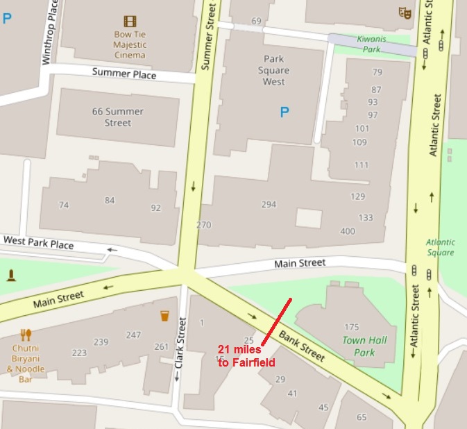
"21 miles to Fairfield" is at the corner of Main and Bank Streets in Stamford. |
|
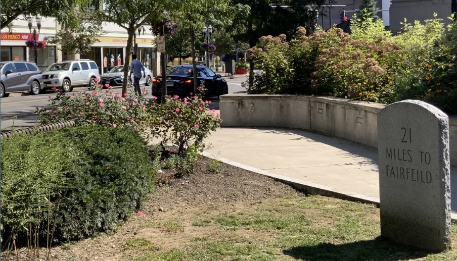
September 2023 photo of 21 miles to Fairfield marker at Main and Bank streets in Stamford. Main Street is in the background. |
|
Stamford - 22 Miles to Fairfield
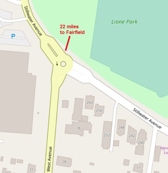
"22 miles to Fairfield" is at the corner of Stillwater and West avenues in Stamford. Stillwater is the Kings Highway in Stamford. |
|

September 2023 photo of 22 miles to Fairfield marker at Stillwater and West avenues in Stamford. Stillwater is the Kings Highway. Stamford Hospital is in the background. |
|
Town of Greenwich
The 6.3-mile route of the Kings Highway in Greenwich, using Colles maps
4a and 3c, is:
- boundary with Stamford
- Palmer Hill Road - includes mile 40 on map 4a
- Mianus River - "Titus Bridge" - mile 39.4 on map 4a
- Valley Road - includes miles 39 and 38 on map 4a
- East Putnam Avenue (US 1)
- Old Post Road - around mile 37.3 on map 4a
- Greenwich Creek - mile 37 on map 4a
- Christ Church Greenwich, 254 East Putnam Avenue - mile 36.7 on map 4a
- Knapps Tavern, now Putnam Cottage, 243 East Putnam Avenue - mile 36.6 on map 4a
- Second Congregational Church, 139 East Putnam Avenue - mile 36.4 on map 4a
- Where East and West Putnam avenues meet - mile 36 on map 3c
- West Putnam Avenue (US 1) - includes miles 35 and 34 on map 3c
- Byram River - mile 33.7 on map 3c
Gary Denton walking through Greenwich: 54,
55.
For a history of Greenwich, see Ye Historie of Ye Town of Greenwich, by Spencer P. Mead, 1911.
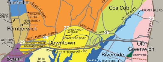
Excerpt from a map of Greenwich neighborhoods through which the Kings Highway runs. The Kings Highway is West Putnam Avenue, East Putnam Avenue, Valley Road, and Palmer Hill Road. The neighborhoods are Pemberwick and Byram on the west side and Cos Cob and Old Greenwich on the east side. Mile markers have been added. Source: Sotheby's. |
Greenwich - 23 Miles to Fairfield
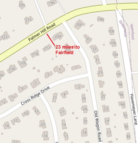
"23 miles to Fairfield" is in front of 212 Palmer Hill Road in Greenwich, just west of the town line. |
|
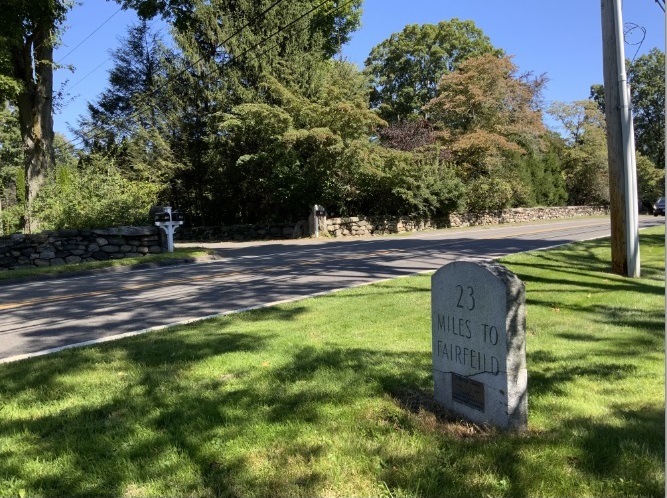
September 2023 photo of 23 miles to Fairfield marker on Palmer Hill Road. |
|
Greenwich - 25 Miles to Fairfield
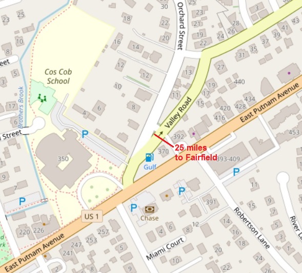
"25 miles to Fairfield" is where Orchard Street and Valley Road meet in Stamford. Valley Road and East Putnam Avenue, west of Valley Road, are the Kings Highway. |
|
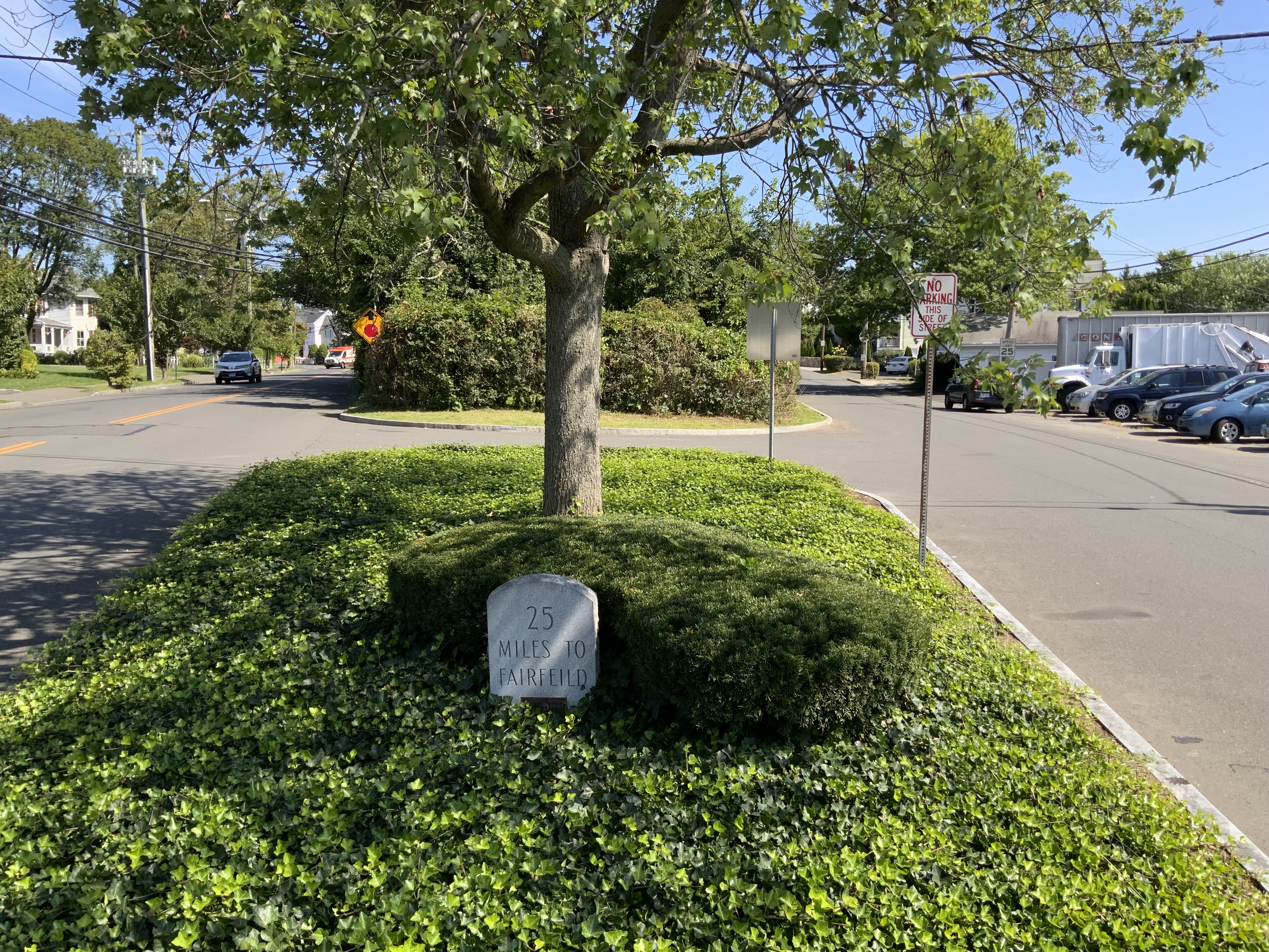
September 2023 photo of 25 miles to Fairfield marker at between Orchard Street and Valley Road. |
|
Greenwich - 27 Miles to Fairfield
"27 miles to Fairfield" is where East and West Putnam avenues meet, at the intersection with Greenwich Avenue. Across the street is the Presbyterian Church. |
|
September 2023 photo of 27 miles to Fairfield marker on Putnam Avenue at Greenwich Avenue. |
|
Greenwich - 28 Miles to Fairfield
"28 miles to Fairfield" is on West Putnam Avenue, west of Edgewood Avenue. |
|
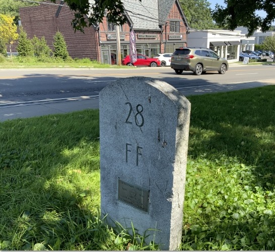
September 2023 photo of 28 miles to Fairfield marker on West Putnam Avenue just west of Edgewood Avenue. Across the street is a Maserati car dealer. |
|
Greenwich - 29 Miles to Fairfield
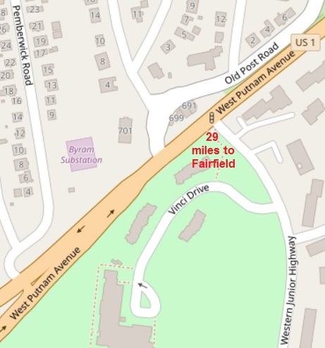
"29 miles to Fairfield" is on West Putnam Avenue, at the intersection with Western Junior Highway. |
|
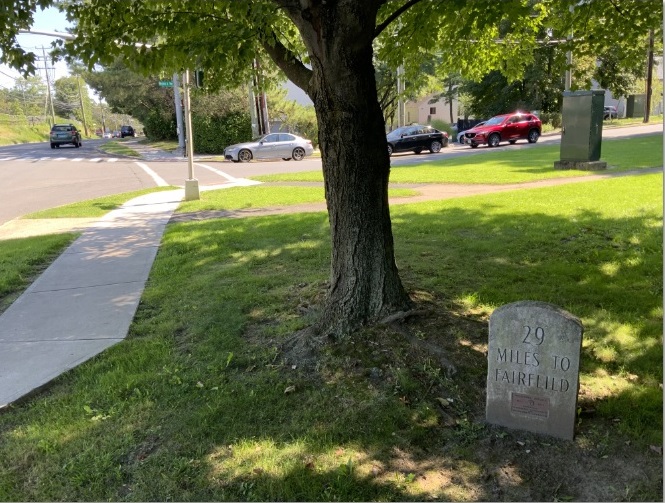
September 2023 photo of 29 miles to Fairfield on West Putnam Avenue, at the intersection with Western Junior Highway. |
|
Greenwich (Horse Neck)
Greenwich was originally known as Horse Neck. It did not become Greenwich until 1848, when the New Haven Railroad came through town. Putnam Hill in Horse Neck was once the center of Greenwich. The hill is named for General Israel Putnam, a Revolutionary War hero who in 1779 evaded pursuing British soldiers by riding from Knapp's Tavern down the steep hill to Stamford where he alerted the militia. General Putnam's military feats are honored with the naming of Putnam Avenue (original Kings Highway) and Putnam Cottage (Knapp's Tavern). Other significant buildings on Putnam Avenue are the Second Congregational Church and Christ Church Greenwich. They appear on the 1789 Colles Map 4a, along with Knapps Tavern. Source: Greenwich Historical Society.
1789 Colles Map 4a - eastern Greenwich
The main road is Palmer Hill Road, Valley Road, and East Putnam Avenue. 40, 39, 38, and 37 are miles from Federal Hall in New York City. I is Old Church Road. + is Christ Church Greenwich, 254 East Putnam Avenue. "H to Bedford" is Maple Avenue. x is Second Congregational Church, 139 East Putnam Avenue. Knaps is Knapps Tavern, now Putnam Cottage. Horse Neck is the original name for Old Greenwich. The wiggly line at 37 is Greenwich Creek. The horseshoe is a blacksmith shop. "L to Stanwich" near 38 is Orchard Road. K is Stanwich Road.
1789 Colles Map 3c - western Greenwich
The main road is West Putnam Avenue. 36, 35, and 34 are miles from Federal Hall in New York City. "G to King Street" is Lafayette Place, the dividing line between East and West Putnam Avenues. The river at 35.5 miles is Horseneck Brook. Gen. Mead is General John Mead, who had a large farm, which was located almost at the western boundary of Greenwich. In addition to farming, he was a public servant as Justice of the Peace, a member of the Legislature and also as a military officer, finally attaining the rank of Brigadier General during the Revolutionary War. "F to King Street" is Pemberwick Road.
Knapps Tavern
Knapps Tavern/Putnam Cottage was built by the Knapp family in the late 1600s, this bright red house on Boston Post Road was. Once the home of Timothy Knapp. It was then used as a tavern in the mid-1700's and served a number of troops and generals during the American Revolutionary War, including General Israel Putnam and General George Washington. See: Putnam Cottage and Putnam Cottage.
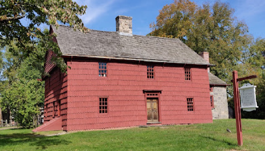
Knapps Tavern/Putnam Cottage, 243 East Putnam Avenue, Greenwich, Connecticut. From photo by Andrey Smirnov, 2021. |
New York
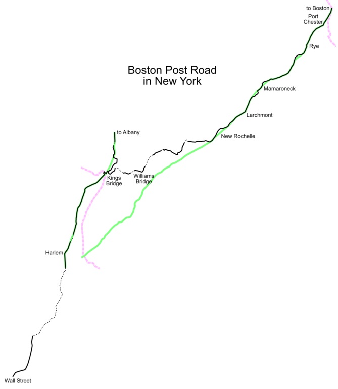
A map of the Boston Post Road in New York. The original road is in black; later realignments are in green. Dotted lines represent roads that no longer exist. The blue on the left is the Harlem River separating the boroughs of Manhattan and the Bronx. The blue on the right is the Byram River separating the states of New York and Connecticut. Source: Boston Post Road |
The 33.7-mile route of the Kings Highway in New York from from Port Chester to Federal Hall, using Colles maps
3,
2,
1 is:
Westchester County
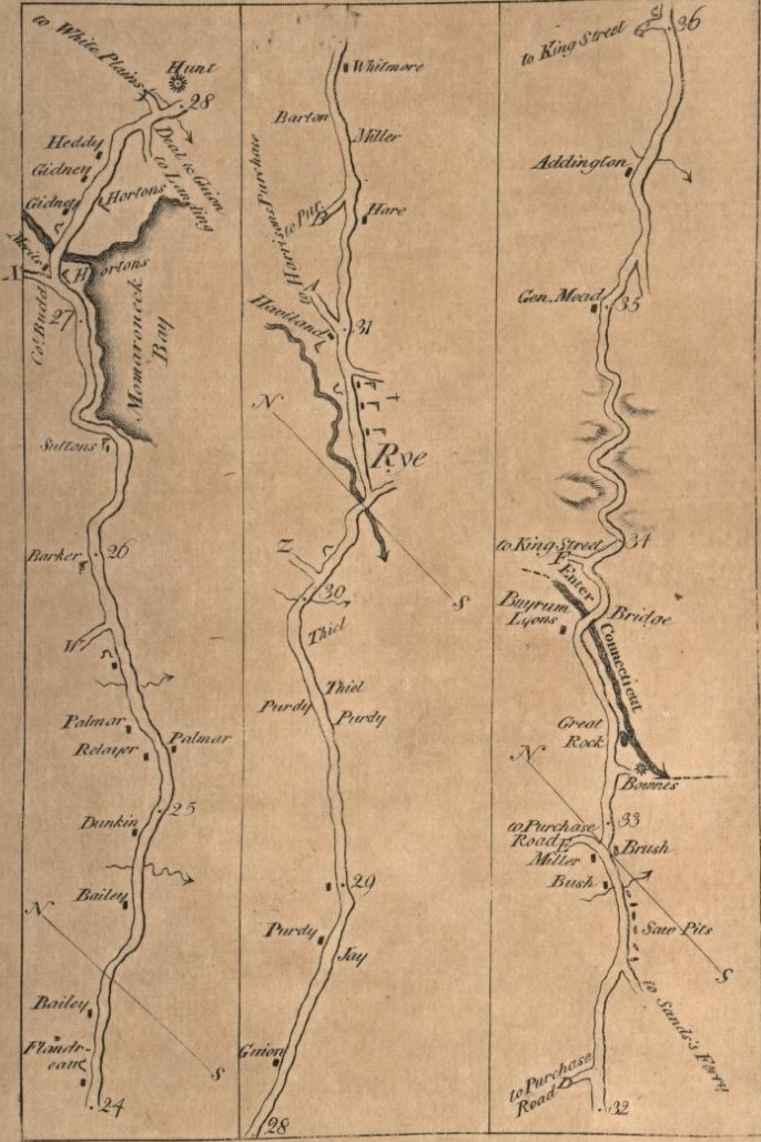
Colles Map 3 |
The 12.4-mile route of the Kings Highway in Westchester County, using Colles maps
3 and
2 is:
- Byram River - mile 33.7 on map 3c
- Village of Port Chester (originally named Saw Pits - mile 32.6 on map 3c)
- North Main Street (US 1) - includes mile 33 on map 3c
- "E Road to Purchase" (Westchester Avenue) - mile 32.9 on map 3c
- South Main Street (US 1)
- road to Sands Ferry (Grace Church Street) - mile 32.5 on map 3c
- South Main Street (US 1)
- Boston Post Road (US 1) - includes mile 32 on map 3c
- City of Rye
- Boston Post Road (US 1)
- A road to "Harrison & Purchase" (East Purchase Street) - mile 31 on map 3b
- Boston Post Road (US 1)
- Blind Brook - mile 30.4 on map 3b
- Boston Post Road (US 1)
- Old Post Road - includes mile 30 on map 3b
- Boston Post Road (US 1)
- Village of Mamaroneck
- East Boston Post Road (US 1)
- Beaver Swamp Brook - mile 28 on map 3a
- East Boston Post Road (US 1)
- Tompkins Avenue
- Mamaroneck River - mile 27.1 on map 3a
- Tompkins Avenue
- East Prospect Avenue
- Mamaroneck Avenue
- West Boston Post Road (US 1)
- Orienta Avenue
- Old Boston Post Road
- West Boston Post Road (US 1)
- Village of Larchmont
- Village of Mamaroneck
- City of New Rochelle
- East Main Street (US 1)
- Old Boston Post Road
- East Main Street (US 1)
- Huguenot Street (US 1) - Trinity-St. Paul's Episcopal Church and Guion's Tavern are at mile 23 on map 2c
- Main Street (US 1)
- Kings Highway
- Town of Pelham
- Hutchinson River - mile 20 on map 2b - area called East Chester in 1789
- City of Mount Vernon (named after George Washington's Mount Vernon)
- Sanford Boulevard East
- Colonial Place
- South Colmbus Avenue (NY 22)
- South Third Avenue (NY 22)
- Kingsbridge Road East
- Kingsbridge Road West
- boundary with The Bronx
Gary Denton walking through Westchester County:
- 56 - Port Chester and Rye
- 57 - Rye and Mamaroneck
- 58 - Mamaroneck and New Rochelle
- 59 - New Rochelle, Pelham, and Mount Vernon
1732 - Saw Pit (Port Chester)
Upon colonial settlement, the Port Chester area became known as Saw Pits for the saw pits in use during the time. Logs were cut in holes in the ground for wood to be used for homesteading. The name Saw Pit was used for the first time in 1732. The Saw Pit area remained largely untouched except for a few farms in the hills above the Byram River and a few taverns along the trail that became the Boston Post Road. Although Rye and Saw Pit were created within Fairfield County, Connecticut, the King of England gave the Duke of York large territories west of present-day Connecticut, forming the New York Colony in 1683. The controversy of divided loyalties to the King and the Duke continued for 105 years. In 1788, the Legislature of New York ruled that Saw Pit was a part of the town of Rye, New York. In 1868, Saw Pit separated from Rye and was renamed Port Chester. The harbor area had become a shipbuilding site and Port Chester was considered a major seaport. Source: Port Chester.
1673 - Rye History
Colonial Rye was a small farming community, but its position along the Westchester Path (later, the Boston Post Road) made it an important post and stagecoach stop. The post from New York to Boston started in 1673 and took 14 days. By 1722, stagecoaches were traveling over the road (known as the Kings Highway) and stopping in Rye. The center of Rye moved from the Long Island Sound area to the Kings Highway, aided by Strang's Tavern at what is now the corner of the Post Road and Rectory Street and the Square House. Both taverns were the center of colonial life, providing local residents and travelers with food, drink, shelter, entertainment, news and politics.
Rye had an unusually large number of mills in the late 1600s and 1700s. The brooks in Rye had a much greater flow of water before the New York City reservoir system was built in the mid-1800s. The first mill in Rye was built in 1656 on the Blind Brook near Oakland Beach Avenue. At the time of the Revolutionary War, 15 or 20 mills were operating in Rye and Port Chester, including one behind the Square House. See: Rye History and Boston Post Road Historic District (Rye).
1671 - Mamaroneck
In 1671, John Richbell of Mamaroneck and John Pell were appointed by the Governor of New York to lay out a new road from New York
City to New England in place of the old Indian trail. It was called the Westchester Path. In 1732, the first regular stage coach route was established along the (Old) Boston Post Road. In 1733 (or before), there was a (private) school house on the north side of what is now the Old Boston Post
Road and Orienta Avenue. It was also used for town meetings. In 1843, the wooden Post Road Bridge over the Mamaroneck River collapsed and was replaced by an iron pipe bridge. In 1889, a new school building opened at the Boston Post Road and Rockland Avenue, later referred to
as the Central School. In 1895, the Post Road Bridge was replaced with the present stone bridge. See: Mamaroneck History.
1762 - Trinity-St. Paul's Episcopal Church in New Rochelle
Tinity-St. Paul's Episcopal Church in New Rochelle in Westchester County, New York, is located at the northwest corner of Huguenot Street (also known as the Boston Post Road) and Division Street. This church represents the body of the majority group of New Rochelle's founding Huguenot French Calvinistic congregation that conformed to the liturgy of the established Church of England in June 1709. King George III gave Trinity its first charter in 1762. After the American Revolutionary War, Trinity became a parish of the Protestant Episcopal Church of America. See: Trinity-St. Paul's Episcopal Church.
1701 - Guion's Tavern in New Rochelle
Guion's Tavern was just south of Trinity-St. Paul's Episcopal Church in New Rochelle. See mile 23 on Colles map 2c. George Washington stayed at Guion's Tavern on April 12, 1776. He was on his way from Boston to New York City. He had just spent ten months as Commander-in-Chief of the Continental Army in the opening phase of the Revolutionary War at the Siege of Boston (April 19, 1775 to March 17, 1776).

The Guion-Allaire house built in 1701 by Louis Guion and sold to his son Louis II in 1725. Demolished in 1900. It stood on 20 acres on the Post Road at New Rochelle. It was the oldest New Rochelle residence captured on film. Source: Find a Grave for Louis Guion. |
1695 - St. Paul's Church in Mount Vernon
St. Paul's Church is at 897 South Columbus Avenue in Mount Vernon. The parish that founded Saint Paul's Church was established in 1665. The first church at the site was a small, square, wooden structure built in 1695 and was known as the Church of Eastchester. The present day church was built in 1764, but its name was not changed to Saint Paul's Church until 1795. On October 18, 1776, the Revolutionary War Battle of Pell's Point was fought less than a mile from the church, and the church served as a hospital for the British Army following the battle. The church's tower contains a bell that was cast in 1758 at the same London foundry as the Liberty Bell. As the fighting began to move closer to the church, George Washington ordered the parishioners to bury the bell to prevent the British from melting it down and using it for ammunition. The bell still hangs in the tower today. Source: Saint Paul's Church National Historic Site.
Borough of The Bronx
The 6.8-mile route of the Kings Highway in The Bronx, using Colles map
2 is:
- boundary with Mount Vernon in Westchester County
- Wakefield neighborhood
- Bussing Avenue (Kingsbridge Road in Mount Vernon)
- gap from 231st Street to 222nd Street (between Barnes Avenue and White Plains Road)
- Williamsbridge neighborhood
- gap from 222nd Street to 217th Street (between Barnes Avenue and White Plains Road)
- White Plains Road (southbound lane)
- East Gun Hill Road
- Bronx River - Williams Bridge - mile 17 map 2a
- Norwood neighborhood
- East Gun Hill Road
- Reservoir Place
- gap at Williamsbridge Reservoir Oval
- Van Cortlandt Avenue East (east of Mosholu Parkway)
- Valentine farm - mile 16.2 map 2a
- Jerome Park neighborhood
- Van Cortlandt Avenue East (west of Mosholu Parkway)
- gap across Jerome Park Reservoir
- Kingsbridge Terrace
- Heath Avenue
- Albany Crescent (east of Bailey Avenue)
- Kingsbridge neighborhood
- Albany Crescent (west of Bailey Avenue)
- 231st Street
- Kingsbridge Avenue
- West 230th Street
- Broadway (US 9)
- boundary with Manhattan - former Kings Bridge over former Spuyten Duyvil Creek - mile 14.5 map 2a
See: Boston Post Road and The Story of the Bronx.
Gary Denton walking through The Bronx:
60,
61.
1693 - Williams Bridge
The neighborhood of Williamsbridge in The Bronx got its name from the historic Williams Bridge, which was constructed in the area in 1693. The bridge was built by John Williams, a farmer and landowner who owned a large tract of land in the region. The bridge played a vital role in connecting Westchester County with Manhattan, serving as a crucial transportation link during that time. Over the years, the area around the bridge became known as Williamsbridge, and the name stuck as the neighborhood developed and grew. Today, while the original bridge no longer exists, the name Williamsbridge continues to honor the rich history and legacy of John Williams and his contribution to the area's development. Source: Williamsbridge.
Gun Hill Road Was Kingsbridge Road
The thoroughfare we know today as Gun Hill Road was once named Kingsbridge Road. It was an important artery over which the British and the colonists fought. Kingsbridge Road was part of the Boston Post Road, a system of mail-delivery routes between New York City and Boston, and became one of the first highways in the country. In January of 1777, colonists dragged a cannon to the top of a hill (in today's Woodlawn Cemetery) and fired down at the British. The hill became known as Gun Hill and in 1875 Kingsbridge Road was renamed Gun Hill Road in honor of the colonists. Source: Williamsbridge.
1758 - Valentine Varian House
When Isaac Valentine bought this parcel of land from the Dutch Reformed Church, carriages traveled the nearby Boston Post Road through a Bronx consisting mostly of farmland. Valentine, a blacksmith and farmer, built this two-story fieldstone house and it stands today as the borough's second oldest house.
The home's symmetrical style, sometimes referred to as Georgian vernacular, features evenly placed windows and identical chimneys at either end. Inside, rooms mirror each other across a central hallway. The design of the deep-set, splayed windows throughout the house let in light and keep out the cold.
During the Revolutionary War (1776-1783), Valentine and his family had to abandon their home, which was occupied by British, Hessian, and American troops. The house, close in proximity to cannons clustered on a nearby hill, miraculously survived several fierce battles. The Valentines returned after the war, but financial ruin forced them to sell their home and the 260-acre property to Isaac Varian, a successful butcher and farmer, in 1792. The Varians kept the house for three generations; one of Isaac's grandsons (also named Isaac) served as New York City's 63rd Mayor, from 1839-1841.
William F. Beller acquired this house in a 1905 auction. His son, William C. Beller, donated it to The Bronx County Historical Society in 1965, but sold the land to developers. The house was then moved diagonally from its original location, across Bainbridge, one block south to its present location in Williamsbridge Oval Park. See: Valentine Varian House.
Kingsbridge Neighborhood
The Kingsbridge neighborhood is named for the King's Bridge. Until the later part of the 19th century Riverdale, Kingsbridge, and other areas now in the northwest Bronx were part of the Town of Yonkers. The areas that are inside the modern-day New York city line broke off to form the Town of Kingsbridge. In 1874, the City of New York annexed three towns that later became the western half of The Bronx, including the Town of Kingsbridge. As the trains to Manhattan were built in the 20th century, a stop in the northwest Bronx along the Hudson River called Riverdale-on-Hudson, now Riverdale, was created. This gave rise to the Riverdale neighborhood. The remainder of the old Town of Kingsbridge developed into the modern-day Kingsbridge neighborhood. Sources: Kingsbridge, Bronx and The Kingsbridge Historical Society.
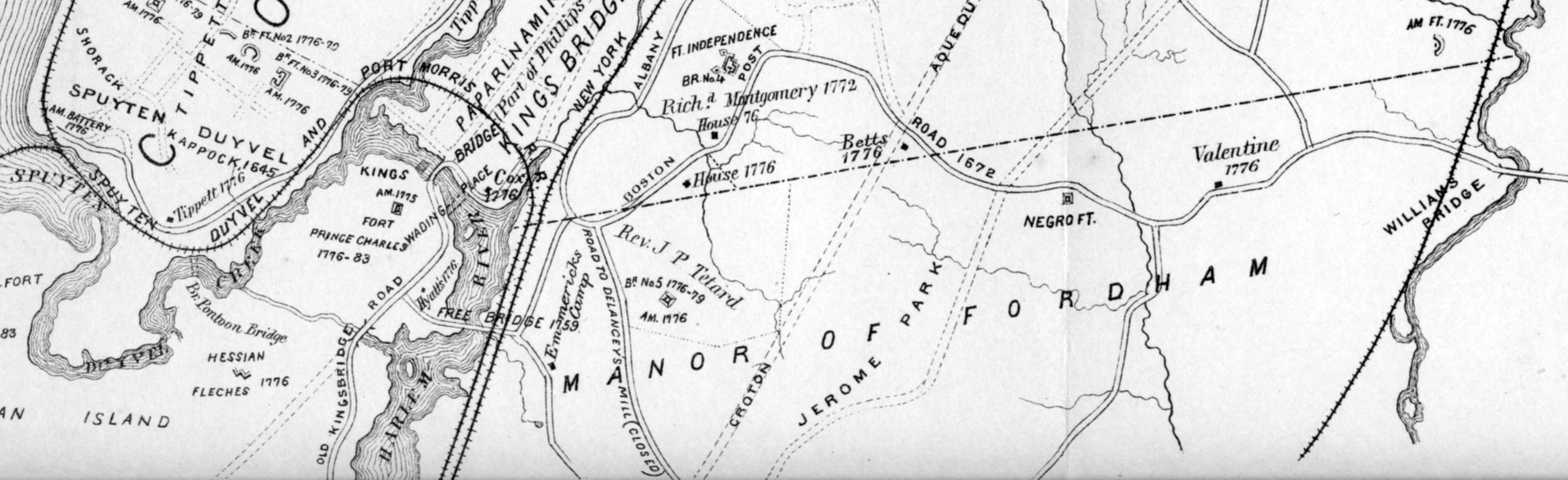
"Boston Post Road 1872" and "Old Kingsbridge Road" from Historical Sketch Map of Kings Bridge 1645 1783 by Thomas Henry Edsall, who wrote the first history of the Kingsbridge neighborhood). Source: Kingsbridge Historical Society Maps. |
1693-1895 - Kings Bridge and Spuyten Duyvil
The Kings Bridge crossed the old Harlem River (Spuyten Duyvil Creek). It connected the Bronx to upper Manhattan. It was originally constructed in 1693 under a grant from the Crown and maintained by the Philipse family as a toll bridge until the revolution.
In 1895, the old Harlem River (Spuyten Duyvil Creek) at what is now 230th Street was replaced by the Harlem Ship Canal at what was then 222nd Street. The Canal severed Marble Hill from Manhattan island, eliminating the old Kings Bridge. The creek's water flow was redirected to the new and deeper shipping canal, south of Marble Hill. Marble Hill, though separated by the river, is still part of Manhattan. Spuyten Duyvil and the Canal are now considered part of the Harlem River.
Source: Spuyten Duyvil Creek and Kings Bridge.
Borough of Manhattan
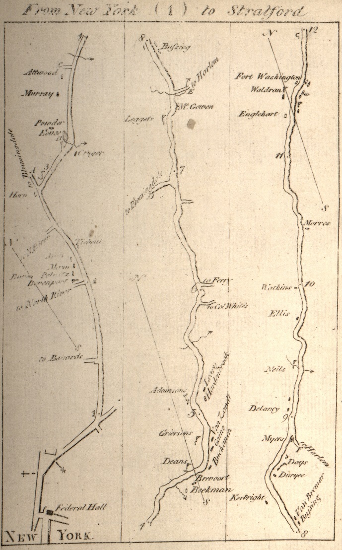
Colles Maps 1a, 1b, 1c. Included are miles 1 through 12. Source: 1789 Colles Maps. |
The 14.5-mile route of the Kings Highway in Manhattan, using Colles maps
2a,
1 is:
- boundary with The Bronx - former Kings Bridge over former Spuyten Duyvil Creek - mile 14.5 map 2a
- "Kingsbridge Road" on 1811 Map
- Broadway (US 9) - Marble Hill, Inwood, and Washington Heights
- Mile 14 on map 2a - between 228th Street and 225th Street in Marble Hill - Hyatts Tavern
- Harlem River
- Mile 13 on map 2a - between 204th and Academy streets -Myers Tavern
- Mile 12 on map 1c - near 189th Street
- Fort Washington - mile 11.6 on map 1c
- Mile 11 on map 1c - near 171st Street and 170th Street
- St. Nicholas Avenue - Washington Heights
- Morris House - mile 10.4 on map 1c - on 160th Street east of St. Nicholas Avenue
- Mile 10 on map 1c - at 152nd Street
- St. Nicholas Avenue - Harlem (formerly Harlem Lane)
- Hamilton Grange - house Alexander Hamilton built in 1802 near 143rd Street
- Mile 9 on map 1c - at 133rd Street
- Mile 8 on map 1c - between 116th and 115th Streets
- "Eastern Road" on 1811 Map
- Central Park from 110th to 92nd streets
- Mile 7.5 on map 1b - McGown's Tavern - in a hilly area of northern Central Park south of Harlem Meer
- Mile 7 on map 1b - in Central Park, west of 5th Avenue, between 98th Street and 97th Street
- Upper East Side
- 5th Avenue between 92nd and 89th streets is part of "Millionaire's Row"
- Various points from 89th to 80th streets between 5th and 3rd avenues - near 3rd Avenue and 81st Street is mile 6 on map 1b
- 3rd Avenue from 80th to 66th street
- Various points from 66th to 59th streets between 3rd and 2nd avenues - 2nd Avenue and 62nd Street is mile 5 on map 1b
- Various points between 59th and 53rd streets between 3rd and 1st avenues
- Turtle Bay - various points from 53rd to 43rd streets between Lexington and 1st Avenue - 3rd Avenue between 46th and 45th streets is mile 4 on map 1b
- Various points from 43rd to 26th streets between Madison and 3rd avenues - Murray farmhouse (Murray Hill) is at mile 3.6 on map 1a
- Madison Square Park
- Madison Avenue and 26th Street (northeast corner of park) is at mile 3 on map 1a
- Broadway and 23rd Street is at mile 2.8 on map 1a
- "Bowery Road" on 1811 Map
- Broadway - from 23rd to 17th streets - "Ladies Mile"
- Union Square - from 17th to 15th streets
- 4th Avenue - from 15th to Astor Place (which is mile 2 on map 1a )
- Cooper Square street - from Astor Place to 4th Street - The Cooper Union is at Cooper Square and 7th Street
- Bowery street - from 4th Street to Park Row - mile 1 on map 1a on Bowery near Park Row
- Park Row street (formerly Chatham Street, then "Newspaper Row")
- "Broadway" on 1811 Map
- St. Paul's Chapel - mile 0.4 on map 1a
- Courtlandt Street to Paulus Hook Ferry to New Jersey
- Wall Street - Federal Hall (at Nassau street) at mile 0 on map 1a
- Hudson River - Paulus Hook Ferry - mile 1 on map 40a
Gary Denton walking through Manhattan:
- 61 - Kingsbridge to Washington Heights
- 62 - Harlem
- 63 - Central Park to Madison Square Park
- 64 - Madison Square Park to the Bowery
- 65 - The Bowery to Federal Hall
1775 Manhattan Map
In 1878, Henry P. Johnston created a 1776 map of Manhattan. The Kings Highway north of 23rd Street was called "Kings Bridge Road or Post Road." From 23rd Street to Park Lane, it was called "Bowery Lane." Park Lane was not named. South of Park Lane, it was called "Broadway." See: 1775 Manhattan map.
1836 Manhattan Map
In 1836, J. H. Cotton created a wall map of Manhattan. The map was created before Central Park, so the Kings Highway from 110th to 92nd streets is included. From 66th Street to Madison Square, it was called "Old Post Road." From Broadway to Bowery, it was called Park Lane and "Chatham Steet." See: 1836 Manhattan Map.
1769 - Milestones
In 1769 the city's Common Council found it prudent to erect 14 milestones from the Kingsbridge down to Federal Hall at Wall and Nassau streets. See: Boston Post Road and Milestones and the Old Post Road.
1693-1895 - Kings Bridge and Spuyten Duyvil
The Kings Bridge crossed the old Harlem River (Spuyten Duyvil Creek). It connected the Bronx to upper Manhattan. It was originally constructed in 1693 under a grant from the Crown and maintained by the Philipse family as a toll bridge until the revolution.
In 1895, the old Harlem River (Spuyten Duyvil Creek) at what is now 230th Street was replaced by the Harlem Ship Canal at what was then 222nd Street. The Canal severed Marble Hill from Manhattan island, eliminating the old Kings Bridge. The creek's water flow was redirected to the new and deeper shipping canal, south of Marble Hill. Marble Hill, though separated by the river, is still part of Manhattan. Spuyten Duyvil and the Canal are now considered part of the Harlem River.
Source: Spuyten Duyvil Creek and Kings Bridge.
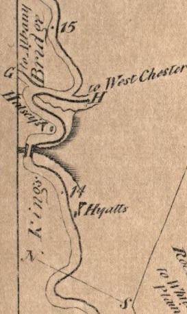
Excerpt from 1789 Colles Map 2a, showing mile markers 14 and 15 from Federal Hall. Included are the Kings Bridge that crosses the Harlem River between mile markers 14 and 15. Source: Colles map 2a. |
|
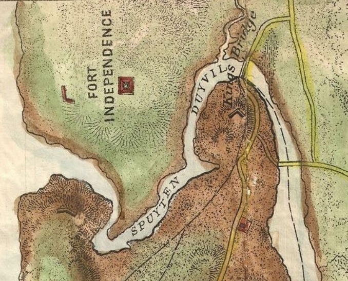
Excerpt from 1776 map of Manhattan created in 1878 by Henry P. Johnston. See: 1775 Manhattan map. |
|
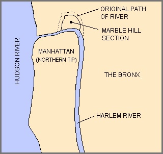
Marble Hill was cut off from Manhattan (except for the Broadway Bridge) when the Harlem River Ship Canal straightened the creek out. Source: Spuyten Duyvil Creek. |
|
1759 - Hyatt's Tavern
Hyatt's Tavern was built around 1759 near the current intersection of 226th Street and Broadway. The tavern was built and run by Jacobus Dyckman, who had run a successful inn called the Black Horse near McGown's Pass in the present Central Park. Source: Hyatt's Tavern.
1750 - Fort Washington
Fort Washington was a fortified position near the north end of Manhattan Island, at the island's highest point, within the modern-day neighborhood of Washington Heights in New York City. The site of Fort Washington is now Bennett Park on Fort Washington Avenue between West 183rd and 185th Streets in Washington Heights, Manhattan, New York City. The locations of the fort's walls are marked in the park by stones, along with an inscription. Nearby is a tablet indicating that the schist outcropping is the highest natural point on Manhattan Island, one of the reasons for the fort's location. Bennett Park is located a few blocks north of the George Washington Bridge. Source: Fort Washington.
St. Nicholas Avenue
St. Nicholas Avenue serves as a border between the West Side of Harlem and Central Harlem. The route, which follows a course that is much older than the grid pattern of the Commissioners' Plan of 1811, passes through the neighborhoods of Harlem, Hamilton Heights, and Washington Heights. It is believed to follow the course of an old Indian trail that became an important road in the 17th century between the Dutch settlement of New Amsterdam and the British New England Colonies. In the post colonial era, it became the western end of the Boston Post Road. St. Nicholas Avenue is named after Saint Nicholas of Myra, patron saint of New Amsterdam since Dutch times. Source: St. Nicholas Avenue.
1765 - Morris House
The Morris House is an 18th-century historic house museum in the Washington Heights neighborhood of Upper Manhattan in New York City. It is the oldest house in Manhattan, having been built in 1765 on St. Nichlas Avenue by British military officer Roger Morris, and was also home to the family of socialite Eliza Jumel in the 19th century. The New York City government has owned the house since 1903. General George Washington used the mansion as his temporary headquarters for one month in late 1776, after which British and Hessian officers occupied the house until 1783. Aaron Burr lived in the house for a short while after he married Eliza Jumel. Source: Morris House.
1802 - Hamilton Grange
Hamilton Grange is a historic house museum within St. Nicholas Park in the Hamilton Heights neighborhood of Manhattan in New York City. Operated by the National Park Service, the structure was the only home ever owned by Alexander Hamilton, a U.S. Founding Father. The house contains exhibits for visitors, as well as various rooms with restored 19th-century interiors. Originally located near present-day 143rd Street, the house was moved in 1889 to 287 Convent Avenue before being relocated again in 2008 to St. Nicholas Park. Source: Hamilton Grange.
1868 - Central Park
The Kingsbridge Road enters what is now Central Park from the north at 110th Street and St. Nicholas Avenue. It departs 5th Avenue and 92nd Street.
McGowan's Pass. The Kingsbridge Road crossed the Harlem Creek, which flowed east into the Harlem River. The road passed through this rocky landscape and descended through McGowan's Pass, named after the McGowan family, who owned a house and tavern near the present-day site of the Park's operational area known as the Mount, around 107th Street.
While restoring this landscape in 2013, the Central Park Conservancy hired archaeologists to determine the impact of the project on any physical remnants of this history. The archaeologists discovered the foundation of the gatehouse as well as the surface of the Kingsbridge Road, still preserved underground. Source: Central Park Consrvancy and NYC Parks.
Overlooking the East Meadow of Central Park from the other side of Fifth Avenue is Mt. Sinai Hospital, where two of my grandchildren were born.
The three maps below show Central Park from 8th to 5th avenues, from 110th to 88th streets in:
- 1836 before the park was built
- 1868 after the park was built
- 2023
Excerpt from 1836 J. H. Cotton map of Manhattan, created before Central Park, so the Kings Highway from 110th to 92nd streets is included. Source: 1836 Manhattan Map. |
|
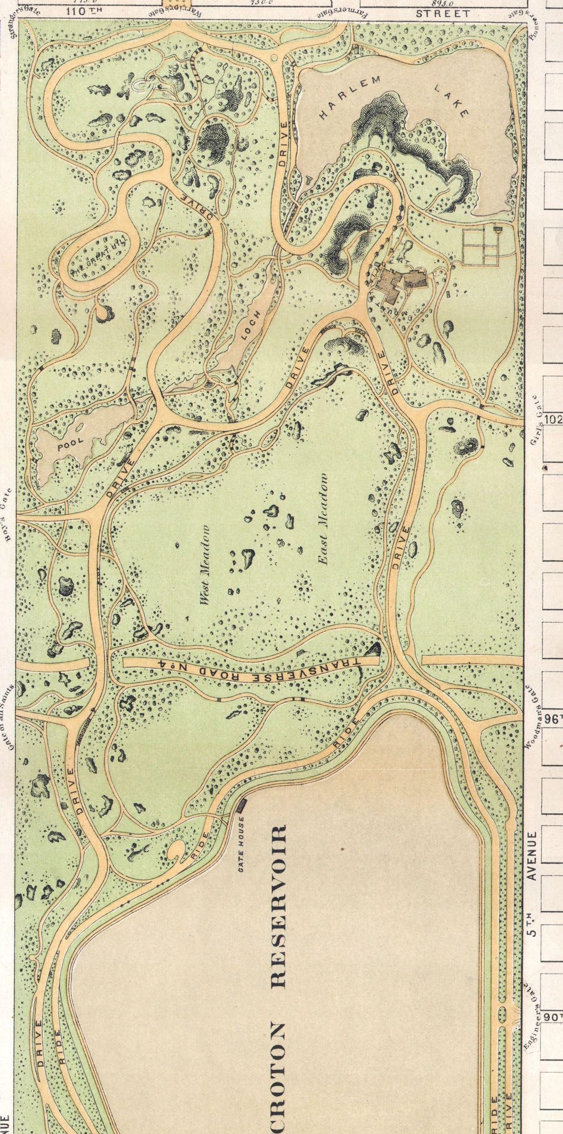
Central Park north of 88th Street from Modified Greensward Plan, 1868. The Croton reservoir was completed in 1862. Source: Central Park |
|
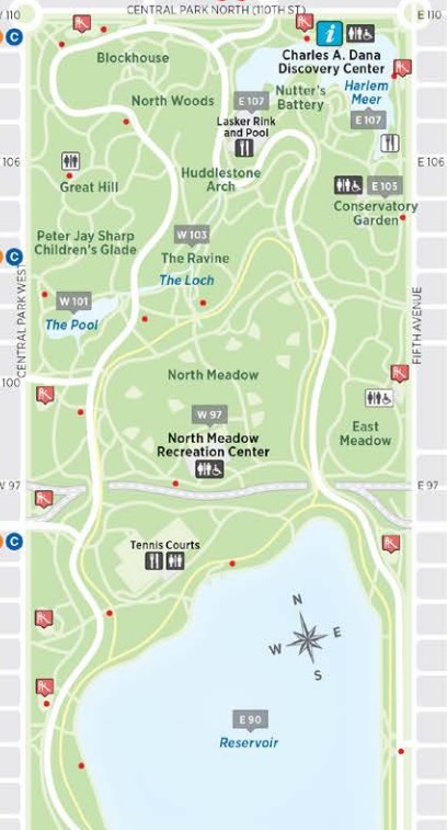
Central Park north of 88th Street from 2023 Central Park Map provided by the Central Park Consrvancy.
Central Park Consrvancy |
|
If you re lost in the Park, lampposts can help you find your way. The base of every lamppost in Central Park contains four numbers the first two numbers indicate the nearest street ( 80 would mean 80th Street) and the last two numbers designate whether you re on the west or east side (odd number means west, even number means east).
1902-1918 - "Millionaire's Row"
The section of Fifth Avenue between
- 96th and 59th streets across Central Park was nicknamed "Millionaire's Row" in the early 20th century due to the high concentration of mansions there
- 96th and 86th streets across Central Park is part of a neighborhood called Carnegie Hill
- 92nd and 89th streets happens to be part of the Kings Highway.
Felix M. Warburg House - Jewish Museum of New York
In 1895, German Jewish banker Felix M. Warburg immigrated to the United States to marry Frieda Schiff, daughter of Jacob Schiff, head of the New York based banking house Kuhn, Loeb & Co., which Warburg joined as a junior partner in 1897. Felix M. Warburg House, 1109 Fifth Avenue at 92nd Street, was built from 1907 to 1908 for Warburg and his family. The Warburgs donated it in 1944 to the Jewish Theological Seminary of America. In 1947, the Seminary opened the Jewish Museum of New York in the mansion. Source: Felix M. Warburg House.
92nd Street. |
Otto H. Kahn House - Convent of the Sacred Heart
The Otto H. Kahn House at 1 East 91st Street was built between 1914 and 1918 as the town residence of Otto H. Kahn, a senior partner at the investment bank Kuhn, Loeb and Co. The house was modeled after the palazzo della Cancelleria of the Papal Chancellery in Rome and took four years to construct. It had up to 80 rooms in addition to living quarters for 40 servants, which made it one of the largest private homes in America. Following Kahn's death in 1934, the house was sold to the Convent of the Sacred Heart (New York City), a private Catholic school for girls. Source: Otto H. Kahn House.
91st Street. |
Andrew Carnegie Mansion - Cooper-Hewitt, Smithsonian Design Museum
The Andrew Carnegie Mansion is at 1090 Fifth Avenue. Andrew Carnegie moved into his newly completed mansion in late 1902 and lived there until his death in 1919; his wife, Louise, continued to live there until her death in 1946. The building is now the Cooper-Hewitt, Smithsonian Design Museum, part of the Smithsonian Institution. The surrounding area, part of the larger Upper East Side neighborhood, has come to be called Carnegie Hill. Source: Andrew Carnegie Mansion
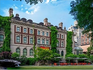
91st-90th Street. |
Engineers Gate into Central Park
There is a large entrance into Central Park at 90th Street and 5th Avenue, called Engineers Gate. It is one of the many gates into Central Park honoring professions that played a prominent role in New York City's history. The NYC Marathon runners enter Central Park at this location, which also leads to the finish line. Source: Engineers Gate.
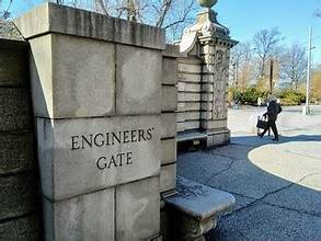
90th Street. |
Third Avenue from 80th to 66th Street
Third Avenue from 66th to 80th streets is part of the old Post Road. In the 19th century the farmland and market garden district of what was to be the Upper East Side was still traversed by the Old Post Road. By the mid-19th century the farmland had largely been subdivided, with the exception of the 150 acres of Jones's Wood. The farm of 132 acres, known by its 19th-century owners as the "Louvre Farm", extended from the Old Boston Post Road (approximating the course of Third Avenue) to the river and from present-day 66th Street to 75th Street. Source: Upper East Side.
1878-1955 - Third Avenue El
An elevated train ran over Third Avenue from 1878 to 1955. There were stations for local trains at 76th and 67th streets. There were three tracks. Two outer tracks served local trains at two side platforms. A center track served express trains. Source: The Rise and Decline of New York City's Third Avenue Elevated Train Line.
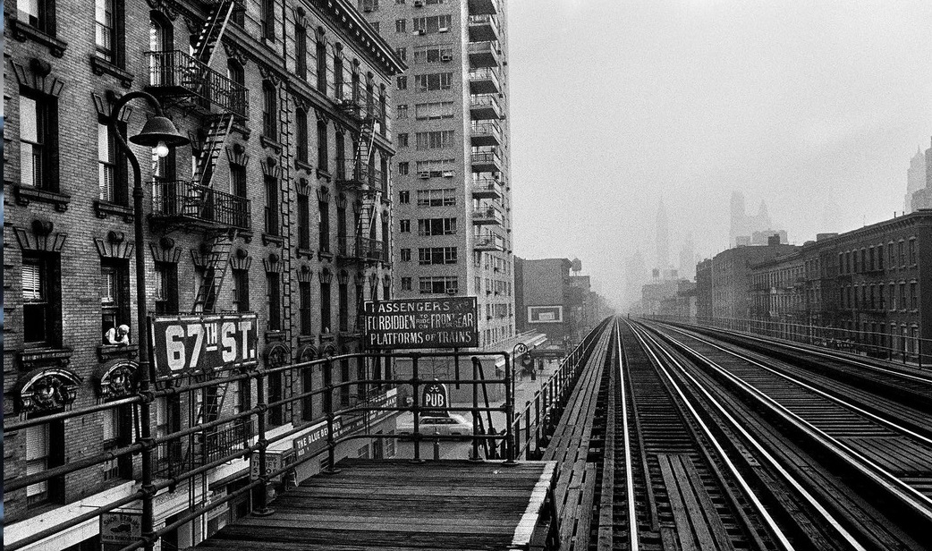
67th Street Station, Third Avenue El, 1955. Photograph by William Klein. Source: facebook. |
1776 - Nathan Hale - "I only regret, that I have but one life to lose for my country"
Nathan Hale, legendary 21-year old hero of the Revolutionary War, was hanged as an American spy on Sunday, September 22, 1776. Arrested Saturday night, he was interrogated by the British commander, General William Howe, at his headquarters near what is now the United Nations. The exact location of the hanging is one of history's uncertainties. Other places have been cited, but a British officer's diary indicated the Royal Artillery park near the Dove Tavern on the Old Post Road, now Third Avenue where it intersects 66th Street. Source: Nathan Hale.
1836 - 66th Street to 44th Street
Based on the 1836 J. H. Cotton map of Manhattan, the "Old Post Road" crossed Second Avenue in two places and and Third Avenue in one place.
- Second Avenue between 63rd and 62nd streets
- Second Avenue at 52nd Street
- Third Avenue between 44th and 45th streets
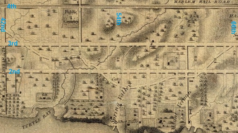
Excerpt from 1836 J. H. Cotton map of Manhattan, showing the Old Post Road from 42nd Street to 66th Street. Source: 1836 Manhattan Map. |
1639 - Turtle Bay
Turtle Bay, a cove of the East River, was between what is now 45th and 48th Streets and was fed by a stream that ran from the present-day intersection of Second Avenue and 48th Street. It was probably named after the turtles found in the area. Historical records from the 17th century described an abundance of turtles nearby, with local residents partaking in a "turtle feast". The Turtle Bay neighborhood was originally a 40-acre land grant given to two Englishmen by the Dutch colonial governor of New Amsterdam in 1639 and named Turtle Bay Farm. The farm extended roughly from what is now 40th to 49th Streets and from Third Avenue to the river. On a knoll overlooking the cove, near 41st Street, the farmhouse was purchased as a summer retreat by Francis Bayard, and in the early 19th century remained the summer villa of Francis Bayard Winthrop. Turtle Creek, or DeVoor's Mill Creek as it was known, emptied into the cove at what is now 47th Street. To the south lay Kip's Bay farm; to the north, on a bluff, stood James Beekman's "Mount Pleasant", the first of a series of houses and villas with water views stretching away up the shoreline. "Beekman" can be seen at mile 4.5 on Colles map 1b. After the street grid system was initiated in Manhattan, the hilly landscape of the Turtle Bay Farm was graded to create cross-streets and the land was subdivided for residential development. Source: Turtle Bay.
1836 - 44th Street to Murray Hill to Madison Square
Based on the 1836 J. H. Cotton map of Manhattan, the "Old Post Road" crossed what is now St. Agnes Church, built in 1874, on the north side of 43rd Street between Lexington Avenue and Third Avenue.
It crossed what is now the Chrysler Building, an Art Deco skyscraper built in 1930, at the northeast corner of 42nd Street and Lexington Avenue, between Third Avenue and Park (Fourth) Avenue.
Based on the 1836 J. H. Cotton map of Manhattan, the "Old Post Road" crossed Lexington Avenue (Irving Place) in two places and and Park (Fourth) Avenue in one place.
- Lexington Avenue at 40th Street
- Lexington Avenue at 30th Street
- Park Avenue at 28th Street
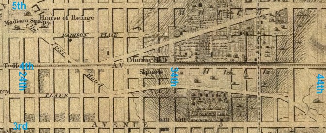
Excerpt from 1836 J. H. Cotton map of Manhattan, showing Madison Square, the Old Post Road, and Murray Hill. Source: 1836 Manhattan Map. |
1762 - Murray Hill
The Murray Hill neighborhood of Manhattan derives its name from the Murray family, whose business interests were mainly concerned with shipping and overseas trade. Robert Murray (1721 1786) arrived in New York City in 1754. About 1762, he rented land from the city for a great house and farm, which he called Inclenberg, Dutch for beautiful hill. The total area was just over 29 acres. In today's terms, the farm began a few feet south of 33rd Street and extended north to the middle of the block between 38th and 39th Street. At the southern end, the plot was rather narrow but at the northern end it went from approximately Lexington Avenue to a spot between Madison and Fifth Avenues. "Murray" can be seen at mile 3.6 on Colles map 1a. Source: Murray Hill and Robert Murray.
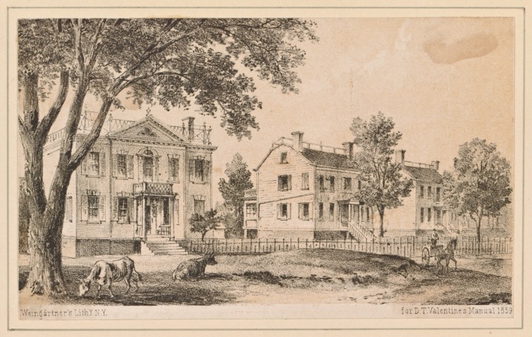
Robert Murray's Inclenberg, around 1859. The great house was built on a since-leveled hill at what is today Park Avenue and 36th Street. Source: Robert Murray. |
1847 - Madison Square
Madison Square Park is a 6.2-acre public park, bounded on the east by Madison Avenue (which starts at the park's southeast corner at 23rd Street); on the south by 23rd Street; on the north by 26th Street; and on the west by Fifth Avenue and Broadway as they cross. The park and the square are at the northern (uptown) end of the Flatiron District neighborhood of Manhattan. The neighborhood to the north and west of the park is NoMad ("NOrth of MADison Square Park") and to the north and east is Rose Hill. On May 10, 1847, the 6.2-acre Madison Square Park, named after President James Madison, opened to the public. Within a few years, the tide of residential development, which was relentlessly moving uptown, had reached the Madison Square area. Source: Madison Square.
1902 - Flatiron Building
The Flatiron Building was designed by Daniel Burnham and Frederick P. Dinkelberg, epitomizing the Chicago school of architecture. It was completed in 1902 and originally included 20 floors. The building sits on a triangular block formed by Broadway (the Kings Highway), Fifth Avenue, and East 22nd Street. The name "Flatiron" derives from its triangular shape, which recalls that of a cast-iron clothes iron. Source: Flatiron Building.
1868-1910 - "Ladies Mile"
The Ladies' Mile was a prime shopping district on Broadway from Madison Square to Union Square (part of the Kings Highway). It served the well-to-do "carriage trade" of the city. Before becoming a shopping district, this area was residential and included rows of identical brownstone townhouses. These townhouses were replaced in the 1860s by department stores.
The architectural style of this district shifted to Beaux-Arts, Neo-Renaissance, Romanesque Revival, and Queen Anne. Many of the new buildings used cast iron because it was cheap and could be made into any shape for extravagant decorations.
The first to make this move was Arnold Constable in 1868, though other were quick to follow. Between the Civil War and World War I, the Ladies Mile was the location of some of New York's most famous department stores and upscale retailers, including:
- Lord & Taylor at 901 Broadway at 20th Street
- Gorham Silver at 889 Broadway
- Arnold Constable at 881-887 Broadway
- W. & J. Sloane on Broadway at 19th Street
Ethel Barrymore, Isabella Stewart Gardner, Lilly Langtry and Lillian Russell were among those who might be found in the opulent shopping district at its zenith. The Ladies Mile was termed so because women were the target consumers and its popularity made it a safe space for women to wander about without men. The construction of the elevated train known as the El on Sixth Avenue in 1878 made the Ladies Mile more accessible to lower class consumers. Extravagant shoppers would continue to arrive in carriages.
Source: Ladies' Mile Historic District.
1884 - Gorham Manufacturing Company Building
889 Broadway, also known as the Gorham Manufacturing Company Building, is a Queen Anne style building located at Broadway and East 19th Street in the Flatiron District of Manhattan, within the Ladies' Mile Historic District. Built in 1883 1884, it was designed by Edward Hale Kendall. The building served as a retail store for the Gorham Manufacturing Company, a major manufacturer of sterling and silverplate, until 1905. The stories above the second floor were originally rented as bachelor apartments until Gorham expanded into the rest of the building. The building was converted into lofts and offices in 1913. In 1977, the original layout was restored. Source: Gorham Manufacturing Company.
1869 - Arnold Constable & Company Building
Arnold Constable & Company was a department store chain in the New York City metropolitan area. At one point it was the oldest department store in America, operating for over 150 years from its founding in 1825 to its closing in 1975. At the company's peak, its flagship "Palace of Trade" in Manhattan located at 881-887 Broadway at East 19th Street was acknowledged to be the store which took the largest portion of the "carriage trade" in New York, serving the rich and elite of the city, such as the wives of Grover Cleveland, Andrew Carnegie, Thomas Edison, J.P. Morgan, John D. Rockefeller, and Cornelius Vanderbilt. Source: Arnold Constable & Company.
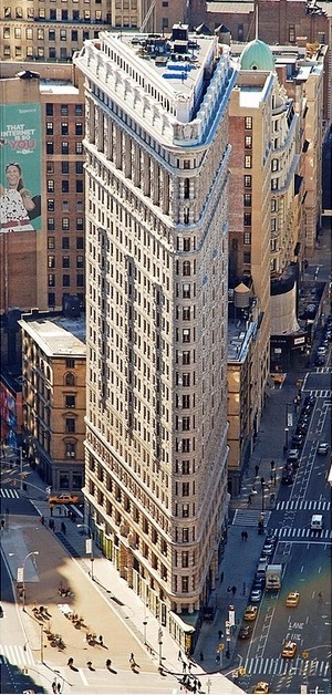
Flatiron Building, 949 Broadway. Looking south, Broadway to the left, Fifth Avenue to the right |
|
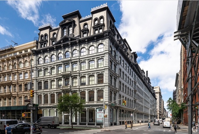
Constable building, 881 Broadway. Looking southwest. 19th Street to the right. Broadway to the left. |
|
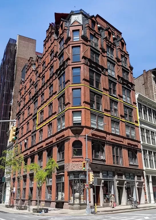
Gorham building, 889 Broadway. Looking northwest. 19th Street to the left. Broadway to the right. |
|
1839 - Union Square
Union Square is a historic intersection and surrounding neighborhood in Manhattan, located where Broadway and the former Bowery Road now Fourth Avenue came together in the early 19th century. Its name denotes that "here was the union of the two principal thoroughfares of the island". The current Union Square Park is bounded by 14th Street on the south, 17th Street on the north, and Union Square West and Union Square East to the west and east respectively. Adjacent neighborhoods are the Flatiron District to the north, Chelsea to the west, Greenwich Village to the southwest, East Village to the southeast, and Gramercy Park to the east. Many buildings of The New School are near the square, as are several dormitories of New York University. The eastern side of the square is dominated by the four Zeckendorf Towers, and the south side by the full-square-block mixed-use One Union Square South, which contains a wall sculpture and digital clock titled Metronome. Union Square Park also contains an assortment of art, including statues of George Washington, Marquis de Lafayette, Abraham Lincoln, and Mahatma Gandhi. Source: Union Square.
1785 - Edward Mooney House
The Edward Mooney House was built between 1785 and 1789 for wealthy butcher Edward Mooney on land he purchased after it was confiscated from British Loyalist James De Lancey. The brick house was built in a mixture of Georgian and Federal styles, and is New York City's earliest remaining Early Federal style townhouse. It has three stories plus an attic and full basement. The home was located close to the slaughterhouses, holding pens and tanneries where Mooney made his living; he occupied the house until his death c.1800. Source: Edward Mooney House.
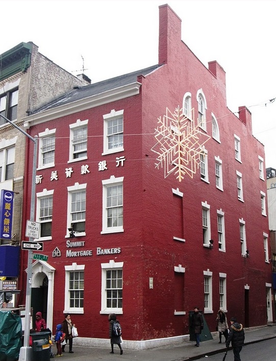
The Edward Mooney House at 18 Bowery, at the corner of Pell Street, in the Chinatown neighborhood of Manhattan. Source: Edward Mooney House |
1859 - Cooper Union
Cooper Union is a private college on Cooper Square in Lower Manhattan. Peter Cooper founded the institution in 1859. Peter Cooper, one of the richest businessmen in the United States. Cooper was a workingman's son who had less than a year of formal schooling. Cooper designed and built America's first steam railroad engine. On February 27, 1860, the school's Great Hall became the site of a historic address by Abraham Lincoln. Widely reported in the press and reprinted throughout the North in pamphlet form, the speech galvanized support for Lincoln and contributed to his gaining the Republican Party's nomination for the presidency. It is now referred to as the Cooper Union Address. Source: New York City Hall.
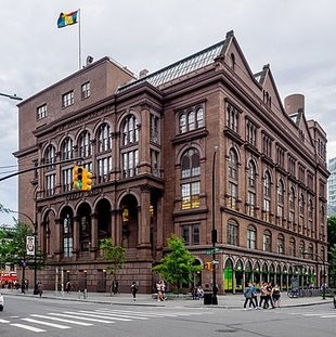
The Cooper Union's Foundation Building at Cooper Square and Astor Place. Source: Cooper Union |
|

Photo of Abraham Lincoln taken February 27, 1860, in New York City by Mathew Brady, the day of his famous Cooper Union speech. Source: Cooper Union Address |
|
1812 - New York City Hall
New York City Hall is the seat of New York City government, located at the center of City Hall Park in the Civic Center area of Lower Manhattan, on Park Row, between Broadway and Chambers Street. Constructed from 1803 to 1812, the building is the oldest city hall in the United States that still houses its original governmental functions.
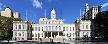
New York City Hall between Broadway, Park Row, and Chambers Street. Source: New York City Hall |
Plans for building a new City Hall were discussed by the New York City Council as early as 1776. The Council chose a site at the old Common at the northern limits of the city, now City Hall Park. City Hall was originally an area for the first almshouse in 1653. In 1736, there was a financed almshouse for those who were fit to work, for the unfit, and those that were like criminals but were paupers. Source: New York City Hall.
1873-1890 - "Newspaper Row"
Starting in the early 19th century and continuing through the 1920s, Park Row grew into the city's "Newspaper Row." By the late 19th century, technological advances in elevator technology and steel framework enabled the construction of taller office buildings, particularly in Lower Manhattan. Park Row was particularly favored because skyscrapers on the street could be readily seen from afar, which in turn was due to the lack of tall buildings in City Hall Park, west of Park Row. Source: Park Row Building.
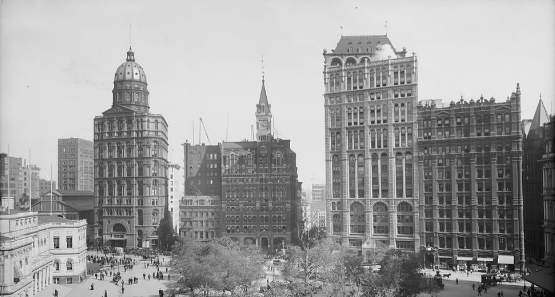
"Newspaper Row" - Park Row buildings in the early 20th century (from bottom left clockwise) are:
- New York City Hall. Opened in 1812.
- New York World Building, 53 63 Park Row (spherical top). Built in 1890 by Joseph Pulitzer. Tallest building in New York when built. Now part of a Brooklyn Bridge entrance ramp
- New Yorker Staats-Zeitung Building (five stories). Built in 1873. Designed by J. William Schickel. Now part of a Brooklyn Bridge entrance ramp
- New York Tribune Building (spire top). Nine stories built in 1875, and nine more added in 1905. Taken down in 1966. Present-day site of the Pace Plaza, part of Pace University
- The New York Times Building, 41 Park Row, Twelve stories built in 1889, and four stories added in 1905. Still standing and part of Pace University
- Potter Building, 38 Park Row. Built in 1886. Part of Newspaper Row, but not a newspaper building.
Source of photo: Library of Congress |
1899 - Park Row Building
The Park Row Building is at 15 Park Row, just south of New York City Hall. It was built in 1899 as an office building. It is now a luxury apartment building. It was the city's tallest building and the world's tallest office buildingm until the completion of the Singer Building in 1908. Source: Park Row Building.
1767 - Old Brick Church
The Old Brick Church was the predecessor church building for the congregation of Brick Presbyterian Church, which is now located on the Upper East Side of Manhattan. The Old Brick Church was located on Park Row. It was built 1767. The church is marked by an x at mile 0.5 on Colles map 1a. Source: Old Brick Church.
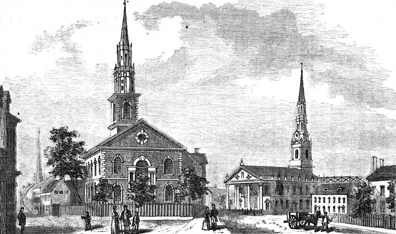
Old Brick Church (left) and St. Paul's Chapel (right) in 1840.. Source: Old Brick Church |
209 Broadway - 1766 - St. Paul's Chapel
St. Paul's Chapel is a chapel building of Trinity Church, an Episcopal parish. It was built in 1766 and is the oldest surviving church building in Manhattan. George Washington, along with members of the United States Congress, worshipped at St. Paul's Chapel on his Inauguration Day, April 30, 1789. Washington also attended services at St. Paul's during the two years New York City was the country's capital. Source: St. Paul's Chapel.
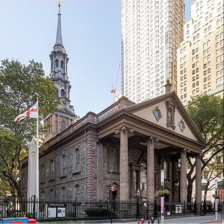
St. Paul's Chapel is a chapel building of Trinity Church, an episcopal parish, located at 209 Broadway in Lower Manhattan. Built in 1766, it is the oldest surviving church building in Manhattan. Source: St. Paul's Chapel |
|
From 1789 Colles map 1a, showing Federal Hall on Wall Street. Below Federal Hall is Broad Street. At the end of Wall Street is Broadway. The angular street is Park Row. St. Paul's Chapel is on Broadway near the start of Park Row (+), where George Washington prayed following his inauguration. The first Brick Presbyterian Church was on Park Row (x). Mile marker 1 is at Chatham Square at the start of the Bowery. (The Trinity Church now at Wall Street is not shown because it was not built until 1790.) |
|
Christopher Colles died in 1816 and was buried at St. Paul's Chapel and Churchyard, in New York City, in an unmarked grave. See: Find a Grave.
222 Broadway - Across from St. Paul's Chapel
1841-1865 - Barnum's American Museum. Barnum's American Museum was a dime museum located at the corner of Broadway, Park Row, and Ann Street in what is now the Financial District of Manhattan, from 1841 to 1865. The museum was owned by famous showman P. T. Barnum, who purchased Scudder's American Museum in 1841. The museum offered both strange and educational attractions and performances. Some were extremely reputable and historically or scientifically valuable, while others were less so. In 1865, the American Museum burned to the ground in one of the most spectacular fires New York has ever seen. Source: Barnum's American Museum. The site at Ann Street was then used for a new building for the New York Herald newspaper.
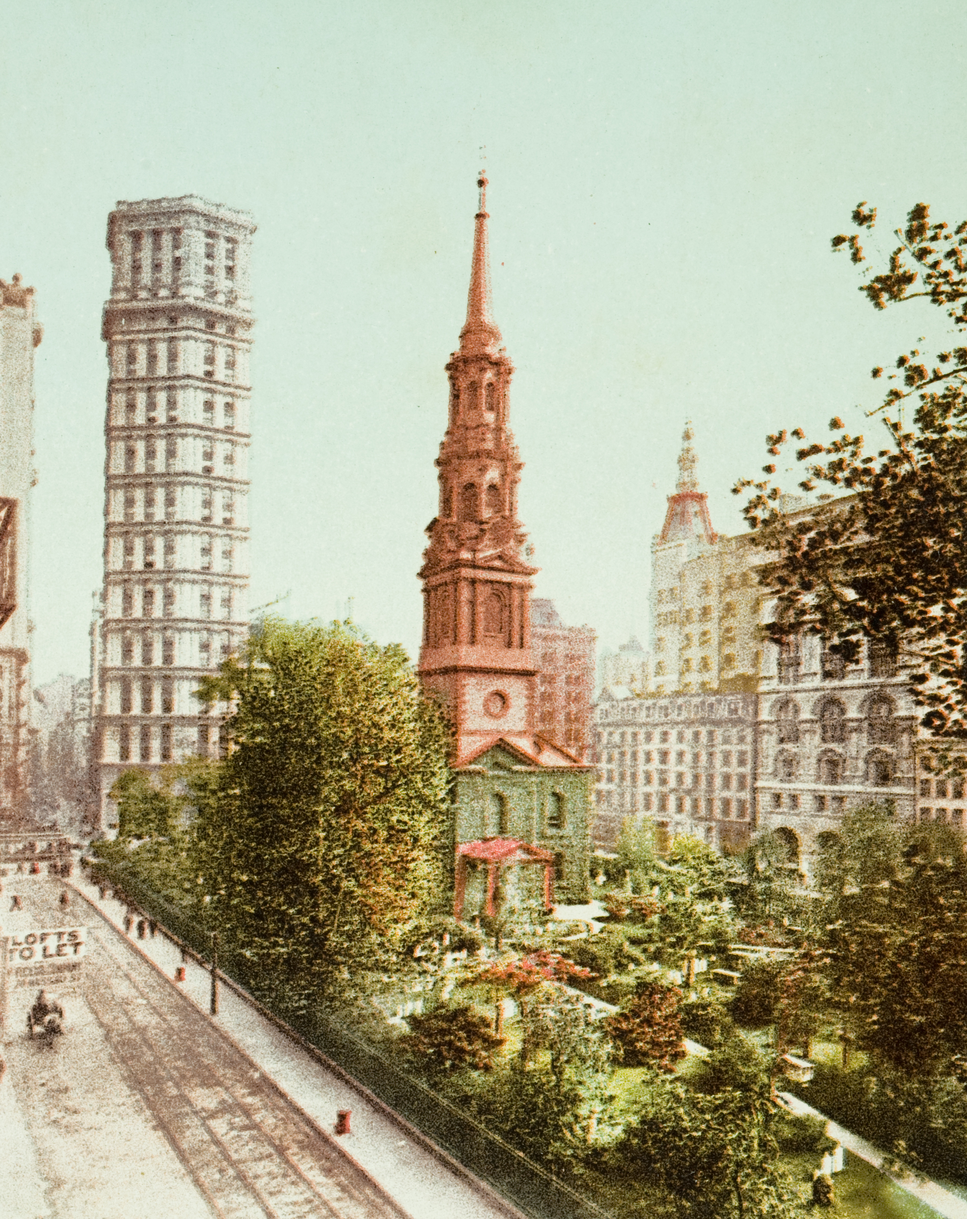
Postal card showing St. Paul's Chapel and the St. Paul Building in the background. Source: St. Paul Building |
1898 - St. Paul Building. The St. Paul Building was an early skyscraper at 220 Broadway, at the southeast corner with Ann Street, in the Financial District of Lower Manhattan in New York City. Completed in 1898, it was one of the tallest skyscrapers in New York City upon its completion, at 26 stories. The St. Paul Building was demolished in 1958 in order to make way for the Western Electric Building. Prior to the St. Paul Building's construction, the site was occupied by Barnum's American Museum, which burned down in 1865. Source: St. Paul Building.
1962-2026 - Office Building. A 31-story structure opened in 1962 at 222 Broadway (between Fulton and Ann Streets) as the corporate headquarters of Western Electric, the manufacturing subsidiary of AT&T, diagonally across the intersection of Broadway and Fulton Street from its parent company’s headquarters, at 195 Broadway. Western Electric sold the building in 1882. In the next 40 years, the building passed through the hands of a succession of financial institutions.
2026 - Apartment Building. Amid ongoing post-pandemic commercial real estate woes (spurred in part by the remote-work trend that has led corporate employers to rethink their need for large suites of workspace), the value of office properties declined precipitously. The building was reconfigured to create more than 800 apartments. This is part of a wave of office-to-residential conversions washing over Lower Manhattan. Source: The Broadsheet.
St. Paul's Chapel across from 222 Broadway |
195 Broadway - 1875 and 1916
The Western Union Telegraph Building was a building at 195 Broadway in the Financial District of Manhattan in New York City. The ten-story structure is considered one of the first skyscrapers in New York City. Western Union decided to construct the building in 1872 after outgrowing a previous space at 145 Broadway. At the time of its completion in 1875, it was one of the tallest structures in New York City, behind only Trinity Church, the New York Tribune Building, and the Brooklyn Bridge towers. The original design contained eleven stories, including the ground story. It had a three-story mansard roof and a clock tower whose pinnacle gave the building its 230-foot height. The top five stories were destroyed by fire in 1890, although the superstructure of the ground story and the lowest five floors remained intact. AT&T, which acquired the Western Union Telegraph Building, decided to redevelop the site with a 29-story building at 195 Broadway, which was completed in 1916. The old Western Union Building was demolished between 1912 and 1914, although Western Union continued to occupy the replacement structure until 1930. Source: Western Union Telegraph Building.
195 Broadway, also known as the Telephone Building, Telegraph Building, or Western Union Building, is an early skyscraper on Broadway in the Financial District of Manhattan in New York City. The building was the longtime headquarters of AT&T Corp. and Western Union. It was the site of one end of the first transcontinental telephone call and the first transatlantic telephone call. It occupies the entire western side of Broadway from Dey to Fulton Streets. The site of the building formerly was occupied by the Western Union Telegraph Building. Source: 195 Broadway.
1875 10-story Western Union Telegraph Building, at 195 Broadway |
|
1916 29-story Telephone Building, at 195 Broadway |
|
192 Broadway - 1889 - Corbin Building
The Corbin Building (also known as 13 John Street and 192 Broadway) is a historic office building at the northeast corner of John Street and Broadway in the Financial District of Manhattan. It was built in 1888–1889 as a speculative development. The building was named for Austin Corbin, a president of the Long Island Rail Road who also founded several banks. The Corbin Building has an exterior of brick, brownstone and terracotta, while its interior vaulted ceilings employ a Guastavino tile system. Structurally, it preceded the use of steel skeletons for skyscrapers, utilizing cast-iron beams and masonry walls that were load-bearing. The Corbin Building sits on a narrow trapezoidal lot with 160 feet of frontage on John Street and 20 feet on Broadway. It was significantly taller than others around at the time it was built. The Corbin Building's site was owned by the Collegiate Reformed Protestant Dutch Church through the 19th century. The site may have been part of a 1724 bequest to the church by landowner John Haberdinck. Source: Corbin Building.
165 Broadway - Singer Building - One Liberty Plaza
During the late 19th century, New York City trailed Chicago in the development of early skyscrapers; New York had just four buildings over 16 stories tall in 1893, compared to twelve such buildings in Chicago. Isaac M. Singer and Edward C. Clark had founded I. M. Singer & Company in 1851. The company, which manufactured sewing equipment, became the Singer Manufacturing Company in 1865. In 1890, the Singer Manufacturing Company acquired the lot at 151–153 Broadway and the lots at 149 Broadway and 83 Liberty Street, at the northwest corner of the two streets. The three lots at the time were occupied by four- to six-story buildings. The new Singer 10-story stone-and-brick building with banking rooms on the lowest two stories, rental office space on six of the center stories, and the Singer Company's offices on the upper stories was completed in early 1898. The building was expanded and a tower was added. In 1908, an observation balcony opened. and The Singer Building quickly became a symbol of Manhattan with its floodlit tower. it remained the tallest in the world for a year after its tower's completion. The record was surpassed by the 700-foot Metropolitan Life Insurance Company Tower, at 24th Street and Madison Avenue. The power source for the building's steam plant was converted from coal to oil in 1921, making the Singer Building the city's first office building to use oil as a fuel. Source: Singer Building.
The Singer Building (and the City Investing Building adjacent to it) were demolished from 1967 to 1968 to clear land for One Liberty Plaza, 165 Briadway. The building was designed by Skidmore, Owings & Merrill (founded in 1936 in Chicago). It was completed in 1973. It has 54 floors and is one of the largest office buildings in New York by usable interior space. Its facade is black, consisting of a structural steel frame. South of the building is Zuccotti Park, formerly called Liberty Plaza Park. Source: One Liberty Plaza.
150 Broadway - Westinghouse Building
150 Broadway, also known as the Westinghouse Building, is a 23 story mixed-use building erected in 1924. Source: 140 Broadway.
The King's Arms Tavern - Zuccotti Park
Zuccotti Park is just south of One Liberty Plaza, 165 Broadway. It is bounded by Broadway to the east, Liberty Street to the north, Trinity Place to the west, and Cedar Street to the south. The park was created in 1968 by Pittsburgh-based United States Steel.
The site was the location of the first coffeehouse in colonial New York City, The King's Arms which opened under the ownership of Lieutenant John Hutchins in 1696. It stood on the west side of Broadway between Crown (now Liberty) Street and Little Queen (now Cedar) Street. On November 5, 1773, summoned by the Sons of Liberty, a huge crowd assembled outside the coffee house to denounce the Tea Act, and agents of the East India Trading Company who were handling cargoes of dutied tea. It was perhaps the first public demonstration in opposition to the Tea Act in the American colonies. Source: Zuccotti Park and The Seaport Museum.
140 Broadway
140 Broadway (formerly known as the Marine Midland Building or the HSBC Bank Building) is a 51-story office building completed in 1967 on the east side of Broadway opposite Zuccotti Park. The building was designed by Skidmore, Owings & Merrill of Chicago. Source: 140 Broadway.
120 Broadway - 1870 and 1915
The Equitable Life Assurance Building, also known as the Equitable Life Building, was the headquarters of the Equitable Life Assurance Society of the United States, at 120 Broadway in Manhattan. It was the world's first office building to feature passenger elevators. It was originally built in 1870 with seven above-ground stories and two basement levels. An expansion in 1885 brought the total height to nine stories. Although it was advertised as fireproof, the Equitable Life Building was destroyed in a 1912 fire that killed six people. The 40-story Equitable Building was completed on the site in 1915. Source: Equitable Life Building and Equitable Building.
9-story Equitable Life Building, 120 Broadway. Circa 1906 |
|
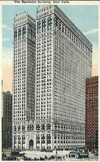
Postcard of 40-story Equitable Building, 120 Broadway |
|
100 Broadway - American Surety Building
The American Surety Building (also known as the Bank of Tokyo Building or 100 Broadway) is an office building and early skyscraper at Pine Street and Broadway in the Financial District of Manhattan, across from Trinity Church. The building has 26 stories. It was one of Manhattan's first buildings with steel framing and curtain wall construction. The building was erected between 1894 and 1896 as a 21-story structure, which was the second tallest building in New York City when completed. Between 1920 and 1922, an annex was built, increasing the floor area and adding two stories to the building. A later tenant, the Bank of Tokyo, restored the lower 13 stories between 1973 and 1975. Source: American Surety Building.
89 Broadway - Trinity Church
Trinity Church is a historic parish in the Episcopal Diocese of New York. The church is located at 89 Broadway opposite Wall Street, in the Financial District of Lower Manhattan. Known for its centuries of history, prominent location, distinguished architecture and bountiful endowment, Trinity's congregation is said to be "high church", its activities based on the traditions of the Episcopal Church and the worldwide Anglican Communion in missionary outreach, and fellowship. The current church building is the third to be constructed for the parish.
- First church: a single-story rectangular structure with tall steeple facing the Hudson River. It was constructed in 1698 and destroyed in the Great New York City Fire of 1776.
- Second church: built facing Wall Street and was consecrated in 1790. President George Washington worshiped there. Additional notable parishioners included John Jay and Alexander Hamilton.
- Third and current church: erected from 1839 to 1846 and was the tallest building in the United States until 1869, as well as the tallest in New York City until 1890.
The Trinity Churchyard, surrounding the church at Wall Street and Broadway, is where Alexander Hamilton and many other famous people are buried. Source: Trinity Church (Manhattan).
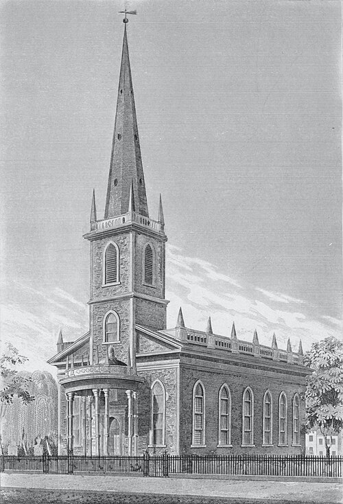
Second church, consecrated in 179 |
|
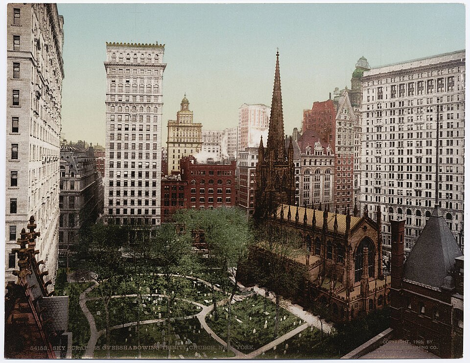
Third church in 1940, across from the 26-story American Surety Building at 100 Broadway. |
|
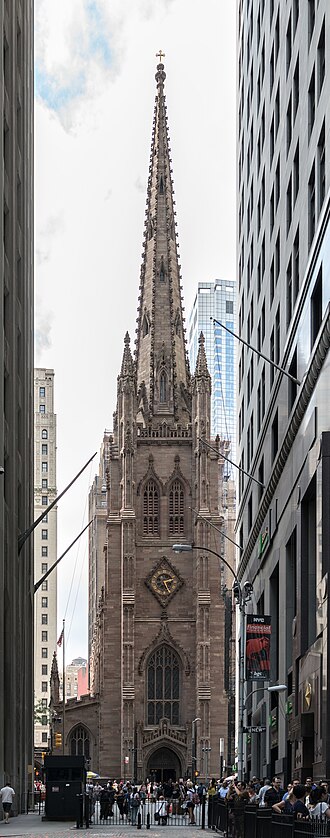
Third and current church, erected from 1839 to 1846 |
|
26 Wall Street - 1703 and 1850 - Federal Hall
New York's second City Hall was built in 1703 on Wall Street. It measured two stories high, with wings extending west and east. A third story was added in 1765. That October, delegates from nine of the Thirteen Colonies met as the Stamp Act Congress in response to the levying of the Stamp Act by the Parliament of Great Britain. Drawn together for the first time in organized opposition to British policy, the attendees drafted a message to King George III, the House of Lords, and the House of Commons, claiming entitlement to the same rights as the residents of Britain and protesting "taxation without representation." The Sons of Liberty took over the building from the British during the American Revolutionary War in 1775. City Hall served briefly as a meeting place for the Continental Congress in 1785.
To the right is an excerpt from the 1789 Colles map 1a, showing Federal Hall on Wall Street. Below Federal Hall is Broad Street. At the beginning of Wall Street is Broadway. The angular street is Park Row. St. Paul's Chapel is on Broadway near the start of Park Row (+), where George Washington prayed following his inauguration. The first Brick Presbyterian Church was on Park Row (x). Mile marker 1 is at Chatham Square at the start of the Bowery. (The Trinity Church now at Wall Street is not shown because it was not built until 1790.)
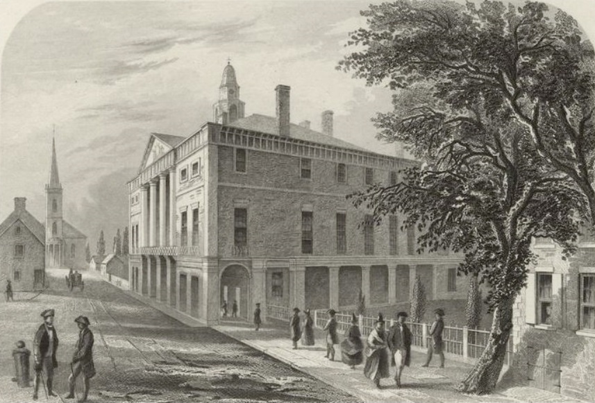
"Old City Hall, Wall St., N.Y." Steel engraving by Robert Hinshelwood, from Washington Irving's Life of George Washington, 5 vol. (1855-59). Source: Wall_Street |
| |
|
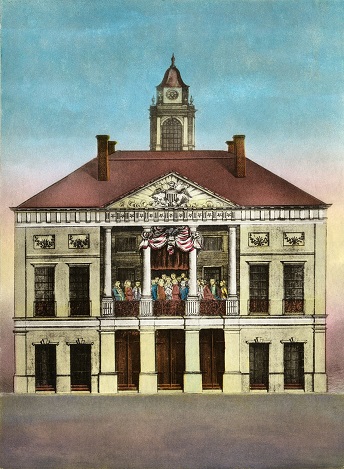
Federal Hall, Seat of Congress, 1790 hand-colored engraving by Amos Doolittle, depicting Washington's April 30, 1789 inauguration. Source: Federal Hall. |
|
In 1789, City Hall was renamed Federal Hall when New York was chosen as the nation's first seat of government under the Constitution.
The 1st Congress met there beginning on March 4, 1789.
The first-ever inauguration of a President of the United States occurred at Federal Hall whe George Washington was inaugurated on April 30, 1789. He took the oath of office on the balcony. His horse-drawn coach was led by militia and a marching band and followed by statesmen and foreign dignitaries in an inaugural parade, with a crowd of 10,000. Robert R. Livingston administered the oath, using a Bible provided by the Freemasons. Washington read a speech in the Senate Chamber, asking "that Almighty Being ... consecrate the liberties and happiness of the people of the United States"
In 1790, the U.S. government moved to Philadelphia, and Federal Hall reverted to City Hall. In 1812, it was replaced by the current Federal Hall building, which served as the U.S. Custom House for the Port of New York, then a U.S. Sub-Treasury in 1862, then the Federal Reserve Bank in 1920, then Federal Hall Memorial National Historic Site in 1939. Source: Federal Hall.
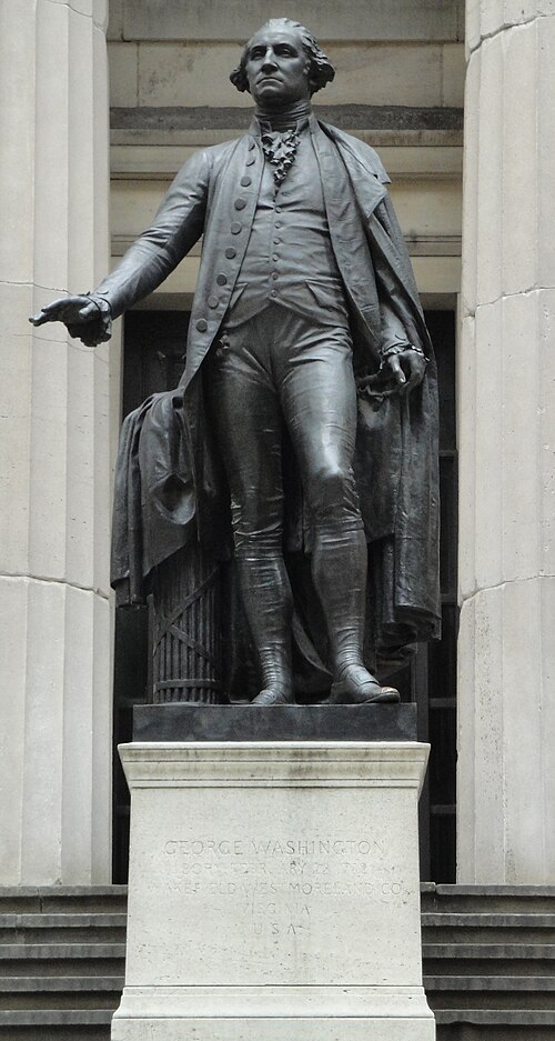
George Washington, 1882, by John Quincy Adams Ward, in front of Federal Hall |
|
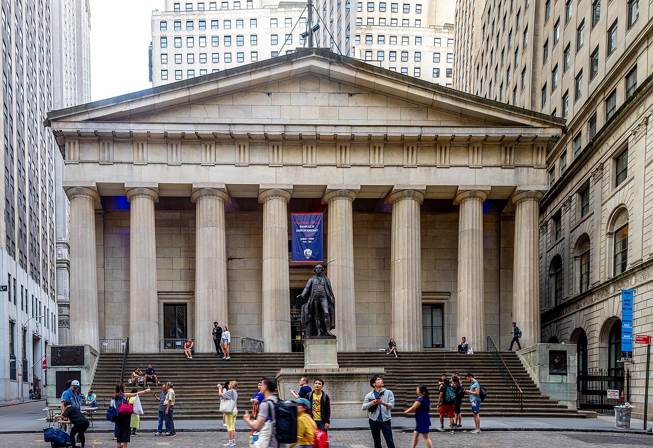
View of Federal Hall Memorial in 2019 |
|
18 Broad Street Street - New York Stock Exchange Building
The New York Stock Exchange Building is the headquarters of the New York Stock Exchange (NYSE), located in the Financial District of Lower Manhattan. It is composed of two connected structures occupying much of the city block bounded by Wall Street, Broad Street, New Street, and Exchange Place. The central section of the block contains the original structure at 18 Broad Street, designed in the Classical Revival style. The northern section contains a 23-story office annex at 11 Wall Street. Source: New York Stock Exchange.
1811 Map - Planned City
In 1811, a Commission designed a street plan for the area of Manhattan above Houston Street and below 155th Street. The Commission consisted of Gouverneur Morris, a Founding Father of the United States; the lawyer John Rutherfurd, a former United States Senator; and the state Surveyor General, Simeon De Witt. Their chief surveyor was John Randel Jr., who was 20 years old when he began the job. Source: Commissioners' Plan of 1811.
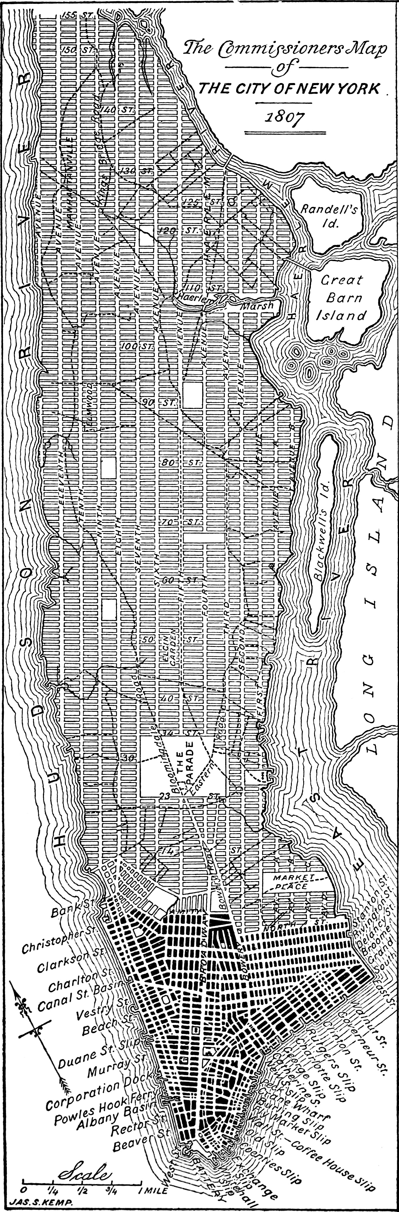
An 1893 redrawing of the 1807 version of the Commissioners' grid plan for Manhattan, a few years before it was adopted in 1811. Source: Commissioners' Plan of 1811. North Street is Houston Street. Rough approximations of the Colle mile markers have been added in red. |
1764 - Paulus Hook Ferry
In July 1764, a ferry began operating to Paulus Hook in Jersey City from Mesier's dock which was located at the foot of Courtland Street, where Courtland Street Ferry Depot was later built and where Battery Park City Ferry Terminal is located today. See: Paulus Hook. The ferry can be seen on the 1811 map above and the 1840 map below.
New Jersey
The 63-mile route of the Kings Highway in New Jersey, using Colles maps
40,
41,
42,
43,
44,
45b
is:
- Hudson County
- Essex County
- Union County
- Middlesex County
- Mercer County
- Delaware River - Trenton ferry - mile 63.6 on map 45b
Northern New Jersey
Towns in the northern route of the Kings Highway in New Jersey, in an excerpt from a 1778 map by William faden reprinted in 1937: Newark, Elizabethtown, Rahway, Woodbridge, Bonhamtown (Edison), Piscataway (Edison), (New) Brunswick. Source: New Jersey Map |
Southern New Jersey
Towns in the southern route of the Kings Highway in New Jersey, in an excerpt from a 1778 map by William faden reprinted in 1937: Piscataway (Edison), (New) Brunswick, Kingston, Princeton, Lawrence (Maidenhead), Trenton. Source: New Jersey Map |
Towns of Jersey City and Kearny
The route of the Kings Highway in Jersey City and Kearny, using Colles map
40 is:
- Hudson River - Paulus Hook Ferry - mile 1 on map 40a
- Jersey City
- Montgomery Street
- mile 3 on map 40a
- Bergen Avenue
- Communipauw Avenue
- Lincoln Highway
- Hackensack River - Ferry - mile 5 on map 40a
- Kearny (Kearny Point)
- Passaic River - Ferry - mile 6 on map 40b
1764 - Paulus Hook Ferry
In July 1764, a ferry began operating to Paulus Hook in Jersey City from Mesier's dock which was located at the foot of Courtland Street, where Courtland Street Ferry Depot was later built and where Battery Park City Ferry Terminal is located today. Paulus Hook is one mile across the river from Manhattan. See: Jersey City Ferry.
Excerpt from Colles map 40 showing the 5-mile route from Paulus Hook to the Hackensack River and the road north to Bergen Square (the oldest city in New Jersey) and south 6 miles to Bergen Point (on Kill van Kull) in Bayonne. |
Town of Newark
The route of the Kings Highway in Newark, using Colles map
40 and 41 is:
- Passaic River - Ferry - mile 6 on map 40b
- Lincoln Highway
- Raymond Boulevard
- Ferry Street - end of old Newark Plank Road
- Market Street
- mile 9 on map 40b
- Broad Street
- Lincoln Park
- Clinton Avenue
- Elizabeth Avenue
- Bound Creek - mile 11 on map 41a
- Elizabeth Avenue
- boundary with Hillside
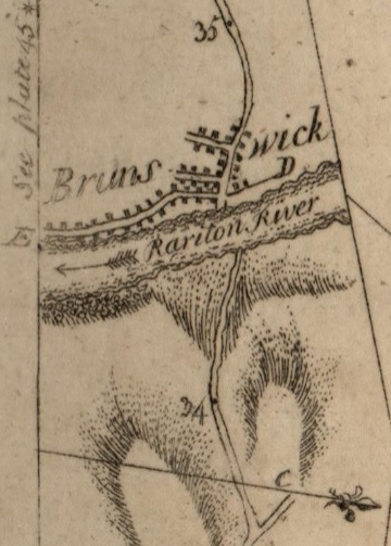
Excerpt from 1789 Colles Map 43a showing Brunswick and the Raritan River. Source: 1789 Colles Map . |
1765 - Newark Plank Road
The Newark Plank Road was a major artery between Hudson Waterfront at Paulus Hook (in today's Jersey City) and city of Newark further inland across the New Jersey Meadows. As its name suggests, a plank road was constructed of wooden planks laid side-to-side on a roadbed. The name is no longer used, the route having been absorbed into other streets and freeways. The Newark Plank Road
- begins at Paulus Hook on the Hudson River where a ferry brought travelers from New York
- follows Montgomery Street, Bergen Avenue, and Communipaw Avenue through Jersey City
- crosses the Hackensack River bridge
- follows the Lincoln Highway through Kearny Point
- crosses the Passaic River Bridge
- follows Ferry Street in the Ironbound section of Newark
Source: Newark Plank Road.
Towns of Hillside and Elizabeth
The route of the Kings Highway in Hillside and Elizabeth, using Colles map
41 is:
- Hillside
- North Broad Street (CR 623)
- "G" Hillside Avenue - mile 12.9 on map 41a
- Elizabeth
- North Broad Street (CR 623)
- Broad Street (CR 623)
- South Broad Street (CR 623)
- Elizabeth River - mile 15.3 on map 41b
- South Broad Street (CR 623)
- Pearl Street (CR 614)
- Rahway Avenue (NJ 27)
1776-90 - Governor Livingston
William Livingston (1723 1790) was an American politician and lawyer who served as the first governor of New Jersey (1776 1790) during the American Revolutionary War. As a New Jersey representative in the Continental Congress, he signed the Continental Association and the United States Constitution. He is considered one of the Founding Fathers of the United States and a Founding Father of New Jersey. In 1772, he moved to Elizabethtown in the colonial-era Province of New Jersey, where he rented a house in town. Livingston started construction of a large country home to house his growing family. The house, known as Liberty Hall, still stands Source: St. John's Episcopal Church.
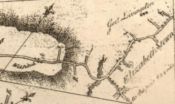
Excerpt from Colles map
41b showing
- Governor Livingston's residence, Liberty Hall, at mile 14.5
- St. John's Episcopal Church at mile 15.1
- Elizabeth River and mile 15.3
|
1706 - St. John's Episcopal Church
St. John's Episcopal Church (official name, St. John's Church) is a historic Episcopal church located at 61 Broad Street in the historic heart of Elizabeth, New Jersey. It was founded in 1706. The current building was completed in 1864. Source: St. John's Episcopal Church.
Towns of Linden and Rahway
The route of the Kings Highway in Linden and Rahway, using Colles map
41 is:
- Linden
- East Saint George Avenue (NJ 27)
- Morses Creek - mile 18.3 on map 41b
- West Saint George Avenue (NJ 27)
- Rahway
- Saint George's Avenue (NJ 27)
- Rahway River - mile 19.9 on map 41c
- Saint George's Avenue (NJ 27)
- Robison's Branch of Rahway River - mile 20.4 on map 41c
- Saint George's Avenue (NJ 27)
- Saint George's Avenue (NJ 35)
- Rahway River-South Branch - mile 21.6 on map 41c
Town of Woodbridge
The route of the Kings Highway in Woodbridge, using Colles maps
42 and
43 is:
- Rahway River-South Branch - mile 21.6 on map 41c
- Saint George's Avenue (NJ 35)
- Amboy Avenue (NJ 35)
- Heards Brook
- Amboy Avenue (NJ 35)
- corner of Amboy and Main is mile 24.6 on map 42a ("Woodbridge" and "3.5 miles from Perth Amboy")
- Main Street (CR 514) - becomes Woodbridge in Edison
1669 - Woodbridge Township
Woodbridge Township is the oldest original township in New Jersey and was granted a royal charter on June 1, 1669, by King Charles II of England. Pumpkin Patch Brook, which flows through Woodbridge, is a tributary of the Robinson's Branch of the Rahway River, which feeds the Robinson's Branch Reservoir. Source: Woodbridge Township.
Town of Edison
The route of the Kings Highway in Edison, using Colles maps
41 and 42 is:
- Woodbridge Avenue (CR 514)
- "F to Metuchin" at mile 27.2 on map 42a is Grandview Avenue to Metuchin
- "H to Metuchin" at mile 29.5 on map 42b is Main Street to Metuchin through Bonhamtown
- Old Post Road
- corner of Old Post Road and Woodbridge is mile 32.3 on map 43a "Piscatawaytown"
- Woodbridge Avenue (CR 514) - St. James Episcopal Church is at mile 32.5 on map 43a
1704 - St. James Episcopal Church - Piscatawaytown
Piscatawaytown is the oldest neighborhood in Edison. It was established in the 1660s as the original village in what was then within Piscataway. Piscatawaytown is centered around St. James Church at 2136 Woodbridge Avenue, the Piscatawaytown Burial Ground and the Piscatawaytown Common, near the intersection of Plainfield and Woodbridge Avenues. The Piscatawaytown Burial Ground is one of the oldest recorded cemeteries in Middlesex County and maintained by the township. Source: Piscatawaytown.
Towns of Highland Park and New Brunswick
The route of the Kings Highway in Highland Park and New Brunswick, using Colles map
43 is:
- Highland Park
- Woodbridge Avenue (CR 514)
- Raritan Avenue (NJ 27)
- Raritan River - mile 34.5 on map 43a
- New Brunswick
- Albany Street (NJ 27)
- French Street (NJ 27)
- Mill Run Brook - mile 35.7 on map 43a
- French Street (NJ 27)
- Somerset Street (NJ 27) (on border of New Brunswick and Franklin)
Kings Highway on NJ 27 and US 206
The King's Highway Historic District covers the portions of New Jersey Route 27 and U.S. Route 206 in New Jersey. This historic roadway dates to colonial times and was a portion of the King's Highway that was laid out by order of Charles II of England to connect Boston with Charleston. It is lined with many institutions and sites that have played an important role in the History of the United States, including Princeton University and the Princeton Theological Seminary. Along the road can be found five National Historic Landmarks: the Lawrenceville School, Morven, Maclean House, Nassau Hall, and the Joseph Henry House.
The historic NJ 27/US 206 highway starts on Raritan Avenue at 6th Avenue (mile 33.7 on map 43a) in Highland Park and proceeds 30.3 miles south to South Broad Street at Centre Avenue in Trenton (mile 64 on map 45b).
The highway runs through eight historic districts:
- Kingston Village Historic District
- Delaware and Raritan Canal Historic District
- Lake Carnegie Historic District
- Kingston Mill Historic District
- Jugtown Historic District
- Princeton Historic District
- Princeton Battlefield / Stony Brook Village Historic District
- Lawrence Township Historic District
The governor's mansion of New Jersey, Drumthwacket, independently listed on the National Register of Historic Places, is found on the road in the western part of Princeton. Source: New Jersey King's Highway Historic District.
1736 - New Brunswick
Centrally located between New York City and Philadelphia along an early thoroughfare known as the King's Highway and situated along the Raritan River, New Brunswick became an important hub for Colonial travelers and traders. New Brunswick was incorporated as a town in 1736 and chartered as a city in 1784.
The Declaration of Independence received one of its first public readings, by Colonel John Neilson in New Brunswick on July 9, 1776, in days following its promulgation by the Continental Congress. A bronze statue marking the event was dedicated on July 9, 2017, in Monument Square, in front of the Heldrich Hotel.
The Trustees of Queen's College (now Rutgers University), founded in 1766, voted by a margin of ten to seven in 1771 to locate the young college in New Brunswick, selecting the city over Hackensack. Classes began in 1771 with one instructor, one sophomore, Matthew Leydt, and several freshmen at a tavern called the 'Sign of the Red Lion' on the corner of Albany and Neilson Streets (now the grounds of the Johnson & Johnson corporate headquarters).
Towns of North Brunswick and South Brunswick
The route of the Kings Highway in North Brunswick and South Brunswick, using Colles maps
44 is:
- North Brunswick
- Lincoln Highway (NJ 27) (on border of North Brunswick and Franklin) - Six Mile Run is in the village of Sixmile Run at mile 39.5 on map 43b
- South Brunswick
- Lincoln Highway (NJ 27) (on border of South Brunswick and Franklin) - Six Mile Run Reformed Church is in the village of Franklin Park at mile 41.2 on map 43c
- Old Road
- Lincoln Highway (NJ 27) (on border of South Brunswick and Franklin)
- Kingston Village (unincorporated part of South Brunswick)
- Main Street (NJ 27) (on border of South Brunswick and Franklin)
- Old Lincoln Highway
1745 - Six Mile Run Reformed Church
The Six Mile Run Reformed Church is located at 3037 Lincoln Highway (New Jersey Route 27) in Franklin Park (formerly known as Six Mile Run). It is in Franklin Township, Somerset County, on the border with South Brunswick, Middlesex County. The current building was built in 1879. The first building on the present site was built in 1745. The first building was replaced by a new building in 1766 and was later replaced in 1817 by a third structure on the same site. The current building replaced the 1817 church that was destroyed by fire on January 7, 1879. Source: Six Mile Run Reformed Church.
Six Mile Run is the historic name for an unincorporated community located within portions of North Brunswick Township and South Brunswick Township in Middlesex County and Franklin Township in Somerset County. Route 27 (historically known as Old Road/King's Highway bisects the village and serves as the dividing line between the two counties. The name of the settlement was formally changed from Six Mile Run to Franklin Park in 1872. Source: Six Mile Run.
1798 - Kingston Bridge
In 1683, Henry Greenland built the first tavern here for travelers between New York City and Philadelphia. The current Kingston Mill, also known as the Kingston Gristmill, was built in 1888, the third one at this site. In 1755, Jacob Skilman built a gristmill and sawmill here on the Millstone River. The mill was burned in 1776 by the British Army during the American Revolutionary War. The district also includes the Greenland Brinson Gulick farm, four nearby houses, and the Kingston Bridge, an 18th-century stone arch bridge over the river. It was one of the first settlements in Princeton, preceded only by the Quaker community along the Stony Brook. See: Kingston Mill Historic District and New Jersey Route 27.
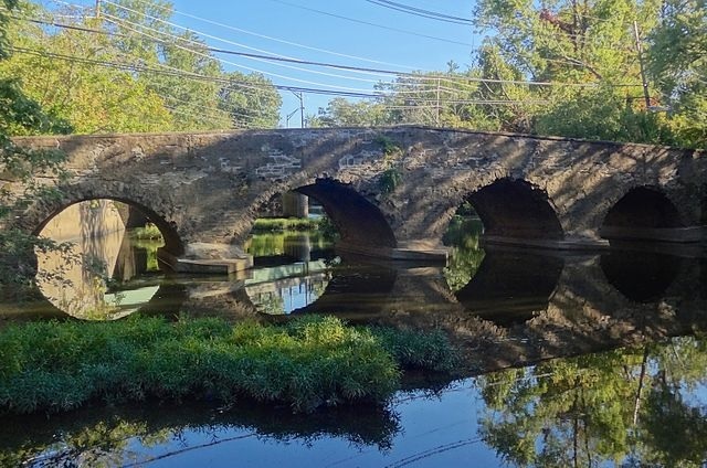
2014 photo of the 1798 Kingston Bridge on the Millstone River. |
|
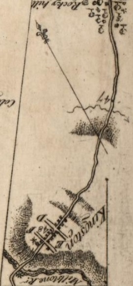
Excerpt from 1789 Colles Map 44a. The main street is now NJ 27, except near the bridge it is Old Lincoln Highway. 48 and 47 are miles to Federal Hall in New York. Rocky Hill is now Little Rocky Hill. |
|
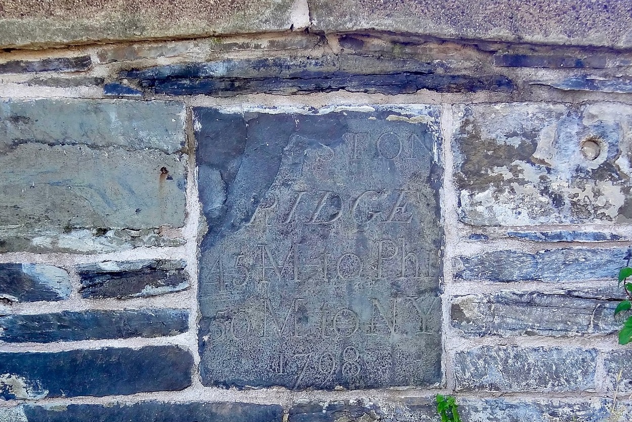
1798 mile marker imbedded in Kingston Bed in Kingston Bridge showing 45 miles to Philadelphia and 50 miles to New Yor City. See: Kingston Mill Historic District |
Town of Princeton
The route of the Kings Highway in Princeton, using Colles map
44 is:
- Old Lincoln Highway
- Millstone River - Old Kings Highway Bridge - mile 48.2 on map 44a
- Old Lincoln Highway
- Princeton-Kingston Road (NJ 27)
- Nassau Street (NJ 27)
- Jugtown at mile 50.4 on map 44b
- Princeton University at mile 51.2 on map 44b
- Stockton Street (US 206)
- Lawrenceville Road (US 206)
- Stony Brook - bridge - mile 53 on map 44c
- Lawrenceville Road (US 206)
1750 - Nassau Street, Jugtown
|
|
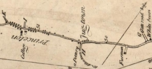
Excerpt from 1789 Colles Map 44b. The main street is Nassau Street (US 27). The college building is Nassau Hall at mile 51.2. Jugtown and a Pottery are at mile 50.4. 51 and 50 are miles to Federal Hall in New York. Source: 1789 Colles Maps. |
|
1756 - Old Nassau in Princeton
Nassau Hall, colloquially known as Old Nassau, is the oldest building at Princeton University in Princeton, New Jersey. It is located on Nassau Street (US 27). It is included on the 1789 Colles Map 44b. In 1783 it served as the United States Capitol building for four months. At the time it was built in 1756, Nassau Hall was the largest building in colonial New Jersey and the largest academic building in the American colonies. When the building was constructed in 1754, the college's board wanted to name it after Jonathan Belcher, the royal governor of New Jersey, but he declined, preferring it to be dedicated "to the immortal memory of the glorious King William III," who hailed from the Dutch House of Orange-Nassau. As a result, the building is known as Nassau Hall. From June 30 to November 4, 1783, Princeton was the provisional capital of the United States, and Nassau Hall served as its seat of government. Source: Nassau Hall and New Jersey Route 27.
1756 - John Maclean House
The President's House, also known as the John Maclean House, or simply the Maclean House, in Princeton, was built to serve as the home of the President of the College of New Jersey, which later became Princeton University. It was completed in 1756, the same year as Nassau Hall. United States Founding Father John Witherspoon lived here from 1768 through 1779, during which time he served as a delegate to the Continental Congress and signed the Declaration of Independence. George Washington occupied Maclean House in January 1777, during the Battle of Princeton and in 1783 while Congress met in Nassau Hall. It now serves as the home of the Alumni Association of Princeton University and houses 35 staff, hosts many alumni functions and showcases Princeton memorabilia and a library of Princetoniana. Source: President's House.
John Maclean House, at the corner of Elm Drive and Nassau Steet, next to Old Nassau. Source: President's House |
1750s - Morven House
Morven, known officially as Morven Museum & Garden, is a historic 18th-century house in Princeton, New Jersey. It served as the governor's mansion for nearly four decades in the 20th century, and has been designated a National Historic Landmark for its association with Richard Stockton (1730-1781), a signer of the United States Declaration of Independence. Source: Morven (Princeton, New Jersey).
Town of Lawrence (Maidenhead)
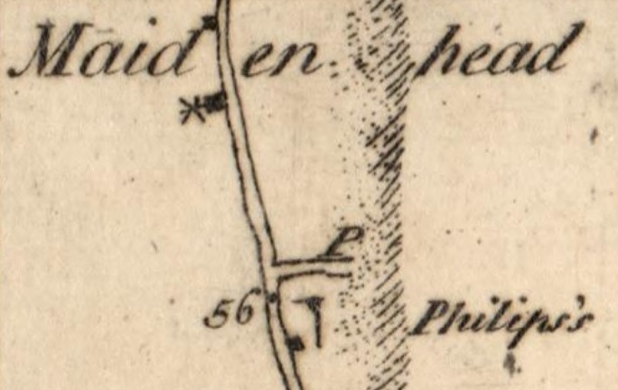
Excerpt from 1789 Colles Map 44c showing the Presbyterian Church and Philips's Tavern on what is now Main Street (US 206). 56 is miles to Federal Hall in New York. Source: 1789 Colles Maps. |
The route of the Kings Highway in Lawrence, using Colles map
44 and
45
is:
- Lawrenceville Road (US 206)
- Shipetaukin Creek - mile 55 on map 44c
- Lawrenceville Road (US 206)
- Main Street (US 206)
- Philips Tavern - mile 56 on map 44c
- Maidenhead Meetinghouse - mile 56.2 on map 44c
- Lawrence Road (US 206)
1753 - Philips Tavern
The Phillips Tavern was erected circe 1753. Later, Theophilus Phillips II erected side wings. See: Lawrence Township Historic District.
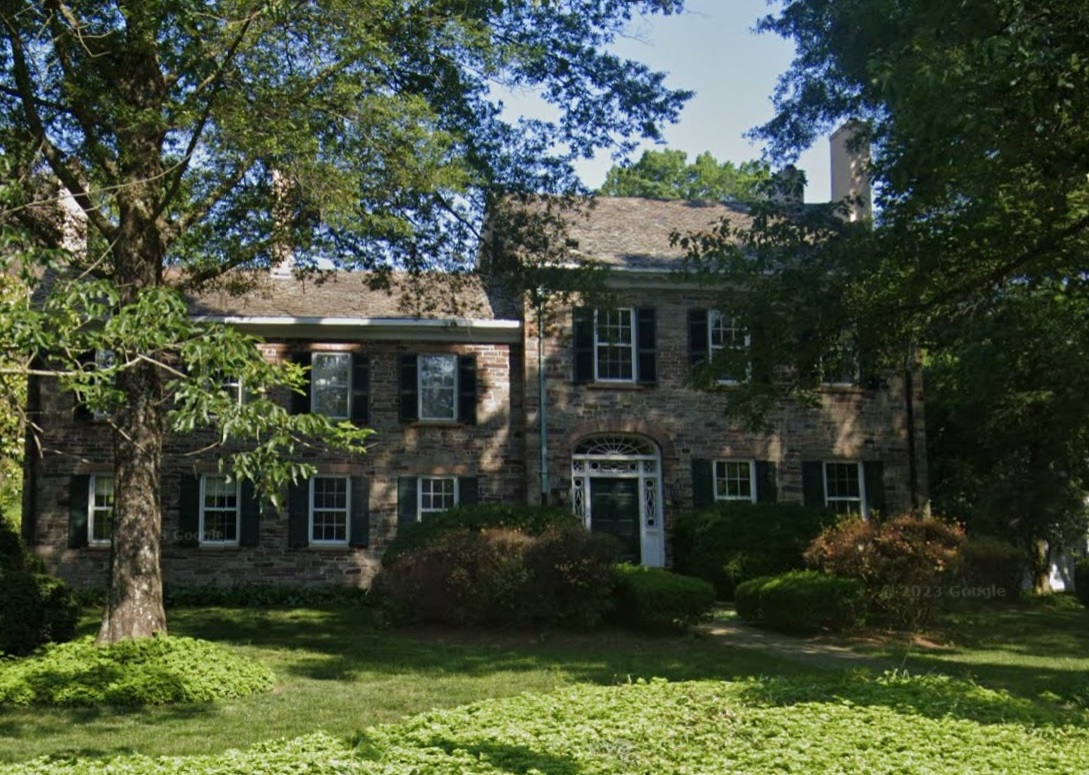
Theophilus Phillips House, originally Philips Tavern, 2837 Main Street, Lawrenceville. Source: Google maps, January 2024 |
1698 - Maidenhead Meetinghouse
The Presbyterian Church of Lawrenceville (formerly Maidenhead) was founded by settlers who came down the old Indian trails from Long Island and Connecticut in the late 17th century. In 1698, those who came to Maidenhead were granted land near the corner of Route 206 and Carter Road for a cemetery, school house and church. The land was never used for these purposes, probably because the grantors expected that an Anglican church would be established, while the settlers preferred a Presbyterian one. A meetinghouse was erected on the site of the present building sometime in the early 1700 s. A record from 1709 indicates that it was used both for a meeting of the Presbytery of Philadelphia and for a session of the Hunterdon County Court. John Hart, signer of the Declaration of Independence, was baptized here on December 31, 1713. The present structure was built in 1764. See: Presbyterian Church of Lawrenceville.
Town of Trenton
The route of the Kings Highway in Trenton, using Colles map
45 is:
- Brunswick Avenue (US 206)
- "F" to Pennington - mile 62.2 on map 45b
- North Broad Street (US 206)
- South Broad Street
- Assunpink Creek - mile 62.8 on map 45b
- South Broad Street (US 206)
- Centre Street
- Ferry Street
- Delaware River - Trenton ferry - mile 63.6 on map 45b
1765 - Eagle Tavern
|
The Old Eagle Tavern (historically known as the Eagle Tavern) is a historic building located at 431, 433 South Broad Street at the corner of Ferry Street in Trenton, New Jersey. The building was built in 1765 by Robert Waln. The building operated as a tavern and hotel from 1765 to 1896. Source: Old Eagle Tavern.
The Old Eagle Tavern, 431, 433 South Broad Street at the corner of Ferry Street in Trenton, New Jersey. The building operated as a tavern and hotel from 1765 to 1896. Source: Old Eagle Tavern |
1776 - Battle of Trenton
George Washington's crossing of the Delaware River, on the night of December 25 26, 1776 during the American Revolutionary War, occurred about ten miles north of the Trenton Ferry and the Kings Highway. Source: George Washington's Crossing of the Delaware River.
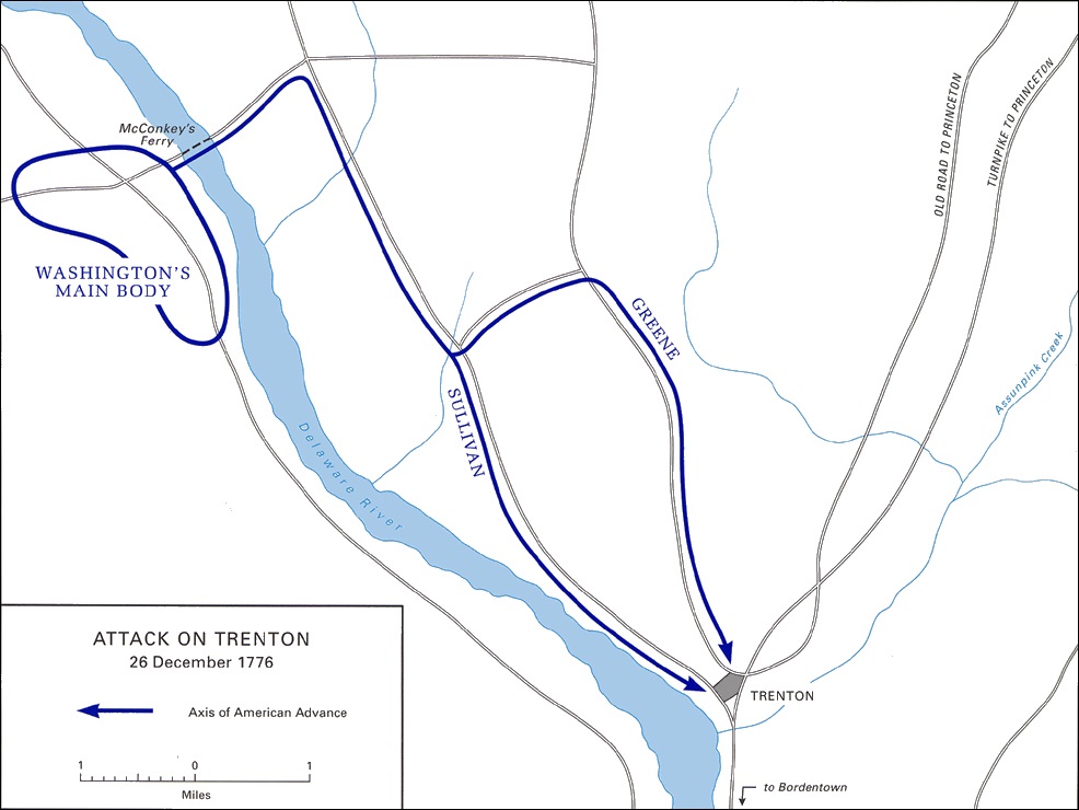
Map showing Washington's movements on the night of December 25 26, 1776, prior to his successful surprise attack in the Battle of Trenton. Source: Battle of Trenton |
|
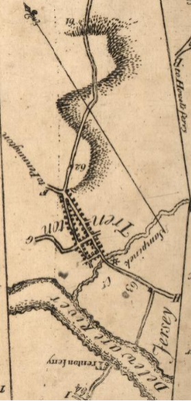
Excerpt from 1789 Colles Map 45b turned upside down so north is close to up. Trenton Ferry is at bottom . Source: 1789 Colles 45b. |
|
Alternate Kings Highway in New Jersey
There is an alternate Kings Highway shown in the 1789 Colles atlas. It goes from Brunswick, New Jersey, to Philadelphia, Pennsylvania. It crosses from Camden, New Jersey, to Philadelphia via Coopers Ferry. The route is eleven mile longer than than the Trenton route described above. It goes through Cranberry (now Cranbury), Crosswicks, Mount Holly, and Moorestown. There is a ten-mile stretch called Kings Highway today from Maple Shade to Bellmawr, New Jersey. The Colles maps are:
45*,
46*,
47*,
48,
49, and
50.
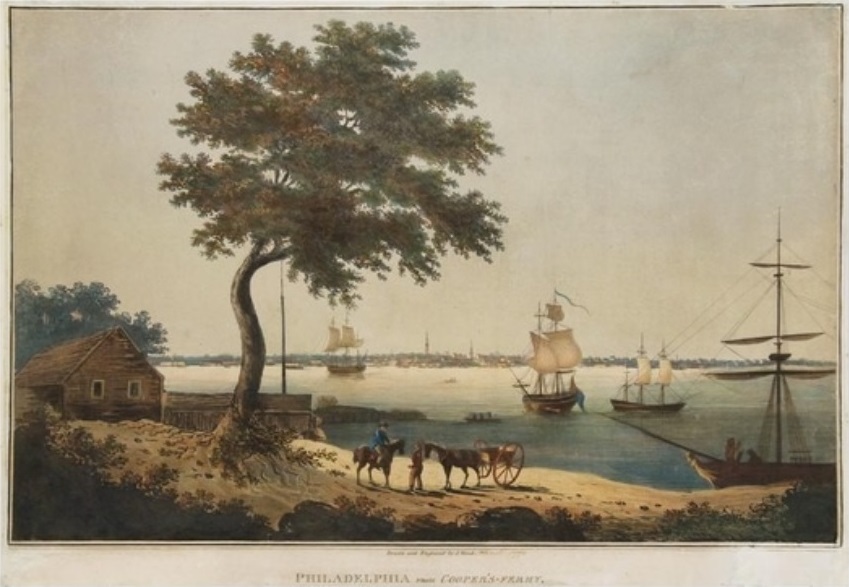
Painting by Joseph Wood (American, 1778 1830). Title: Philadelphia from Cooper's Ferry, ca. 1800 1804. Medium: color aquatint.
Size: 14.8 x 20.5 inches. Source: artnet. |
Pennsylvania
The route for the Kings Highway in Pennsylvania from Morrisville to Marcus Hook, using Colles maps
45b,
46,
47,
51, and
52
is:
1697 - US 13 between Morrisville and Marcus Hook
US 13 between Marcus Hook and Morrisville via Philadelphia was originally part of the Kings Highway, a colonial road named in honor of King Charles II of England. The King's Highway bridge over the Pennypack Creek in what is now Northeast Philadelphia was built in 1697 and is the oldest bridge in continuous use in the United States. During the reign of Anne, Queen of Great Britain, it was called the Queen's Highway. Published in 1940, the Pennsylvania Guide noted that, between Glenolden and Darby, "US-13 now occasionally coincides with the Queen's Highway, an important Colonial road. Impassibility was the rule rather than the exception on this link between the North and South, as it was on all early roads. As late as 1834, the mail coach had to be dragged through the mud by oxen."
The US 13 routing dates back to colonial times as part of the King's Highway. In the 19th century, the road was part of several turnpikes, including the Darby and Ridley Turnpike (or Chester Pike) between Chester and Darby and the Frankford and Bristol Turnpike between Philadelphia and Morrisville. In the early 20th century, these private turnpikes became public roads. US 13 was designated through Pennsylvania in 1926, running between the Delaware border in Marcus Hook and US 1 in Morrisville.
Source: US 13 in Pennsylvania.
Bucks County
The route for the Kings Highway in Bucks County, Peg Colles maps
45b and
46
is:
- Delaware River - Trenton ferry - mile 63.6 on map 45b
- Bucks County
- Morrisville Borough
- East Philadelphia Avenue
- West Philadelphia Avenue
- Falls Township
- Bristol Road
- Old Bristol Pike
- Tullytown Borough
- Old Bristol Pike
- Fallsington Avenue
- Main Street
- Martins Creek - mile 68.5 on map 45c
- Main Street
- Bristol Township
- North Radcliffe Street
- Radcliffe Street
- Bristol Borough
- Radcliffe Street
- mile 73 on map 46a
- Mill Street
- Old US Highway 13
- Mill Creek - mile 73.7 on map 46b
- Bristol Township
- Old US Highway 13
mile 74 on map 46b
- Bristol Pike
- Bensalem Township
- Bristol Pike (US 13)
- Neshaminy Creek - mile 76 on map 46b
- Bristol Pike (US 13)
- Poquessing Creek - mile 80 on map 46c
1681 - King George II Inn in Bristol
The King George II Inn, located in Bristol, Pennsylvania, is believed to be the oldest continuously operated inn in the United States. It was first established in 1681 as the Ferry House by Samuel Clift. The inn was a main stopping point on the road from New York to Philadelphia. The inn overlooks the Delaware River and is located at the corner of Radcliffe and Mill Streets in the Bristol Historic District. As George Washington's army approached Bucks County in 1781, the image of George II was replaced with a likeness of General Washington. Source: King George II Inn.
King George II Inn at the corner of Radcliffe and Mill Streets in Bristol. Source: King George II Inn |
|
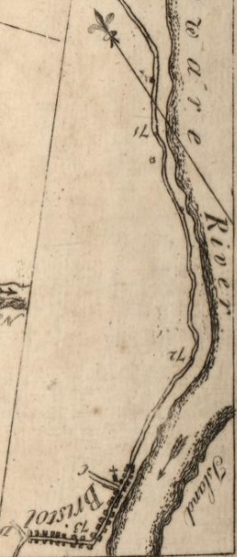
Excerpt from 1789 Colles Map 46a turned upside down so north is close to up. The corner of Radcliffe and Mill Streets in Bristol is at bottom at mile 73. Source: 46 |
|
Philadelphia
The route for the Kings Highway in Philadelphia, using Colles maps
46,
47, and
51
is:
- Poquessing Creek - mile 80 on map 46c
- Philadelphia
- Northeast and Kensington
- Frankford Avenue (US 13)
- Pennypack Creek - mile 82.8 on map 47a
- Frankford Avenue (US 13)
- Frankford/Tacony Creek and grist mill- mile 87.5 on map 47b
- Frankford Avenue (US 13)
- Frankford Avenue
- Lower North
- Girard Avenue
- Cohocksink Creek (now a sewer) - mile 91.5 on map 47c
- Girard Avenue
- North Front Street
- Cohoquinoque Creek (now a sewer) - mile 92 on map 47c
- City Center
- North Front Street
- mile 92.7 on map 47c
- Market Street
- Schuylkill River - mile 2 on map 51a
- West
- Market Street
- Woodland Walk
- Southwest (Kingsessing)
- Woodland Avenue
- Mill Creek
- Woodland Avenue
- Cobbs Creek - mile 6.8 on map 51b
1697 - Frankford Avenue/Pennypack Creek Bridge
The Frankford Avenue Bridge, also known as the Pennypack Creek Bridge, the Pennypack Bridge, the Holmesburg Bridge, and the King's Highway Bridge, was erected in 1697 in the Holmesburg section of Northeast Philadelphia. It is the oldest surviving roadway bridge in the United States. The three-span, 73-foot-long twin stone arch bridge carries Frankford Avenue (U.S. 13), just north of Solly Avenue, over Pennypack Creek in Pennypack Park. The bridge, built at the request of William Penn to connect his mansion with the new city of Philadelphia, was an important link on the King's Highway that linked Philadelphia with cities to the north (Trenton, New York, and Boston). In 1803, the bridge was paved with macadam, and at its south end a toll booth was erected, remaining in operation until 1892 when the turnpike was purchased by the city of Philadelphia. The bridge was widened in 1893 to accommodate streetcars, which commenced service in 1895.
On March 10, 1683, the Pennsylvania General Assembly passed a law requiring the building of bridges across all of the rivers and creeks along all of the King's Highway in Pennsylvania, from the Falls of the Delaware (at Trenton, N.J.) to the southernmost ports of Sussex County (now part of the state of Delaware). The bridges, which were to be completed within 18 months, were to be ten feet wide and include railings along each side. See: Frankford Avenue Bridge.
Front Street - Philadelphia
Front Street in Philadelphia is a north south street running parallel to and near the Delaware River. In 1682, when the city was laid out by William Penn, it was the first street surveyed and built in during the colonial era Province of Pennsylvania. As part of the King's Highway, which extended from Boston to Charleston, South Carolina, and as the waterfront of Philadelphia's port, it was the most important street in the city from its founding into the 19th century. Source: Front Street (Philadelphia).
Market Street - Philadelphia
Excerpt from 1789 Colles Map 47 showing Market Street westbound from the Delaware River. Market Street is 5 miles south of Pennypack Creek. 91 and 92 are miles from Federal Hall in New York. Cohocksink Creek (now a sewer) is at mile 91.5. Cohoquinoque Creek (now a sewer) is at mile 92 |
Market Street, originally known as High Street, is a major east west highway and street in Philadelphia. Long before the city was laid out or settled, Philadelphia's founder, William Penn, had planned that markets would be held regularly on the 100-foot wide High Street. The city's first market stalls were situated in the center of the thoroughfare starting at Front Street and proceeding west eventually to 8th Street. The stalls soon became covered and were not taken down as planned. Later, additional covered sheds appeared west of Center Square as the city expanded westward. The street began to be called Market Street around 1800.
Market Street has been called the most historic highway in the United States because of the various historic sites along its eastern section.
- 2nd Street: the historic Christ Church, once the tallest building in North America
- 4th Street: Benjamin Franklin's house
- 5th and 6th Streets (Independence Mall)
- Liberty Bell
- Independence Hall
- President's House, the mansion of Robert Morris, used by George Washington and John Adams as their residence during their terms as president. In 1951, confusion over the exact location of the Philadelphia President's House led to its surviving walls being unknowingly demolished.
- 7th Street: Graff or Declaration House. Thomas Jefferson resided here while drafting the Declaration of Independence, working in rooms rented from bricklayer Jacob Graff. Demolished in 1883, the house was reconstructed by the National Park Service in 1975.
Source: Market Street (Philadelphia).
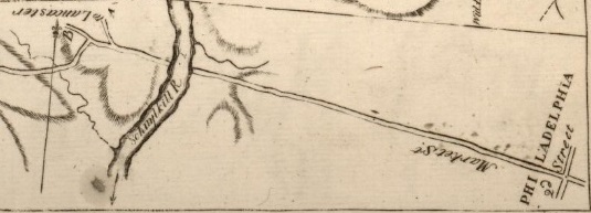
Excerpt from 1789 Colles Map 51 showing Market Street westbound toward the Schuylkill River |
1673 - Market Street Ferry - Schuylkill River
A ferry was established at Market Street across the Schuylkill River by 1673. It came to be called the "Middle Ferry," because a ferry operated upstream (Upper Ferry) and another downstream (Lower Ferry). Source: Market Street Bridge (Philadelphia).
1877 - Market Street Pontoon Bridge - Schuylkill River
Early in the Revolutionary War, American General Israel Putnam built a pontoon bridge at the Middle Ferry site, made of floating logs bound together by rope. This was intentionally destroyed to prevent its falling into the hands of the British. The British Army built its own pontoon bridge at the site during the 1777-78 Occupation of Philadelphia. It washed away in 1780. Its replacement washed away in 1784. That was succeeded by a plank-floor bridge also built on floating logs. Source: Market Street Bridge (Philadelphia).
1805 - Market Street Bridge - Schuylkill River
In the 1780s, Thomas Paine, the famed author of the revolutionary tract Common Sense and leading figure in the American Revolution, rendered plans for the construction of an iron bridge across the Schuylkill River. However, the project lay idle and in 1798 a design by Timothy Palmer for a wooden bridge was selected over Thomas Paine's model. On October 18, 1800, construction began on Palmer's Permanent Bridge at Market Street. The Permanent Bridge opened to the public in 1805. The covered bridge spanned the 550-foot length of the river with a series of arches and was 1300 feet long in total construction.37 In 1850 it was destroyed by fire and reconstructed and widened to incorporate tracks of the Pennsylvania Railroad. Fire destroyed this bridge in 1875. A new Market Street Bridge constructed with iron spans and stone in 1887. See: West Philadelphia: The History and Market Street Bridge (Philadelphia)..
1755 - University of Pennsylvania
The University of Pennsylvania is a private Ivy League research university in Philadelphia, Pennsylvania. One of nine colonial colleges, it was chartered in 1755 through the efforts of founder and first president Benjamin Franklin, who had advocated for an educational institution that trained leaders in academia, commerce, and public service. Source: History of the University of Pennsylvania.
First Campus: Center City. It's first building was in Center City, Philadelphia, on the west side of Fourth Street, south of Arch Street, a block north of Market Street.
Second Campus: Center City. On July 15, 1800, the University of Pennsylvania bought the President's House property: the mansion, and twelve lots (no president ever occupied the Ninth Street house). It was located on Ninth Street between Market and Chestnut Streets in Center City, Philadelphia. Classes started at this new campus in the spring of 1802. The mansion was demolished in 1829 to make room for two new university buildings. Source: President's House (Ninth Street).

College Hall, University City, 3450 Woodland Walk,
Philadelphia, the oldest building on the campus of the University of Pennsylvania, built in 1873, photo circa 1873. Source: College Hall (University of Pennsylvania) |
Third Campus: West Philadelphia. The University of Pennsylvania's campus today spans approximately 299 acres in West Philadelphia, featuring a blend of historic and modern architecture. College Hall, built in 1873, is the oldest building on the West Philadelphia campus of the University of Pennsylvania in University City, 3450 Woodland Walk,
Philadelphia. Source: College Hall (University of Pennsylvania).
1735 - Hamilton Estate
The land that would become The Woodlands Cemetery at 4000 Woodland Avenue, Philadelphia, was originally a 250-acre tract on the west bank of the Schuylkill River. It was purchased in 1735 by the famous Philadelphia lawyer Andrew Hamilton. When Hamilton died in 1741, he willed his lands to his son, also named Andrew. The son survived his father by only six years, but in that time built up his landholdings enough to leave a 300-acre estate to his own son, William Hamilton (1745 1813), who acquired it at the age of twenty-one. William built a Georgian-style mansion with a grand, two-storied portico overlooking the river above Gray's Ferry. Source: The Woodlands (Philadelphia).
1764 - Volges Street House in West Philadelphia
Volges Street House is at 1814 South Volges Street in West Philadelphia. It fronted on Woodland Avenue long before the buildings at Woodland 5516-22 were built. An influential figure in Philadelphia's development in that era, Colonel James Coultas, was likely the cottage's first owner. Source: Darby History and Hidden Philadelphia.
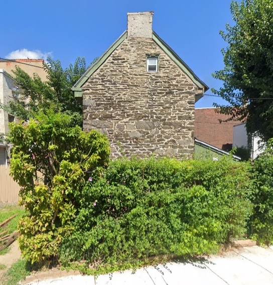
Volges Street House is at 1814 South Volges Street in West Philadelphia. It fronted on Woodland Avenue long before the buildings at 5516-22. Source: Google maps, January 2024 |
1762 - St James Kingsessing
St. James Kingsessing, commonly called "Old Swedes," is an historic American church located at South 68th Street and Woodland Avenue in the Kingsessing neighborhood of Philadelphia. It is one of the churches created by settlers and descendants of the Delaware Valley colony of New Sweden, a colony planted by the Swedish South Company that existed from 1638 and 1655, when it was conquered by the Dutch. Source: Darby History, St James Kingsessing, and St James Church of Kingsessing.
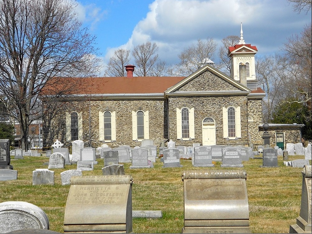
St James Kingsessing Episcopal Church, 6838 Woodland Avenue, Philadelphia. Source: St James Kingsessing |
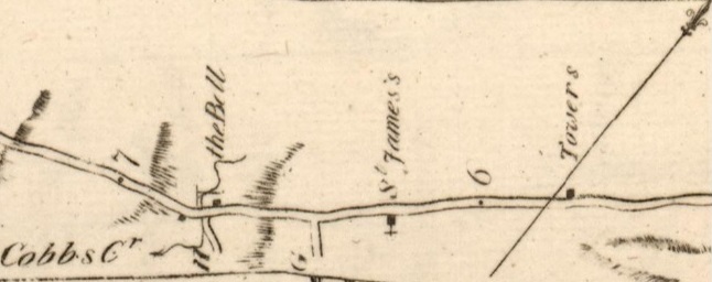
Excerpt from 1789 Colles map 51b showing St. James Church, Bell Tavern, and Cobbs Creek, between miles 6 and 7. "G" is now South 70th Street. "H" is now Island Avenue. Source: Colles map 51 |
Delaware County
The route for the Kings Highway in Delaware County, Pennsylvania, using Colles maps
51 and
52
is:
- Cobbs Creek - mile 6.8 on map 51b
- Delaware County
- Colwyn, Darby, Glenolden, Norwood, Prospect Park, Eddystone
- Main Street
- Chester Pike
- Darby Creek - mile 7.8 on map 51b
- Chester Pike
- Chester Pike (US 13)
- Little Crum Creek - mile 12.6 on map 52a
- Chester Pike (US 13)
- Crum Creek - mile 13.3 on map 52a
- Chester Pike (US 13)
- Ridley Creek - mile 13.8 on map 52a
- Chester
- Morton Avenue (US 13)
- East 5th Street
- Chester Creek - mile 15.1 on map 52a
- West 5th Street
- Lloyd Street
- West 4th Street
- Trainer
- Post Road
- Stoney Creek
- Post Road (US 13)
- Marcus Hook Creek - mile 18.8 on map 52b
- Marcus Hook
- Pennsylvania-Delaware border - mile 20 on map 52b
1766 - Blue Bell Tavern
The Blue Bell Inn is an 18th-century, two-story tavern resting on the cusp of Southwest Philadelphia and the borough of Darby. Originally built by Henry Paschall in 1766, the Blue Bell was noted for its prominent location on Kings Highway (now called Main Street/Woodland Avenue), a popular stagecoach route into the city that sat in close proximity to Pennsylvania's first water-driven grist mill. While traveling, George Washington and his soldiers frequented the Inn on several occasions, once on their way to the Battle of Brandywine. Source: Darby History and Darby Creek Valley Association.
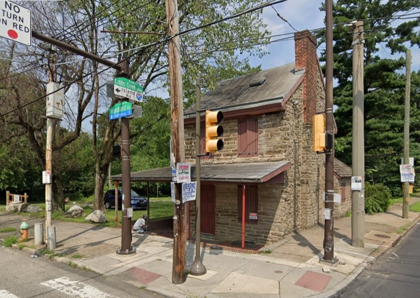
1766 Blue Bell Tavern, 7303 Woodland Avenue, Philadelphia. Source: Google maps, January 2024 |
|
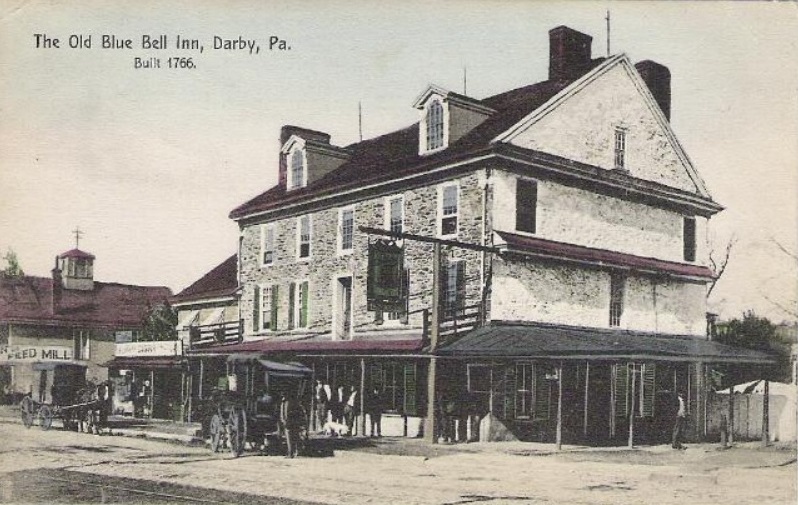
Post card of the 1766 Blue Bell Tavern before a large addition of 1801 was torn down. Postcard from the collection of Ed Springer. Source: Darby History |
|
1682 - William Penn Landed in Chester
In 1682. William Penn received the charter for the Province of Pennsylvania from King Charles II of England. That year, Penn went to the province and landed in Chester, the only town, then known as Upland. About 500 Europeans lived in the province at that time, mostly in the preseof Delaware and Chester centered around Upland. Swedish and Dutch settlers had lived in the area since the 1630s, and Quakers had moved there from West Jersey starting about 1675. Penn sailed aboard the ship Welcome from Deal, Kent, on the English Channel. Source: William Penn Landing Site.
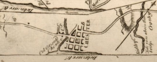
Excerpt from 1789 Colles map 52a, showing Ridley Creek, mile 14, Chester (mile 15), Chester Creek, and mile 16. Source: Colles map 52 |
Delaware
The Kings Highway in Delaware is 26 miles long, from the Pennsylvania border to Newark in New Castle County. It can be seen on Colles 1789 maps at: 52,
53,
54.
- Pennsylvania-Delaware border - mile 19.8 on map 52b
- New Castle County
- Philadelphia Pike (US 13)
- Naamans Creek - mile 20.3 on map 52b
- Philadelphia Pike
- Stoney Run (Stone Creek) - mile 23.4 on map 52c
- North Market Street
- Wilmington - mile 28 on map 53a
- North Market Street
- Brandywine River - mile 27 on map 53a
- North Market Street - Brandywine Academy at mile 27.3 on map 53a
- North King Street
- South Market Street
- Martin Luther King Boulevard (DE 48)
- Maryland Avenue (DE 4)
- Maryland Avenue (DE 4)
- North Maryland Avenue (DE 4)
- Little Mill Creek
- North Maryland Avenue (DE 4)
- South Maryland Avenue (DE 4)
- East Newport Pike (DE 4)
- East Market Street
- West Market Street
- West Newport Pike (DE 4)
- Hershey Run
- West Newport Pike (DE 4)
- Red Clay Creek - mile 33.4 on map 53c
- West Newport Pike (DE 4)
- Main Street (DE 4)
- White Clay Creek - mile 34.4 on map 53c
- Stanton Christiana Road - Mill, Hale-Byrnes House - mile 34.9
- Stanton Christiana Road (DE 7)
- North Old Baltimore Pike (DE 7)
- Old Baltimore Pike
- Leatherman's Run - Mill, Hale-Byrnes House - mile 34.9
- Old Baltimore Pike
- Christiana River - Cooch's Bridge - mile 41.9 on map 54b
- Old Baltimore Pike
- Iron Hill - mile 43 on map 54b
- Blue Ball Tavern - mile 43.7 on map 54c
- Muddy Run - mile 43.9 on map 54c
- Old Baltimore Pike
- Delaware-Maryland border - mile 45 on map 54c
2015 -- Along Delaware's Old Post Road
Delaware's Old Post Road goes from Claymont to Iron Hill, through the Colonial towns of Claymont, Wilmington, Newport, Stanton, Christiana, and the Pencader Hundred portion of northern Delaware. This 26-mile route has different names, from Philadelphia Pike to Maryland Avenue to Old Baltimore Pike, but it is along this road that the State of Delaware has its earliest roots. From Cooch's Bridge at one end, where the only battle on Delaware soil was fought, to Archmere Academy at the northern end, the corridor has a largely forgotten place in history. Travelers now trace the same route once traversed by George Washington, Thomas Jefferson, and Charles Mason and Jeremiah Dixon as they rode into history. Source: Along Delaware's Old Post Road by Ken Baumgardt 2015.
1820s - Philadelphia Pike
1723 - Robinson House
The Robinson House is on the Philadelphia Pike in Claymont, Delaware. It was built in 1723, on the site of the original settlement on Naaman's Creek. The Block House, which stands a few yards northeast of the Robinson House, is the only remaining building from the original 1654 settlement. George Washington, General Anthony Wayne, the Marquis de Lafayette, and "Light Horse" Harry Lee were all guests at the Robinson House. From 1914 to 1964, the Robinson House was home to the Naamans Tea House. Source: Robinson House.
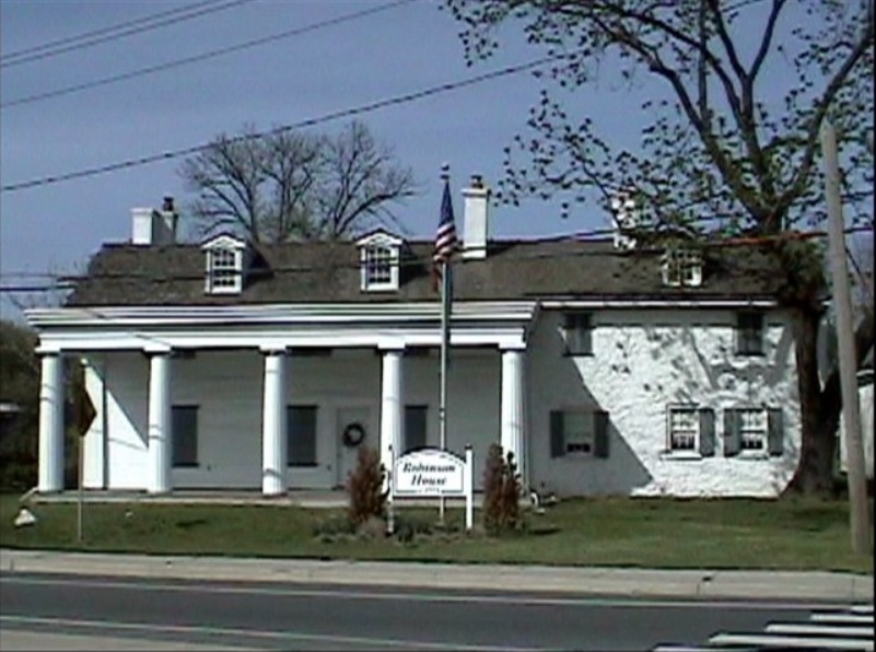
The Robinson House is a historic guest house located at the junction of Naamans Road (Delaware Route 92) and The Kings Highway (now U.S. Route 13, Philadelphia Pike) in Claymont, Delaware. Source: Robinson House. |
1749 - Penny House
This home called The Penny House on 235 Philadelphia Pike in Wilmington, Delaware was built in 1749 by Arthur Penny. The home was said to have been a toll stop on the Philadelphia Turnpike and became witness to the "W 3R Route" which took the Continental troops over 700 miles from Rhode Island to Yorktown. Virginia. Source: Penny House.
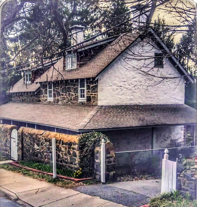
The Penny House on 235 Philadelphia Pike in Wilmington, Delaware. Source: Penny House. |
1798 - Brandywine Academy
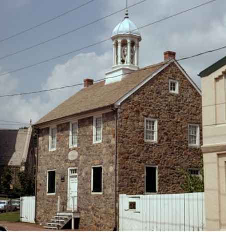
The school, located on Vandever Avenue near Market Street, was founded in 1798. The land was donated by John Dickinson and Dr. John Welsh. Seventy-nine persons contributed $443.13 to erect the building. It was an English and Classical academy chartered in 1815 and 1832. The Academy served as a school until 1870 and a branch library from 1915 to 1943. Source: Brandywine Academy and Brandywine Academy.. |
1762 - Brandywine Bridge
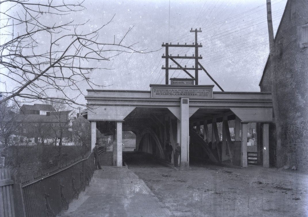
1884 photo of entrance to Brandywine Bridge, Wilmington, Delaware. Glass negative showing the entrance to Brandywine Bridge, a covered bridge. Electiral wires are strung above the bridge and a man stands in the entryway. A sign hangs over this bridge reading "[...] Builders, 1839. Keep to the right as the law directs, Walk your horses over the bridge, Under the penalty of 5 dollars, Built for New Castle County Building Committee." The Brandywine Bridge refers to State Bridge #575 or the North Market Street Bridge, originally a chain suspension bridge as early as 1762. After various repairs and updates, the bridge washed away in 1822 and was rebuilt into a double-span timber bridge, running 145 feet long and 28 feet wide. This new structure washed away in an 1839 flood and was replaced by bridge builder Lewis Wernwag. In 1887, the wooden bridge was replaced by an iron and steel bridge. Source: Brandywine Bridge.. |
1720 - Old Baltimore Pike
The Old Baltimore Pike was built before 1720. The road was known as the Great Road and ran between Head of Elk (now Elkton, Maryland) and Christiana Bridge. It was later known as the Christiana-Elkton Turnpike before becoming Old Baltimore Pike. This path served as a major connection between Philadelphia and Baltimore in addition to providing access between the shipping area of Christiana Bridge and agricultural areas in northern Delaware, northern Maryland, and southeastern Pennsylvania. In 1723, Welsh Tract settlers pushed for the road to be improved. This road was part of the Washington Rochambeau Revolutionary Route that was used by the French army during their march from Newport, Rhode Island, to Yorktown, Virginia, during the Revolutionary War, passing through the area in September 1781. The road, also known as Old Post Road, was incorporated in 1813 as the Elk and Christiana Turnpike in order to get more money for repairs. The turnpike was completed in April 1817. As a turnpike, tolls were collected to pay for the maintenance of the road. The construction of the New Castle and Frenchtown Railroad lowered the revenues of the turnpike and it became a public road again in 1838. The road historically went through agricultural areas; however, the surroundings have become more developed over the years. Much of the Old Baltimore Pike remains two lanes. Source: Old Baltimore Pike.
1735 - Newport
Newport, on the Christina River, was among the earliest communities in Delaware, tracing its roots to the early colonial days of the Country. The Old Kings Road , which traveled from Philadelphia to Baltimore, ran through the lands where Newport now stands. Newport's location as a stage coach (relay) stop along Kings Highway made the Town an important commercial hub for the young nation. Source: Town of Newport.
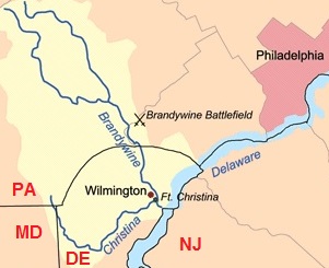
Map of the Christina River, which flows into the Delaware River. The river was named for Queen Christina of Sweden. The Brandywine Creek flows into the Christina River. Also shown is the Brandywine Battlefield, where more troops fought than at any other battle of the American Revolution. The arc border between Pennsylvania and Delaware is part of a circle with a radius of 12 miles. Source: Christiana River. |
1750 - Hale-Byrnes House
The Hale-Byrnes House is a historic home located at 606 Stanton-Christiana Road, Stanton, New Castle County, Delaware. It was built in 1750, and is a two-story, five bay brick dwelling. The house was built by Samuel Hale, who sold it to miller Daniel Byrnes in 1754. The house gained historic stature after the Battle of Cooch's Bridge, the only Revolutionary War battle in Delaware. After the skirmish General George Washington held a council at the house on September 6, 1777. Source: Hale-Byrnes House.
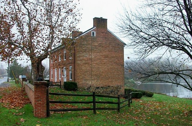
The Hale-Byrnes House, 606 Stanton-Christiana Road,
Stanton, Delaware. On White Clay Creek, a tributary of the Christina River. Source: Hale-Byrnes House. |
1732 - Christiana Presbyterian Church
The village at Christiana Bridge was a budding river port in 1732 when the Christiana Presbyterian Church was organized. In 1738, the first church building was erected on land purchased and donated by Colonel John Read, father of George Read, a signer of the Declaration of Independence. The church was known in its early days as the Presbyterian Church at Christiana Bridge. The original church building, a 26 x 36 foot frame structure, stood until July 4, 1857, when it was sold at public auction. The cornerstone of the present church building was laid September 8, 1857, on the site of the former structure. Source: Christiana Presbyterian Church.
|
|
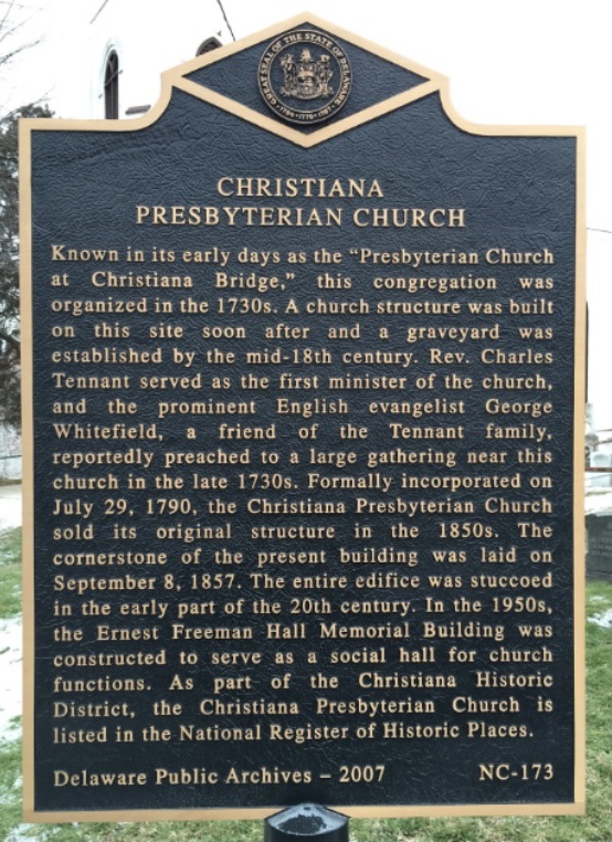
Marker NC-173 for the Christiana Presbyterian Church, 15 North Old Baltimore Pike, Christiana, Delaware. Source: Delaware Public Archives. |
|
Cooch's Bridge
Cooch's Bridge is three miles north of the Maryland border. The Cooch's Bridge Historic Site includes the Cooch Homestead and Cooch-Dayett Mill complex. The location of Delaware's only Revolutionary War era land battle, the site's history covers centuries. Source: Cooch's Bridge Historic Site.
About 1,700 British and Hessian soldiers marched from Elkton into Delaware, roughly following today's U.S. 40, then turned north at Glasgow and headed toward Iron Hill and Cooch's Bridge. Defending the area was a newly formed light infantry corps of about 800 men, led by Brigadier General William Maxwell of New Jersey. Outnumbered by roughly two to one, Maxwell's unit could not stop the British advance, but it did slow down the enemy. Source: Battle of Cooch's Bridge.
Maryland
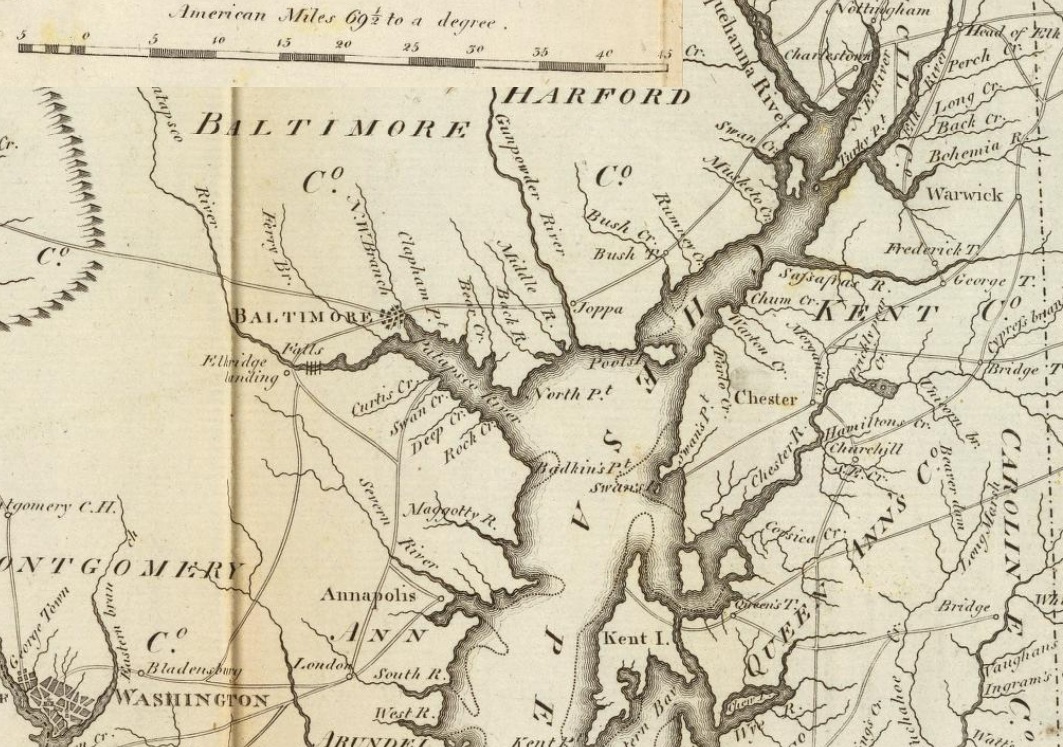
Excerpt from 1796 atlas of Maryland. Source: Rumsey Maps. |
Cities, towns, and villages cover only 4.4% of Maryland's land mass, so the Kings Highway sorted out here by county only.
MD 7 in Cecil, Harford, and Baltimore Counties
Maryland Route 7 (MD 7) is a collection of state highways in Maryland. Known for much of their length as Philadelphia Road, there are five disjoint mainline sections of the highway totaling 40 miles that parallel US 40 in Cecil, Harford, and Baltimore counties in northeastern Maryland.
MD 7 was first laid out early in colonial times and later formed part of the post road between Baltimore and Philadelphia (going further north to New York City and into New England to Boston) and between the northern and southern of the original Thirteen Colonies on the East Coast. The highway in Baltimore and Harford counties became a turnpike, constructed and operated by a private stockholder company in the early 19th century.
The rough alignment of what is now MD 7 in Baltimore and Harford counties existed by 1695 as a rudimentary road; Baltimore County ordered that the road be widened to 30 feet in width to allow easy passage for carts and for bridges to replace ferries at the numerous creeks along the route. In 1717, the route from Baltimore to Elkton became part of a new overland post road between Philadelphia and Williamsburg, Virginia. The highway between Baltimore and Havre de Grace was maintained as a turnpike, the Baltimore and Havre-de-Grace Turnpike, by 1825. This turnpike later became known as the Baltimore and Philadelphia Turnpike and, after collection of tolls had ceased on the highway, the Philadelphia Road or the Post Road. Source: Maryland Route 7.
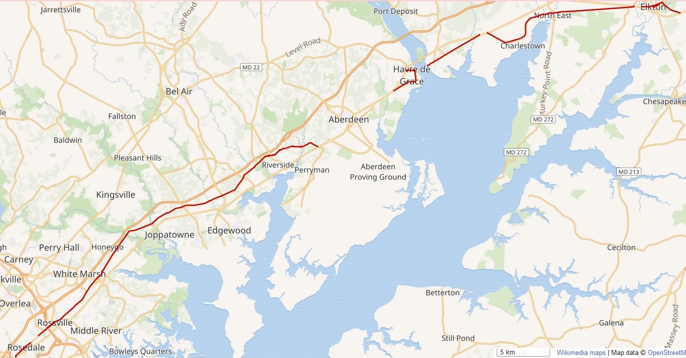
Maryland Route 7. |
Cecil County
The 19-mile route of the Kings Highway in Cecil County using Colles maps
54,
55, and
56:
- Delaware-Maryland border - mile 45 on map 54c
- Cecil County
- Red Hill Road (MD 281)
- Another road to Cooch's Bridge over the Christina River- mile ina River- mile 46.1 on map 54c
- Big Elk Creek - mile 47.6 on map 55a
- East Main Street (MD 281)
- East Main Street (MD 7)
- West Main Street
- Elkton (Head of Elk) - mile 48.2 on map 55a
- Hollingsworth Tavern - mile 48.3 on map 55a
- Little Elk Creek and grist mill - mile 49.1 on map 55a
- East Old Philadelphia Road (MD 7)
- D to Brick meetinghouse of Nottingham - mile 49.5 on map 55a
- West Old Philadelphia Road (MD 7)
- D to Brick meetinghouse of Nottingham - mile 49.5 on map 55a
- East Cecil Avenue (MD 7) in North East
- West Cecil Avenue (MD 7) in North East
- North East River - mile 54.6 on map 55b
- West Old Philadelphia Road (MD 7)
- to Nottingham - mile 55.3 on map 55c
- Charlestown - mile 57.3 on map 55c
- Principio Furnace Road (MD 7)
- Principio Creek - mile 60.9 on map 56a
- Broad Street (MD 7) in Perryville (Susquehanna, Lower Ferry)
- Rodgers Tavern - mile 64 on map 56b
- Susquehanna River - mile 64-65 on map 56b - Susquehanna Lower Ferry
1740 - Hollingsworth Tavern
1936 photo of Hollingsworth Tavern, 207 West Main Street, Elkton. Source: Library of Cogress |
|
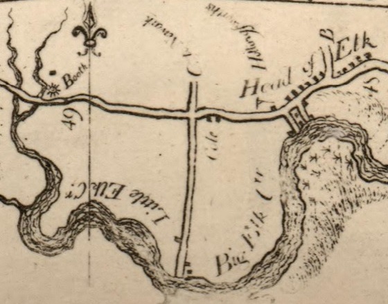
Excerpt from 1789 Colles map 55 showing miles 48 and 49 and the Hollingsworth Tavern at mile 48.3 in Head of Elk. |
|
1695 - Rodgers Tavern
Rodgers Tavern, also known as Stevenson's Tavern, is a historic hotel located at Perryville, Cecil County, Maryland. It is a mid-18th-century, two-story stone structure with a basement. All rooms have corner fireplaces. It was visited by George Washington 30 times between the years 1755 and 1798, when it was owned and operated as an inn and tavern by Colonel John Rodgers (1728 1791). It was built in 1695 and originally known as the Ferry House due to the fact that it was built next to the ferry. Source: Rodgers Tavern.
Rodgers Tavern, 259 Broad Street, Perryville MD. |
Harford County
The 20-mile route of the Kings Highway in Harford County using Colles maps
56,
57, and
58:
- Susquehanna River - mile 64-65 on map 56b - Lower Ferry
- Harford County
- Havre de Grace
- Union Avenue - "D" at mile 65 on Map 56b
- Revolution Street (MD 7)
- Lewis Lane
- Pulaski Highway
- Pulaski Highway
- Aberdeen
- Pulaski Highway
- Old Post Road
- Swan Creek (Gasheys Creek) - mile 68.6
- North Post Road
- Post Road
- South Post Road
- Old Philadelphia Road (MD 7)
- Old Philadelphia Road (MD 7)
- "C to Spes Una (Spesutia) Church" - mile 72.2 on map 57a - at South Sleeping Road in Ripkins Corner
- Grays Run - mile 72.3 on map 57a
- Philadelphia Road (MD 7)
- Humphreys Run - mile 73.6 on map 57a
- Hartford or Bushtown - mile 76.7 on map 57b
- Newtown - mile 77.7 on map 57b
- Winter's Run - mile 80.3 on map 57c
- T to Joppa - mile 83 on map 57c
- Little Gunpowder Falls - mile 84 on map 58a
1695 - Ferry to Havre de Grace
In 1695, a ferry service was established across the Susquehanna River and the area became known as Susquehanna Lower Ferry. This ferry formed a key transportation link for George Washington's troops during the Revolutionary War and for Union troops during the Civil War. Havre de Grace was founded in 1782 and incorporated in 1785, making Havre de Grace the second oldest municipality in Maryland after Annapolis. The name Havre de Grace is attributed to General Marquis de Lafayette (1757-1834), who played a large part in the American Revolution. While on his way to meet General George Washington in Philadelphia in 1782, Lafayette admired the lovely view of the broad Susquehanna River as it opened into the Chesapeake Bay. He is said to have exclaimed, C est Le Havre! for it reminded him of the French port city Le Havre (originally called Le Havre de Gr ce). Source: Brief History of Havre de Grace.
Union Avenue
Union Avenue is a road that has run through Harford County for approximately 350 years. Being the main route for the "post" (mail), Post Road (its former name) was the main thoroughfare carrying traffic north and south. Envisioned as early as the 1660s, Post Road linked Alexandria to Philadelphia and was also known as "King's Highway." Source: Streets of Havre de Grace.
Baltimore County
The 26-mile route of the Kings Highway in Baltimore County using Colles maps
58,
59, and
60:
- Little Gunpowder Falls - mile 84 on map 58a
- Baltimore County
- Philadelphia Road (MD 7)
- Big Gunpowder Falls - mile 86 on map 58a
- White Marsh Run - Nottingham Iron Works - mile 89.4 on map 58b
- Stemmers Run - Rossdale
- Red House Run - mile 96 on map 59a - Rosedale
- Baltimore City
- Pulaski Road
- Kingsbury ironworks - mile 98 on map 59a
- B to Patapsco neck (North Point) - mile 99 on map 59a
- East Baltimore Street
- "T to Fells Point" - Wahington Street- mile 100.8 on map 59b
- Jones Falls
- Baltimore Market House - mile 101.5 on map 59b - Old Marsh Market
- West Baltimore Street
- South Greene Street
- Washington Boulevard
- Ridgely's Delight - between Russell Street and South Fremont Avenue
- Mount Clare Mansion in Carroll Park
- to the Forge - mile 104.3 on map 59c - Baltimore Iron Works
- Gwynn's Falls - mile 104.6 on map 59c
- Baltimore & Ohio Railroad - built on road "K" and "L" on map 59c
- Washington Boulevard
- Herbert Run - mile 108.5 on map 60a
- Patapsco River - mile 110 on map 60a
1787 - Old Marsh Market
The Old Marsh Market was built in 1787 at 17 Market Place in Baltimore, between Baltimore and Water streets. It was later later known as the Center Market. The market was built on top of an old marsh, on the banks of the Jones Falls, and extended for years south towards Pratt Street. The market burned down in the Great Fire of 1904, but was rebuilt. Later known as Baltimore's Fish Market, it survived into the early 1980's, when the building was converted into a night club, called the Fish Market. In 1998 the site became the new home of the Port Discovery Children's Museum. Source: Kilduff's Baltimore Markets.
In 1851, the Maryland Institute College of Art moved above the Marsh Market. The building covered an entire block and had two stories built on a series of brick arches above the market, with two clock towers at each end. For 79 years the institute remained in the location above the Marsh Market. Its "Great Hall" was large enough to accommodate 6,000, attracted many famous speakers and lecturers. In 1852, it hosted both of the national political conventions to nominate presidential candidates Winfield Scott and his opponent Franklin Pierce (who was later elected 14th president of the United States). During the American Civil War, the institute served briefly as an armory for the Union and a hospital for soldiers wounded at the Battle of Antietam. On April 18, 1864, President Abraham Lincoln gave his famous speech known as the "Baltimore Address" (or "Liberty Speech") to benefit Union soldiers and families. Source: Maryland Institute College of Art.
1732 - Ridgely's Delight
Washington Boulevard goes through the Ridgely's Delight Historic District is a wedge-shaped area roughly bounded by Fremont Avenue on the west, Conway Street on the south, Russell and Green Streets on the east, and Pratt Street on the north. At the turn of the 19th century
the southwest portion consisted primarily of the estates of
Charles Ridgely and Judge McHenry, among others, as well as a collection of
smaller houses located on the established roads. A major thoroughfare was Alexandria or Columbia Pike (Washington
Boulevard) which ran westerly and served as the main artery to
Washington. Source: Ridgely's Delight Historic District.
Col. Charles Ridgely II, "Charles The Merchant" (1702 1772), of "Ridgely's Whim", was a Justice, planter, merchant, ironmaster, and member of the General Assembly of Maryland's lower chamber, House of Delegates and one of Baltimore County's commissioners. He acquired the estate known as "Howard's Timber Neck" from his father-in-law, just southwest of Baltimore Town, which had been established in 1729, and laid out the following year. In 1732, this land was combined with another property known as "Brotherly Love", resurveyed and renamed "Ridgely's Delight". In 1735, Ridgely began leasing parcels of land in "Ridgely's Delight". Ridgely's Delight is situated on what was first a Susquehannock Indian path leading south from the Susquehanna River valley further north, and in the Federal period of the late 18th century, a main East Coast post road/highway from Philadelphia southwest through Baltimore and on to Georgetown, Maryland. After running through Baltimore, the post road is now known as Washington Boas Washington Boulevard. The earliest houses within today's boundaries of the pie-shaped wedge community of Ridgely's Delight date from about 1804. Source: Charles Ridgely II.
1763 - Mount Clare Mansion
Mount Clare Mansion is the oldest Colonial-era structure in the City of Baltimore. It is located in Carroll Park at 1500 Washington Boulevard. The Georgian style of architecture plantation house exhibits a somewhat altered five-part plan. It was built on a Carroll family plantation beginning in 1763 by Charles Carroll the Barrister (1723 1783), said to be a distant relative of Charles Carroll of Carrollton (1737 1832), a signer of the Declaration of Independence, also the layer of the First Stone of the new Baltimore and Ohio Railroad, just a short distance away, in 1828. The first building on the Mount Clare property was built by John Henry Carroll, barrister Charles Carroll's brother, in 1754, and was probably eventually incorporated into the larger house. Charles inherited the property after John's death. The property consisted of 800 acres from the much larger Georgia Plantation, which had belonged to their father, Dr. Charles Carroll. Charles began construction of the house between 1757 and 1760. The mansion left the Carroll Family's ownership in 1840, and the house's flanking hyphen wings were demolished. During the American Civil War, when Baltimore was occupied in May 1861 by northern state militia and then regular army forces, Mount Clare was used as a headquarters by Union Army forces who fortified the site and named it Camp Carroll, one of a series of earthen forts surrounding Baltimore, then making it the second most-fortified city in the world at that time, after Washington, D.C. After the War, and a period of use as a beer garden (called the Schutzengarten) by the German community in Baltimore, the house and adjacent acreage 70 acres facing Washington Boulevard and the Gwynns Falls and Middle Branch of the river were purchased in 1890 by the City of Baltimore as its third large landscaped park. Source: Mount Clare Mansion.
Mount Clare Mansion, Carroll Park, 1500 Washington Boulevard, Baltimore. Source: Mount Clare Mansion |
1763 - Baltimore Iron Works
Mount Clare overlooked the northwestern shore of Ridgely's Cove of the Middle Branch and Ferry Branch of the Patapsco River, where some wharves and docks existed along with the Baltimore Iron Works, one of the largest industrial enterprises of colonial America. Source: Mount Clare Mansion.
1827 - B&O Railroad
The Baltimore and Ohio Railroad Company was formed in 1827. Charles Carroll of Carrollton (1737 1832) ws one of its directors. He had the important ceremonial position of setting the First Stone for the railroad at the end of the big parade, festivities and ceremonies on Independence Day, July 4, 1828, near the Mount Clare Mansion. The railroad was horse-drawn during its first four years. Source: Mount Clare Mansion.
Excerpt from Colles map 59c showing:
- "to the Forge" (Baltimore Iron Works)
- wiggly line pointing south (Gwynn's Falls)
- road "K" and "L", the later location of the B&O railroad
between 104 and 105 miles from Philadelphia. Source: 59 |
Howard and Anne Arundel Counties
The route of the Kings Highway using Colles maps
60,
61,
62, and
63:
- Patapsco River - mile 109.9 on map 60a
- Howard County - Elk Ridge Landing - mile 110 on map 60a
- Main Street
- Furnace Avenue
- Deep Run River - mile 110.4 on map 60a
- Anne Arundel County
- Furnace Avenue
- Old Furnace - mile 110.5 on map 60a
- Stony Run River - mile 113 on map 60a
- Baltimore Washington International Airport built in 1944
- Veterans Highway
- Severn River - mile 122 on map 61a
- Generals Highway (MD 178)
- Three Oak Corner - corner of Generals Highway and West Street - mile 131 on map 61c - "G to Bladensburg, Alexandria, etc." is Defense Highway - Three Mile Oak
- West Street (MD 450)
- Annapolis
- West Street (MD 450)
- Duke of Gloucester Street - eastbounr
- Duke of Gloucester Street - westbound
- West Street (MD 450)
- West Street
- Three Oak Corner - corner of Generals Highway and West Street - mile 131 on map 61c - "G to Bladensburg, Alexandria, etc." is Defense Highway - Three Mile Oak
- Defense Highway (MD 450)
- Broad Creek - mile 4.4 on map 62b
- Bacon Ridge Branch - mile 7.1 on map 62b
- North River - mile 7.4 on map 62b
- South River - mile 9 on map 63a
- Robert Crain Highway
- Patuxent River - mile 14 on map 63b - Governor's Bridge
1751 - Elkridge Furnace
The Elkridge Furnace is a historic iron works located on approximately 16 acres at Elkridge, Howard County, Maryland. There are six remaining buildings of an iron furnace which operated from the 18th century into the 1860s.
Source: Elkridge Furnace Complex.
1950 - Baltimore/Washington International Airport (BWI)
Planning for a new airport on 3,200 acres to serve the Baltimore Washington area began just before the end of World War II. The site was chosen because it was a 15-minute drive from downtown Baltimore; close to the Pennsylvania Railroad line, the Baltimore and Annapolis Railroad line and the proposed Baltimore Washington Parkway. Much of the land was purchased from Friendship Methodist Church in 1946, and ground was broken on May 2, 1947. Friendship Methodist Church held its last service on Easter Sunday in 1948.Friendship Methodist Church was razed to make room for the new airport. In addition, several pieces of land were bought, and 170 bodies buried in a cemetery were moved. Baltimore Fort Meade Road was moved to the west to make way for the airport's construction. Friendship International Airport was dedicated on June 24, 1950, by President Harry S. Truman. To attract passengers from the Washington metropolitan area, particularly Montgomery and Prince George's counties, the airport was renamed Baltimore/Washington International Airport in 1973. Source: Baltimore/Washington International Airport.
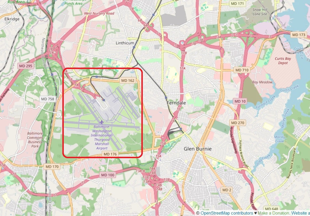
Source: OpenStreet Map. January 2024. The general are of the BWI airport is marked in red. |
|
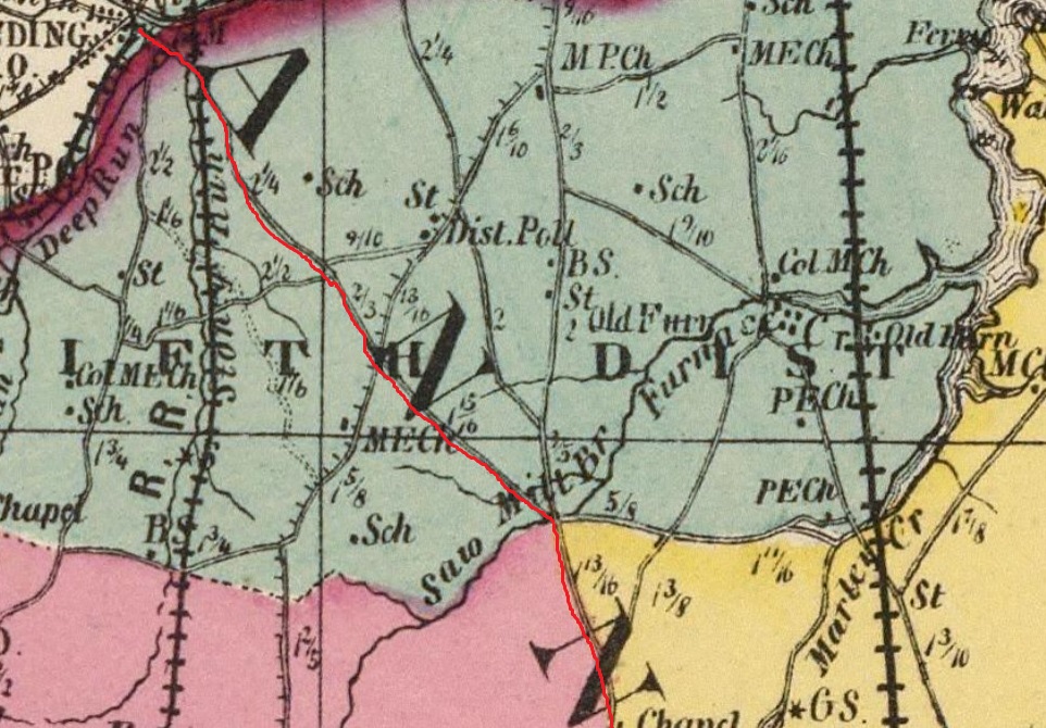
Excerpt from 1873 Map of Anne Arundel and Prince George counties. Source: Rumsey Maps. The likely route of the Kings Highway is marked in red. |
|
Generals Highway (MD 178)
Generals Highway follows the path of an Annapolis Philadelphia post road established by 1733. The highway is so named because it was traveled by George Washington on his journey from New York to Annapolis, then acting as the capital of the United States, to resign his commission as Commander-in-Chief of the Continental Army in December 1783. George Washington was greeted and escorted the remaining distance to Annapolis by a group of prominent citizens from the Three Mile Oak, a prominent tree located 3 miles from the Maryland State House. The Three Mile Oak was located at what is today the southern terminus of MD 178. MD 178 passes the historic home Iglehart in the eponymous hamlet, where the highway passes Old Generals Highway. MD 178 passes the historic home Belvoir. In Crownsville, the highway passes St. Paul's Chapel at the corner of Crownsville Road. Source: Maryland Route 178.
1692 - St. Anne's Church
At 100 Duke of Gloucester Street in Annapolis, Maryland, is St. Anne's Church, built in 1692. St. Anne's is a historic Episcopal church located in Church Circle, Annapolis. The first church in Annapolis, it was founded to serve as the parish church for the newly created Middle Neck Parish, one of the original 30 Anglican parishes in the Province of Maryland. It remains in use by the Parish of St. Anne, part of the Episcopal Diocese of Maryland. Source: St. Anne's Church and St. Anne's Church.
|
|
Excerpt from 1789 Colles Map 62a showing Annapolis, Maryland. The lower east-west street is Duke of Gloucester Street, where the Carroll House was built in 1706. The upper east-west street is Main Street. The church is where the two streets come together. The church is not shown on the map because, In 1775, the building was taken down in anticipation of constructing a new church. The start of the Revolution put building plans on hold. A new building was not completed until 1792.
Map source: Colles Maps. |
|
1706 - Charles Carroll House
At 107 Duke of Gloucester Street in Annapolis, Maryland, is the Charles Carroll House, built in 1706. It was the home of
- Charles Carroll the Settler (1661 1720), first Attorney General o>his son, Charles Carroll of Annapolis (1702 1782)
- his son, Charles Carroll of Carrollton (1737-1832)
Charles Carroll of Carrollton was the only Catholic to sign the Declaration of Independence in 1776. The Carroll House is one of only fifteen surviving signer's birthplaces in the United States.
The Y chromosome DNA of Charles Carroll of Carrollton is identified here: Z16291 Ely Carroll DNA.
A second cousin of Charles Carroll the Settler, John Carroll, was the first Catholic bishop in the United States, having been named first Bishop of Baltimore in 1789. Source: Charles Carroll House of Annapolis and The Carrolls of Maryland.
|
|
Excerpt from 1789 Colles Map 62a showing Annapolis, Maryland. The lower east-west street is Duke of Gloucester Street, where the Carroll House was built in 1706. The upper east-west street is Main Street. The street connecting them them is Conduit Street. 134 is the miles from Philadelphia. To the right is the Severn River. At the bottom is Spa Creek. At the top is College Creek. On south side of College Creek are St. John's College and the United States Naval Academy. Off of College Creek is Peter's Cove. Source: Colles Maps. |
|
Three Mile Oak
Three Mile Oak was located at the corner of West Street and Generals Highway, three miles from the Maryland State House in the center of Annapolis. Prominent visitors were met at the tree, on the outskirts of Annapolis, and escorted into the city.
The Three Mile Oak was from the 18th century. Presumably a white oak, about six feet in diameter. The tree was struck by lightning, became hollow, was killed by fire, and finally blew down on May 22, 1909. At the site where the tree stood, a delegation is reported to have met George Washington en route to Annapolis (then the U.S. capital) to resign his commission on December 19, 1783. Washington resigned as commander-in-chief on December 23.
While on display outdoors for many years, the Three Mile Oak was exhibited with a plaque erected in 1967 by the Four Rivers Garden Club, Rotary of Annapolis, explaining its significance. The plaque states:
Under this tree passed General George Washington December 19, 1783 on his way to Annapolis to resign his Commission as Commander-In-Chief of the Continental Armies, and it is thought that General Smallwood accompanied by General Gates and distinguished citizens of Annapolis met General Washington at this spot.
General Lafayette passed here December 17, 1824 to visit the friends of revolutionary days.
Source: Three Mile Oak.
Prince George's County and the District of Columbia
The route of the Kings Highway using Colles maps
63,
64, and
65:
- Patuxent River - mile 14 on map 63b - Governor's Bridge
- Prince George's County
- North West Crain Highway
- Annapolis Road (MD 450)
- "K to Marlborough" - mile 20.4 on map 63c - MD 193
- Bladensburg
- Annapolis Road (MD 450)
- Baltimore Avenue
- "F to Elk Ridge landing" is US 1 to Elkridge
- Northast Branch of Potomac River (Anacostia River) - mile 29.3 on map 64b
- North Brentwood
- Rhode Island Avenue (US 1)
- Brentwood
- Rhode Island Avenue (US 1)
- Mount Ranier
- Rhode Island Avenue (US 1)
- District of Columbia (part of Maryland before 1791)
- Rhode Island Avenue Northeast (US 1)
- Florida Avenue Northwest
- P Street Northwest
- Rock Creek - Ford/Lauzun's Legion Bridge - mile 36.7 on map 65a
- Georgetown
- 27th Street Northwest (originally Monroe Street)
- M Street Northwest (originally Bridge Street)
- Wisconsin Avenue (originally High Street to the north and Water Street to the south)
- Potomac River - Georgetown-Mason Island Ferry - mile 38 on map 65a
1742 - Bladensburg
Bladensburg was established in 1742 as a regional commercial center by an act of the Maryland General Assembly. Bladensburg is best remembered for the Battle of Bladensburg during the War of 1812, the only battle in US history in which a sitting president (James Madison) rode into battle. US defeat in that battle, called "the greatest disgrace ever dealt to American arms", cleared the way for the burning of Washington by British troops. The town was an important crossroads of routes north to Baltimore and east to Annapolis and west to the District of Columbia. Source: Bladensburg.
1742 - William Hilleary House
The William Hilleary House, or Hilleary-Magruder House, is a historic home located at Bladensburg. It was built between 1742 and 1764 by William Hilleary. The house passed through a number of 18th-century owners, including Richard Henderson. Henderson was a prominent merchant and land speculator, who served as a County Justice and was well known for his "paper wars" in local newspapers. George Washington's diary, May 9, 1787, states that he dined at Richard Henderson's in Bladensburgh. The Ross Home was used for a hospital during the Battle of Bladensburg of the War of 1812. Source: William Hilleary House.
1760s - George Washington House
The George Washington House, or Indian Queen Tavern, is located at Baltimore Avenue, at Upshur Street, in Bladensburg. It was constructed in the 1760s. The Indian Queen Tavern gained its reputation as the "George Washington House" through an assumption that "George Washington slept here." The brick tavern began to be known as the "George Washington House" before 1878 when it was being used as a hotel. Source: George Washington House.
1791 - District of Columbia
The U.S. Constitution provides for a federal district under the exclusive jurisdiction of the U.S. Congress. As such, Washington, D.C. is not part of any state, nor is it one itself. In 1790, Congress approved the creation of the capital district along the Potomac River. In 1791, Major Pierre Charles L'Enfant developed a street plan for the new city of Washington for George Washington. The city was founded in 1791, and Congress held its first session there in 1800. In 1801, the District of Columbia, formerly part of Maryland and Virginia and including the existing settlements of Georgetown and Alexandria, was officially recognized as the federal district; the city initially comprised only a portion of its modern territory, as a distinct entity within the larger federal district. In 1846, Congress returned the land originally ceded by Virginia, including the city of Alexandria. Source: L'Enfant Plan and Washington, D.C..
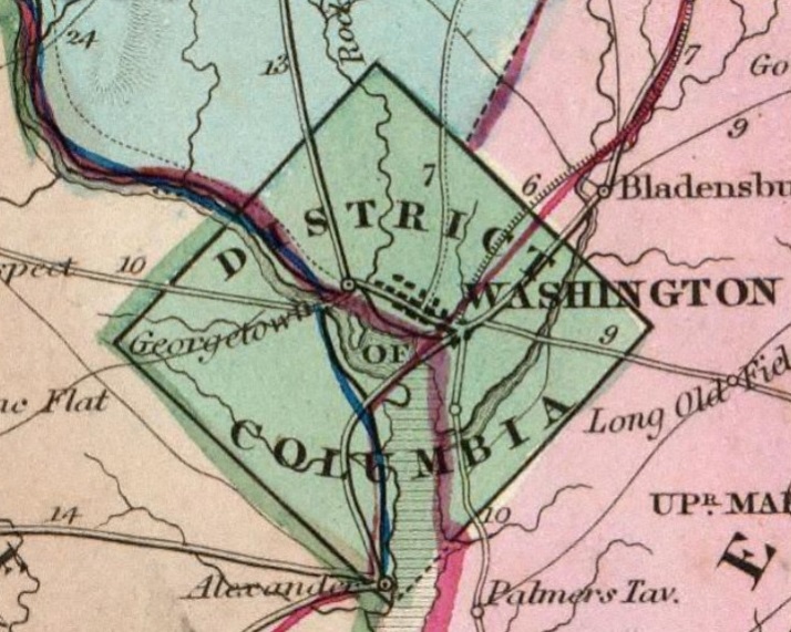
Excerpt from 1839 map of Virgina and Maryland showing the District of Columbia, including the road from Georgetown to Alexandria. Four Mile Run can be seen unnamed half-way between Georgetown and Alexandria. Source: 1839 map |
1751 - Georgetown
Georgetown was established in 1751. Situated on the fall line, Georgetown was the farthest point upstream to which oceangoing boats could navigate the Potomac River. The strong flow of the Potomac kept a navigable channel clear year-round; and, the daily tidal lift of the Chesapeake Bay, raised the Potomac's elevation in its lower reach; such that fully laden ocean-going ships could navigate easily, all the way to the Bay. It did not take long before Georgetown grew into a thriving port, facilitating trade and shipments of tobacco and other goods from colonial Maryland. With the economic and population growth of Georgetown also came the founding of Georgetown University in 1789. Source: Georgetown and Georgetown Historic Dustrict.
1765 - Old Stone House in Georgetown
The Old Stone House is the oldest unchanged building structure in Washington, D.C. The house is also the last pre-revolutionary colonial building in Washington, D.C. Built in 1765, Old Stone House is located at 3051 M Street Northwest in the city's Georgetown neighborhood. Sentimental local folklore preserved the Old Stone House from being demolished, unlike many colonial homes in the area that were replaced by redevelopment. Source: Old Stone House (Washington, D.C.).
1796 - City Tavern in Georgetown
The City Tavern was constructed in 1796 and first managed by Clement Sewall, who served in the Revolutionary War alongside his friend John Parke Custis, George Washington's stepson. Sewall enlisted as a sergeant at age 19 in the Maryland Line, was promoted six months later to ensign and then severely wounded at the Battle of Germantown. Located in the heart of Georgetown, the City Tavern served not only as a traditional lodging house but also as the meeting place for Georgetown's governing body, the Georgetown Corporation and the location for elections and meetings of the Mayor's Court. Many of the country's founding fathers, including George Washington, Thomas Jefferson and John Adams frequented the City Tavern during this historic time. Source: City Tavern Club.
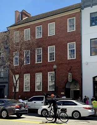
The City Tavern Club located at 3206 M Street Northwest, near the corner of Wisconsin Avenue and M Street. Built in 1796. Source: City Tavern Club |
Wisconsin Avenue
From the Georgetown riverfront on the Potomac River, Wisconsin Avenue climbs steeply north through Northwest Washington, D.C. Wisconsin Avenue follows the route of an ancient Native American trail. It was used by Europeans since the 1690s. Between 1805 and 1820, it was turned into a toll road by the Georgetown and Rockville Turnpike Company to carry tobacco and other products between Georgetown and Frederick.
The section of Wisconsin Avenue in Georgetown was called High Street before the street names in Georgetown were changed in 1895 to conform to those of the L'Enfant Plan for the federal city (although Georgetown predates the planned capital by half a century). Source: Wisconsin Avenue
Georgetown-Mason Island Ferry
Georgetown's transportation importance was defined by its location just below the fall line of the Potomac River. The Francis Scott Key Bridge, more commonly known as the Key Bridge, was completed in 1923. It is Washington's oldest surviving road bridge across the Potomac River, connected Georgetown with Virginia. It was prededed by The Aqueduct Bridge. Before the Aqueduct Bridge was built, a ferry service owned by John Mason connected Georgetown to Virginia, by way of Mason Island. The island was purchased by the Mason family in 1717. It is now called Theodore Roosevelt Island. The Mason ferry opened in 1748. The ferry stayed in operation for over 100 years until 1867. The ferry was operated by a pull chain that connected the island to Georgetown, carrying passengers across the Potomac River. Over this period, the armies of Rochambeau and Lafayette used the ferry on their way to the Battle of Yorktown in 1781. Even George Washington used it for travel and wrote about his journey over the river on the Mason ferry in 1785. Source: Theodore Roosevelt Island - Mason Island Ferry and Key Bridge
2023 Google Map of a likely Kings Highway in Virgina, south of Yorktown. |
2023 Google Map of likely Kings Highway in Virgina, based on Colles maps. |
Virginia
The route of the Kings Highway in Virginia is:
Arlington County
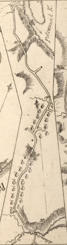
Excerpt from Colles 1789 map 65b At the top is Theodore Roosevelt Island in the Potomac Rive. At the bottom is Four Mile Run and the unnamed Long Branch Creek. Arlionton National Cemetery today is roughtly between mile 38.9 and 41.2. Source: 65 |
The route of the Kings Highway from Georgetown to Arlington, using Colles maps 65 is:
- Potomac River - mile 38 on map 65a
- Arlington County
- Parkways
- North Arlington Ridge Road
- River Place
- Arlington Ridge park
- Arlington National Cemetery
- South Arlington Ridge Road
- Four Mile Run - mile 42.3 on map 65b
Arlington Ridge Road
Arlington Ridge Road (originally known as Mount Vernon Avenue) is a street through residential areas and business districts in Arlington, Virginia. South Arlington Ridge Road is roughly 1.5 miles in length and extends from Prospect Hill Park/Army-Navy Drive in the north to Glebe Road and Four Mile Run creek in the south. As it crosses the creek it turns into Mount Vernon Avenue. Arlington Ridge Road was first constructed in 1840, and formerly extended north through Arlington National Cemetery to Rosslyn, Virginia near Francis Scott Key Bridge and the Potomac River. The cemetery's Eisenhower Avenue largely follows the path of the Arlington Ridge Road. Source: Arlington Ridge Road.
Arlington National Cemetery
Arlington National Cemetery was built over Arlington Ridge Road, the path of the Kings Highway.
Nearly 400,000 people are buried in its 639 acres, including my sister-in-law, Anne Roarty Biggins (1944-2014). It was established on May 13, 1864, during the American Civil War after Arlington Estate, the land on which the cemetery was built, was confiscated by the U.S. federal government from the private ownership of Confederate States Army General Robert E. Lee's family following a tax dispute over the property. The cemetery is managed by the U.S. Department of the Army. As of 2024, it conducts approximately 27 to 30 funerals daily. Source: Arlington National Cemetery.
1839 - Map of the District of Columbia
Excerpt from 1839 map of Virgina and Maryland showing the District of Columbia, including the road from Georgetown to Alexandria. Four Mile Run can be seen unnamed half-way between Georgetown and Alexandria. Source: 1839 map |
Four Mile Run
Four Mile Run is a 9.4-mile-long stream in Northern Virginia that starts near Interstate 66, at Gordon Avenue in Fairfax County and proceeds southeast through Falls Church to Arlington County in Virginia. In Arlington, the stream passes from the Piedmont through the Fall Line to the Atlantic Coastal Plain in a deep forested valley. The stream's eastern section forms the boundary of Arlington County and the City of Alexandria. The stream eventually empties into the Potomac River immediately south of Reagan National Airport. Source: Four Mile Run.
Alexandria
The route of the Kings Highway in Alexandria, using Colles maps 65 and
66 is:
- Four Mile Run - mile 42.3 on map 65b
- Alexandria
- Mount Vernon Avenue
- East Glebe Road
- Richmond Highway (US 1)
- Powhatan Street
- North Washington Street - Christ Church at mile 45.3 on map 65c
- King Street
- ?
- Telegraph Road (SR 611)
- Cameron Run
1773 - Christ Church, Alexandria
Christ Church is an Episcopal church located in Alexandria's Old Town, at the southwest corner of North Washington and Cameron Streets. The building was designed by Col. James Wren, a descendant of Sir Christopher Wren.
George Washington was a member. Franklin Roosevelt, Winston Churchill, and Eleanor Roosevelt visited the church on January 1, 1942 to commemorate World Day of Prayer for Peace. The church was known as Fairfax Church until given the name Christ Church in 1816. Source: Christ Church, Alexandria.
Christ Church is on Washington Street between King and Queen streets.
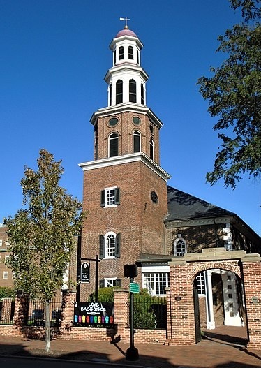
Christ Church is at 118 North Washington Street. Built in 1773
Architect, James Wren. Source: Christ Church. |
|
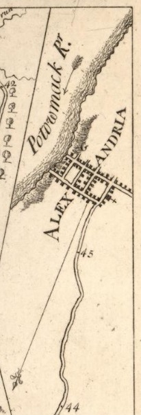
Excerpt from 1789 Colles Map 65c. Christ Church (+) is at 118 North Washington Street. Streets to the Potomac River are King Street and Queen Street. Map source: Colles map 65c. |
|
Fairfax County

Excerpts from 1789 Colles Maps 66b and 66c, showing Geo. Washington's Land (Mount Vernon) and Pohick Church (George Washington's church). North is bottom right. |
The route of the Kings Highway in Fairfax County, using Colles maps 66 and
67 is:
- Cameron Run
- Fairfax County
- Telegraph Road (SR 611)
- North Kings Highway (VA 241)
- Richmond Highway (US 1)
- Little Hunting Creek
- Mt. Vernon - Geo. Washington's Land - mile 53 on map 66b
- Dogue Creek
- Accotink Creek - mile 56 on map 66c
- Pohick Church - mile 57 on map 66c
- Old Colchester Road (SR 611)
- Pohick Creek - mile 58 on map 66c
- Giles Run - mile 60 on map 67a
- Occoquan River - Colchester Ferry, Williams Bridge - mile 61 on map 67a
George Washington's Land
At mile marker 53 on the 1789 Colles map 66 is George Washington's Land. This is the Mount Vernon area, which was once a part of the farms of George and Martha Washington's expansive Mount Vernon estate. Much of the land was gradually donated through the dying wishes of George and Martha Washington to the public and others who are affiliated with the Washington family. The area is located on US 1 in Northern Virginia, 13 miles south-southwest of downtown Washington, D.C. Mount Vernon sits on the Atlantic Coastal Plain on the north side of the Potomac River. Shown on the map on either side of George Washington's Land are two small tributaries of the Potomac River that flow south through the area:
- Little Hunting Creek forms the area's eastern border
- Dogue Creek runs through the western part of the area
The Mount Vernon Mansion is on the Potomac between the mouths of the two rivers.
Sources: Mount Vernon Area and Mount Vernon Map.
1774 - Pohick Church
At mile marker 57 on the 1789 Colles map 66 is the Pohick Church. It is an Episcopal church in the community of Lorton in Fairfax County, Virginia. Often called the "Mother Church of Northern Virginia, the church is notable for its association with important figures in early Virginian history such as George Washington and George Mason, both of whom served on its vestry. Source: Pohick Church.
1750 - Fairfax Arms
The Fairfax Arms, also known as the Colchester Inn, is a historic inn and tavern located at Colchester, Fairfax County. It was built in the mid-18th century, and is a three-bay, brick building measuring approximately 25 feet by 32 feet. It features flanking exterior stone chimneys and a gable roof with dormers. Source: Fairfax Arms.
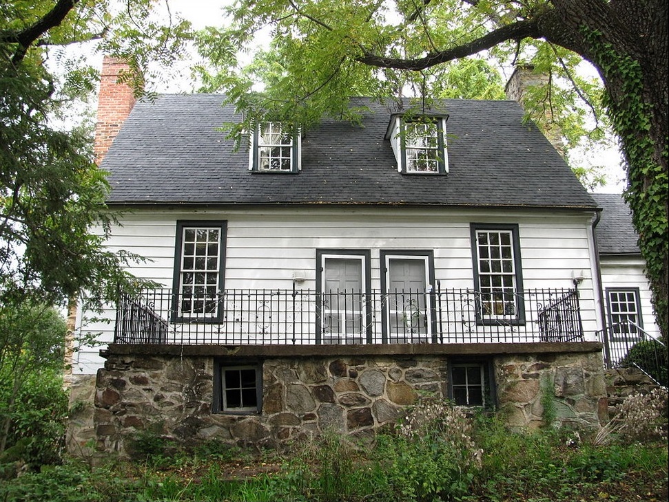
Fairfax Arms, 10712 Old Colchester Road. Source: Fairfax Arms |
Prince William County
The route of the Kings Highway in Prince William County, using Colles maps 67 and
68 is:
- Occoquan River - Colchester Ferry, Williams Bridge - mile 61 on map 67a
- Prince William County
- Richmond Highway (US 1)
- Nabisco Creek - mile 66.2 on map 67b
- Powells Creek - mile 67.5 on map 67c
- Dewey's Creek - mile 69 on map 67c
- Main Street (US 1)
- Quantico Creek in Dumfries- mile 70.8 on map 67a
- Main Street
- Richmond Highway (US 1)
- Little Creek - mile 72 on map 68a
- Chopawamsic Creek - mile 74.7 on map 68a
1753 - Colchester Ferry Over the Occoquan River
At mile marker 61 on the 1789 Colles map 67 is Colchester, founded in 1753 at the location of a ferry crossing over the Occoquan River, was the second town established in Fairfax County. Located on the main post road from Boston to Charleston, and at the end of the Ox Road leading west to the Blue Ridge, the town prospered as a trading center and tobacco port. In 1781, Gen. Washington and Comte de Rochambeau passed through Colchester en route to Yorktown. The creation of an alternate postal route over a new bridge upstream in 1805; the diversion of grain shipping from the Shenandoah Valley to Georgetown, Alexandria, and Baltimore; and, according to tradition, a great fire in 1815 contributed to the town's decline. Sources: Colchester and Virginia Marker E107.
|
|
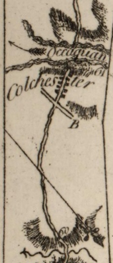
Excerpt from Colles Map 67a showing Colchester on the Occoquan River, a tributary of the Potomac River, at mile 61. Source: 1789 Colles Maps. |
|
1795 - Wood Bridge Over the Occoquan River
The area of Woodbridge, in Prince William County, takes its name from Thomas Mason's 1795 wooden toll bridge built to supplant the existing ferry, carrying the King's Highway traffic across the Occoquan River. Mason's Woodbridge Plantation was located in the area of the present day Belmont Bay golf course community. The original bridge from which the area takes its name was washed away in 1807 following a heavy storm. Source: Woodbridge, Virginia.
Stafford County
The route of the Kings Highway in Stafford County, using Colles maps 68 and
69 is:
- Chopawamsic Creek - mile 74.7 on map 68a
- Stafford County
- Richmond Highway (US 1)
- Aquia Creek - mile 82.3 on map 68c
- Stafford - mile 83 on map 68c
- Potomac Creek - mile 87.5 on map 69a
- Cambridge Street (US 1)
- Falmouth - mile 92 on map 69b
- Rappahannock River - mile 92 on map 69b
1750s - Aquia Church
Aquia Church is a historic church and congregation at 2938 Richmond Highway (US 1 at VA 610) in Stafford, Virginia. It is an Episcopal congregation founded in 1711, that meets in an architecturally exceptional Georgian brick building that was built in the 1750s. Source: Aquia Church.
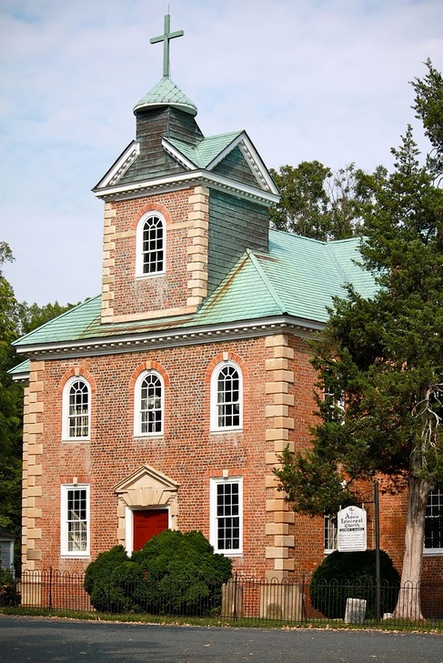
Aquia Church, 2938 Richmond Highway, Aquia. Source: Aquia Church |
Fredericksburg and Spotsylvania County
The route of the Kings Highway in Fredericksburg and Spotsylvania County, using Colles maps 69 and
70 is:
- Rappahannock River - mile 92 on map 69b
- Fredericksburg - mile 94-95
- Princess Anne Street
- Charles Street (VA 2)
- Dixon Street (VA 2)
- Spotsylvania County
- Tidewater Trail (VA 2)
- Massaponax Creek (Ruffins Pond) - mile 100.5 on map 70a
- Tidewater Trail (VA 2)
- Sandy Lane Drive
1741 - St. George's Episcopal Church, Fredericksburg
St. George's Episcopal Church is in Fredericksburg at 905 Princess Anne Street. The church, built in the 18th century and re-built in 1815 and 1849, is a part of the Episcopal Diocese of Virginia. An area of land was designated as "St. George's Parish" as early as 1720, but construction of a church building was not begun until 1732. The wooden frame church was completed in 1741. Mary Ball Washington, the mother of George Washington, and her family living in the area, attended this old St. George's. A new building, in brick, replaced the old wooden church in 1815, but that was itself replaced by the present building in 1849. Source: St. George's Episcopal Church.
Caroline County
The route of the Kings Highway in Caroline County, using Colles maps 71,
72, and
73 is:
- Caroline County
- Fredericksburg Turnpike (VA 2)
- Bowling Green - mile 117 on map 71b
- North Main Street (VA 2)
- South Main Street (VA 2)
- Richmond Turnpike (US 301, VA 2)
- Sparta Road (SR 721)
- Mattaponi Trail (SR 627)
- Old Stage Road (SR 623)
- Burke's Bridge Road
- Mattaponi River - mile 125.7 on map 72a
- Richmond Turnpike (US 301, VA 2)
- Pamunkey River - mile 139.3 on map 73b
Hanover and New Kent Counties
The route of the Kings Highway in Hanover and New Kent Counties, using Colles maps 73,
74,
75, and
76 is:
- Pamunkey River - mile 139.3 on map 73b
- Hanover County
- Hanover Courthouse Road (US 301, VA 2)
- Hanover CH - mile 141.1 on map 73c
- River Road (SR 605)
- Hanovertown - mile 150 on map 74b
- River Road
- Tototomoy Creek - mile 152.5 on map 74b
- New-Castle - mile 154.2 on map 74c (town destroyed by silting of the Pamunkey River in the early 19th century. Source: Newcastle Town Archaeological Site. There is an Old New Castle Road on the other side of the river)
- ?
- Old Church Road (SR 606)
- Matadequin Creek - mile 159.5 on map 75a
- New Kent County
- Old Church Road (SR 606)
- Old River Road (SR 608)
- New Kent Highway (VA 249)
- New Kent Court House - mile 173.3 on map 76a
- Cooks Mill Road (SR 623)
- New Kent Highway (VA 249)
James City County and Williamsburg
The route of the Kings Highway in James City County and Williamsburg, using Colles maps 76,
77, and
78: is:
- James City County
- Old Stage Road
- Richmond Road
- Burnt Ordinary - mile 190.7 on map 77b
- "E" at mile 190.7 on map 77b is Forge Road in Toana
- "F" at mile 191 on map 77b is Chickahominy Road
- Williamsburg
- Richmond Road
- College of William & Mary - mile 200 on map 78a
- West Duke of Gloucester Street
- East Duke of Glouch\ester Street
- York Street
1780 - Burnt Ordinary, Toano
First called John Lewis's Ordinary and then Fox's, Burnt Ordinary received its name in Jan. 1780 when, according to the Virginia Gazette, Fox's Ordinary burned to the ground. Later, in Oct. 1781, when the French army's wagon train passed by, Alexander Berthier wrote that "two old chimneys" stood here in the fork of the road. Also in 1781, Samuel DeWitt, George Washington's cartographer, noted the site of the "Burnt Brick Ordinary" on one of his maps. Elements of Lafayette's army camped two miles south of here at Chickahominy Church after the Battle of Green Spring on 6 July 1781. Source: Burnt Ordinary.
1699 - Williamsburg
In 1632, English settlers founded Middle Plantation as a fortified settlement on high ground between the James and York rivers and farther inland than their headquarters at Jamestown. The city of Williamsburg was established at the site of Middle Plantation in 1699. It functioned as the capital of the Colony and Commonwealth of Virginia from 1699 to 1780 and became the center of political events in Virginia leading to the American Revolution. Source: Williamsburg, Virginia.
1674 - Bruton Parish Church
Bruton Parish Church is located in the restored area of Colonial Williamsburg in Williamsburg, Virginia, United States. It was established in 1674 by the consolidation of two previous parishes in the Virginia Colony, and remains an active Episcopal parish. Bruton Parish Church today is the most active parish in the Episcopal Diocese of Southern Virginia. It has nearly two thousand members, four regular Sunday services, and active youth and college organizations. The Church has been restored to its appearance during the colonial era, and name plates on its box pews commemorate famous worshippers from the time, including George Washington, James Madison, John Tyler, Benjamin Harrison, Patrick Henry, and Thomas Jefferson. The church still uses a bell cast in 1761, which rang to celebrate the signing of the Declaration of Independence in 1776 and the signing of the Treaty of Paris in 1783, marking the end of the American Revolutionary War. Source: Bruton Parish Church.
1693 - College of William & Mary
The College of William & Mary was founded in 1693 by a royal charter issued by King William III and Queen Mary II. It is the second-oldest institution of higher education in the United States. It educated future U.S. Presidents Thomas Jefferson, James Monroe, and John Tyler. The College issued George Washington his surveyor's certificate, which led to his first public office. Washington was later appointed the first American Chancellor in 1788 following the American Revolution. Serving as chancellor of the college was to be his last public office, one he held until his death in 1799. In 1695, construction began on what is now known as the Sir Christopher Wren Building. Source: Wren Building.
The Wren Building is the oldest college building in America. It is part of the College of William & Mary. The Wren Building is at the end of Duke of Gloucester Street. William, Duke of Gloucester, was born in 1689, the son of Anne, the Queen of England from 1702 to 1714. In 1700 Gloucester died at the age of eleven, and the street was named after him.
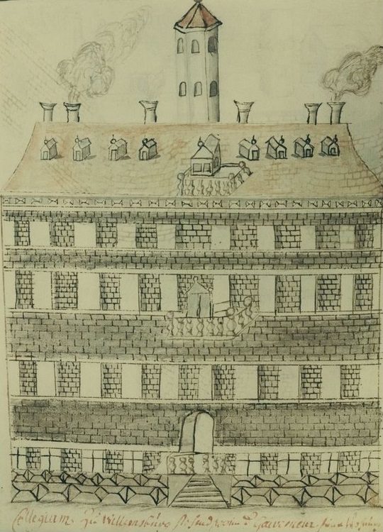
Wren Building, College of William and Mary. Earliest known drawing of the building by Swiss traveler Fran ois-Louis Michel, 1702. Source: Wren Building. |
|
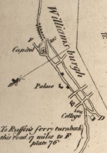
Excerpt from 1789 Colles Map 78a. Main road is the Duke of Gloucester Street. Source: Colles Maps. |
|
Colonial Williamsburg
Colonial Williamsburg is a living-history museum and private foundation presenting a part of the historic district in Williamsburg, Virginia. Its 301-acre historic area includes several hundred restored or recreated buildings from the 18th century, when the city served as the capital of the colonial era Colony of Virginia. The district includes 17th-century, 19th-century, Colonial Revival, and more recent structures and reconstructions. The historic area includes three main thoroughfares and their connecting side streets, which are designed to represent how Williamsburg existed in the 18th century. The core of Colonial Williamsburg runs along Duke of Gloucester Street and the Palace Green that extends north and south perpendicular to it. This area is largely flat, with ravines and streams branching off on the periphery. Duke of Gloucester Street and other historic area thoroughfares are closed to motorized vehicles during the day, in favor of pedestrians, bicyclists, joggers, dog walkers, and animal-drawn vehicles. Prominent buildings include the Raleigh Tavern, the Capitol, the Governor's Palace (all reconstructed), the Courthouse, the Wythe House, the Peyton Randolph House, the Magazine, and the independently owned and functioning Bruton Parish Church (all originals). Colonial Williamsburg's portion of the historic area begins east of the College of William & Mary's College Yard. Source: Colonial Williamsburg.
York County
The route of the Kings Highway in York County, using Colles maps 78 and
79 is:
York County
- Yorktown Naval Weapons Station, which ncludes Kiskiack House
- Old Williamsburg Road
- Water Street
- Mathews Street
- Main Street - Yorktown - mile 213 on map 79b
- Zwaybrucken Road
- Ballard Street
- Cook Road
- Surrender Road
- Old York-Hampton Highway
- George Washington Memorial Highway (US 17)
Yorktown Naval Weapons Station
Naval Weapons Station Yorktown provided a weapons and ammunition storage and loading facility for ships of the United States Atlantic Fleet, and more recently, for those from the Fleet Forces Command. The Complex (including Cheatham Annex) is 108.5 square miles in area, roughly 1/5 of the total land area of York County, in which most of it lies; a small portion is within James City County. the Navy acquired the site in August 1918 by presidential proclamation in response to the outbreak of World War I in Europe. This eventually developed as the largest naval installation in the world. The station is located on the York River, in an area that was an early settlement of English colonists in Virginia. They displaced the Algonquian-speaking Kiskiack and other American Indian tribes of the Powhatan Confederacy, who historically inhabited the area. The colonial infantry of the American Revolutionary War and forces of the Civil War slogged along the Old Williamsburg Road that today runs through the station. Source: Naval Weapons Station Yorktown.
Kiskiack (Lee House)
Kiskiack (Lee House) is the name of an early 17th-century brick building, originally built as a private residence, which still stands at the Naval Weapons Station Yorktown in York County, Virginia. This brick structure, the oldest building owned by the U.S. Navy, is listed on the National Register of Historic Places. It was named for the historic Kiskiack, an Algonquian-speaking tribe of the Powhatan Confederacy, who occupied this area at the time of English colonization. Source: Kiskiack (Lee House).
1682 - Yorktown
Yorktown is an unincorporated area in York County, Virginia. It was named for the ancient city of York in Yorkshire, Northern England. It was founded in 1691 as a port on the York River for English colonists to export tobacco to Europe. Yorktown's population was 221 as of the 2020 census.
The town is most famous as the site of the siege and subsequent surrender of General Charles Cornwallis to General George Washington and the French Fleet during the American Revolutionary War on October 19, 1781. This British defeat at Yorktown effectively ended the war in North America. See: Yorktown, Virginia.
1700 - Somerwell House
TThe Somerwell House was built around 1700 on Main Street in Yorktowm. See: Yorktown, Virginia..
1721 - Yorktown Custom House
The Old Custom House is a historic customs house located at Yorktown, York County, Virginia. It was built in 1721 and is a two 1/2-story brick Colonial building with a hipped roof. It has a corbeled brick interior end chimney. An extensive restoration project was undertaken by Richmond architect W. Duncan Lee in 1929. Also on the property are a contributing kitchen, necessary, and a brick wall, all added during the restoration. See: Old Custom House (Yorktown, Virginia).
1730 - Thomas Nelson House
The circa 1730 "Thomas Nelson House" was built by Thomas "Scotch Tom" Nelson in Yorktown, Virginia. Source: Thomas "Scotch Tom" Nelson.
1730 - Thomas Nelson Jr
Thomas Nelson, Jr was living there during the Revolutionary War. Thomas Nelson Jr. was one of the thirteen committee members appointed in the Continental Congress on June 12, 1776, to "prepare and digest the form of confederation" they drafted the Articles of Confederation. He was a Declaration of Independence Signer.
Thomas Nelson Jr. was a brigadier general of the Lower Virginia Militia and succeeded Thomas Jefferson as governor of Virginia. Nelson was engaged in the siege of Yorktown. According to legend, Thomas Nelson Jr. urged General George Washington (or, in some versions, Marquis de Lafayette) to fire on his own home, the Nelson House, where General Cornwallis had his headquarters, offering five guineas to the first man to hit his house.
Source: Thomas Nelson Jr..
1781 - Siege of Yorktown
In Yorktown, in the fall of 1781, General George Washington, with allied American and French forces, besieged General Charles Lord Cornwallis's British army. On October 19, Cornwallis surrendered, effectively ending the war and ensuring independence. See: Siege of Yorktown.
Surrender of Lord Cornwallis is an oil painting, 12 feet 18 feet, by John Trumbull. The painting, which was completed in 1820, now hangs in the rotunda of the United States Capitol in Washington, D.C.
The painting depicts the surrender of British Lieutenant General Charles, Earl Cornwallis at Yorktown, Virginia, on October 19, 1781. Included in the depiction are many leaders of the American troops that took part in the siege of Yorktown. . Source: Surrender of Lord Cornwallis |
Hampton and Norfolk
The route of the Kings Highway in Hampton and Norfolk is:
- Hampton
- Neil Armstrong Parkway
- North King Street
- Kings Way North
- South King Street
- Settlers Landing Road
- West Country Street
- East Country Street
- Water Street
- Old Point Comfort
- Hampton Roads - Ferry from Old Point Comfort to Norfolk Waterside
- Norfolk
1802 - Norfolk Map
An 1802 map of the Borough of Norfolk was complied by Joseph Mosier in 2005. Included are Church Street, Main Street, Water Street, and Union Street, all of which can be found on a present-day map. It is based on an 1802 plat drawn by George Nicholson. The map can be seen at: Norfolk Historical Society.
1839 - Map of Virgina
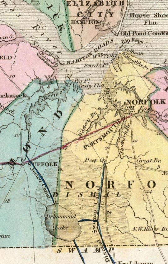
Excerpt from 1839 map of Virgina showing a ferry from Old Point Comfort in Hampton to Norfolk via the Elizabeth River, a main road from Norfolk to Suffolk, and a minor road from Suffolk along the west dide side of the Dismal Swamp. Source: 1839 map |
<
Portsmouth and Suffolk
The route of the Kings Highway in Portsmouth and Suffolk is:
- West branch of Elizabeth River - Ferry
- Portsmouth
- North Street
- Washington Street
- High Street
- Airline Boulevard (US 58)
- West Miltary Highway (US 58)
- Suffolk
- Portsmouth Boulevard (US 58)
- East Constance Road (US 58)
- North Main Street (VA 32)
- Carolina Road (VA 32)
1789 - Watts House
The original Watts House was built for Col. Dempsey Watts in 1799 across from 525 North Street. This proved not to be good placement due to nearby Windmill Creek repeatedly flooding and the house was moved to 500 North Street sometime in the 1890s. The house was passed down to son Captain Watts, who held dinners and parties at this home welcoming the affluent and popular persons of his time. One such guest was Chief Black Hawk who dined with the family many times. It is said that when Captain Watts took Chief Black Hawk to the Navy Yard on a tour, he was unimpressed until he saw the Delaware battleship in dry dock, to which he said took big man to build that big canoe. Henry Clay also dined, danced, and dozed at the home on his presidential campaign tour in 1844. Source: Watts House and Olde Towne Portsmouth.
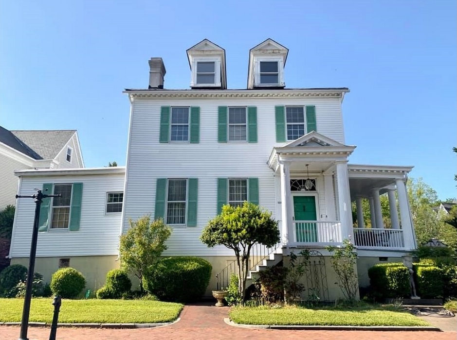
Watts House, 500 North Street, Portsmouth. Source: Watts House |
North Carolina
The likely route of the Kings Highway in North Carolina is NC 32 to Edenton, then US 17 and NC 179 to Carolina Shores, through 11 counties, a length of 269 miles based on Google Maps. The North Carolina portion of the Kings Highway is longer than any other state.
2023 Google Map of likely Kings Highway in North Carolina. |
J. D. Lewis and Carolana
J.D. Lewis is an avid amateur historian and genealogist in general, but specifically focused on the Carolinas. Born and raised in North Carolina, he left and has lived all over the country, then moved back to South Carolina in the early 1990s. Constantly amazed at how different the two states are, he tried for over a decade to figure it out. His website Carolana is one result of that long-standing curiosity. His website has been invaluable to me in developing this web page.
The Kings Highway in North Carolina
Excerpt from 1775 North Carolina map by J. D. Lewis showing the Kings Highway in black to the right and county boundaries in red. |
Leaving Norfolk, Virginia, a traveler on the Kings Highway began a difficult trek through and around the lowland swamps of the tidewater areas of Virginia and the Carolinas. Many fords were necessary on this route, which followed present-day US Highway 58 from Norfolk to Suffolk, Virginia; then into North Carolina via what is now NC Highway 32; skirting west to avoid the Dismal Swamp and then south to Edenton, North Carolina. From the Quaker communities around Edenton, the old highway followed what is now US Highway 17 to New Bern, North Carolina, an important seaport and the early colonial capital of North Carolina. From New Bern, the highway bypassed White Oak and Angola Swamps in a fairly direct line to Wilmington, North Carolina at the Cape Fear River. As US Highway 17 does today, the old road continued on to Georgetown. Source: The Kings Highway in North Carolina
1663 - Carolina Named after Charles I
In 1629, King Charles I of England "erected into a province" all the land from the Albemarle Sound
in the north to the St. John's River in the south, which he directed should be named Carolana. Carolana is from the word Carolus, the Latin form of Charles, and the name he personally selected for his new colony. Carolina is the name King Charles II used in 1663 to finally implement his father's original vision of 1629. By 1663, King Charles II granted a charter to start a new colony. He named it Carolina in honor of his father, Charles I. Source: North Carolina
1690-1730 - Carolina Split into North and South
Sometime between 1690 and 1730 Carolina was split into North and South carolina. Source: The Split
1739 - Post Road in North Carolina
The earliest record of an attempt to set up a post road in North Carolina is a letter written by William Farris in 1739. Farris, who identified himself as "postmaster of North Carolina," petitioned the South Carolina Common House of Assembly to contribute money to establish a post road from Georgetown to Eden Town, "from whence they have a regular Post once a month to Virginia." This post was established, as records indicate that Farris was paid 200 for his services-although the post apparently was short-lived, as no appropriation was made after the first year. In October 1755 a message was read during a session of the North Carolina legislature clearly stating that "there is no established post thru this Province." Source: Post Roads in North Carolina
1738-39 - North Carolina Markers A-24 and D-30
At the beginning and end of The Kings Highway in North Carolina are two markers entitled "First Post Road." They say that "The road from New England to Charleston over which mail was first carried regularly in North Carolina, 1738-39, passed near this spot."
The North Carolina Department of Natural and Cultural Resources has provided an essay for each:
The first post road in North Carolina was constructed in 1738-1739, extending a road network that ran from Philadelphia to Williamsburg. In April 1738, the Virginia Gazette reported that Virginia Governor Alexander Spotswood had ordered a road to be cut from Williamsburg to Edenton in accordance with the wishes of North Carolina's post-master Abraham Blacknall.
A year later, in April 1739, the South Carolina Gazette recorded the establishment of a postal route from Charleston to Georgetown, Cape Fear, Edenton, and so through the Northern Colonies that would run on the 20th day of every month. In May 1739, the reported that the road running from Edenton to Charleston had been finished. The following month the paper noted that a continuous route was then in existence from Boston to Charleston.
The exact route of the road through North Carolina remains something of a mystery. However, it is known to have passed near or through the present-day towns of Corapeake, Edenton, Bath, New Bern, and Belgrade, and through Brunswick County before entering South Carolina. The route apparently fell into disrepair in the 1740s and 1750s. As the British colonies were drawn into the War of Jenkins's Ear and the French and Indian War, colonial legislatures could scarcely afford to support the post road. Furthermore, oftentimes it was quicker and more efficient to simply mail letters by ship for delivery along the coastal trading routes.
In 1765, when William Tryon succeeded Arthur Dobbs as royal governor, North Carolina was the only colony that did not have an official post system, leaving a gap in communications between the northern colonies, South Carolina, and Georgia. Tryon attempted to ameliorate the situation by funding the rebuilding and maintenance of the route, but by 1774 the post road was only partially operable. That same year the first east-west postal route in North Carolina was established between Wilmington and Cross Creek.
References:
- William L. Saunders, ed., Colonial Records of North Carolina, V (1890)
- Alan D. Watson, Society in Colonial North Carolina (1975)
- (Williamsburg) Virginia Gazette, April 28, 1738; May 25, 1739; June 22, 1739
- (Charleston) South Carolina Gazette, April 26, 1739
1828 Map
Gates and Chowan Counties
The route of the Kings Highway in Gates and Chowan Counties is:
- Gates County
- Corapeake
- NC 32
- Trotman Creek
- NC 32
- Warwick Creek
- Chowan County
- Virginia Road (NC 32)
- Stumpy Creek
- Virginia Road (NC 32)
- Rockyhock Creek
- Virginia Road (NC 32)
- Pollock swamp
- Virginia Road (NC 32)
- Edenton
- Virginia Road
- North Broad Street
- South Broad Street
- West Queen Street
- Pembroke Creek
- West Queen Street
- West Queen Street
- US 17
- Chowan River
1658 - Edenton
In 1658, adventurers from the Jamestown area drifted through the wilderness from now called Edenton Bay. Edenton Colony was the first permanent European settlement in what is now the state of North Carolina.
Edenton was established in 1712 as "the Towne on Queen Anne's Creek". It was later known as "Ye Towne on Mattercommack Creek" and still later as "the Port of Roanoke". It was renamed "Edenton" and incorporated in 1722 in honor of Governor Charles Eden, who had died that year.
Edenton served as the second capital of the Province of North Carolina, from 1722 to 1743, with the governor establishing his residence there. Source: Edenton, North Carolina.
1774 - Edenton Tea Party
A landmark in women's history occurred in Edenton in 1774. Fifty-one women in Edenton, led by Penelope Barker, signed a protest petition agreeing to boycott English tea and other products, in what became known, decades later, as the Edenton Tea Party. The Edenton Tea Party is the first known political action by women in the British American colonies. In fact it so shocked London that newspapers published etchings depicting the women as uncontrollable. Source: Edenton Tea Party.
1800 - James Iredell House
The James Iredell House is a historic home located at Edenton, Chowan County, North Carolina. The original section was built 1800, and expanded to its present configuration about 1827. It is a two-story, L-shaped frame dwelling with Georgian and Federal style design elements. It was the home of James Iredell, an ardent patriot and Justice of the Supreme Court. Source: James Iredell House.
James Iredell House at South Broad and East Church streets in Edenton. Source: James Iredell House |
Bertie and Martin Counties
The route of the Kings Highway in Bertie and Martin Counties is:
- Chowan River
- Bertie County
- US 17
- Salmon Creek
- US 17
- Windsor
- South King Street (US 17)
- Cashie River
- South King Street
- Granville Street
- Granville Street
- US 17
- Roquist Creek
- US 17
- Roanoke River
- Martin County
- Williamston
- East Boulevard (US 17)
- East Main Street
- West main Street
- Washington Street
- Washington Street
- US 17
- Ready Branch
- US 17
- Jack's Swamp
- US 17
- Smithwick creek
- US 17
Beaufort County
The route of the Kings Highway in Beaufort County is:
Beaufort County
- US 17
- Batts Crossroads
- US 17
- Old Ford Swamp
- US 17
- Cherry Run
- Carolina Avenue (US 17 BUS)
- Washington
- Carolina Avenue (US 17 BUS)
- Bridge Street (US 17 BUS)
- Pamlico River
- US 17 BUS
- Chocowinity
- US 17 BUS
- Maple Branch
- US 17 BUS
- US 17 BUS
- US 17
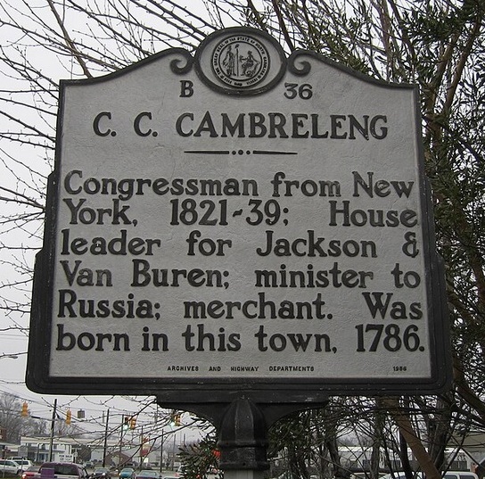
Historical marker B-36 designating the birthplace of Churchill C. Cambreleng. This marker is located in Washington, North Carolina, on the east side of North Bridge Street (U.S. Route 17) just north of West Main Street. |
1776 - Washington, North Carolina
Established in 1776 on land donated by Col. James Bonner, Washington is the first city named after George Washington. The settlement at the current location of the city was founded in the 1770s by James Bonner on his land and was known as Forks of the Tar. In 1776, it was renamed Washington. During the American Revolutionary War, Washington served as a supply port when major neighboring ports were under British siege. Source: Washington, North Carolina.
1786-1862 - Churchill C. Cambreleng
Churchill Caldom Cambreleng (1786 1862) was an American businessman and politician from New York. He was born in Washington, Beaufort County, North Carolina on October 24, 1786, the son of Stephen Cambreleng and Ann (Patten) Cambreleng. He attended school in New Bern, North Carolina, and moved to New York City in 1802. He is notable for his service in the United States House of Representatives from 1821 to 1839, including terms as chairman of several high-profile committees. In addition, he served as U.S. Minister to Russia from 1840 to 1841. He attended the 1848 Democratic National Convention in Baltimore as a Barnburner but withdrew with his faction, and participated in the nomination of Van Buren as the candidate of the Free Soil Party. Later he rejoined the Democrats and supported Franklin Pierce for president in 1852. Source: Cambreleng and Cambreleng marker.
Craven County
The route of the Kings Highway in Craven County is:
- Craven County
- US 17
- Old Washington Road
- Main Street
- Vanceboro
- Mauls Swamp
- Main Street
- US 17
- Weyerhaeuser Road (NC 43)
- Swift Creek
- Weyerhaeuser Road (NC 43)
- Neuse River
- Washington Post Road (NC 43)
- Bachelor Creek
- Washington Post Road (NC 43)
- New Bern
- Washington Post Road (NC 43)
- Neuse Boulevard
- Broad Street
- Neuse Boulevard
- Dr. Martin Luther King Junior Boulevard
- Heyward Creek
- Dr. Martin Luther King Junior Boulevard
- Rocky Run
- US Highway 17 South
1710 - New Bern
New Bern was founded in October 1710 by the Palatines and Swiss under the leadership of Christoph von Graffenried. The new colonists named their settlement after Bern, the Swiss region from which many of the colonists and their patron had emigrated. New Bern is the second-oldest European-settled colonial town in North Carolina, after Bath. It served as the capital of North Carolina from 1770 to 1792. Source: New Bern, North Carolina.
Jones County
The route of the Kings Highway in Jones ighway in Jones County is:
- Jones County
- Unnamed highway
- Pollocksville
- Old US 17
- US 17
- Maysville
- New Bern Highway
- White Oak River
- New Bern Highway
- New Bern Highway (US 17)
- Starkys Creek
- New Bern Highway (US 17)
- Northeast Creek
- New Bern Highway (US 17)
- Wolf Swamp
- New Bern Highway (US 17)
Onslow County
The route of the Kings Highway in Onslow County is:
- Onslow County
- Jacksonville
- North Marine Boulevard
- Marine Boulevard
- Chaney Creek
- Marine Boulevard
- Chaney Avenue
- Railroad Street
- Old Bridge Street
- New River
- Old Bridge Street
- South Marine Boulevard
- Wilmington Highway
- Wilmington Highway (US 17)
- Wilmington Highway (US 17)
- Southwest Creek
- Wilmington Highway (US 17)
- Hicks Run
- Wilmington Highway (US 17)
- Holly Ridge
- Wilmington Highway (US 17)
- Wilmington Highway (US 17)
Pender and New Hanover Counties
The route of the Kings Highway in Pender and New Hanover Counties is:
- Pender County
- Wilmington Highway (US 17)
- New Hanover County
- Market Street (US 17)
- Wilmington
- Market Street (US 17)
- Market Street
- South Front Street
- Cape Fear River - Cape Fear Memorial Bridge (A ferry system originally operated from the foot of Market Street to Peter Point.)
- Andrew Jackson Highway
1730s - Wilmington
The city was founded in the 1730s. After going through a series of different names (New Carthage, New London, Newton), its name became Wilmington. Due to Wilmington's commercial importance as a major port, it had a critical role in opposition to the British in the years leading up to the revolution. The city had outspoken political leaders who influenced and led the resistance movement in North Carolina. The foremost of these was Wilmington resident Cornelius Harnett, who was serving in the General Assembly at the time, and where he rallied opposition to the Sugar Act in 1764. When the British Parliament passed the Stamp Act the following year, designed to raise revenue for the Crown with a kind of tax on shipping, Wilmington was the site of an elaborate demonstration against it. Source: Wilmington, North Carolina.
1859 - Bellamy Mansion
The Bellamy Mansion, built between 1859 and 1861, is a mixture of Neoclassical architectural styles, including Greek Revival and Italianate, and is located at 503 Market Street in the heart of downtown Wilmington, North Carolina. It is one of North Carolina's finest examples of historic antebellum architecture. Source: Bellamy Mansion.
Brunswick County
The route of the Kings Highway in Brunswick County is:
- Brunswick County
- Leland
- Andrew Jackson Highway
- Ocean Highway East (US 17)
- Brunswick River
- Ocean Highway East (US 17)
- Ocean Highway East (US 17)
- Town Creek
- Ocean Highway East (US 17)
- US 17 - Ocean Highway
- Old Ocean Highway
- Bolivia
- Old Ocean Highway
- Lockwood Folly River
- Old Ocean Highway
- Clark Branch
- Old Ocean Highway
- Ocean Highway (US 17)
- Shallotte
- Main Street
- Shallotte River
- Main Street
- Village Road
- Bricklanding Road Southwest
- Hale Swamp Road Southwest
- Old Georgetown Road Southwest
- Calabash River
- Old Georgetown Road Southwest
- Beach Drive Southwest
South Carolina
The likely route of the Kings Highway in South Carolina on US 17 or roads paralleling it.
2023 Google Map of likely Kings Highway in South Carolina. |
|
|
The Oldest Road in America, The King's Highway, Begins In South Carolina
"In South Carolina, if you've ever driven the coastal Highway 17 between Charleston and the North Carolina state line, then you've traveled in the same path as the colonials. Of course, the surface is now paved and has been widened to accommodate more traffic and vehicles larger than a carriage or a horse, but it's believed that most of the South Carolina portion of the King's Highway is still in the same place as the original road. In fact, along the Grand Strand, parts of Highway 17 Business (the original road) are actually named Kings Highway." Source: Robin Jarvis, 2019.
South Carolina Encyclopedia
The South Carolina section of the Kings Highway, built between 1739 and 1750, crossed the North Carolina line just above Little River on its way to Georgetown. It then skirted the Santee delta before passing through Jerveyville (McClellanville) to reach Charleston. While individuals could travel on foot or by horse, wagon, or carriage, the easiest and most economical mode was by post stagecoach. The driver was responsible for repairs and for fresh horses, accommodations, and food, usually to be found at inns every seven to ten miles along the way. In the twentieth century much of this road became utilized as U.S. Highway 17. Source: South Carolina Encyclopedia
The Georgetown Road
As early as 1713, the colonial government in South Carolina began its own program of building roads and ferries, both along the coast and inland. Local committees were commissioned with the power to tax local landowners for the construction costs, and ferries over the Charleston harbor, North and South Santee rivers, and Winyah Bay were authorized with specific and very detailed charters issued for the ferry operators. By about 1735, it was possible, though certainly not easy, to travel from Charles Towne to the newly surveyed state line near Little River. This road came to be known as the "Georgetown Road." Source: Legacy of a Lost Highway By Dennis Chastain.
A Recent Article
The following article appeard in Georgetown Times.
"Original Kings Highway valuable to local heritage"
By Scott Harper For Inlet Outlook
April 16, 2014. Updated Aug 20, 2020.
Whether you are on North Kings Highway or South Kings Highway in Myrtle Beach, you are not on the original road that was given that name.
If you were to travel the original Kings Highway, you would be trespassing on a lot of private property.
That is what Dennis Chastain discovered as he explored the 123-mile stretch of highway in South Carolina to collect information for an upcoming article that will be published in South Carolina Wildlife magazine.
He has written for the magazine for 25 years. Chastain shared his knowledge of the path used by George Washington in 1791 during a lecture at Coastal Carolina University last week.
While Chastain centered his presentation on the South Carolina portion of the historic passageway, what was known as Kings Highway was actually a 1300-mile stretch from Boston to Charleston. The road was directed to be built by Charles II of England in the late 1600s.
Chastain said his interest in the original north to south route began while he was on Highway 179 in Calabash gathering information for a different story. While there, he saw a historic marker noting the Kings Highway and the fact it had been used by America's first president.
I was intrigued by this story, he said, adding he spent about two years researching the former highway.
Chastain began his journey near the border of North and South Carolina where he discovered a portion of the original Kings Highway is on Marsh Harbour Golf Links in Calabash. Through a series of slides he took those in attendance southward along the former roadway which, in many areas, was farther east than Highway 17, which is the current Kings Highway in the Myrtle Beach area.
Before 1929, the road was not called Kings Highway. It was called the Georgetown Highway, Chastain explained.
The road, in many areas, was right along the beachfront. Horses and carriages had to deal with swamps and sandy dunes.
Chastain said the road was along the beach through most of Horry County but shifted west - closer to the current Highway 17 - in Surfside Beach.
For part of his research, Chastain met with Doc Lachicotte of Pawleys Island.
Doc always knew tourism was the way of the future, Chastain said, adding as a child and teenager, Lachicotte lived at Waverly Mils but went to school in Georgetown which was a two hour trip each way because it consisted of two bus rides and one ferry ride across the Winyah Bay.
Chastain said Lachicotte explained how Kings Highway roughly paralleled what is now Kings River Road.
A lot of names have been preserved in that area, like Caledonia and True Blue, Chastain said.
The research shows Kings Highway went through the Brookgreen Gardens property which is where the road split. It became a single road again on the Hobcaw Barony property.
Chastain spent a lot of time exploring Hobcaw Barony and the role Kings Highway played in the development of that area.
The first bridge connecting Georgetown and the Waccamaw Neck was completed in 1929, Chastain said. It was the Lafayette Bridge, which is known to locals as the broken bridge which is now used for fishing. Before that a ferry ride was required from what was known as Fraser's Point on Hobcaw. Pilings from the Fraser's Point landing can still be seen from the remains of the Lafayette Bridge.
Those traveling Kings Highway had to use a ferry to cross the Sampit river from Georgetown to what is now Maryville and the Santee River along the Georgetown-Charleston County border.
In McClellanville, Bud Hill is working to get a 12-mile stretch of the former highway placed on the National Register of Historic Places.
It is currently under review, Chastain said.
Kings Highway ended at Shem Creek behind Wando Shrimp Company.
Chastain explained his fascination with the original Kings Highway is because of its importance to history. He said if there had been no Kings Highway, the Grand Strand of today would not exist.
Horry County
The route of the Kings Highway in Horry County is:
- Horry County
- SC 179
- Mullet Creek
- SC 179
- US 17
- Atlantic Intracoastal Waterway
- US 17
- North Myrtle Beach
- US 17
- North Kings Highway (US 17)
- Myrtle Beach
- Mark Garner Highway (US 17)
1735 - Historical Marker in Myrtle Beach
There is a Kings Highway historical marker on the Myrtle Beach Boardwalk and Promenade. It is at the intersection of North Ocean Boulevard and 9th Ave N.
"By the mid 1700's a 1,300 mile continuous road linked all thirteen colonies. Called the Kings Highway the thoroughfare stretched from Boston, Massachusetts to Charles Town, South Carolina. It took at least two months for wagons averaging about 20-25 miles per day to complete the entire journey. Sections of US Highway 17 follow this original roadbed. In Myrtle Beach, Business 17 is still referred to as Kings (King s) Highway."
Source: The Kings Highway,
1735.
Georgetown County
The route of the Kings Highway in Georgetown County is:
- Georgetown County
- Old Kings Highway
- Brookgreen Gardens
- Pawleys Island
- Kings River Road
- Chapel Creek
- Kings River Road
- Ocean Highway
- Waccamaw River
- Pier Road
- Great Pee Dee River
- Georgetown
- Pier Road
- Church Street
- South Fraser Street (US 17)
- Sampit River
- South Fraser Street (US 17)
- North Santee River
1791 - Pawleys Island
In 1791, President George Washington traveling The King's Highway to an unincorporated portion of Pawleys Island to visit the Alstons, who owned several plantations in the area. The post office address includes an unincorporated area on the mainland adjacent to the island, which is also commonly referred to as Pawleys Island and includes a district along the Ocean Highway (US Route 17) as well as a residential area between the highway and the Waccamaw River. Source: Pawleys Island.
1739 - All Saints Church (Pawleys Island)
All Saints Episcopal Church, at 3560 Kings River Road, was one of the most significant Episcopal churches in the South Carolina lowcountry in the eighteenth and nineteenth centuries. Its first congregation was formed in 1739, and the church has been located at this site since then. Source: All Saints Church.
The Early History of All Saints
by Clinch Heyward, Senior Warden
The land of All Saints Church goes "way back" in the recorded history of this Low Country region. In the
early 1700's, our property was owned by Percival Pawley and his wife Ann, who transferred the title to
their son, Thomas George Pawley, and William Poole as trustees for "the people of the Waccamaw
Neck" in order to build an Anglican church on the site.
Our "old church" adjoining the cemetery is actually the fourth church building on that site. The first was
built in the 1730's, the second in 1816, the third in 1843, and the present church in 1916.
Access by the early parishioners to these early churches was gained in two ways by land and by
sea! On the south side of the All Saints property is a wetland drainage basin, which forms the small
creek which crosses Kings River Rd. This creek winds behind the Rectory, behind the cemetery and Old
Church, where it becomes a larger body of navigable water known to this day as "Chapel Creek". Chapel
Creek runs out to the Waccamaw River. Many of today's residents of the Waverly neighborhood have
boats behind their homes in canals which run into Chapel Creek. "Back in the Day" owners of
Waccamaw or Pee Dee River Plantations might have been sailed or rowed to church in high style,
navigating up Chapel Creek to a landing at the back of the Old Church. In fact, just adjoining the north
side of the Old Church property line, there was a boat landing in active use, especially by some of us
duck hunters, until about 20 years ago. In the dead of winter, our small boats could be launched quickly
and close to our preferred part of the river. A man would come out of an adjoining trailer with his hand
out, no matter the time...no matter the weather, and expect a one dollar bill to be placed in his palm for
the privilege of using his boat ramp. Worth every penny!
Now, the road running in front of the Old Church which we call Kings River Road has been in use since
the earliest colonial times. The section of Kings River Road from Willbrook Blvd. until it rejoins Hwy 17
lies on top of the original road used by plantation families, neighboring residents, and even George
Washington himself! That's right! At the end of the Revolutionary War, Washington embarked on a
Southern Tour, to celebrate the birth of the new nation. He traveled along a dirt track, which ran down
from Boston, and which served as the primary land route, up and down the east coast. It was a road
through thick forests, which were typically dark and gloomy. One bright spot for travelers, if the tide was
low, was a detour onto the beach, just above the location of the current Dunes Club. Washington's diary
recounts how his carriage and outriders hit the beach and road it all the way down to near where the
current airport is located. The "Grand Strand" was certainly grand on that day! Washington enjoyed a
big dose of Southern Hospitality all along the way until reaching his southernmost stop in Savannah,
Georgia.
But, on a particular day of that trip, Washington passed by All Saints Church, and perhaps tipped his hat
to the faithful servants of that time, who were our forefathers in faith, here in this place.
Remnants of the Abandoned Kings Highway in Georgetown
"There's a section of the Kings Highway in Georgetown that used to run alongside rice fields. This section is found right along the Great Pee Dee River just before it converges with the Waccamaw River at the Winyah Bay.
Taking a look at Georgetown on Google Maps, we can easily see the abandoned section of Highway 17 running just to the north of the historic downtown area. The L. H. Siau bridge crosses the Great Pee Dee and the Black Rvers as visitors and locals travel north on (the new) Highway 17. Just over the first bridge to the left is the merging of the old Kings Highway section of Highway 17. A bird's eye view shows us that the old Kings Highway bridge that crossed the Great Pee Dee is now a fishing pier, which provides easy access to urbex explorers curious about the old abandoned highway and bridge.
This eerily haunting abandoned section of the old original Kings Highway runs the length of nearly a full mile, with the exception of the brief break in the bridge created for boat passage on the river." Source:
Robin Jarvis, 2022.
1735 - Hopsewee Plantation
Hopsewee Plantation, also known as the Thomas Lynch, Jr., Birthplace or Hopsewee-on-the-Santee, is a plantation house built in 1735 near Georgetown, South Carolina, in the Lowcountry. It was the main house of a rice plantation and the birthplace of Thomas Lynch, Jr.,who was a signer of the Declaration of Independence. Source: Hopsewee.

Hopsewee Plantation, located about 13 miles south of Georgetown, with access to U.S. Highway 17, in the vicinity of North Santee on the North Santee River. Source: Hopsewee |
Charleston County
The route of the Kings Highway in Charleston County is:
- North Santee River
- Charleston County
- ?
- Old Georgetown Road
- Sandy Point Creek
- Old Georgetown Road
- Five Points Marker
- Old Georgetown Road
- North US Highway 17
- Awendaw
- Awndaw River
- North US Highway 17
- Mt. Pleasant
- North US Highway 17
- Old Georgetown Road
- Bowman Road
- Old Georgetown Road
- Chuck Dawley boulevard
- Coleman Boulevard
- Hibben Street
- Church Street
- Shem Creek
- Charleston Harbor
- Charleston - Broad Street
Old Georgetown Road
The Old Georgetown Road is one of longest surviving unpaved sections of the King's Highway. It parallels a portion of US 17 between Georgetown and Charleston. It runs 32.5 miles southwest from the South Santee River to join US 17 about three miles north of Awendaw. Highway SC 45 crosses the Old Road at its midpoint and goes to McClellanville. The portion of the Old Road between SC 45 and the river is listed on the National Register of Historic Places and Old Georgetown Road.
The Old Georgetown Road parallels a portion of US 17 between Georgetown and Charleston. |
1768 - St. James-Santee Church
Episcopal Church was built on the Old Georgetown Road in 1768. It is also called the Brick Church at Wambaw.
Although Wambaw Church stands alone on the old Kings Highway among the pines and oaks of the forest, it was once the center of a busy and prosperous community. North and south along the Santee River were rice plantations whose Carolina rice became famous all over the world and the prosperity of the planters is reflected in the beauty and proportions of Wambaw Church. The body of the church was built of brick imported from England, but the columns of the portico were constructed of local wedge-shaped bricks. The pews were made of hand-pegged cypress, the flagstone floor has withstood the ravages of two wars and the vaulted ceiling still retains the original plaster work.
The building had identical porticos until 1852 when the north one was enclosed to form a vestry room. The Palladian window on the east marks the original chancel which was moved to its present location after the Civil War. Although the pews were removed at that time, they were not damaged and the church was closed until it could be repaired.
By 1768 when St. James Santee's Wambaw Church was built, many descendants of the original French refugees had intermarried with English settlers. St. James Santee, though, has always been closely associated with the Huguenot immigrants who first settled the area and has been known variously as The French Church and as the church of the Huguenots.
See: Wambaw Church, A Trip Back in Time: The Old Georgetown Road, and Map of Wambaw Church.
Five-Points Mile Marker on Old Georgetown Road
There is a four-sided granite mile marker on the Old Georgetown Road at a junction of five roads called Five Points. The roads are:
- Old Georgetown Road (south to Mount Pleasant)
- Palmer Bridge Road (north)
- Old Georgetown Road (north to Saint James-Santee Church),
- State Road S-10-1336 (east to McClellanville)
- Tibwin Road (southeast to Tibwin Plantation)
There is mile information on two sides:
- "McC 4" which indicates that there are four miles from there to McClellanville.
- "MtP 32" which indicates that there are 32 miles from there to Mount Pleasant, which is near Charleston.
For more information and some excellent photos taken by Brandon Coffey in 2017, see: Old Kings Highway.
1708 - Christ Church, Mount Pleasant
Christ Church parish was one of ten established in South Carolina under the Church Act of 1706, an act of the British Parliament. As such the parish also served as a civil administrative district. A small wooden building was built on this site in 1708, but was accidentally destroyed by a fire in 1725. The current rectangular brick Colonial building with its hipped roof dates back to 1726. The cemetery contains graves dating back to the mid-1700s.
The church is at 2755 North Highway 17. There is an Old Georgetown Road that parallels US 17 for about 3,000 feet just north of the church.
Source: Christ Church.
1755 - Hibben House, Mount Pleasant
The Hibben House is at 111 Hibben Street in the Old Village (Haddrell's Point) neighborhood of Mount Pleasant. It is the oldest home in Mount Pleasant. It was constructed in 1755. Source: Mount Pleasant.
1770 - Hibben's Ferry
In 1770, Andrew Hibben bought land on the south side of Shem Creek from Jacob Motte. Hibben obtained a ferry charter and opened Hibbens Ferry - the first ferryboat service to connect Haddrells Point, the area between Shem Creek and the cove at the end of Pitt Street, to Charleston. Later, Haddrells Point was called the village of Mount Pleasant, but people often used the old name. Georgetown Road, the area's major roadway, ran to the Ferry House and functioned as part of the main travel-mail route to the North. Source: Town of Mount Pleasant.
1825 Mount Pleasant and Charleston
An 1825 map of Charleston and Mount Plasant shows ferries operating across the Cooper River between Charleston andMount Pleasant.
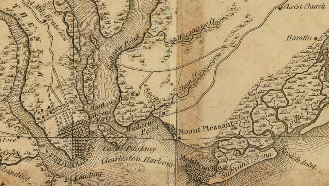
Excerpt from: 1825 Map of Charleston District showing Matthew's Ferry and Hibben Ferry going across the Cooper River from Mount Pleasant to Charleston. Also shown in the upper right is Christ Church in Mount Pleasant. |
1720 Shepheard's Tavern
There is a Marker at 46 Broad Street (South State Bank), for Shepheard's Tavern. It was originally built around 1720 by Charles Shepeard. The tavern has the richest history of all the public houses in early Charleston. It was near the center of town. It was a place to hold public meetings and write or receive mail. In 1743, Charles Shepheard was made made Postmaster for the province of South Carolina. Source: Shepheard's Tavern.
1767-1771 The Old Exchange House in Charleston
The Old Exchange House is located at the northeast corner of East Bay and Broad Streets. The main facade faces west. The Exchange was built from 1767 1771 by South Carolina's provincial government. It was used as a prisoner of war facility operated by British forces during the American Revolutionary War. The building is now a museum operated by the Daughters of the American Revolution. The building housed the South Carolina convention to ratify the United States Constitution in 1788, and was the site of many of the events in George Washington's week-long stay in Charleston. He was greeted by a crowd on the balcony.
It was used during the 18th century for a variety of civic functions, including as a custom house, public market, public meeting place, and jail. The building continued as an Exchange until the 19th century, when it also became a post office.
Source: The Old Exchange.

The Old Exchange House at the intersection of Broad Street and East Bay Street in Charleston, South Carolina. Source: The Old Exchange. |
Broad Street in Charleston
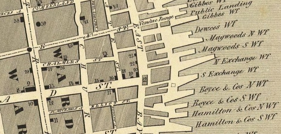
Excerpt from: 1844 Map of Charleston. The Old Exchange (21) is at the start of Broad Street. The Bank of Charleston (18), site of Shepeard's Tavern, is on the northeast corner of Broad and State streets. At the corner of Broad and Meeting streets are: City Hall (13), St. Michael's Church (12), the Main Guard House (10), and the Court House (9). |
Broad Street was originally named Cooper Street.
St. Michael's Church
St. Michael's Church is the oldest surviving religious structure in Charleston. It is located at Broad and Meeting streets. It was built in the 1750s by order of the South Carolina Assembly. St. Michael's Church was built between 1751 and 1761 on the site of St. Philip's Church, the original wooden church built in 1681. St. Philip's Church had been damaged in a hurricane in 1710 and a new St. Philip's Church was built several blocks away on Church Street. In 1727, what was left of the old wooden church was demolished. During his 1791 visit to the city, President George Washington worshipped in pew no. 43 of the church. St. Michael's Churchyard, adjacent to the church, is the resting place of some famous historical figures, including two signers of the U.S. Constitution. Source: St. Michael's Church.
Four corners at Broad and Meeting streets in Charleston. Source: Google maps, 2023. |
1753 - South Carolina Statehouse
The South Carolina Statehouse was built in 1753 at what is now the northwest corner of Broad and Meeting streets. It burned down in 1788. It was the capitol building for the Colony of South Carolina under British colonial rule.
Irish architect James Hoban designed a new statehouse building nearby, which was burned down during the Civil War.
Source: Charleston County Courthouse.
1790-92 - Charleston County Courthouse
The Charleston County Courthouse was built in place of the Statehouse in 1790 1792. It was designed by Irish architect James Hoban. It was a likely model for Hoban's most famous building, the White House, and both buildings are modeled after Leinster House, the current seat of the Irish Parliament in Dublin.
President George Washington visited Charleston on his Southern Tour in May 1791. He may have met with Hoban, and summoned the architect to Philadelphia, the national capital at the time, in June 1792. The following month, Hoban was named the winner of the design competition for the presidential mansion, later named the White House, in Washington, D.C. He later altered his design under Washington's influence.
In 1883 1884, the courthouse underwent a large renovation performed by Kerrigan & Grant. The Courthouse remains in use.
Source: Charleston County Courthouse.
1760 - Edward Rutledge House
The Edward Rutledge House, also known as the Carter-May House and now The Governor's House Inn, is a historic house at 117 Broad Street in Charleston, South Carolina. This 18th-century house was the home of Founding Father Edward Rutledge (1749-1800), a signer of the United States Declaration of Independence and later Governor of South Carolina. Despite many changes to the house, it retains its 18th-century core dating to about 1760. Source: Edward Rutledge House.

Edward Rutledge House, also known as the Carter-May House and now The Governor's House Inn, at 117 Broad Street in Charleston. Source: Edward Rutledge House |
|
|
 The Kings Highway